Houks Plantation

Wood, Forest in Roxburghshire

Scotland

Houks Plantation

The last strip of cereal to be combine harvested With Miens Neuk in the background.
The field now awaits the baler!
The last strip of cereal to be combine harvested Credit: Russel Wills

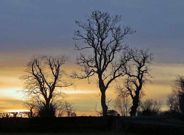
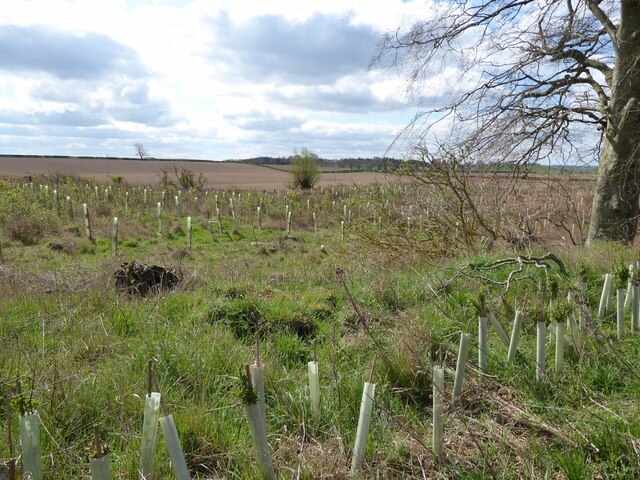
Houks Plantation is a charming woodland area located in the picturesque region of Roxburghshire, Scotland. Spread across several acres, this forested landscape offers a serene escape from the hustle and bustle of everyday life. The plantation is situated near the village of Houks, surrounded by rolling hills and scenic countryside.

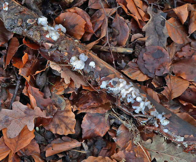
The woodland is predominantly composed of native tree species, including oak, beech, and birch, creating a diverse and beautiful natural environment. The tall canopy formed by these trees provides shade and shelter for a variety of wildlife, making it a popular spot for nature enthusiasts and birdwatchers.

Houks Plantation features several well-maintained walking trails, allowing visitors to explore the area at their own pace. These paths wind through the forest, offering glimpses of tranquil streams, enchanting wildflowers, and ancient stone walls. The plantation has a peaceful ambiance, making it an ideal location for leisurely walks, picnics, or simply enjoying the beauty of nature.

The woodland is also home to a rich array of wildlife, including red squirrels, deer, and various bird species. Birdwatchers can often spot colorful feathered residents such as woodpeckers, jays, and thrushes. The plantation's biodiversity and ecological importance have led to its designation as a Site of Special Scientific Interest (SSSI), ensuring its preservation for future generations.

Overall, Houks Plantation in Roxburghshire is a hidden gem for those seeking tranquility and a connection with nature. With its stunning woodland, diverse wildlife, and peaceful atmosphere, it offers a delightful escape for visitors of all ages.

If you have any feedback on the listing, please let us know in the comments section below.

Houks Plantation Images

Images are sourced within 2km of 55.610319/-2.5315038 or Grid Reference NT6635. Thanks to Geograph Open Source API. All images are credited.

The last strip of cereal to be combine harvested With Miens Neuk in the background.
The field now awaits the baler!
The last strip of cereal to be combine harvested
With Miens Neuk in the background. The field now awaits the baler!
Fields waiting for the baler After combine harvesting.
Smailholm Tower in the background.
Fields waiting for the baler
After combine harvesting. Smailholm Tower in the background.
Charterhouse Wood A wide strip, recently felled and replanted.
Charterhouse Wood
A wide strip, recently felled and replanted.
Winter trees at Smailholm The trees by the B6397 on the southeast side of Smailholm village were viewed from a field boundary.
Winter trees at Smailholm
The trees by the B6397 on the southeast side of Smailholm village were viewed from a field boundary.
Toward  Kelso  on  B6397.  Charter  Plantation  on  the  right
Toward Kelso on B6397. Charter Plantation on the right
Crossroads  on  a  high  point  131  Metres The road to Floors Castle and Kelso is straight on, descending steadily into the Tweed Valley
Crossroads on a high point 131 Metres
The road to Floors Castle and Kelso is straight on, descending steadily into the Tweed Valley
Leaf litter at Nenthorn A small dead branch on the leaves is hosting small white fungi.
Leaf litter at Nenthorn
A small dead branch on the leaves is hosting small white fungi.
An 18th century symbolic gravestone at Nenthorn Old Cemetery The Death’s head skull and crossed femur bones are symbols of mortality while the winged soul above is a symbol of the immortality of the human soul. The upside down heart above normally signifies death while the star and flower on either side are symbols of immortality.
A list has been made of the gravestone information and inscriptions which is housed in a small box by the entrance gate to the cemetery.
This stone is numbered 55 with the following inscription:-

Here lyes James Cairns
tenant in Nenthorn
who died 11.9.1706 aged 57 years
Also Janet Trotter his spouse
who died 11.2.1725 aged 63 years
An 18th century symbolic gravestone at Nenthorn Old Cemetery
The Death’s head skull and crossed femur bones are symbols of mortality while the winged soul above is a symbol of the immortality of the human soul. The upside down heart above normally signifies death while the star and flower on either side are symbols of immortality. A list has been made of the gravestone information and inscriptions which is housed in a small box by the entrance gate to the cemetery. This stone is numbered 55 with the following inscription:- Here lyes James Cairns tenant in Nenthorn who died 11.9.1706 aged 57 years Also Janet Trotter his spouse who died 11.2.1725 aged 63 years
Charterhouse Wood Felled and replanted.
Charterhouse Wood
Felled and replanted.
Watson's Plantation
Watson's Plantation
The view from Sandyknowe The view from close to Sandyknowe Farm, looking across to The Cheviot.
The view from Sandyknowe
The view from close to Sandyknowe Farm, looking across to The Cheviot.
Eden Water A ford on a green lane at Nenthorn.
Eden Water
A ford on a green lane at Nenthorn.
Approaching harvest Providing some good weather prevails at Mainberry in Roxburghshire.
Approaching harvest
Providing some good weather prevails at Mainberry in Roxburghshire.
Crop nearing harvest at Easter Muirdean in Roxburghshire
Track in to the fields At Easter Muirdean in Roxburghshire.
Track in to the fields
At Easter Muirdean in Roxburghshire.
B6397 heading towards Kelso
Stubble fields near Charterhouse These arable fields were viewed from the B6404. A large number of geese have landed in the foreground field to forage in the stubble.
Stubble fields near Charterhouse
These arable fields were viewed from the B6404. A large number of geese have landed in the foreground field to forage in the stubble.
Approaching Smailholm from the southeast The B6397 runs through Smailholm. The parish church is just to the right of the village sign.
Approaching Smailholm from the southeast
The B6397 runs through Smailholm. The parish church is just to the right of the village sign.
Show me another place!

Houks Plantation is located at Grid Ref: NT6635 (Lat: 55.610319, Lng: -2.5315038)

Unitary Authority: The Scottish Borders

Police Authority: The Lothians and Scottish Borders

What 3 Words

///monday.workouts.huddling. Near Kelso, Scottish Borders

Related Wikis

Smailholm

Smailholm (Scots: Smailhowm) is a small village in the historic county of Roxburghshire in south-east Scotland. It is at grid reference NT648364 and straddles...

Nenthorn

Nenthorn is a parish and hamlet in the south of the historic county of Berwickshire in the Scottish Borders area of Scotland. It is included in the Floors...

Makerstoun

Makerstoun is a parish in the Scottish Borders area of Scotland, as well as the historic county of Roxburghshire, 4 miles (6 km) south-west of Kelso.The...
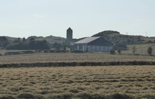
Smailholm Tower

Smailholm Tower is a peel tower at Smailholm, around five miles (8 km) west of Kelso in the Scottish Borders. Its dramatic situation, atop a crag of Lady...

Nearby Amenities

Located within 500m of 55.610319,-2.5315038
The data included in this document is from www.openstreetmap.org. The data is made available under ODbL.

Have you been to Houks Plantation?

Leave your review of Houks Plantation below (or comments, questions and feedback).