Oak Brae

Wood, Forest in Aberdeenshire

Scotland

Oak Brae

Forest roads of Bennachie
Forest roads of Bennachie Credit: Ralph Greig

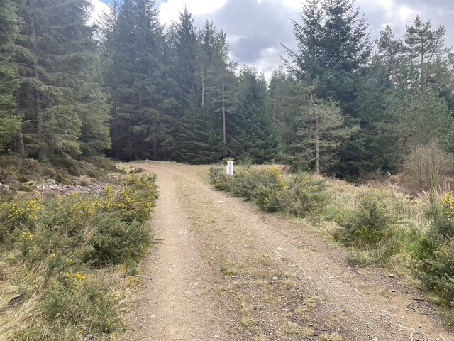
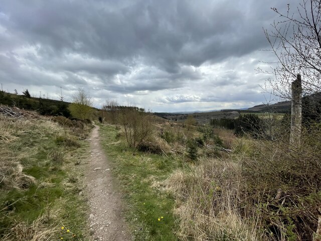
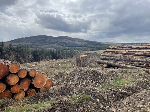
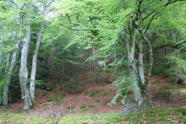
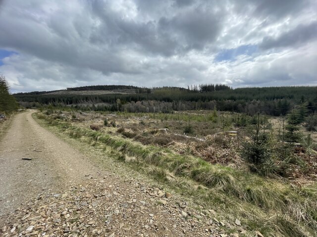
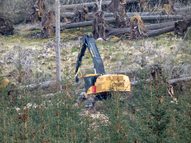
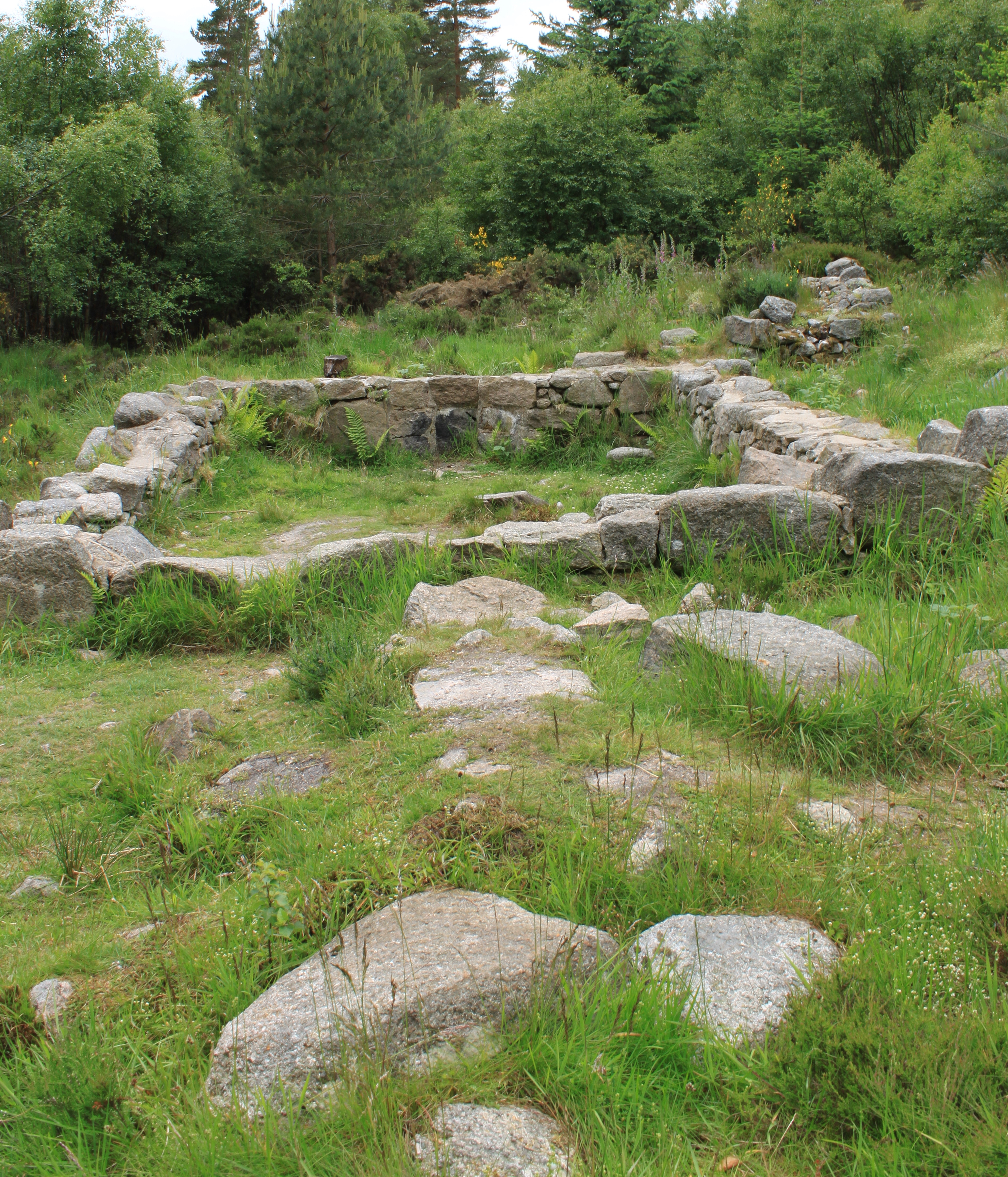
Oak Brae is a picturesque woodland area located in Aberdeenshire, Scotland. Spread over an expansive area, this forest is known for its dense growth of oak trees, which give it its distinctive name. The woodland is situated in a hilly region, offering visitors breathtaking views of the surrounding countryside.

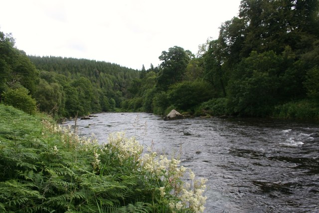
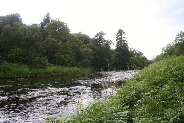
One of the notable features of Oak Brae is the rich biodiversity it supports. The forest is home to a wide range of flora and fauna, making it a haven for nature enthusiasts and wildlife lovers. The oak trees, with their strong and sturdy trunks, provide a habitat for various bird species, including woodpeckers and owls, as well as small mammals like squirrels and deer. The forest floor is covered with a lush carpet of mosses, ferns, and wildflowers, adding to its natural beauty.

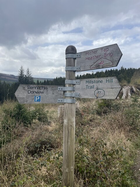
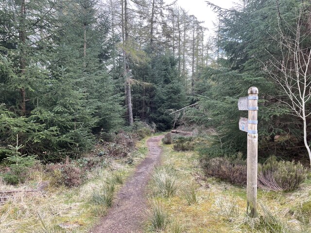
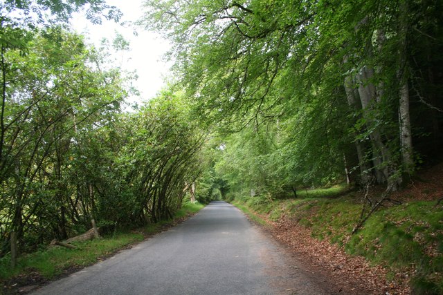
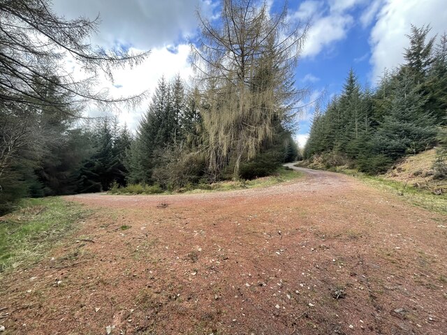
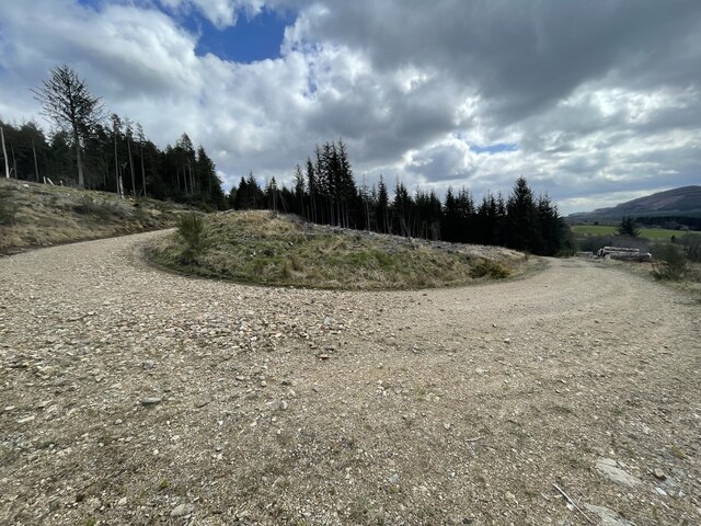
The woodland is crisscrossed by numerous walking trails and footpaths, allowing visitors to explore its wonders at their own pace. These trails offer a chance to immerse oneself in the tranquility of nature, away from the hustle and bustle of city life. Along the way, visitors may stumble upon hidden streams or encounter small waterfalls, adding to the charm of the forest.

Oak Brae is a popular destination for outdoor activities such as hiking, birdwatching, and photography. The forest also serves as an educational resource, with guided tours and workshops available to help visitors learn more about the local flora and fauna.

Overall, Oak Brae in Aberdeenshire is a captivating woodland retreat that showcases the natural beauty and diverse ecosystem of the region.

If you have any feedback on the listing, please let us know in the comments section below.

Oak Brae Images

Images are sourced within 2km of 57.262526/-2.5572368 or Grid Reference NJ6619. Thanks to Geograph Open Source API. All images are credited.

Forest roads of Bennachie
Which way? Bennachie is a range of hills in Aberdeenshire, Scotland.It has several tops, the highest of which, Oxen Craig, has a height of 528 metres (1,732 ft). Though not particularly high, compared to other peaks within Scotland, the mountain is very prominent, owing to its isolation and the relative flatness of the surrounding terrain, and dominates the skyline from several viewpoints.
Which way?
Bennachie is a range of hills in Aberdeenshire, Scotland.It has several tops, the highest of which, Oxen Craig, has a height of 528 metres (1,732 ft). Though not particularly high, compared to other peaks within Scotland, the mountain is very prominent, owing to its isolation and the relative flatness of the surrounding terrain, and dominates the skyline from several viewpoints.
A path on Bennachie Bennachie is a range of hills in Aberdeenshire, Scotland.It has several tops, the highest of which, Oxen Craig, has a height of 528 metres (1,732 ft). Though not particularly high, compared to other peaks within Scotland, the mountain is very prominent, owing to its isolation and the relative flatness of the surrounding terrain, and dominates the skyline from several viewpoints.
A path on Bennachie
Bennachie is a range of hills in Aberdeenshire, Scotland.It has several tops, the highest of which, Oxen Craig, has a height of 528 metres (1,732 ft). Though not particularly high, compared to other peaks within Scotland, the mountain is very prominent, owing to its isolation and the relative flatness of the surrounding terrain, and dominates the skyline from several viewpoints.
Harvest time for trees Bennachie is a range of hills in Aberdeenshire, Scotland.It has several tops, the highest of which, Oxen Craig, has a height of 528 metres (1,732 ft). Though not particularly high, compared to other peaks within Scotland, the mountain is very prominent, owing to its isolation and the relative flatness of the surrounding terrain, and dominates the skyline from several viewpoints.
Harvest time for trees
Bennachie is a range of hills in Aberdeenshire, Scotland.It has several tops, the highest of which, Oxen Craig, has a height of 528 metres (1,732 ft). Though not particularly high, compared to other peaks within Scotland, the mountain is very prominent, owing to its isolation and the relative flatness of the surrounding terrain, and dominates the skyline from several viewpoints.
Where the trees used to be
Only one way to go
Only one way to go
Don by Tilliehashlach The River Don with the Paradise Wood on the right side. Tilliehashlach translates as the knoll of the rapid ford.
Don by Tilliehashlach
The River Don with the Paradise Wood on the right side. Tilliehashlach translates as the knoll of the rapid ford.
Don Upstream The River Don flowing towards the camera from Woodhead, Paradise Wood on the far bank.
Don Upstream
The River Don flowing towards the camera from Woodhead, Paradise Wood on the far bank.
Forest Edge The edge of the Bennachie Forest from the roadside.
Forest Edge
The edge of the Bennachie Forest from the roadside.
Bennachie Road The road bordering the Bennachie forest between Ramstone and Tilliehashlach.
Bennachie Road
The road bordering the Bennachie forest between Ramstone and Tilliehashlach.
Don and Paradise The River Don and Paradise Wood.
Don and Paradise
The River Don and Paradise Wood.
River Don by Paradise Wood Scenic reach of the Don upstream from Pitfichie.
<span class="nowrap"><a title="http://en.wikipedia.org/wiki/River_Don,_Aberdeenshire" rel="nofollow ugc noopener" href="http://en.wikipedia.org/wiki/River_Don,_Aberdeenshire">Link</a><img style="margin-left:2px;" alt="External link" title="External link - shift click to open in new window" src="https://s1.geograph.org.uk/img/external.png" width="10" height="10"/></span>
River Don by Paradise Wood
Scenic reach of the Don upstream from Pitfichie. LinkExternal link
River Don at Paradise Wood
More forest hairpin bends Bennachie is a range of hills in Aberdeenshire, Scotland.It has several tops, the highest of which, Oxen Craig, has a height of 528 metres (1,732 ft). Though not particularly high, compared to other peaks within Scotland, the mountain is very prominent, owing to its isolation and the relative flatness of the surrounding terrain, and dominates the skyline from several viewpoints.
More forest hairpin bends
Bennachie is a range of hills in Aberdeenshire, Scotland.It has several tops, the highest of which, Oxen Craig, has a height of 528 metres (1,732 ft). Though not particularly high, compared to other peaks within Scotland, the mountain is very prominent, owing to its isolation and the relative flatness of the surrounding terrain, and dominates the skyline from several viewpoints.
Even more hairpin bends Bennachie is a range of hills in Aberdeenshire, Scotland.It has several tops, the highest of which, Oxen Craig, has a height of 528 metres (1,732 ft). Though not particularly high, compared to other peaks within Scotland, the mountain is very prominent, owing to its isolation and the relative flatness of the surrounding terrain, and dominates the skyline from several viewpoints.
Even more hairpin bends
Bennachie is a range of hills in Aberdeenshire, Scotland.It has several tops, the highest of which, Oxen Craig, has a height of 528 metres (1,732 ft). Though not particularly high, compared to other peaks within Scotland, the mountain is very prominent, owing to its isolation and the relative flatness of the surrounding terrain, and dominates the skyline from several viewpoints.
Forest roads around Bennachie Bennachie is a range of hills in Aberdeenshire, Scotland.It has several tops, the highest of which, Oxen Craig, has a height of 528 metres (1,732 ft). Though not particularly high, compared to other peaks within Scotland, the mountain is very prominent, owing to its isolation and the relative flatness of the surrounding terrain, and dominates the skyline from several viewpoints.
Forest roads around Bennachie
Bennachie is a range of hills in Aberdeenshire, Scotland.It has several tops, the highest of which, Oxen Craig, has a height of 528 metres (1,732 ft). Though not particularly high, compared to other peaks within Scotland, the mountain is very prominent, owing to its isolation and the relative flatness of the surrounding terrain, and dominates the skyline from several viewpoints.
Forestry Operations on Millstone Hill
Forest path
Forest path
Show me another place!

Oak Brae is located at Grid Ref: NJ6619 (Lat: 57.262526, Lng: -2.5572368)

Unitary Authority: Aberdeenshire

Police Authority: North East

What 3 Words

///hawks.revealing.tester. Near Kemnay, Aberdeenshire

Related Wikis

Bennachie

Bennachie ( ben-ə-HEE; Scottish Gaelic: Beinn na Cìche) is a range of hills in Aberdeenshire, Scotland. It has several tops, the highest of which, Oxen...

Blairdaff

Blairdaff is a parish in Garioch, Aberdeenshire, Scotland, next to the villages of Kemnay and Monymusk. Blairdaff had a grocery store, a post office, and...

Bograxie

Bograxie is a farm in Aberdeenshire, Scotland. == References ==

Castle Forbes

Castle Forbes is a 19th-century country house in the Scottish baronial architecture style near Alford in Aberdeenshire, Scotland. The 6,000-acre (2,400...

Monymusk

Monymusk (Scottish Gaelic: Monadh Musga) is a planned village in the Marr area of Aberdeenshire, Scotland. == History == Malcolm Canmore first established...

Monymusk Parish Church

Monymusk Parish Church (also known as the Church of the Blessed Mary) is located in Monymusk, Aberdeenshire, Scotland. It is of Church of Scotland denomination...

House of Monymusk

The House of Monymusk is located on the outskirts of the Scottish village of Monymusk, in the Marr region of Aberdeenshire. The house is located near the...

The Colony (Bennachie)

The Colony was a squatters' community on "commonty", or common land, on one side of Bennachie, a range of hills near Aberdeen, in Scotland.From the beginning...

Nearby Amenities

Located within 500m of 57.262526,-2.5572368
Power: pole
Lat/Long: 57.2591484/-2.5520787
Power: pole
Lat/Long: 57.2597295/-2.5529835
Power: pole
Lat/Long: 57.2600058/-2.5534393
Power: pole
Lat/Long: 57.2604439/-2.5541042
Power: pole
Lat/Long: 57.2607714/-2.5546458
Power: pole
Lat/Long: 57.2614596/-2.5552842
Power: pole
Lat/Long: 57.2621739/-2.5559513
Power: pole
Lat/Long: 57.2626264/-2.5563674
Power: pole
Lat/Long: 57.2630752/-2.5567835
Power: pole
Lat/Long: 57.2634479/-2.557138
Power: pole
Lat/Long: 57.2640253/-2.5576642
Power: pole
Lat/Long: 57.2644004/-2.5580186
Power: pole
Lat/Long: 57.2649266/-2.558503
Power: pole
Lat/Long: 57.2655492/-2.5591018
Power: pole
Lat/Long: 57.2660433/-2.5602467
Power: pole
Lat/Long: 57.2666957/-2.5593946
Power: pole
Lat/Long: 57.2657576/-2.5613695
Power: pole
Lat/Long: 57.2656576/-2.5617482
Power: pole
Lat/Long: 57.2652194/-2.5634809
The data included in this document is from www.openstreetmap.org. The data is made available under ODbL.

Have you been to Oak Brae?

Leave your review of Oak Brae below (or comments, questions and feedback).