Knowhead Wood

Wood, Forest in Aberdeenshire

Scotland

Knowhead Wood

Forgotten Logs These large logs have evidently been forgotten when the forest was being cleared. They will no doubt provide habitat for assorted small wildlife.
Forgotten Logs Credit: Anne Burgess

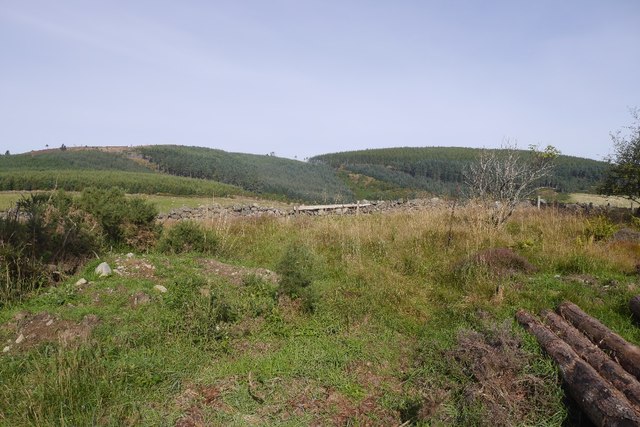
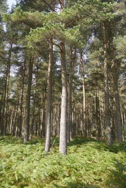
Knowhead Wood is a charming and picturesque forest located in Aberdeenshire, Scotland. Covering an area of approximately 50 hectares, it is a popular destination for nature enthusiasts and outdoor lovers alike. The wood is situated near the village of Kemnay, just a short distance from the bustling city of Aberdeen.

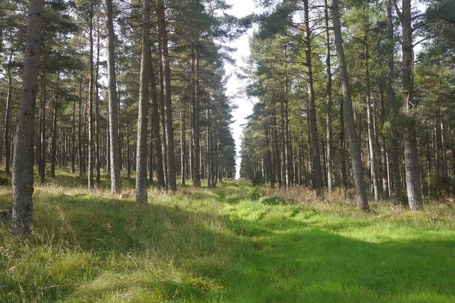
Knowhead Wood boasts a diverse range of flora and fauna, making it an important habitat for wildlife. Visitors can expect to encounter a variety of tree species, including oak, birch, and Scots pine, which contribute to the wood's distinct and enchanting atmosphere. The forest floor is adorned with a carpet of vibrant wildflowers during the spring and summer months, adding a splash of color to the landscape.

The wood offers a network of well-maintained trails, allowing visitors to explore its beauty at their own pace. These paths are suitable for both walking and cycling, providing a wonderful opportunity to immerse oneself in nature and enjoy the peaceful surroundings. Additionally, there are designated picnic areas where visitors can take a break and relish in the tranquility of the wood.

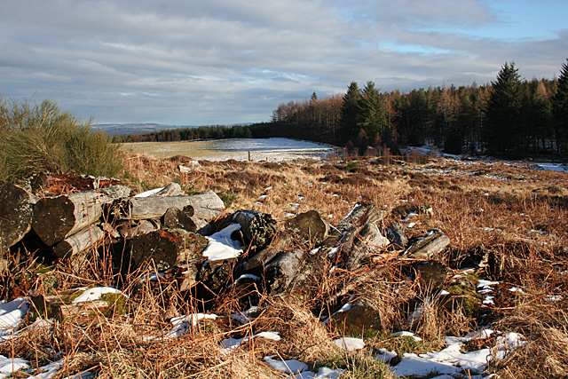
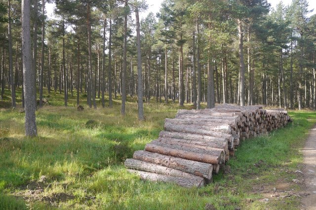
Knowhead Wood is not only a haven for wildlife and flora, but also a rich historical site. It is believed to have served as a source of timber for local communities in the past, and remnants of old sawpits and charcoal platforms can still be found within the wood. These historical features add an extra layer of intrigue and significance to the site.

Overall, Knowhead Wood is a captivating and idyllic destination that offers a serene escape from the urban bustle. Whether it's a leisurely walk, a family picnic, or a wildlife spotting adventure, this forest has something to offer for everyone.

If you have any feedback on the listing, please let us know in the comments section below.

Knowhead Wood Images

Images are sourced within 2km of 57.21262/-2.5585537 or Grid Reference NJ6613. Thanks to Geograph Open Source API. All images are credited.

Forgotten Logs These large logs have evidently been forgotten when the forest was being cleared. They will no doubt provide habitat for assorted small wildlife.
Forgotten Logs
These large logs have evidently been forgotten when the forest was being cleared. They will no doubt provide habitat for assorted small wildlife.
Whitehills Just to show that there is more in this grid square than the recumbent stone circle, this is the farm from which the stone circle takes one of its names.
Whitehills
Just to show that there is more in this grid square than the recumbent stone circle, this is the farm from which the stone circle takes one of its names.
Bogmore Wood The bluish hint on the trees suggests that they are Douglas Fir. They make a pleasant change from Sitka Spruce. Through the gap, there's a distant glimpse of the village of Monymusk.
Bogmore Wood
The bluish hint on the trees suggests that they are Douglas Fir. They make a pleasant change from Sitka Spruce. Through the gap, there's a distant glimpse of the village of Monymusk.
Boulders in a Dyke Most of this field seems to be marked by a row of very large boulders, presumably erratics cleared from the field.
Boulders in a Dyke
Most of this field seems to be marked by a row of very large boulders, presumably erratics cleared from the field.
Saltire Tree Stump The cross in the surface of this tree stump is the remains of four twigs growing at right angles to one another. The tree eventually engulfed them as it expanded, and the woodcutter's saw just happens to have cut at just the right level to expose them to view.
Saltire Tree Stump
The cross in the surface of this tree stump is the remains of four twigs growing at right angles to one another. The tree eventually engulfed them as it expanded, and the woodcutter's saw just happens to have cut at just the right level to expose them to view.
Lonesome Pine This solitary Scots Pine looks as if it has a bit of a history. It may have been part of a plantation, but if so it was left standing when its fellows were felled. It was then able to grow out a bit, as Scots Pines will do when not competing with others too close to them. Then it has lost some of its lower branches, leaving bare stumps near the base of the tree, but it still has a green crown.
Lonesome Pine
This solitary Scots Pine looks as if it has a bit of a history. It may have been part of a plantation, but if so it was left standing when its fellows were felled. It was then able to grow out a bit, as Scots Pines will do when not competing with others too close to them. Then it has lost some of its lower branches, leaving bare stumps near the base of the tree, but it still has a green crown.
Westside The snow in the foreground field is shaded by the forest in this view across the Todlachie Burn to Westside.
Westside
The snow in the foreground field is shaded by the forest in this view across the Todlachie Burn to Westside.
Woodland, Tillyfourie Hill Mature conifers beside the Pitfichie Forest car park.
Woodland, Tillyfourie Hill
Mature conifers beside the Pitfichie Forest car park.
Logging road, Tillyfourie Hill Near the car park.
Logging road, Tillyfourie Hill
Near the car park.
Dense woodland, Pitfichie Forest Fight on both sides with young Sitka spruce plantations. Fortunately most of the route up to Cairn William was through more interesting forest.
Dense woodland, Pitfichie Forest
Fight on both sides with young Sitka spruce plantations. Fortunately most of the route up to Cairn William was through more interesting forest.
Tillyfourie Hill Mature Scots Pine woodland and log pile in Pitfichie Forest.
Tillyfourie Hill
Mature Scots Pine woodland and log pile in Pitfichie Forest.
View towards White Lady White Lady is a wooded hill in Pitfichie Forest.
View towards White Lady
White Lady is a wooded hill in Pitfichie Forest.
Ride, Tillyfourie Hill A survivor from the ride pattern shown on the 1961 1:25,000 map.
Ride, Tillyfourie Hill
A survivor from the ride pattern shown on the 1961 1:25,000 map.
View out of the forest Looking eastwards out of Pitfichie Forest.
View out of the forest
Looking eastwards out of Pitfichie Forest.
Under Green Hill A field above Whitehills, under Pitfichie Forest.
Under Green Hill
A field above Whitehills, under Pitfichie Forest.
Scots pines, Pitfichie Forest The eastern slopes of Green Hill.
Scots pines, Pitfichie Forest
The eastern slopes of Green Hill.
Logging road, Pitfichie Forest The road runs the length of the forest and is waymarked as the "white" route. The full route runs around Cairn William.
Logging road, Pitfichie Forest
The road runs the length of the forest and is waymarked as the "white" route. The full route runs around Cairn William.
Pitfichie Forest The road runs along the eastern side of the woodland and goes up and down a bit.  The view is through an area of young trees towards Green Hill.
Pitfichie Forest
The road runs along the eastern side of the woodland and goes up and down a bit. The view is through an area of young trees towards Green Hill.
Show me another place!

Knowhead Wood is located at Grid Ref: NJ6613 (Lat: 57.21262, Lng: -2.5585537)

Unitary Authority: Aberdeenshire

Police Authority: North East

What 3 Words

///novels.arise.regular. Near Sauchen, Aberdeenshire

Related Wikis

Tillyfourie railway station

Tillyfourie railway station was a railway station serving Tillyfourie, Aberdeenshire, Scotland. The station opened on 2 June 1860 on the Alford Valley...

Monymusk railway station

Monymusk railway station was a station on the Alford Valley Railway in Monymusk, Aberdeenshire, Scotland. The station opened on 25 March 1859 and closed...
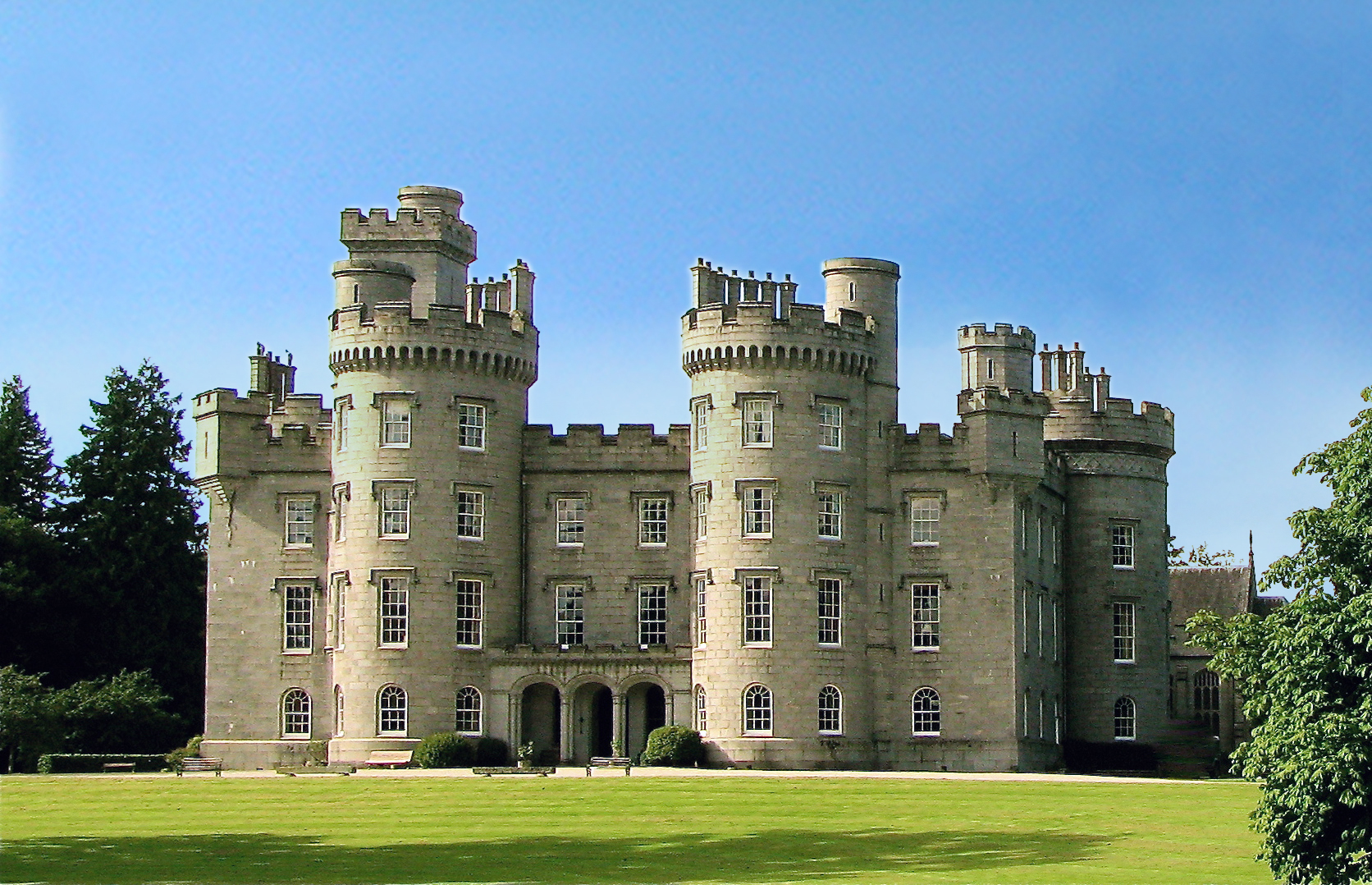
Tillycairn Castle

Tillycairn Castle is an L-plan castle, dating from the 16th century, standing on high ground around 2.0 miles (3.2 km) south-east of Cluny in Aberdeenshire...

Monymusk

Monymusk (Scottish Gaelic: Monadh Musga) is a planned village in the Marr area of Aberdeenshire, Scotland. == History == Malcolm Canmore first established...

Monymusk Parish Church

Monymusk Parish Church (also known as the Church of the Blessed Mary) is located in Monymusk, Aberdeenshire, Scotland. It is of Church of Scotland denomination...

A944 road

The A944 road connects Aberdeen with Strathdon in north-east Scotland. == Route == It originates at the Lang Stracht in the city, which is a re-routing...

House of Monymusk

The House of Monymusk is located on the outskirts of the Scottish village of Monymusk, in the Marr region of Aberdeenshire. The house is located near the...

Cluny Castle

Cluny Castle was originally built c.1604 as a Z-plan castle replacing either a house or small peel tower. Sited in the parish of Cluny, it is south of...

Nearby Amenities

Located within 500m of 57.21262,-2.5585537
Power: pole
Lat/Long: 57.2104838/-2.5513714
Power: pole
Lat/Long: 57.2101235/-2.552167
Power: pole
Lat/Long: 57.2099058/-2.5526174
Power: pole
Lat/Long: 57.2096139/-2.5532758
Material: wood
Power: pole
Lat/Long: 57.2097099/-2.5543125
Material: wood
Power: pole
Lat/Long: 57.2098555/-2.555704
Material: wood
Power: pole
Lat/Long: 57.2097505/-2.5565717
Power: pole
Lat/Long: 57.2096184/-2.557607
Power: pole
Lat/Long: 57.2090284/-2.5540367
The data included in this document is from www.openstreetmap.org. The data is made available under ODbL.

Have you been to Knowhead Wood?

Leave your review of Knowhead Wood below (or comments, questions and feedback).