Pitfichie Forest

Wood, Forest in Aberdeenshire

Scotland

Pitfichie Forest

Logging road, Pitfichie Forest The road runs the length of the forest and is waymarked as the "white" route. The full route runs around Cairn William.
Logging road, Pitfichie Forest Credit: Richard Webb

Pitfichie Forest is a sprawling woodland located in Aberdeenshire, Scotland. Covering an area of approximately 1,500 hectares, it is situated near the town of Pitcaple, about 25 miles west of the city of Aberdeen. The forest is managed by Forestry and Land Scotland and offers a variety of recreational opportunities for visitors.

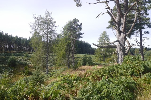
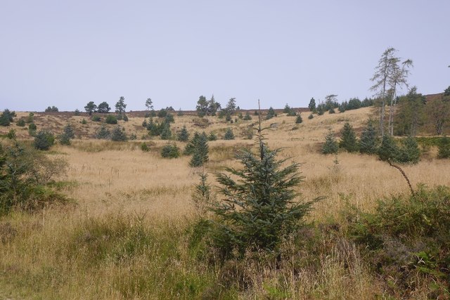
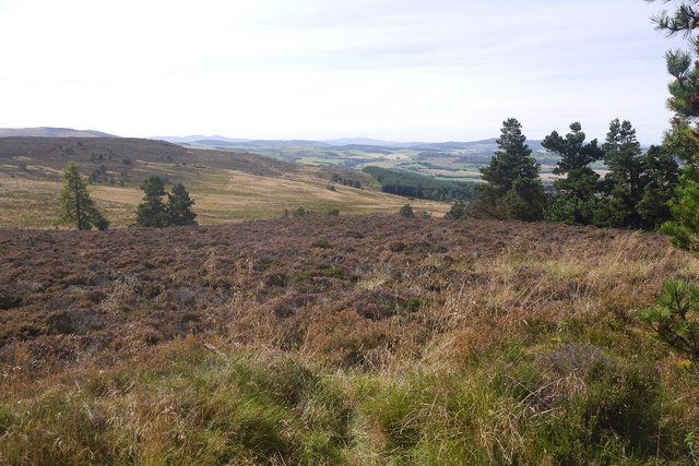
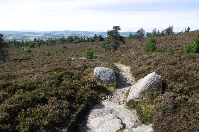
The landscape of Pitfichie Forest is characterized by a mixture of coniferous and broadleaf trees, creating a diverse and picturesque environment. The forest is home to a wide range of wildlife, including red squirrels, roe deer, and various bird species, making it a popular destination for nature enthusiasts and birdwatchers.

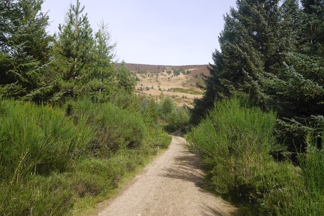
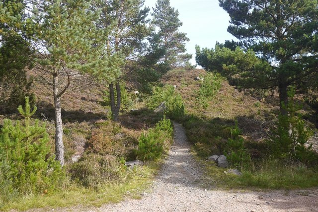
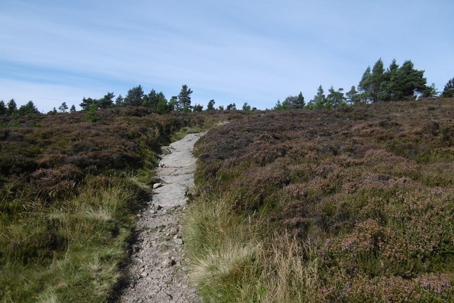
The forest features an extensive network of well-marked trails, providing opportunities for walking, mountain biking, and horse riding. The trails cater to different levels of difficulty, from easy routes suitable for families to more challenging paths for experienced outdoor enthusiasts. One of the prominent trails is the Pitfichie Mountain Bike Trails, which offers a thrilling experience for mountain bikers with its range of technical features and jumps.

In addition to the recreational activities, Pitfichie Forest also offers amenities such as picnic areas, a children's play area, and toilet facilities, making it an ideal destination for a day out with family and friends. The forest has a parking area, and access is free of charge.

Overall, Pitfichie Forest is a beautiful and accessible woodland area, providing a tranquil escape from the hustle and bustle of city life. With its diverse wildlife, well-maintained trails, and recreational facilities, it offers something for everyone to enjoy.

If you have any feedback on the listing, please let us know in the comments section below.

Pitfichie Forest Images

Images are sourced within 2km of 57.235858/-2.5707666 or Grid Reference NJ6516. Thanks to Geograph Open Source API. All images are credited.

Logging road, Pitfichie Forest The road runs the length of the forest and is waymarked as the "white" route. The full route runs around Cairn William.
Logging road, Pitfichie Forest
The road runs the length of the forest and is waymarked as the "white" route. The full route runs around Cairn William.
Pitfichie Forest The road runs along the eastern side of the woodland and goes up and down a bit.  The view is through an area of young trees towards Green Hill.
Pitfichie Forest
The road runs along the eastern side of the woodland and goes up and down a bit. The view is through an area of young trees towards Green Hill.
Logging road, Pitfichie Forest An older pine, perhaps from a time when Bogmore was a less formal woodland with scattered trees and moorland.
Logging road, Pitfichie Forest
An older pine, perhaps from a time when Bogmore was a less formal woodland with scattered trees and moorland.
Bogmore Land around the Pitmunie Burn has not been formally replanted.  There are still some old pines here.
Bogmore
Land around the Pitmunie Burn has not been formally replanted. There are still some old pines here.
Scots pines, Pitfichie Forest Eastern slopes of Cairn William.
Scots pines, Pitfichie Forest
Eastern slopes of Cairn William.
Cleared area, Pitfichie Forest Self seeded spruce dot a hillside which has been clear felled and left.
Cleared area, Pitfichie Forest
Self seeded spruce dot a hillside which has been clear felled and left.
Logging road, Pitfichie Forest Climbing to the col south of Cairn William. The view down the hill is towards a dun slope where there has been some clear felling in the past.
Logging road, Pitfichie Forest
Climbing to the col south of Cairn William. The view down the hill is towards a dun slope where there has been some clear felling in the past.
Granite Top Trail The mountain bike  route over Cairn William.  Cairn William is a significant hill and the path also gives a good walk to the summit.  It is a steady climb, so there should be no problems getting in the way of fast moving bikes.
Granite Top Trail
The mountain bike route over Cairn William. Cairn William is a significant hill and the path also gives a good walk to the summit. It is a steady climb, so there should be no problems getting in the way of fast moving bikes.
View over King's Moss Moorland above Pitfichie Forest.
View over King's Moss
Moorland above Pitfichie Forest.
Path, Cairn William The gently climbing, but technical mountain bike path route over Cairn William. It is also walkable and a good route to the summit with fine views.
Path, Cairn William
The gently climbing, but technical mountain bike path route over Cairn William. It is also walkable and a good route to the summit with fine views.
Path, Cairn William The Granite Top mountain bike trail has some interesting rock features. Unfortunately I am not fit enough to climb fast enough to clear a lot of them.  The descent beyond the summit was very easy though and nowhere near as technical.
Path, Cairn William
The Granite Top mountain bike trail has some interesting rock features. Unfortunately I am not fit enough to climb fast enough to clear a lot of them. The descent beyond the summit was very easy though and nowhere near as technical.
Col, Cairn William A view over to Millstone Hill and Mither Tap on Benachie from the mountain bike path on Cairn William.
Col, Cairn William
A view over to Millstone Hill and Mither Tap on Benachie from the mountain bike path on Cairn William.
Mountain bike track, Cairn William The path, used by bikes in ascent so fine to walk along too, uses granite bedrock and boulders for trail features.
Mountain bike track, Cairn William
The path, used by bikes in ascent so fine to walk along too, uses granite bedrock and boulders for trail features.
Cairn William There is a lot of exposed granite near the summit of Cairn William. It is used by a mountain bike track along the ridge.
Cairn William
There is a lot of exposed granite near the summit of Cairn William. It is used by a mountain bike track along the ridge.
Summit, Cairn William Bare granite and a triangulation pillar. The views are very fine.
Summit, Cairn William
Bare granite and a triangulation pillar. The views are very fine.
Path off Cairn William The tape banners mark the route for a hill race which was held from Monymusk later in the day.
Path off Cairn William
The tape banners mark the route for a hill race which was held from Monymusk later in the day.
Summit, Cairn William View past the triangulation pillar towards Mither Tap on Benachie.
Summit, Cairn William
View past the triangulation pillar towards Mither Tap on Benachie.
Pitfichie Forest Looking down on plantations from Cairn William's summit.
Pitfichie Forest
Looking down on plantations from Cairn William's summit.
Show me another place!

Pitfichie Forest is located at Grid Ref: NJ6516 (Lat: 57.235858, Lng: -2.5707666)

Unitary Authority: Aberdeenshire

Police Authority: North East

What 3 Words

///emptied.reefs.haunts. Near Sauchen, Aberdeenshire

Related Wikis

Monymusk

Monymusk (Scottish Gaelic: Monadh Musga) is a planned village in the Marr area of Aberdeenshire, Scotland. == History == Malcolm Canmore first established...

Monymusk Parish Church

Monymusk Parish Church (also known as the Church of the Blessed Mary) is located in Monymusk, Aberdeenshire, Scotland. It is of Church of Scotland denomination...

House of Monymusk

The House of Monymusk is located on the outskirts of the Scottish village of Monymusk, in the Marr region of Aberdeenshire. The house is located near the...

Monymusk railway station

Monymusk railway station was a station on the Alford Valley Railway in Monymusk, Aberdeenshire, Scotland. The station opened on 25 March 1859 and closed...

Whitehouse railway station (Scotland)

Whitehouse railway station was a station in Whitehouse, Aberdeenshire. It opened with the along with the rest of the Alford Valley Railway line from Kintore...

Tillyfourie railway station

Tillyfourie railway station was a railway station serving Tillyfourie, Aberdeenshire, Scotland. The station opened on 2 June 1860 on the Alford Valley...

Blairdaff

Blairdaff is a parish in Garioch, Aberdeenshire, Scotland, next to the villages of Kemnay and Monymusk. Blairdaff had a grocery store, a post office, and...

Castle Forbes

Castle Forbes is a 19th-century country house in the Scottish baronial architecture style near Alford in Aberdeenshire, Scotland. The 6,000-acre (2,400...

Have you been to Pitfichie Forest?

Leave your review of Pitfichie Forest below (or comments, questions and feedback).