Chalvedon

Settlement in Essex Basildon

England

Chalvedon

Grazing near Basildon
Grazing near Basildon Credit: JThomas

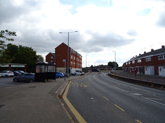
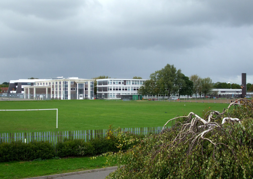
Chalvedon is a suburban area located in the borough of Basildon in the county of Essex, England. Situated approximately 30 miles east of London, Chalvedon is a well-established residential neighborhood with a distinct community feel.

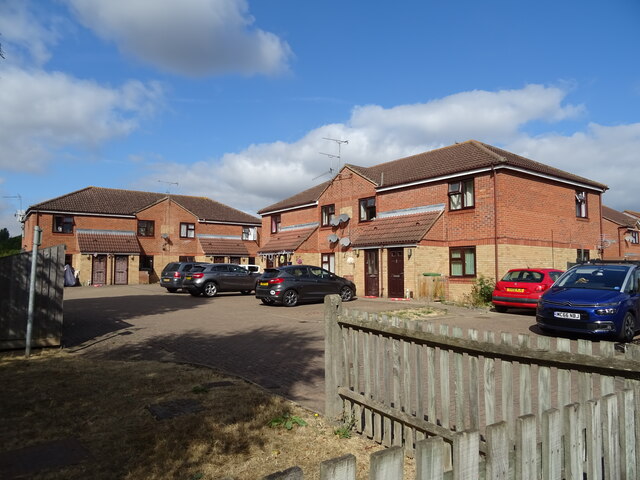
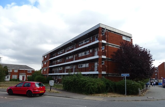
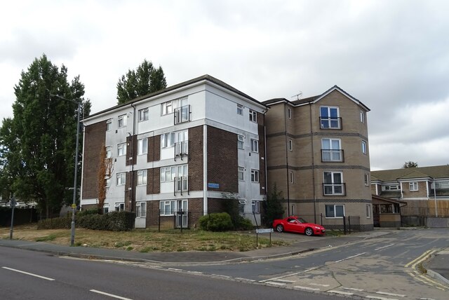
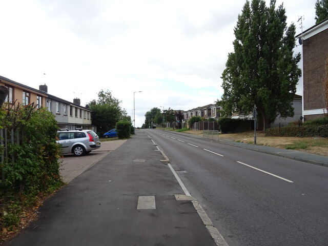
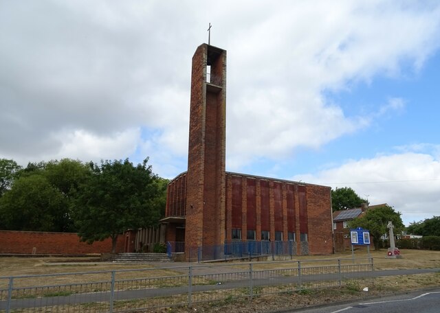
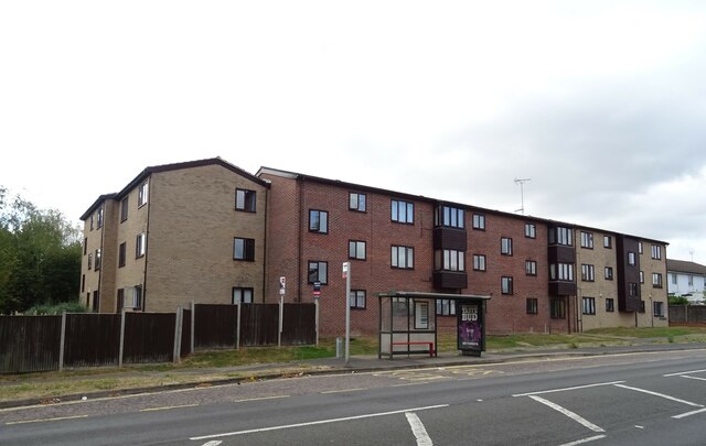
The area is characterized by predominantly 20th-century housing, with a mix of detached and semi-detached houses, as well as some low-rise apartment buildings. The architecture is typically suburban, with well-maintained gardens and tree-lined streets adding to the pleasant ambiance of the area.

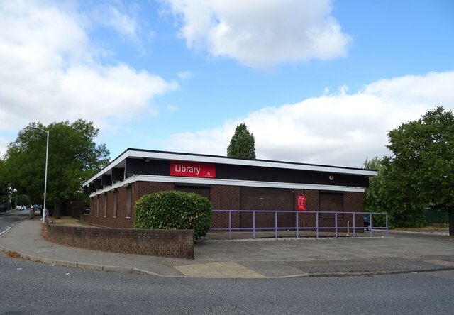
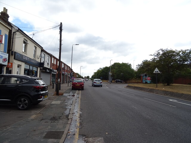
Chalvedon benefits from a range of local amenities and services that cater to its residents' needs. The neighborhood features a small shopping precinct, including a supermarket, convenience stores, and a variety of shops and businesses. Additionally, there are several local pubs, cafes, and restaurants that provide options for dining and socializing.

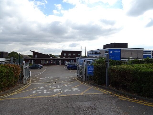
For families, Chalvedon offers access to a number of schools, both primary and secondary, which are well-regarded for their academic performance and community involvement. The area benefits from several green spaces and recreational areas, providing opportunities for outdoor activities and relaxation.

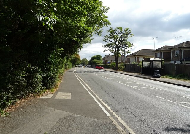
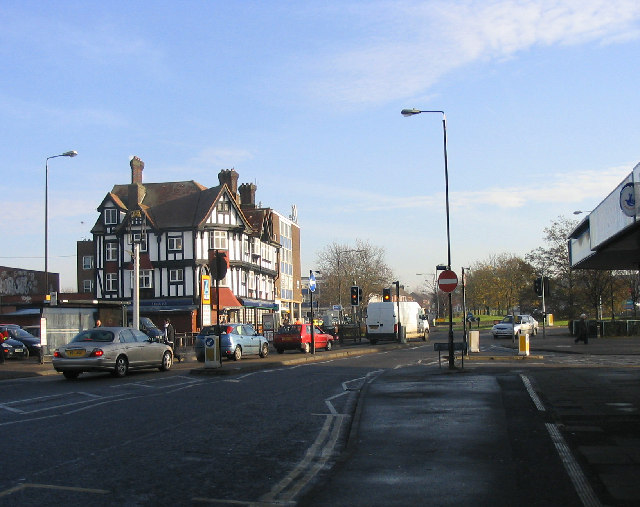
Transport links are also convenient with Chalvedon being in close proximity to the A13 road, connecting it to nearby towns and London. Additionally, there are regular bus services serving the area, as well as a nearby train station providing direct links to the capital.

Overall, Chalvedon offers a tranquil suburban lifestyle with good accessibility to nearby amenities and transport links, making it an attractive place to live for families and individuals seeking a peaceful residential area within easy reach of London.

If you have any feedback on the listing, please let us know in the comments section below.

Chalvedon Images

Images are sourced within 2km of 51.568834/0.500618 or Grid Reference TQ7388. Thanks to Geograph Open Source API. All images are credited.

Grazing near Basildon
Houses on Sunnedon, Basildon
Clay Hill Road, Basildon
Flats off  Southview Road, Basildon
Flats off Southview Road, Basildon
Vange Library, Basildon
Bus stop and shelter on Clay Hill Road, Basildon
Bardfield Academy, Basildon
Flats, Middle Crockerford Basildon
Clay Hill Road (B1464), Basildon
St Chad's Church, Vange, Basildon
Chestnut Court Flats, Basildon.
Chestnut Court
Flats, Basildon.
Railway bridge over High Road (B1464)
TSB Bank, Pitsea
TSB Bank, Pitsea
Aldi supermarket, Pitsea, Basildon
B1464, Pitsea, Basildon
Post Office and shop, Pitsea, Basildon
Houses on London Road, Basildon
London Road (B1464), Basildon Towards Southend.
London Road (B1464), Basildon
Towards Southend.
Show me another place!

Chalvedon is located at Grid Ref: TQ7388 (Lat: 51.568834, Lng: 0.500618)

Administrative County: Essex

District: Basildon

Police Authority: Essex

What 3 Words

///luxury.wounds.chins. Near Pitsea, Essex

Nearby Locations

Chalvedon

Related Wikis

Pitsea

Pitsea is a town and former civil parish in the Borough of Basildon in south Essex, England. It comprises five sub-districts: Eversley, Northlands Park...

Chalvedon School

Chalvedon School and 6th Form College was a Specialist Technology College in Pitsea, Essex, England. It was a comprehensive school educating pupils aged...

Barstable School

The Barstable School was a mixed intake secondary school in Basildon, Essex. It closed in 2009 to become a founding member of the Basildon Academies....

Northlands Park, Basildon

Northlands Park is a park in Basildon, Essex, England. == History of the park == Basildon Northlands Park was created by Basildon Development Corporation...

Pitsea railway station

Pitsea railway station is on the London, Tilbury and Southend line, serving the small town of Pitsea in the borough of Basildon, Essex. It is situated...

Fryerns Comprehensive School

Fryerns Comprehensive School , also known as Fryerns Community School, was a mixed intake secondary school in Basildon, Essex that opened in 1956. The...

Bowers & Pitsea F.C.

Bowers & Pitsea Football Club is a football club based in Pitsea, Essex, England. The club are currently members of the Isthmian League North Division...

Hashtag United F.C.

Hashtag United Football Club is a semi-professional football club based in Essex, England. They are currently members of the Isthmian League Premier Division...

Nearby Amenities

Located within 500m of 51.568834,0.500618
Bus Stop
Chevers Pawen
Bus: yes
Naptan AtcoCode: 150036035010
Naptan Bearing: E
Naptan CommonName: Chevers Pawen
Naptan Crossing: Chevers Pawen
Naptan Indicator: Opp
Naptan Landmark: Chevers Pawen
Naptan NaptanCode: esxdmtdp
Naptan PlusbusZoneRef: BASILDN
Naptan Street: Wickford Avenue
Naptan Verified: yes
Public Transport: platform
Source: naptan_import
Lat/Long: 51.5690827/0.4989446
Bus Stop
Chalvedon School
Bus: yes
Naptan AtcoCode: 150036035011
Naptan Bearing: NW
Naptan CommonName: Chalvedon School
Naptan Crossing: Steeplehall
Naptan Indicator: NW-bound
Naptan Landmark: Chalvedon School
Naptan NaptanCode: esxdmtdt
Naptan PlusbusZoneRef: BASILDN
Naptan Street: Wickford Avenue
Naptan Verified: yes
Public Transport: platform
Source: naptan_import
Lat/Long: 51.5684247/0.5023864
Bus Stop
Dover Way
Naptan AtcoCode: 150036035013
Naptan Bearing: W
Naptan CommonName: Dover Way
Naptan Crossing: Dover Way
Naptan Indicator: Opp
Naptan Landmark: Dover Way
Naptan NaptanCode: esxdmtga
Naptan Street: Wickford Avenue
Naptan Verified: no
Public Transport: platform
Source: naptan_import
Lat/Long: 51.5678895/0.5076533
Bus Stop
Station Lane
Bus: yes
Naptan AtcoCode: 150036038001
Naptan Bearing: W
Naptan CommonName: The Railway Hotel
Naptan Crossing: Station Lane
Naptan Indicator: Opp
Naptan Landmark: The Railway Hotel
Naptan NaptanCode: esxdpawg
Naptan PlusbusZoneRef: BASILDN
Naptan Street: High Road
Naptan Verified: no
Public Transport: platform
Source: naptan_import
Lat/Long: 51.5647555/0.5036423
Bus Stop
Station Lane
Bus: yes
Naptan AtcoCode: 150036038002
Naptan Bearing: E
Naptan CommonName: The Railway Hotel
Naptan Crossing: Station Lane
Naptan Indicator: Adj
Naptan Landmark: The Railway Hotel
Naptan NaptanCode: esxdmtgp
Naptan PlusbusZoneRef: BASILDN
Naptan Street: High Road
Naptan Verified: no
Public Transport: platform
Source: naptan_import
Lat/Long: 51.5648903/0.5040682
Bus Stop
Chalvedon School
Bus: yes
Naptan AtcoCode: 1500CHLVDNSC
Naptan Bearing: SE
Naptan CommonName: Chalvedon School
Naptan Crossing: Steeplehall
Naptan Indicator: SE-bound
Naptan Landmark: Chalvedon School
Naptan NaptanCode: esxdmtdw
Naptan PlusbusZoneRef: BASILDN
Naptan Street: Wickford Avenue
Naptan Verified: yes
Public Transport: platform
Source: naptan_import
Lat/Long: 51.5683991/0.5027458
Bus Stop
Chevers Pawen
Bus: yes
Naptan AtcoCode: 1500IM202
Naptan Bearing: W
Naptan CommonName: Chevers Pawen
Naptan Crossing: Buckerills
Naptan Indicator: Adj
Naptan Landmark: Chevers Pawen
Naptan NaptanCode: esxdmtdm
Naptan PlusbusZoneRef: BASILDN
Naptan Street: Wickford Avenue
Naptan Verified: yes
Public Transport: platform
Source: naptan_import
Lat/Long: 51.5690434/0.4974127
Mini Roundabout
Direction: clockwise
Lat/Long: 51.5690751/0.4958846
Post Box
Brand: Royal Mail
Brand Wikidata: Q638098
Brand Wikipedia: en:Royal Mail
Operator: Royal Mail
Operator Wikidata: Q638098
Lat/Long: 51.5725257/0.5012443
Shops
Lat/Long: 51.5724585/0.5008294
Noexit: yes
Lat/Long: 51.5669415/0.4961373
Noexit: yes
Lat/Long: 51.5648504/0.4978156
Parking
Lat/Long: 51.5647381/0.4980178
Noexit: yes
Lat/Long: 51.5673944/0.496124
Addr City: Basildon
Addr Country: GB
Addr Housenumber: 150
Addr Street: Wickford Mews
Lat/Long: 51.569138/0.4964817
Addr City: Basildon
Addr Country: GB
Addr Housenumber: 166
Addr Street: Wickford Mews
Lat/Long: 51.5695109/0.4964972
Noexit: yes
Lat/Long: 51.5675122/0.501885
Noexit: yes
Lat/Long: 51.5679984/0.5031734
Crossing
Crossing: uncontrolled
Crossing Ref: zebra
Lat/Long: 51.5682073/0.5033325
Addr Housenumber: 1
Lat/Long: 51.5700191/0.496386
Addr Housenumber: 35
Lat/Long: 51.5703502/0.4963974
Addr Housenumber: 2
Lat/Long: 51.5699046/0.4961956
Addr Housenumber: 28
Lat/Long: 51.5698958/0.4964767
Addr City: Basildon
Addr Country: GB
Addr Housenumber: 60
Addr Street: Broomfields
Lat/Long: 51.5698993/0.4968791
Addr City: Basildon
Addr Country: GB
Addr Housenumber: 80
Addr Street: Broomfields
Lat/Long: 51.5698993/0.4971285
Addr City: Basildon
Addr Country: GB
Addr Housenumber: 37
Addr Street: Broomfields
Lat/Long: 51.5700226/0.4972249
Addr City: Basildon
Addr Country: GB
Addr Housenumber: 69
Addr Street: Broomfields
Lat/Long: 51.5700261/0.4974629
Addr City: Basildon
Addr Country: GB
Addr Housenumber: 124
Addr Street: Broomfields
Lat/Long: 51.5700402/0.4989762
Addr City: Basildon
Addr Country: GB
Addr Housenumber: 130
Addr Street: Broomfields
Lat/Long: 51.5700367/0.4991972
Addr City: Basildon
Addr Country: GB
Addr Housenumber: 87
Addr Street: Broomfields Court
Lat/Long: 51.5703009/0.5005688
Addr City: Basildon
Addr Country: GB
Addr Housenumber: 93
Addr Street: Broomfields Court
Lat/Long: 51.570315/0.5002061
School
Len Wastell Junior School
Lat/Long: 51.5651559/0.501458
Addr City: Basildon
Addr Country: GB
Addr Housenumber: 1
Addr Street: Burns Avenue
Lat/Long: 51.5648194/0.5028999
Addr City: Basildon
Addr Country: GB
Addr Housenumber: 2
Addr Street: Burns Avenue
Lat/Long: 51.5648921/0.5030415
Addr City: Basildon
Addr Country: GB
Addr Housenumber: 37
Addr Street: Burns Avenue
Lat/Long: 51.5664151/0.5028702
Addr City: Basildon
Addr Country: GB
Addr Housenumber: 40
Addr Street: Burns Avenue
Lat/Long: 51.5664233/0.5030264
Post Box
Post Box Type: lamp
Ref: SS13 505
Lat/Long: 51.5678365/0.5069907
Crossing
Crossing: uncontrolled
Lat/Long: 51.5689145/0.506513
Restaurant
Mediterranean Grill
Lat/Long: 51.5726379/0.5008121
Noexit: yes
Lat/Long: 51.5680027/0.5033092
Cash Converters
Addr City: Pitsea
Addr Housenumber: 6
Addr Postcode: SS13 3DU
Addr Street: Northlands Pavement
Brand: Cash Converters
Brand Wikidata: Q5048645
Brand Wikipedia: en:Cash Converters
Shop: pawnbroker
Website: https://www.cashconverters.co.uk/stores/pitsea
Lat/Long: 51.5661003/0.5043082
Pharmacy
Boots
Addr City: Pitsea
Addr Housenumber: 8
Addr Postcode: SS13 3DU
Addr Street: Northlands Pavement
Brand: Boots
Brand Wikidata: Q6123139
Brand Wikipedia: en:Boots UK
Dispensing: yes
Healthcare: pharmacy
Website: https://www.boots.com/stores/5668-basildon-pitsea-ss13-3du
Lat/Long: 51.566187/0.5043028
Crossing
Crossing: unmarked
Lat/Long: 51.5648071/0.5029784
Crossing
Crossing: unmarked
Lat/Long: 51.5648916/0.5036461
Crossing
Crossing: unmarked
Lat/Long: 51.564666/0.5022275
Crossing
Crossing: unmarked
Lat/Long: 51.5643939/0.501547
Crossing
Lat/Long: 51.5694666/0.5077531
Generator Method: photovoltaic
Generator Output Electricity: yes
Generator Source: solar
Generator Type: solar_photovoltaic_panel
Location: roof
Power: generator
Lat/Long: 51.5673939/0.4968497
Generator Method: photovoltaic
Generator Output Electricity: yes
Generator Source: solar
Generator Type: solar_photovoltaic_panel
Location: roof
Power: generator
Lat/Long: 51.5716602/0.4960062
Generator Method: photovoltaic
Generator Output Electricity: yes
Generator Source: solar
Generator Type: solar_photovoltaic_panel
Location: roof
Power: generator
Lat/Long: 51.5716635/0.4959592
Generator Method: photovoltaic
Generator Output Electricity: yes
Generator Source: solar
Generator Type: solar_photovoltaic_panel
Location: roof
Power: generator
Lat/Long: 51.572422/0.4986656
Generator Method: photovoltaic
Generator Output Electricity: yes
Generator Source: solar
Generator Type: solar_photovoltaic_panel
Location: roof
Power: generator
Lat/Long: 51.5723353/0.49656
Generator Method: photovoltaic
Generator Output Electricity: yes
Generator Source: solar
Generator Type: solar_photovoltaic_panel
Location: roof
Power: generator
Lat/Long: 51.5719186/0.497067
Generator Method: photovoltaic
Generator Output Electricity: yes
Generator Source: solar
Generator Type: solar_photovoltaic_panel
Location: roof
Power: generator
Lat/Long: 51.5719152/0.4971394
Generator Method: photovoltaic
Generator Output Electricity: yes
Generator Source: solar
Generator Type: solar_photovoltaic_panel
Location: roof
Power: generator
Lat/Long: 51.5724195/0.4997572
Generator Method: photovoltaic
Generator Output Electricity: yes
Generator Source: solar
Generator Type: solar_photovoltaic_panel
Location: roof
Power: generator
Lat/Long: 51.5724137/0.4996446
Generator Method: photovoltaic
Generator Output Electricity: yes
Generator Source: solar
Generator Type: solar_photovoltaic_panel
Location: roof
Power: generator
Lat/Long: 51.5720886/0.498569
Generator Method: photovoltaic
Generator Output Electricity: yes
Generator Source: solar
Generator Type: solar_photovoltaic_panel
Location: roof
Power: generator
Lat/Long: 51.5686551/0.498396
Generator Method: photovoltaic
Generator Output Electricity: yes
Generator Source: solar
Generator Type: solar_photovoltaic_panel
Location: roof
Power: generator
Lat/Long: 51.5686551/0.4984403
Generator Method: photovoltaic
Generator Output Electricity: yes
Generator Source: solar
Generator Type: solar_photovoltaic_panel
Location: roof
Power: generator
Lat/Long: 51.5649713/0.4994863
Generator Method: photovoltaic
Generator Output Electricity: yes
Generator Source: solar
Generator Type: solar_photovoltaic_panel
Location: roof
Power: generator
Lat/Long: 51.5649813/0.4995346
Generator Method: photovoltaic
Generator Output Electricity: yes
Generator Source: solar
Generator Type: solar_photovoltaic_panel
Location: roof
Power: generator
Lat/Long: 51.5662768/0.5022007
Generator Method: photovoltaic
Generator Output Electricity: yes
Generator Source: solar
Generator Type: solar_photovoltaic_panel
Location: roof
Power: generator
Lat/Long: 51.5671155/0.5022731
Generator Method: photovoltaic
Generator Output Electricity: yes
Generator Source: solar
Generator Type: solar_photovoltaic_panel
Location: roof
Power: generator
Lat/Long: 51.5671138/0.502308
Generator Method: photovoltaic
Generator Output Electricity: yes
Generator Source: solar
Generator Type: solar_photovoltaic_panel
Location: roof
Power: generator
Lat/Long: 51.5673572/0.5003446
Generator Method: photovoltaic
Generator Output Electricity: yes
Generator Source: solar
Generator Type: solar_photovoltaic_panel
Location: roof
Power: generator
Lat/Long: 51.5673505/0.5003849
Generator Method: photovoltaic
Generator Output Electricity: yes
Generator Source: solar
Generator Type: solar_photovoltaic_panel
Location: roof
Power: generator
Lat/Long: 51.5674656/0.5008301
Generator Method: photovoltaic
Generator Output Electricity: yes
Generator Source: solar
Generator Type: solar_photovoltaic_panel
Location: roof
Power: generator
Lat/Long: 51.57091/0.5005324
Generator Method: photovoltaic
Generator Output Electricity: yes
Generator Source: solar
Generator Type: solar_photovoltaic_panel
Location: roof
Power: generator
Lat/Long: 51.5716868/0.501329
Generator Method: photovoltaic
Generator Output Electricity: yes
Generator Source: solar
Generator Type: solar_photovoltaic_panel
Location: roof
Power: generator
Lat/Long: 51.5720403/0.5008408
Generator Method: photovoltaic
Generator Output Electricity: yes
Generator Source: solar
Generator Type: solar_photovoltaic_panel
Location: roof
Power: generator
Lat/Long: 51.5680741/0.5066559
Generator Method: photovoltaic
Generator Output Electricity: yes
Generator Source: solar
Generator Type: solar_photovoltaic_panel
Location: roof
Power: generator
Lat/Long: 51.5684126/0.5070797
Generator Method: photovoltaic
Generator Output Electricity: yes
Generator Source: solar
Generator Type: solar_photovoltaic_panel
Location: roof
Power: generator
Lat/Long: 51.568636/0.5068919
Crossing
Crossing: unmarked
Crossing Island: no
Lat/Long: 51.5671471/0.4959755
Give Way
Direction: forward
Lat/Long: 51.5671459/0.4959526
Fast Food
Greggs
Addr City: Pitsea
Addr Housenumber: 5
Addr Postcode: SS13 3DU
Addr Street: Northlands Pavement
Brand: Greggs
Brand Wikidata: Q3403981
Contact Website: https://www.greggs.co.uk/shop-finder?shop-code=0861
Cuisine: sandwich;bakery
Fhrs Id: 64107
Takeaway: yes
Lat/Long: 51.5663526/0.5042826
Cafe
Costa
Addr City: Pitsea
Addr Housenumber: 14
Addr Postcode: SS13 3DU
Addr Street: Northlands Pavement
Brand: Costa
Brand Wikidata: Q608845
Cuisine: coffee_shop
Fhrs Id: 1356727
Takeaway: yes
Lat/Long: 51.5659285/0.5042934
The Range
Addr City: Pitsea
Addr Postcode: SS13 3DU
Addr Street: Northlands Pavement
Brand: The Range
Brand Wikidata: Q7759409
Fhrs Id: 1257621
Shop: houseware
Website: https://www.therange.co.uk/stores/pitsea-3
Lat/Long: 51.5667564/0.5052138
Library
Pitsea Library
Lat/Long: 51.566743/0.5039253
Pitsea Leisure Centre
Leisure: fitness_centre
Lat/Long: 51.5671334/0.5042501
Cafe
Dee Dees Cafe
Addr City: Pitsea
Addr Postcode: SS13 3DU
Addr Street: Northlands Pavement
Fhrs Id: 925217
Lat/Long: 51.566642/0.5050297
JES General Store
Addr City: Pitsea
Addr Housenumber: 4
Addr Postcode: SS13 3DU
Addr Street: Northlands Pavement
Fhrs Id: 494398
Shop: general
Lat/Long: 51.5665343/0.5042718
Cafe
Rose Cafe
Addr City: Pitsea
Addr Housenumber: 3
Addr Postcode: SS13 3DU
Addr Street: Northlands Pavement
Fhrs Id: 144144
Lat/Long: 51.5665209/0.5041418
Social Facility
Pitsea Food Bank
Addr City: Pitsea
Addr Postcode: SS13 3DU
Addr Street: Northlands Pavement
Social Facility: food_bank
Website: https://www.trusselltrust.org/get-help/find-a-foodbank/basildon/
Lat/Long: 51.5672343/0.5039902
Crossing
Crossing: unmarked
Crossing Island: yes
Crossing Markings: no
Tactile Paving: yes
Lat/Long: 51.5646885/0.5027588
The data included in this document is from www.openstreetmap.org. The data is made available under ODbL.

Have you been to Chalvedon?

Leave your review of Chalvedon below (or comments, questions and feedback).