North and South Plantation

Wood, Forest in Roxburghshire

Scotland

North and South Plantation

Field entrance near Pirnie
Field entrance near Pirnie Credit: JThomas

North and South Plantation, located in Roxburghshire, is a picturesque woodland area known for its lush greenery and diverse range of plant species. Situated in the southern borders of Scotland, this plantation encompasses a vast expanse of land, offering visitors a serene and tranquil environment to explore.

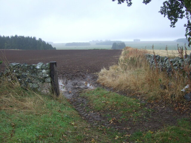
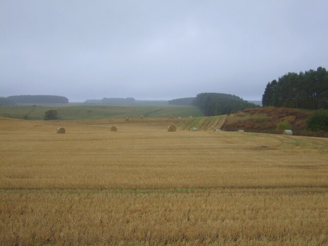
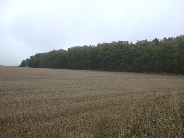
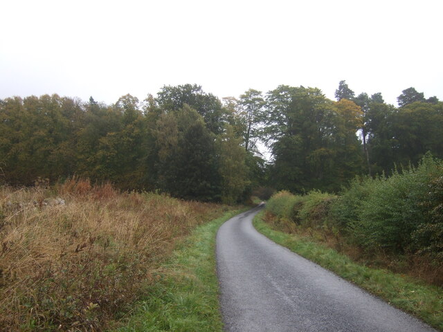
The woodland is divided into two sections, namely North Plantation and South Plantation. Both areas are characterized by dense forests consisting of various tree species such as oak, birch, and pine. The towering trees provide a sheltered habitat for numerous wildlife species, including birds, mammals, and insects.

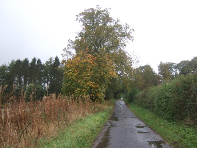
Visitors can enjoy a peaceful walk along the well-maintained trails that wind through the woodlands, allowing them to immerse themselves in the natural beauty of the surroundings. The trails offer breathtaking views of the rolling hills and the meandering River Teviot, which adds to the charm of the area.

North and South Plantation also serve as an important habitat for several rare and protected plant species. The woodlands are home to a variety of wildflowers, ferns, and mosses, creating a vibrant and colorful carpet under the canopy of trees.

Nature enthusiasts and birdwatchers flock to the area to observe the numerous bird species that inhabit the woodlands. From elusive owls to vibrant songbirds, the plantation offers a haven for avian enthusiasts.

Overall, North and South Plantation in Roxburghshire is a haven for nature lovers seeking tranquility and a chance to immerse themselves in the beauty of Scotland's woodlands.

If you have any feedback on the listing, please let us know in the comments section below.

North and South Plantation Images

Images are sourced within 2km of 55.546182/-2.5712891 or Grid Reference NT6428. Thanks to Geograph Open Source API. All images are credited.

Field entrance near Pirnie
Stubble field, Pirnie Bales still out on the field.
Stubble field, Pirnie
Bales still out on the field.
Minor road, Pirnie On a damp morning in Autumn.
Minor road, Pirnie
On a damp morning in Autumn.
Farm track near Pirnie
Grazing near Pirnie
Grazing near Pirnie
Minor road near Pirnie Towards Fairnington.
Minor road near Pirnie
Towards Fairnington.
Ploughed field near Fairnington Towards Major's Plantation.
Ploughed field near Fairnington
Towards Major's Plantation.
Ploughed field near Fairnington Towards distant woodland and the Waterloo Monument on Peniel Heugh.
Ploughed field near Fairnington
Towards distant woodland and the Waterloo Monument on Peniel Heugh.
Minor road Fairnington
Prepared field and woodland near Fairnington
Minor beside woodland near Fairnington Towards Muirhouselaw.
Minor beside woodland near Fairnington
Towards Muirhouselaw.
Stubble field and woodland, Under Snipecleuch
Minor road into woodland, Under Snipecleuch
Border Berries at Rutherford Farm Two large fields on the south side of the main farm buildings are used during the summer months as a pick your own fruit farm. The main fruits are strawberries, raspberries, gooseberries, red currants and black currants. On this occasion I was picking strawberries.
Border Berries at Rutherford Farm
Two large fields on the south side of the main farm buildings are used during the summer months as a pick your own fruit farm. The main fruits are strawberries, raspberries, gooseberries, red currants and black currants. On this occasion I was picking strawberries.
Ordnance Survey Cut Mark This OS cut mark can be found on the west angle of a roadside barn at Muirhouselaw Farm. It marks a point 136.547m above mean sea level.
Ordnance Survey Cut Mark
This OS cut mark can be found on the west angle of a roadside barn at Muirhouselaw Farm. It marks a point 136.547m above mean sea level.
Baron’s Folly This octagonal stone structure with slated roof on Down Law is reputed to have been built by a local Baron as a trysting place for himself and his lover. The Eildon Hills are on the skyline to the left.
Baron’s Folly
This octagonal stone structure with slated roof on Down Law is reputed to have been built by a local Baron as a trysting place for himself and his lover. The Eildon Hills are on the skyline to the left.
Dere Street The course of Dere Street is marked by a grown out strip wood with a few mature trees.
Dere Street
The course of Dere Street is marked by a grown out strip wood with a few mature trees.
Pile of stones Recently dug up and dumped stones beside St Cuthbert's Way.
Pile of stones
Recently dug up and dumped stones beside St Cuthbert's Way.
Show me another place!

North and South Plantation is located at Grid Ref: NT6428 (Lat: 55.546182, Lng: -2.5712891)

Unitary Authority: The Scottish Borders

Police Authority: The Lothians and Scottish Borders

What 3 Words

///implanted.subject.tadpole. Near Saint Boswells, Scottish Borders

Related Wikis

Peniel Heugh

Peniel Heugh (237 m) is a hill near Ancrum and Nisbet in the Scottish Borders area of Scotland. On it stands the Waterloo Monument. == Geology == The heugh...
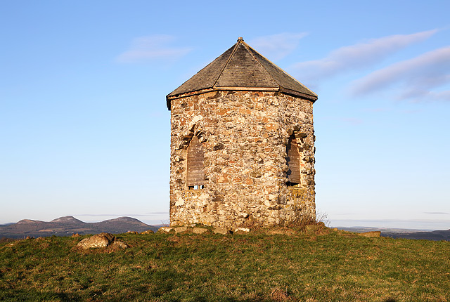
Waterloo Monument

The Waterloo Monument near Ancrum in the Scottish Borders is a 150-foot tower, built between 1817 and 1824 to commemorate the Battle of Waterloo. It was...

Battle of Ancrum Moor

The Battle of Ancrum Moor was fought during the War of the Rough Wooing in 1545. The Scottish victory put a temporary end to English incursions in the...

Maxton railway station

Maxton railway station served the hamlet of Maxton, Roxburghshire, Scotland from 1851 to 1964 on the Kelso Line. == History == The station opened in June...

Nearby Amenities

Located within 500m of 55.546182,-2.5712891
Fairnington
Place: hamlet
Lat/Long: 55.5446619/-2.5651653
Parking
Parking: surface
Lat/Long: 55.5453093/-2.5661275
Power: pole
Lat/Long: 55.5446618/-2.5694949
Power: pole
Lat/Long: 55.5448541/-2.5682357
Power: pole
Lat/Long: 55.5450377/-2.5669688
Power: pole
Lat/Long: 55.5452897/-2.5654393
Power: pole
Lat/Long: 55.545498/-2.5644685
Power: pole
Lat/Long: 55.5456801/-2.5635982
The data included in this document is from www.openstreetmap.org. The data is made available under ODbL.

Have you been to North and South Plantation?

Leave your review of North and South Plantation below (or comments, questions and feedback).