Brock's Forest
Wood, Forest in Aberdeenshire
Scotland
Brock's Forest

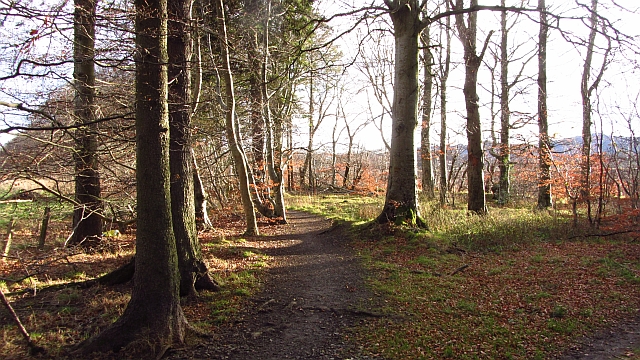
Brock's Forest is a picturesque woodland located in Aberdeenshire, Scotland. Stretching over an expansive area of approximately 200 hectares, this forest is a haven for nature enthusiasts and outdoor adventurers alike.
The forest is characterized by a diverse range of tree species, including native Scots pine, oak, and birch. These towering trees provide a lush canopy that offers shade and shelter to a plethora of wildlife species. Visitors can spot a variety of birds, such as red kites, buzzards, and woodpeckers, as well as small mammals like red squirrels and roe deer.
Traversing through the forest, visitors can explore a network of well-maintained trails and paths. These paths cater to various levels of fitness and offer stunning views of the surrounding countryside. For those seeking a more challenging trek, there are also options for off-trail hiking.
Brock's Forest is not only a natural haven but also a site of historical significance. The forest is home to remnants of ancient settlements, including stone circles and burial mounds, which provide a fascinating glimpse into the region's rich history.
The forest is managed by the local forestry commission, ensuring its preservation and conservation for future generations. Facilities such as picnic areas and parking lots are available on-site, making it an ideal destination for families and day-trippers.
Overall, Brock's Forest is a captivating destination that offers a blend of natural beauty, wildlife encounters, and historical intrigue. Whether you are a nature lover, history enthusiast, or simply seeking a tranquil escape, this Aberdeenshire woodland is sure to leave a lasting impression.
If you have any feedback on the listing, please let us know in the comments section below.
Brock's Forest Images
Images are sourced within 2km of 57.333867/-2.6210378 or Grid Reference NJ6227. Thanks to Geograph Open Source API. All images are credited.


Brock's Forest is located at Grid Ref: NJ6227 (Lat: 57.333867, Lng: -2.6210378)
Unitary Authority: Aberdeenshire
Police Authority: North East
What 3 Words
///prowl.poker.minds. Near Insch, Aberdeenshire
Nearby Locations
Related Wikis

Insch railway station
Insch railway station is a railway station serving the village of Insch, Aberdeenshire, Scotland. The station is managed by ScotRail and is on the Aberdeen...
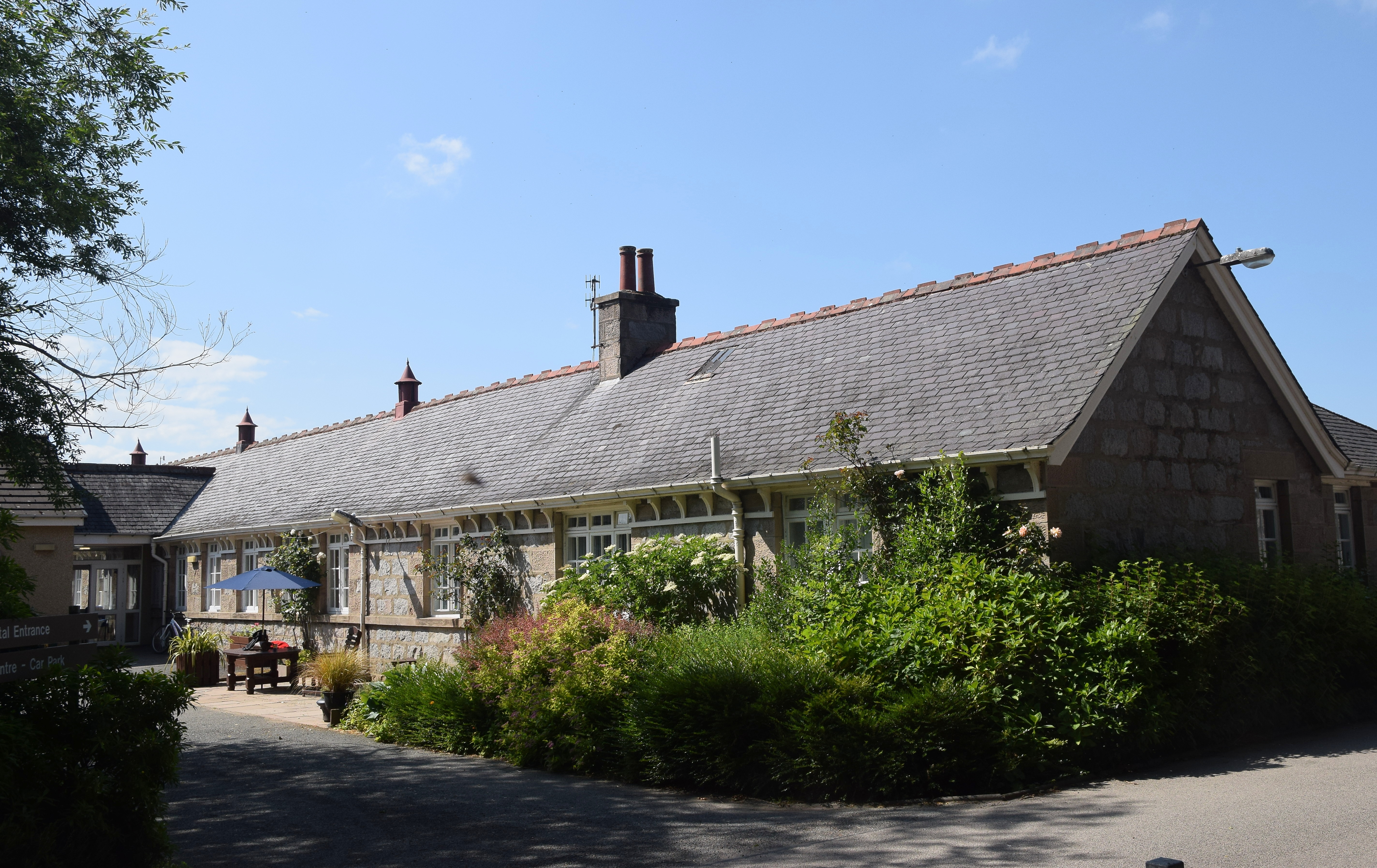
Insch War Memorial Hospital
Insch War Memorial Hospital is a small community hospital located at Insch, Aberdeenshire, Scotland. It is managed by NHS Grampian. == History == The hospital...
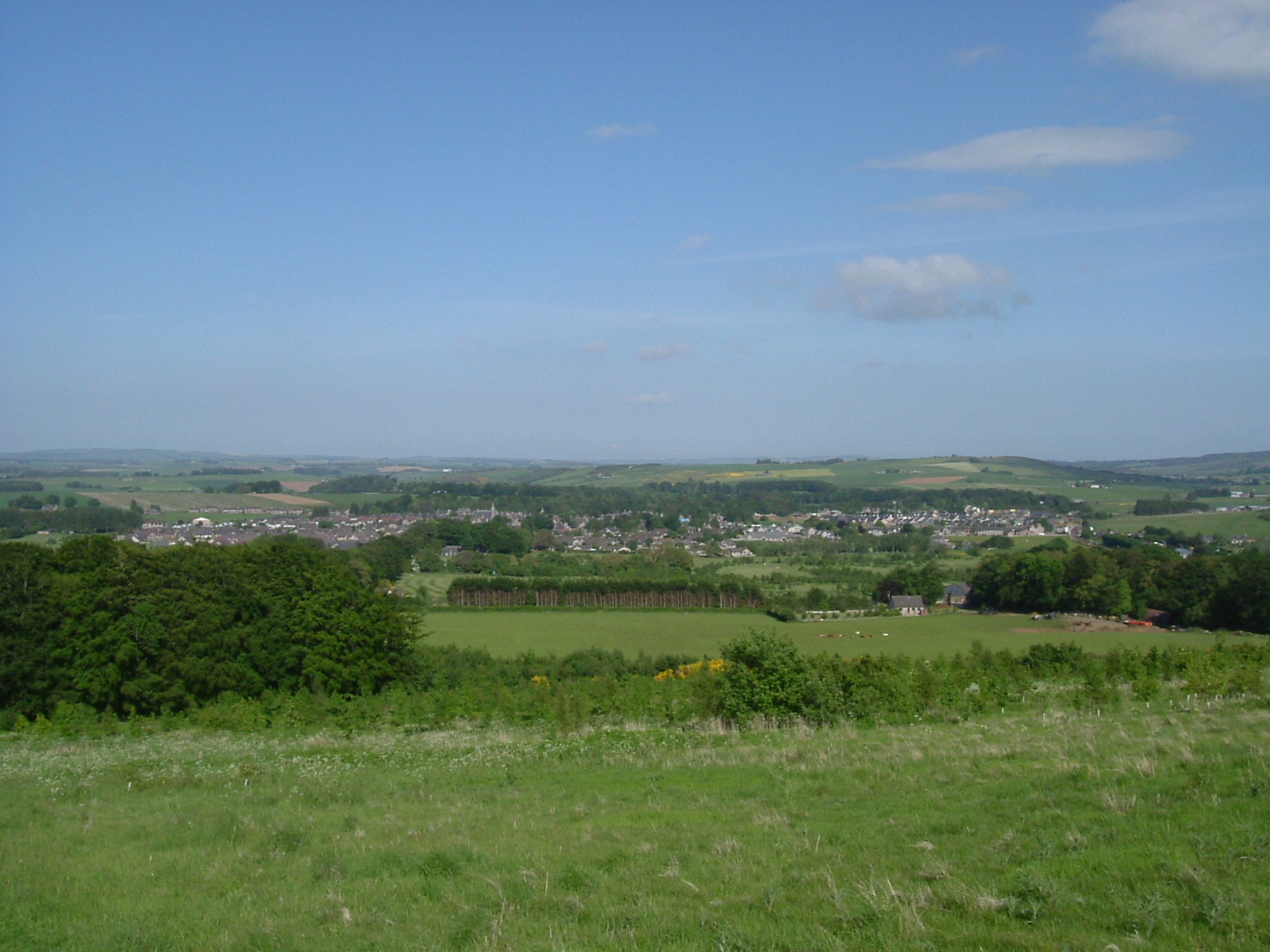
Insch
Insch (Scottish Gaelic: An Innis or Innis Mo Bheathain) is a village in the Garioch, Aberdeenshire, Scotland. It is located approximately 28 miles (45...

Dunnideer Castle
Dunnideer Castle, now ruined, was a tower house located near Insch, Aberdeenshire, Scotland. It was built c. 1260 partially from the remains of an existing...

Ardoyne, Aberdeenshire
Ardoyne is a rural area near Insch in Aberdeenshire, Scotland. == References ==

Buchanstone railway station
Buchanstone railway station is a former railway station in Aberdeenshire. On the Great North of Scotland Railway, the station was on the north side of...
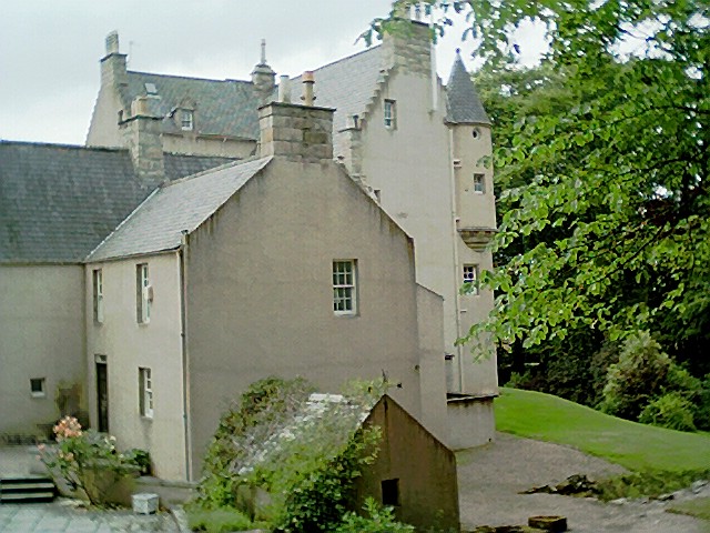
Lickleyhead Castle
Lickleyhead Castle is a well-restored L-plan castle, dating from around 1600, a little south of Auchleven, by the banks of the Gadie Burn, in Aberdeenshire...
Wardhouse Castle
Wardhouse Castle was a 13th-century tower house, about 2.5 miles (4.0 km) west of Insch, Aberdeenshire, Scotland. The castle was called Weredors, Wardes...
Nearby Amenities
Located within 500m of 57.333867,-2.6210378Have you been to Brock's Forest?
Leave your review of Brock's Forest below (or comments, questions and feedback).