Flass Wood

Wood, Forest in Berwickshire

Scotland

Flass Wood
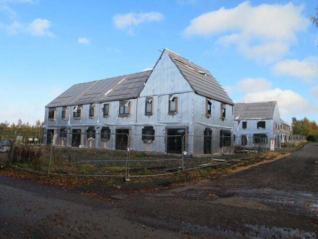
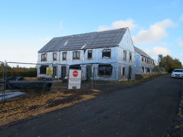
Passivhaus development at Westruther A development of 10 houses being built to the 'Passivhaus' standard on Edgar Road.
Passivhaus development at Westruther Credit: M J Richardson

The requested URL returned error: 429 Too Many Requests

If you have any feedback on the listing, please let us know in the comments section below.

Flass Wood Images

Images are sourced within 2km of 55.753119/-2.6060483 or Grid Reference NT6251. Thanks to Geograph Open Source API. All images are credited.

Passivhaus development at Westruther A development of 10 houses being built to the 'Passivhaus' standard on Edgar Road.
Passivhaus development at Westruther
A development of 10 houses being built to the 'Passivhaus' standard on Edgar Road.
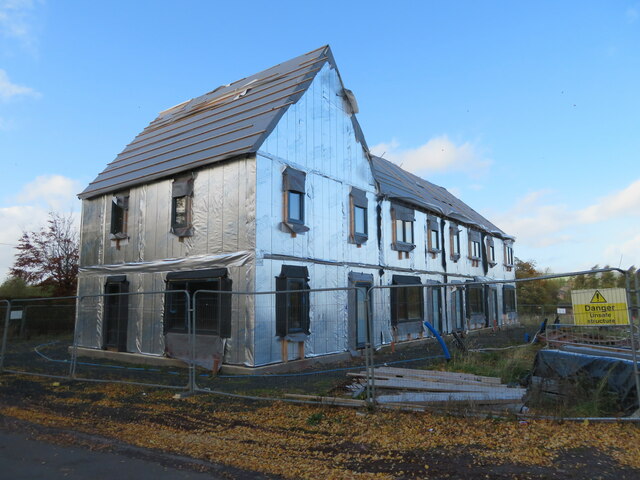
Passivhauses at Westruther A development of 10 houses being built to the 'Passivhaus' standard on Edgar Road. It was blowing a gale, and the noise made by the wind catching loose bits of material was very loud.
Passivhauses at Westruther
A development of 10 houses being built to the 'Passivhaus' standard on Edgar Road. It was blowing a gale, and the noise made by the wind catching loose bits of material was very loud.
Passivhauses at Westruther A development of 10 houses being built to the 'Passivhaus' standard on Edgar Road.
Passivhauses at Westruther
A development of 10 houses being built to the 'Passivhaus' standard on Edgar Road.
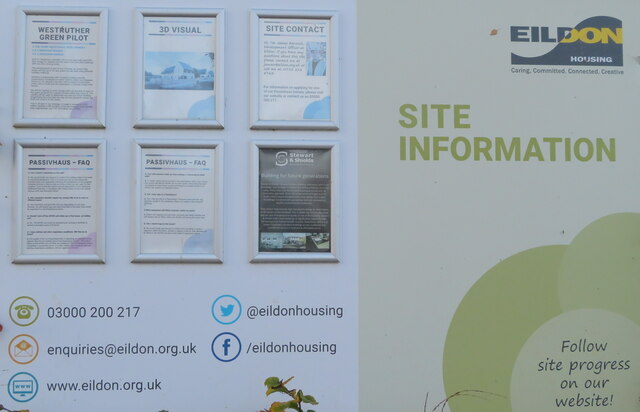
Passivhauses at Westruther Information about the building of 10 houses being built to the 'Passivhaus' standard on Edgar Road.
Passivhauses at Westruther
Information about the building of 10 houses being built to the 'Passivhaus' standard on Edgar Road.
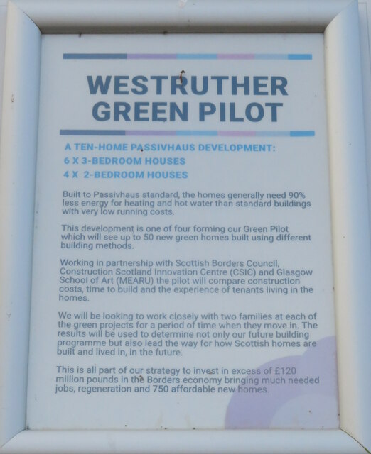
Passivhaus development at Westruther Information about the pilot study of 10 houses being built to the 'Passivhaus' standard on Edgar Road.
Passivhaus development at Westruther
Information about the pilot study of 10 houses being built to the 'Passivhaus' standard on Edgar Road.
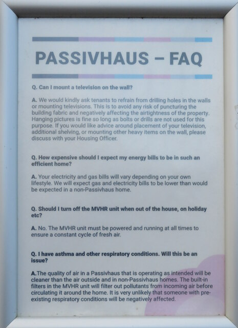
Passivhaus development at Westruther - FAQ Information of how tenants might live in houses being built to the 'Passivhaus' standard on Edgar Road.
Passivhaus development at Westruther - FAQ
Information of how tenants might live in houses being built to the 'Passivhaus' standard on Edgar Road.
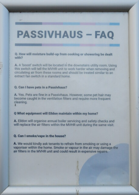
Passivhaus at Westruther - FAQ Information of how tenants might live in houses being built to the 'Passivhaus' standard on Edgar Road.
Passivhaus at Westruther - FAQ
Information of how tenants might live in houses being built to the 'Passivhaus' standard on Edgar Road.
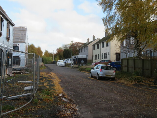
Edgar Road, Westruther With 10 Passivhaus dwellings being constructed on the left, opposite existing housing.
Edgar Road, Westruther
With 10 Passivhaus dwellings being constructed on the left, opposite existing housing.
Abandoned poultry enterprise [?], Westruther An apparently abandoned collection of eighty animal sheds and pens off The Loaning at Westruther. I can't think what else this might be. Richard Webb, in a nearby photo <a href="https://www.geograph.org.uk/photo/208824">NT6349 : Rearing pens, Westruther</a>, suggests there might be game rearing in the area.
Abandoned poultry enterprise [?], Westruther
An apparently abandoned collection of eighty animal sheds and pens off The Loaning at Westruther. I can't think what else this might be. Richard Webb, in a nearby photo NT6349 : Rearing pens, Westruther, suggests there might be game rearing in the area.
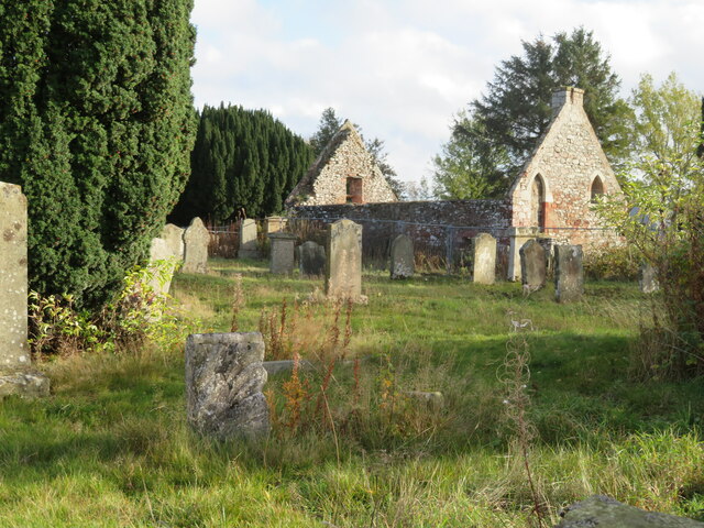
The Auld Kirk at Westruther Dating from 1649 <span class="nowrap"><a title="https://en.wikipedia.org/wiki/Westruther," rel="nofollow ugc noopener" href="https://en.wikipedia.org/wiki/Westruther,">Link</a><img style="margin-left:2px;" alt="External link" title="External link - shift click to open in new window" src="https://s1.geograph.org.uk/img/external.png" width="10" height="10"/></span> it was replaced by the 'New Kirk' in 1834.
The Auld Kirk at Westruther
Dating from 1649 LinkExternal link it was replaced by the 'New Kirk' in 1834.
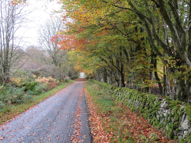
A litter of Beech leaves A strong wind was blowing a lot of leaves from the woodland at Edgarhope.
A litter of Beech leaves
A strong wind was blowing a lot of leaves from the woodland at Edgarhope.
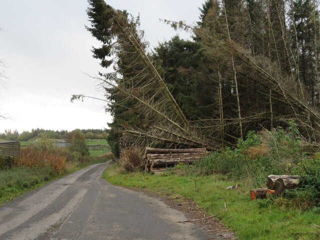
Storm damaged shelterbelt On the road at Raecleugh.
Storm damaged shelterbelt
On the road at Raecleugh.
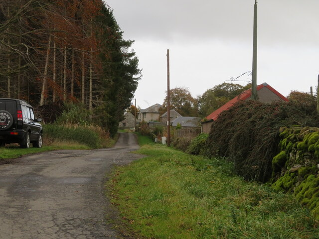
Windyedge and Raecleugh A small cul-de-sac settlement on the southern edge of the Lammermuir Hills.
Windyedge and Raecleugh
A small cul-de-sac settlement on the southern edge of the Lammermuir Hills.
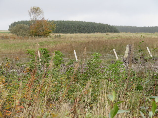
Rough grassland at Raecleugh Looking north from the minor road to Raecleugh.
Rough grassland at Raecleugh
Looking north from the minor road to Raecleugh.
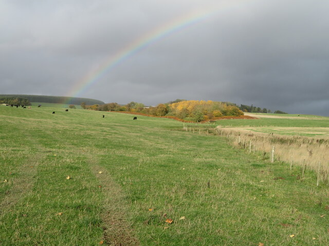
Rainbow over Flass Wood Looking north over cattle pasture to the birch wood in autumn colour.
Rainbow over Flass Wood
Looking north over cattle pasture to the birch wood in autumn colour.
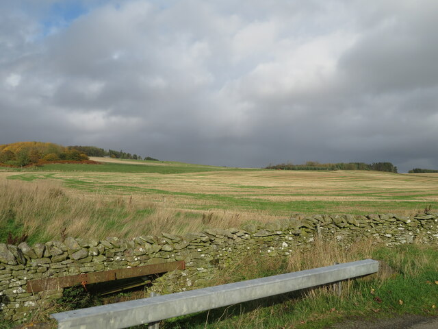
Road protection, near Westruther The minor road passes over a small burn; the Armco-type barrier will stop vehicles from inadvertently ending up in the burn. Flass Wood is on the left.
Road protection, near Westruther
The minor road passes over a small burn; the Armco-type barrier will stop vehicles from inadvertently ending up in the burn. Flass Wood is on the left.
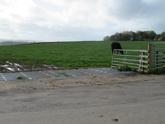
Cattle grids do work! On the road to Flass, this field contained many grazing cattle.
Cattle grids do work!
On the road to Flass, this field contained many grazing cattle.
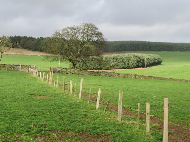
Farmland near Flass With forestry beyond.
Farmland near Flass
With forestry beyond.
Show me another place!

Flass Wood is located at Grid Ref: NT6251 (Lat: 55.753119, Lng: -2.6060483)

Unitary Authority: The Scottish Borders

Police Authority: The Lothians and Scottish Borders

What 3 Words

///rejoins.undertook.increases. Near Lauder, Scottish Borders

Nearby Locations

Flass Wood

Related Wikis

Westruther

Westruther is a village on the B6465, in the Scottish Borders area of Scotland, on the lower slopes of the Lammermuir Hills, in the former Berwickshire...

Blackadder Water

Blackadder Water () is a river in Berwickshire in the Scottish Borders area of Scotland, forming part of the River Tweed system. It reached 2.84m at Mouthbridge...

Houndslow

Houndslow is a hamlet in the Scottish Borders area of Scotland. It is situated on the A697, about 5 miles (8.0 km) west of Greenlaw, and 3 miles (4.8 km...

Bassendean, Scottish Borders

Bassendean is a village in the Scottish Borders area of Scotland, 4 kilometres (2.5 mi) south of Westruther and 3 kilometres (1.9 mi) north-west of Gordon...

Nearby Amenities

Located within 500m of 55.753119,-2.6060483
Barrier: cattle_grid
Lat/Long: 55.7515324/-2.6052189
Barrier: cattle_grid
Lat/Long: 55.752135/-2.603047
The data included in this document is from www.openstreetmap.org. The data is made available under ODbL.

Have you been to Flass Wood?

Leave your review of Flass Wood below (or comments, questions and feedback).