Chalgrove

Settlement in Oxfordshire South Oxfordshire

England

Chalgrove

Farmland, Chalgrove The footpath north of Cadwell Covert heads towards another copse.
Farmland, Chalgrove Credit: Andrew Smith

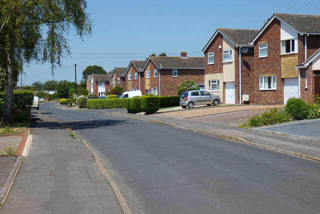
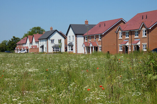
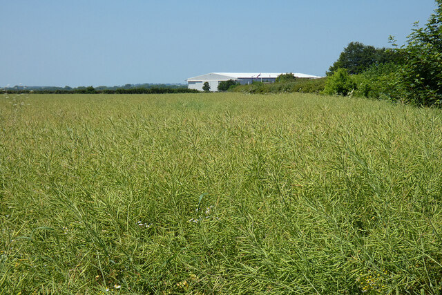
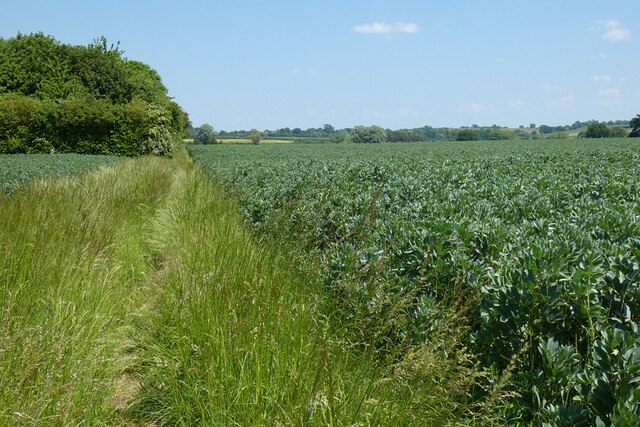
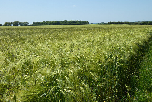
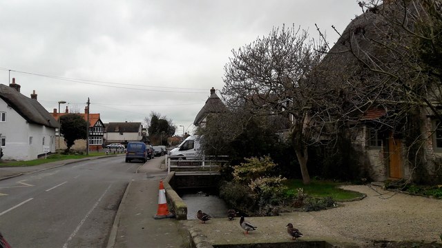
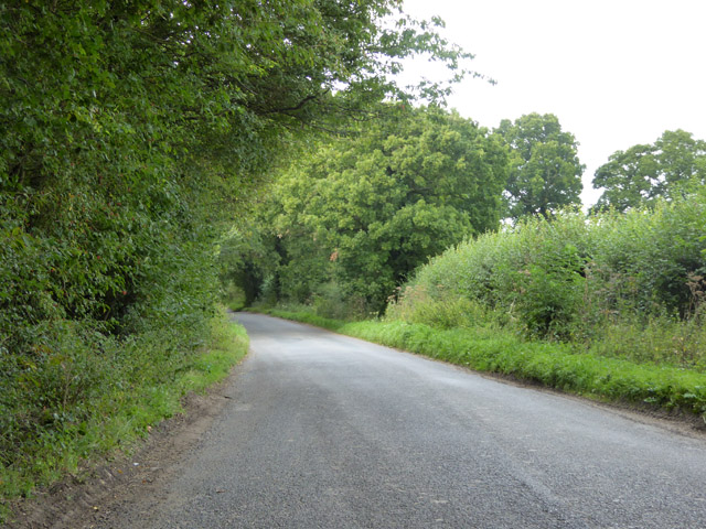
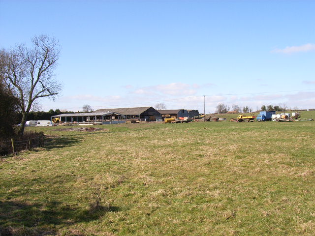
Chalgrove is a rural village located in South Oxfordshire, England. Situated approximately 10 miles southeast of the city of Oxford, it covers an area of about 1.7 square miles. The village is nestled in the scenic countryside, surrounded by fields and farmlands, creating a picturesque setting.

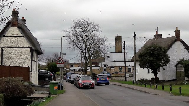
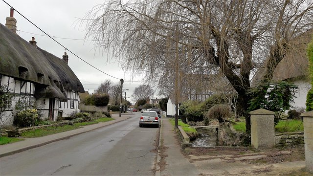
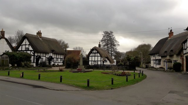
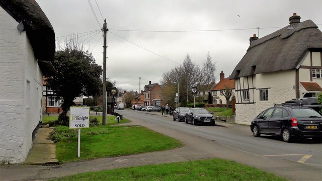
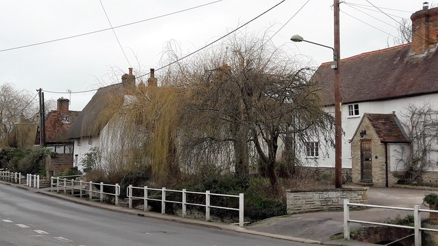
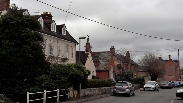
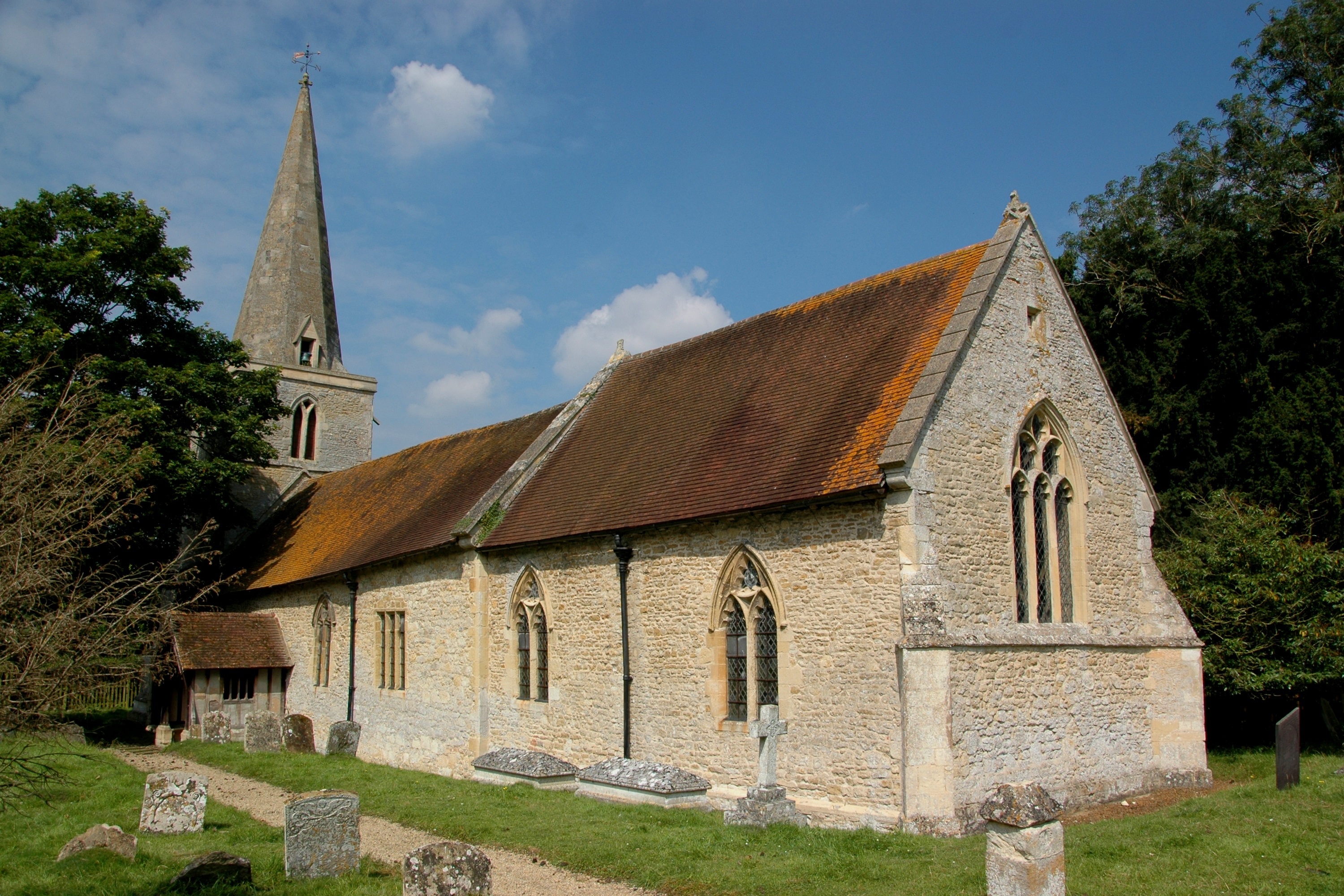
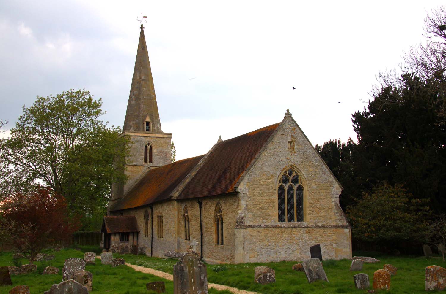
The history of Chalgrove dates back to the Saxon era, and it is mentioned in the Domesday Book of 1086. The village retains much of its historic charm, with several timber-framed cottages and stone buildings from the 16th and 17th centuries still standing.

Chalgrove offers a range of amenities to its residents, including a primary school, a village hall, a post office, and a local shop. The village also has a traditional pub, The Red Lion, which is a popular gathering spot for locals and visitors alike.

Nature lovers can enjoy the surrounding countryside, as Chalgrove is located near the Chiltern Hills Area of Outstanding Natural Beauty. There are numerous walking and cycling routes in the area, providing opportunities to explore the scenic landscapes.

In terms of transport, Chalgrove is conveniently located near the M40 motorway, providing easy access to Oxford, London, and other major cities. The village is served by regular bus services, connecting it to nearby towns and villages.

Overall, Chalgrove offers a tranquil and idyllic setting for residents, with its rich history, countryside scenery, and convenient location.

If you have any feedback on the listing, please let us know in the comments section below.

Chalgrove Images

Images are sourced within 2km of 51.667874/-1.08144 or Grid Reference SU6396. Thanks to Geograph Open Source API. All images are credited.

Farmland, Chalgrove The footpath north of Cadwell Covert heads towards another copse.
Farmland, Chalgrove
The footpath north of Cadwell Covert heads towards another copse.
Farmland, Chalgrove A footpath and wheat beside the western edge of the village.
Farmland, Chalgrove
A footpath and wheat beside the western edge of the village.
Brinkinfield Road, Chalgrove The latter part of the twentieth century saw a rapid expansion of the village with development like this.
Brinkinfield Road, Chalgrove
The latter part of the twentieth century saw a rapid expansion of the village with development like this.
New houses, Chalgrove Houses on Lacey Green, part of the recent Chalgrove Meadow development, look out onto an area mostly left to  nature with ponds and a play area.
New houses, Chalgrove
Houses on Lacey Green, part of the recent Chalgrove Meadow development, look out onto an area mostly left to nature with ponds and a play area.
Farmland, Chalgrove Oil-seed rape and business premises on the airfield.
Farmland, Chalgrove
Oil-seed rape and business premises on the airfield.
Farmland, Chalgrove A bridleway, in theory, cuts through the field of beans here on its way to Easington.  In practice, it's never been an easy one to follow.
Farmland, Chalgrove
A bridleway, in theory, cuts through the field of beans here on its way to Easington. In practice, it's never been an easy one to follow.
Farmland, Chalgrove Barley beside the footpath between Warpsgrove and Standhill.
Farmland, Chalgrove
Barley beside the footpath between Warpsgrove and Standhill.
Foot entrance to the Brookside Estate, Chalgrove
The B480 at the junction of French Laurence Way
Chalgrove Primary School and High Street Thatched cottages, which still dominate Chalgrove High Street, frame the school's 1960s or '70s extension.  As often in this unnamed vale below the Chilterns, the sky is full of red kites.
Chalgrove Primary School and High Street
Thatched cottages, which still dominate Chalgrove High Street, frame the school's 1960s or '70s extension. As often in this unnamed vale below the Chilterns, the sky is full of red kites.
High Street, Chalgrove Chalgrove is a long village which looks as if it stagnated in the 18th and 19th centuries and so retained many older cottages.  Development from the second half of the 20th century has been extensive and transformative but has left much of the High Street intact.  The brook running the length of the village along the north side of the street adds to its personality.
High Street, Chalgrove
Chalgrove is a long village which looks as if it stagnated in the 18th and 19th centuries and so retained many older cottages. Development from the second half of the 20th century has been extensive and transformative but has left much of the High Street intact. The brook running the length of the village along the north side of the street adds to its personality.
The green at Chalgrove This looks like an improvised green to me, a former house plot perhaps.  Does anybody know?
The green at Chalgrove
This looks like an improvised green to me, a former house plot perhaps. Does anybody know?
High Street, Chalgrove The busiest part of High Street begins about here; the green is just beyond on the left and the Post Office is visible further along.
High Street, Chalgrove
The busiest part of High Street begins about here; the green is just beyond on the left and the Post Office is visible further along.
Chalgrove High Street and residents The brook is integral to the scene in Chalgrove High Street.
Chalgrove High Street and residents
The brook is integral to the scene in Chalgrove High Street.
High Street, Chalgrove Towards the north-west end of High Street the brook is fenced off from the pavement by white railings.
High Street, Chalgrove
Towards the north-west end of High Street the brook is fenced off from the pavement by white railings.
High Street, Chalgrove The early 18th century old vicarage is the only house on the High Street where the brook is culverted for a front garden.  Beyond is the John Hampden Hall and far right, the Post Office.  John Hampden was fatally wounded at the skirmish at Chalgrove field in 1643.
High Street, Chalgrove
The early 18th century old vicarage is the only house on the High Street where the brook is culverted for a front garden. Beyond is the John Hampden Hall and far right, the Post Office. John Hampden was fatally wounded at the skirmish at Chalgrove field in 1643.
Lane towards Chalgrove
Entering Chalgrove on Berrick Road Not many things vertical here.
Entering Chalgrove on Berrick Road
Not many things vertical here.
Show me another place!

Chalgrove is located at Grid Ref: SU6396 (Lat: 51.667874, Lng: -1.08144)

Administrative County: Oxfordshire

District: South Oxfordshire

Police Authority: Thames Valley

What 3 Words

///producing.patting.speedily. Near Chalgrove, Oxfordshire

Nearby Locations

Chalgrove

Related Wikis

Chalgrove

Chalgrove is a village and civil parish in South Oxfordshire about 10 miles (16 km) southeast of Oxford. The parish includes the hamlet of Rofford and...
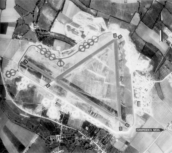
Chalgrove Airfield

Chalgrove Airfield (ICAO: EGLJ) is a former Second World War airfield in Oxfordshire, England. It is approximately 3 mi (4.8 km) north-northeast of Benson...

Brightwell Baldwin

Brightwell Baldwin is a village and civil parish in Oxfordshire, about 4+1⁄2 miles (7 km) northeast of Wallingford. It was historically in the Hundred...

Easington, South Oxfordshire

Easington is a small village in the civil parish of Cuxham with Easington, in the South Oxfordshire district, in the county of Oxfordshire, England. It...

Ascott, Oxfordshire

Ascott is a hamlet and manor house in the English county of Oxfordshire. Ascott lies close to the River Thame north of Dorchester, around about 7 miles...

Great Holcombe

Great Holcombe is a hamlet in Newington civil parish in South Oxfordshire, about 4.5 miles (7.2 km) north of Wallingford. == References ==

Newington, Oxfordshire

Newington is a village and civil parish in South Oxfordshire, about 4+1⁄2 miles (7 km) north of Wallingford. The 2011 Census recorded the parish's population...

Beauforest House

Beauforest House is a historic house, near Newington, Oxfordshire, England. It has been listed Grade II on the National Heritage List for England since...

Nearby Amenities

Located within 500m of 51.667874,-1.08144
Turning Circle
Lat/Long: 51.6688998/-1.0778581
Bus Stop
Red Lion PH
Bus: yes
Local Ref: opp
Naptan AtcoCode: 340000177GRN
Naptan Bearing: SE
Naptan CommonName: Red Lion PH
Naptan Indicator: Opposite
Naptan Landmark: Bus Shelter
Naptan NaptanCode: oxfampga
Naptan Street: High Street
Naptan Verified: no
Public Transport: platform
Source: naptan_import
Lat/Long: 51.6674611/-1.0807789
Bus Stop
Red Lion PH
Bus: yes
Local Ref: o/s
Naptan AtcoCode: 340000177OUT
Naptan Bearing: NW
Naptan CommonName: Red Lion PH
Naptan Indicator: Outside
Naptan Landmark: Red Lion
Naptan NaptanCode: oxfampdw
Naptan Street: High Street
Naptan Verified: no
Public Transport: platform
Source: naptan_import
Lat/Long: 51.667397/-1.0805526
Bus Stop
Quartermain Road
Bus: yes
Local Ref: adj
Naptan AtcoCode: 340003278CNR
Naptan Bearing: NW
Naptan CommonName: Quartermain Road
Naptan Indicator: Corner
Naptan Landmark: Bus Shelter
Naptan NaptanCode: oxfatpgm
Naptan Street: High Street
Naptan Verified: no
Public Transport: platform
Source: naptan_import
Lat/Long: 51.6690605/-1.0839857
Bus Stop
Church Lane
Bus: yes
Local Ref: adj
Naptan AtcoCode: 340003279CNR
Naptan Bearing: NW
Naptan CommonName: Church Lane
Naptan Indicator: Corner
Naptan Landmark: Bus Shelter
Naptan NaptanCode: oxfawpjp
Naptan Street: High Street
Naptan Verified: no
Public Transport: platform
Source: naptan_import
Lat/Long: 51.6653277/-1.077291
Bus Stop
Church Lane
Bus: yes
Local Ref: opp
Naptan AtcoCode: 340003279OPP
Naptan Bearing: SE
Naptan CommonName: Church Lane
Naptan Indicator: Opposite
Naptan Landmark: Opp Bus Shelter
Naptan NaptanCode: oxfawtgj
Naptan Street: High Street
Naptan Verified: no
Public Transport: platform
Source: naptan_import
Lat/Long: 51.6653038/-1.0770028
Bus Stop
Chalgrove Area Pick Up Zone
Bus: yes
Naptan AtcoCode: 340005000FLX
Naptan Bearing: E
Naptan CommonName: Chalgrove Area Pick Up Zone
Naptan Indicator: Flexible
Naptan Landmark: Village
Naptan NaptanCode: oxfawtad
Naptan Street: Chalgrove Village
Naptan Verified: no
Public Transport: platform
Source: naptan_import
Lat/Long: 51.6676438/-1.0810499
Pub
Red Lion
Wheelchair: limited
Wikidata: Q26650232
Lat/Long: 51.6676131/-1.0805023
Pub
The Crown
Lat/Long: 51.667407/-1.0810478
Turning Circle
Source: Bing
Lat/Long: 51.6688895/-1.0855096
Parking
Chalgrove Fields (7:00am - 9:00pm)
Lat/Long: 51.666812/-1.0810173
Recycling
Bottle bank
Lat/Long: 51.6666989/-1.0810173
Pharmacy
Chalgrove Pharmacy
Addr City: Chalgrove
Addr Country: GB
Addr Housenumber: 60
Addr Postcode: OX44 7SS
Addr Street: High Street
Contact Phone: +44 1865 890587
Fhrs Id: 272066
Healthcare: pharmacy
Lat/Long: 51.6686021/-1.0831738
Londis
Addr City: Chalgrove
Addr Country: GB
Addr Housenumber: 66
Addr Postcode: OX44 7SS
Addr Street: High Street
Brand: Londis
Brand Wikidata: Q21008564
Brand Wikipedia: en:Londis (United Kingdom)
Shop: convenience
Lat/Long: 51.6685222/-1.0829271
Shop: convenience
Lat/Long: 51.6678301/-1.0810388
School
Chalgrove Community Primary School
Wikidata: Q66231784
Lat/Long: 51.6668919/-1.0801161
Post Box
Chalgrove post office
Lat/Long: 51.6678905/-1.0811758
Turning Circle
Lat/Long: 51.6690235/-1.0861367
Turning Circle
Turning Circle: y-head
Lat/Long: 51.6677348/-1.0756167
Location Transition: yes
Power: pole
Source: Bing
Lat/Long: 51.6639079/-1.0843903
The Acupuncture Barn
Addr City: Chalgrove
Addr Housenumber: 149
Addr Street: High Street
Healthcare: alternative
Healthcare Speciality: acupuncture
Opening Hours: tu - th 0900 - 1800
Phone: 07879403800
Website: www.acupuncturebarn.co.uk
Lat/Long: 51.6666481/-1.078818
Direction: 140
Generator Method: photovoltaic
Generator Output Electricity: yes
Generator Solar Modules: 14
Generator Source: solar
Generator Type: solar_photovoltaic_panel
Location: roof
Power: generator
Lat/Long: 51.6676186/-1.0755162
Direction: 135
Generator Method: photovoltaic
Generator Output Electricity: yes
Generator Solar Modules: 12
Generator Source: solar
Generator Type: solar_photovoltaic_panel
Location: roof
Power: generator
Lat/Long: 51.6672017/-1.075952
Turning Circle
Turning Circle: knuckle
Lat/Long: 51.6682343/-1.0768188
Direction: 190
Generator Method: photovoltaic
Generator Output Electricity: yes
Generator Solar Modules: 12
Generator Source: solar
Generator Type: solar_photovoltaic_panel
Location: roof
Power: generator
Lat/Long: 51.6680748/-1.0778326
Turning Circle
Lat/Long: 51.6684957/-1.0775013
Direction: 170
Generator Method: photovoltaic
Generator Output Electricity: yes
Generator Solar Modules: 10
Generator Source: solar
Generator Type: solar_photovoltaic_panel
Location: roof
Power: generator
Lat/Long: 51.6685618/-1.0881313
Fixme: solar panels?
Lat/Long: 51.668043/-1.0883424
Direction: 170
Generator Method: photovoltaic
Generator Output Electricity: yes
Generator Solar Modules: 15
Generator Source: solar
Generator Type: solar_photovoltaic_panel
Location: roof
Power: generator
Lat/Long: 51.6690224/-1.0880142
Fixme: solar panels?
Lat/Long: 51.6686824/-1.0835501
Direction: 200
Generator Method: photovoltaic
Generator Output Electricity: yes
Generator Solar Modules: 22
Generator Source: solar
Generator Type: solar_photovoltaic_panel
Location: roof
Power: generator
Lat/Long: 51.6670746/-1.0816526
Direction: 135
Generator Method: photovoltaic
Generator Output Electricity: yes
Generator Solar Modules: 14
Generator Source: solar
Generator Type: solar_photovoltaic_panel
Location: roof
Power: generator
Lat/Long: 51.6651958/-1.0799571
Chalgrove
Place: village
Lat/Long: 51.6679467/-1.0800624
Bus Stop
Quatermain Road
Bus: yes
Local Ref: opp
Public Transport: platform
Lat/Long: 51.6691343/-1.0838645
The data included in this document is from www.openstreetmap.org. The data is made available under ODbL.

Have you been to Chalgrove?

Leave your review of Chalgrove below (or comments, questions and feedback).