Chalgrave

Settlement in Bedfordshire

England

Chalgrave

St George's Church, Toddington
St George's Church, Toddington Credit: David Howard

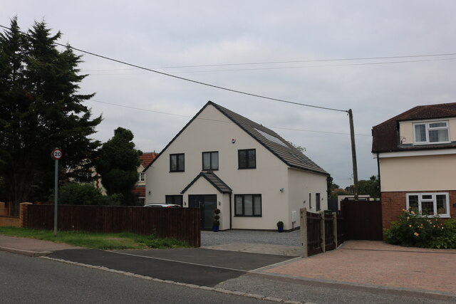
Chalgrave is a small village located in Bedfordshire, England. Situated near the town of Toddington and about 4 miles east of Dunstable, Chalgrave is known for its picturesque countryside and rural charm.

The village is home to a mix of traditional cottages and modern houses, with a population of around 500 residents. The community is tight-knit and friendly, with a strong sense of local pride.

Chalgrave is surrounded by rolling hills and farmland, making it an ideal location for those who enjoy outdoor activities such as hiking, cycling, and horseback riding. The village is also close to the Chiltern Hills Area of Outstanding Natural Beauty, providing residents with even more opportunities to explore the great outdoors.

Despite its rural setting, Chalgrave is conveniently located near major road networks, including the M1 motorway, making it easily accessible for commuters and visitors alike. The village has a primary school, a church, and a village hall, as well as a pub and a few small shops for everyday conveniences. Overall, Chalgrave offers a peaceful and idyllic setting for those looking to escape the hustle and bustle of city life.

If you have any feedback on the listing, please let us know in the comments section below.

Chalgrave Images

Images are sourced within 2km of 51.935451/-0.534545 or Grid Reference TL0027. Thanks to Geograph Open Source API. All images are credited.

St George's Church, Toddington
Houses on Leighton Road, Toddington
New house on Leighton Road, Toddington This replaced a very nice traditional bungalow.
New house on Leighton Road, Toddington
This replaced a very nice traditional bungalow.
Conger Hill, Toddington A scheduled monument, site of a former motte and bailey castle.
Conger Hill, Toddington
A scheduled monument, site of a former motte and bailey castle.
Trees on the Ickniekd Way
Chalgrave Memorial Hall, Tebworth I'm not sure why this village hall is named after Chalgrave when it is situated in the village of Tebworth on the lane to Wingfield !
It looks to be quite a new construction, so perhaps it replaced an earlier hall near to Chalgrave itself (see <a href="https://www.geograph.org.uk/photo/116127">TL0027 : All Saints, Chalgrave : Chequered Stonework</a>)
[Edit - extra information from "sarah"] There never was a Chalgrave village proper; it's the parish name. The settlement/church known as Chalgrave was Saxon East Coton, and became known as Chalgrave for the Manor adjacent to it (which eventually gave its name to the parish). The Memorial Hall is probably named for the Parish, not the village. There'll shortly be a Chalgrave Heritage Trail and set of information boards that (I hope) will explain this and more.
Chalgrave Memorial Hall, Tebworth
I'm not sure why this village hall is named after Chalgrave when it is situated in the village of Tebworth on the lane to Wingfield ! It looks to be quite a new construction, so perhaps it replaced an earlier hall near to Chalgrave itself (see TL0027 : All Saints, Chalgrave : Chequered Stonework) [Edit - extra information from "sarah"] There never was a Chalgrave village proper; it's the parish name. The settlement/church known as Chalgrave was Saxon East Coton, and became known as Chalgrave for the Manor adjacent to it (which eventually gave its name to the parish). The Memorial Hall is probably named for the Parish, not the village. There'll shortly be a Chalgrave Heritage Trail and set of information boards that (I hope) will explain this and more.
Sunny shorn sheep I reckon that these sheep are very pleased to have been shorn of their woolly coats as the temperature when I took this photo was in the mid nineties ºF ( = mid thirties ºC) - absolutely baking. The strands to be seen at the top of the picture are the cables of the National Grid electricity line which crosses the land just south of this point.
Sunny shorn sheep
I reckon that these sheep are very pleased to have been shorn of their woolly coats as the temperature when I took this photo was in the mid nineties ºF ( = mid thirties ºC) - absolutely baking. The strands to be seen at the top of the picture are the cables of the National Grid electricity line which crosses the land just south of this point.
Stream north of Tebworth This little stream crosses beneath the Toddington Road north of Tebworth. It may well usually be more substantial than this trickle because the weather recently has been exceptionally dry. It is a little difficult to follow its course on the map, but I think that it eventually joins up with Clipstone Brook to the west.
Stream north of Tebworth
This little stream crosses beneath the Toddington Road north of Tebworth. It may well usually be more substantial than this trickle because the weather recently has been exceptionally dry. It is a little difficult to follow its course on the map, but I think that it eventually joins up with Clipstone Brook to the west.
Boundary hedge north of Tebworth This hedge and the two trees pictured mark the route of a stream (see <a href="https://www.geograph.org.uk/photo/204810">SP9927 : Stream north of Tebworth</a>) which flows between two fields. On the far side of the hedge is a footpath which hugs the stream's course too.
Boundary hedge north of Tebworth
This hedge and the two trees pictured mark the route of a stream (see SP9927 : Stream north of Tebworth) which flows between two fields. On the far side of the hedge is a footpath which hugs the stream's course too.
Tebworth Village House Several lanes come together in Tebworth and in the centre of the village a little island is formed by small lanes. This house is on the edge of one of the lanes forming the island. The brickwork colour and style reminds me of Victorian railway architecture, but I can see no sign of any abandoned railway line - perhaps they used a railway architect !
Tebworth Village House
Several lanes come together in Tebworth and in the centre of the village a little island is formed by small lanes. This house is on the edge of one of the lanes forming the island. The brickwork colour and style reminds me of Victorian railway architecture, but I can see no sign of any abandoned railway line - perhaps they used a railway architect !
Herne Poplar An interesting conversion of farm buildings to high standard living accommodation at Herne Poplar Farm.
Herne Poplar
An interesting conversion of farm buildings to high standard living accommodation at Herne Poplar Farm.
The Queens Head, Tebworth A Charles Wells village local. Youngs beers now available too but sadly not from Wandsworth.
The Queens Head, Tebworth
A Charles Wells village local. Youngs beers now available too but sadly not from Wandsworth.
All Saints, Chalgrave According to the map this is a church "without tower or spire" - which seems a little unfair as it definitely has got a tower albeit a rather dumpy one ! This little church is off the beaten track down its own lane.
More information about the church and Chalgrave here <span class="nowrap"><a title="http://www.british-history.ac.uk/report.asp?compid=42446" rel="nofollow ugc noopener" href="http://www.british-history.ac.uk/report.asp?compid=42446">Link</a><img style="margin-left:2px;" alt="External link" title="External link - shift click to open in new window" src="https://s1.geograph.org.uk/img/external.png" width="10" height="10"/></span>
All Saints, Chalgrave
According to the map this is a church "without tower or spire" - which seems a little unfair as it definitely has got a tower albeit a rather dumpy one ! This little church is off the beaten track down its own lane. More information about the church and Chalgrave here LinkExternal link
All Saints, Chalgrave : Chequered Stonework A three-quarters shot of this attractive church showing the appealing chequered stone work, the solid little tower and interesting cylindrical turret. This church looks to be very well kept.
More information about Chalgrave and All Saints here <span class="nowrap"><a title="http://www.british-history.ac.uk/report.asp?compid=42446" rel="nofollow ugc noopener" href="http://www.british-history.ac.uk/report.asp?compid=42446">Link</a><img style="margin-left:2px;" alt="External link" title="External link - shift click to open in new window" src="https://s1.geograph.org.uk/img/external.png" width="10" height="10"/></span>
All Saints, Chalgrave : Chequered Stonework
A three-quarters shot of this attractive church showing the appealing chequered stone work, the solid little tower and interesting cylindrical turret. This church looks to be very well kept. More information about Chalgrave and All Saints here LinkExternal link
Toddington - General View A general scene in the village of Toddington, Beds. The church (ref: TL010289) is actually in the adjacent square (TL0128) , but all the foreground is in TL0028.
This village is more attractive than this photo suggests - I'll have to take another photo on a sunnier day.
Toddington - General View
A general scene in the village of Toddington, Beds. The church (ref: TL010289) is actually in the adjacent square (TL0128) , but all the foreground is in TL0028. This village is more attractive than this photo suggests - I'll have to take another photo on a sunnier day.
Toddington - The pool This attractive pool and little park are adjacent to the High Street in Toddington. 
The pool and trees just sneak into TL0128 (though the grass is in TL0028 !)
Toddington - The pool
This attractive pool and little park are adjacent to the High Street in Toddington. The pool and trees just sneak into TL0128 (though the grass is in TL0028 !)
The Green, Toddington Toddington is a pleasant large village in Bedfordshire. As can be seen it has quite a large Village Green.
M1 Jn12 is close by.
The Green, Toddington
Toddington is a pleasant large village in Bedfordshire. As can be seen it has quite a large Village Green. M1 Jn12 is close by.
St. George of England, Toddington The church stands amongst the oldest and most interesting buildings in Toddington at the Northern end of the Green.
More information about Toddington and St. George's church here <span class="nowrap"><a title="http://www.british-history.ac.uk/report.asp?compid=42462" rel="nofollow ugc noopener" href="http://www.british-history.ac.uk/report.asp?compid=42462">Link</a><img style="margin-left:2px;" alt="External link" title="External link - shift click to open in new window" src="https://s1.geograph.org.uk/img/external.png" width="10" height="10"/></span>
(Note: Originally, inexplicably, I mis-entered the dedication for this church as "All Saints" - it is definitely dedicated to St. George.)
St. George of England, Toddington
The church stands amongst the oldest and most interesting buildings in Toddington at the Northern end of the Green. More information about Toddington and St. George's church here LinkExternal link (Note: Originally, inexplicably, I mis-entered the dedication for this church as "All Saints" - it is definitely dedicated to St. George.)
Show me another place!

Chalgrave is located at Grid Ref: TL0027 (Lat: 51.935451, Lng: -0.534545)

Unitary Authority: Central Bedfordshire

Police Authority: Bedfordshire

What 3 Words

///static.prep.allies. Near Toddington, Bedfordshire

Nearby Locations

Chalgrave

Related Wikis

Chalgrave Castle

Chalgrave Castle stood to the south of the large village of Toddington, Bedfordshire. This was a timber motte and bailey castle, constructed in two phases...

Church of All Saints, Chalgrave

The Church of All Saints is a Grade I listed church in Chalgrave, Bedfordshire, England. It became a listed building on 3 February 1967. The church, dedicated...

Dropshort Marsh

Dropshort Marsh is a 2.7-hectare (6.7-acre) biological Site of Special Scientific Interest in Toddington in Bedfordshire. It was notified under Section...

Chalgrave

Chalgrave is a civil parish in the Central Bedfordshire district of Bedfordshire, England. The hamlets of Tebworth and Wingfield are in the west of the...

Nearby Amenities

Located within 500m of 51.935451,-0.534545
Power: tower
Lat/Long: 51.93453/-0.5391501
Power: tower
Lat/Long: 51.9334318/-0.5355271
Power: tower
Lat/Long: 51.9321158/-0.5312896
Parking
Lat/Long: 51.9390607/-0.5341722
Barrier: kissing_gate
Bicycle: no
Foot: designated
Horse: no
Material: metal
Motor Vehicle: no
Lat/Long: 51.9390005/-0.5353851
Bus Stop
Bench: yes
Bus: yes
Public Transport: platform
Shelter: yes
Lat/Long: 51.9398542/-0.5349715
Parking
Lat/Long: 51.9395819/-0.5345427
The data included in this document is from www.openstreetmap.org. The data is made available under ODbL.

Have you been to Chalgrave?

Leave your review of Chalgrave below (or comments, questions and feedback).