West Lees Plantation
Wood, Forest in Roxburghshire
Scotland
West Lees Plantation
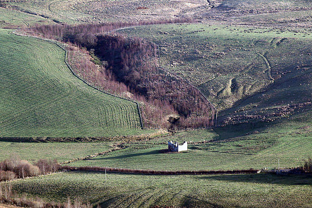
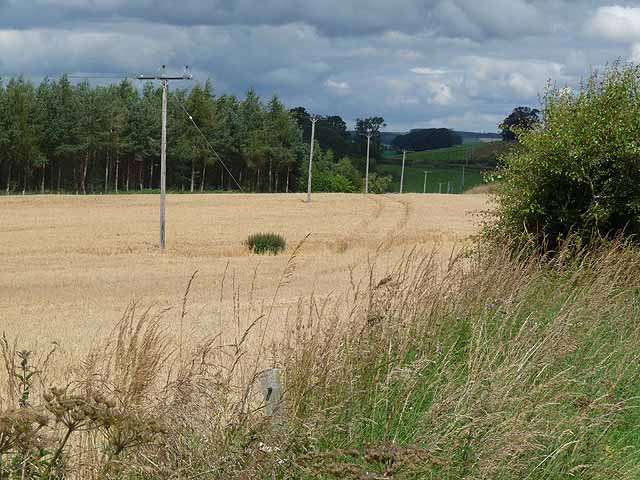
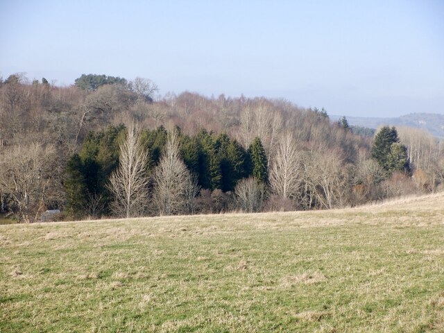
West Lees Plantation is a scenic woodland area located in Roxburghshire, Scotland. Covering an expansive area, it is known for its dense forests and lush greenery, making it a popular destination for nature enthusiasts and hikers.
The plantation is situated amidst the stunning landscape of the Scottish Borders, offering breathtaking views of rolling hills and picturesque valleys. The woodlands are characterized by a variety of tree species, including oak, beech, and birch, creating a diverse and vibrant ecosystem.
Visitors to West Lees Plantation can explore its numerous walking trails, which meander through the thick forests and alongside babbling streams. These paths provide an opportunity to immerse oneself in nature and enjoy the tranquility and serenity of the surroundings. The plantation is also home to an array of wildlife, with deer, foxes, and various bird species being commonly spotted.
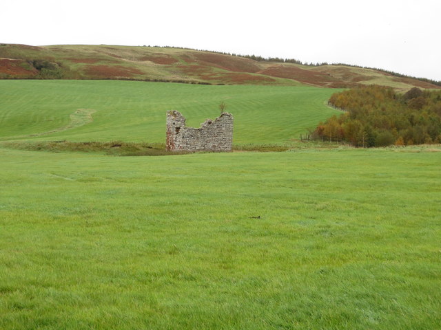
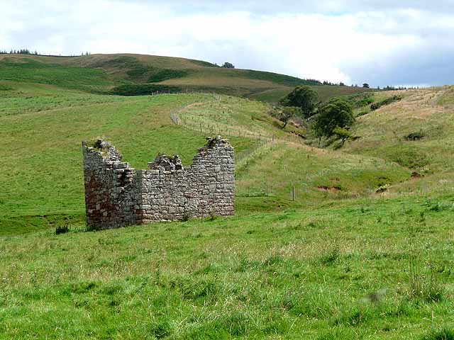
In addition to its natural beauty, West Lees Plantation holds historical significance. The remains of a 16th-century tower house can still be seen within the woodland, serving as a reminder of the area's rich heritage.
For those seeking a peaceful retreat in the heart of nature, West Lees Plantation offers a perfect escape. Its idyllic setting, combined with its abundance of flora and fauna, makes it an ideal location for outdoor activities such as picnics, bird watching, and photography.
Overall, West Lees Plantation in Roxburghshire is a captivating destination that showcases the beauty of Scotland's woodlands, providing visitors with an opportunity to connect with nature and appreciate the rich history of the area.
If you have any feedback on the listing, please let us know in the comments section below.
West Lees Plantation Images
Images are sourced within 2km of 55.435864/-2.6490318 or Grid Reference NT5915. Thanks to Geograph Open Source API. All images are credited.


West Lees Plantation is located at Grid Ref: NT5915 (Lat: 55.435864, Lng: -2.6490318)
Unitary Authority: The Scottish Borders
Police Authority: The Lothians and Scottish Borders
What 3 Words
///tenders.attends.currently. Near Jedburgh, Scottish Borders
Nearby Locations
Related Wikis

Rubers Law
Rubers Law is a prominent, conical hill in the Scottish Borders area of south-east Scotland. It stands on the south bank of the River Teviot, between the...

Fulton Tower
Fulton Tower is a ruined 16th century tower house, about 4.5 miles (7.2 km) south west of Jedburgh, Scottish Borders, Scotland, and about 2 miles (3.2...

Hallrule
Hallrule is a hamlet on the B6357 road, in the Scottish Borders area of Scotland, on the Rule Water, near Abbotrule, Bedrule Bonchester Bridge, Denholm...

Bedrule
Bedrule (Scottish Gaelic: Ruail Bheathaig) is a hamlet and civil parish in the historic county of Roxburghshire in the Scottish Borders area of Scotland...
Bedrule Castle
Bedrule Castle is a ruined 13th-century castle in the Rule Valley, in the Scottish Borders area of Scotland.The castle was built in the 13th century by...

Westgate Hall, Denholm
Westgate Hall is located in Westgate in the village of Denholm, Roxburghshire, in the Scottish Borders. It stands at the western and south-western approaches...
Denholm
Denholm is a small village located between Jedburgh and Hawick in the Scottish Borders region of Scotland, UK. The estimated population of Denholm is 600...
Spittal-on-Rule
Spittal-on-Rule is a farm in the council area of Scottish Borders in Scotland. As the name suggests it is situated on the river Rule Water, and the Spittal...
Nearby Amenities
Located within 500m of 55.435864,-2.6490318Have you been to West Lees Plantation?
Leave your review of West Lees Plantation below (or comments, questions and feedback).