Ruberslaw Covert

Wood, Forest in Roxburghshire

Scotland

Ruberslaw Covert

A698 approaching Denholm
A698 approaching Denholm Credit: JThomas

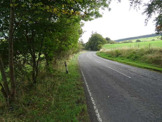
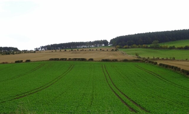
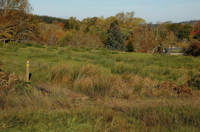
Ruberslaw Covert is a beautiful woodland located in Roxburghshire, Scotland. Covering an area of approximately 450 acres, this forest is a diverse mix of native and exotic tree species, providing a rich habitat for a variety of wildlife.

The forest is known for its ancient oaks, beech, and pine trees, creating a picturesque landscape for visitors to explore. The woodland is crisscrossed with a network of walking trails, making it a popular destination for hikers and nature lovers.

Ruberslaw Covert is home to a wide range of wildlife, including deer, red squirrels, and a variety of bird species. Birdwatchers will delight in spotting species such as woodpeckers, owls, and buzzards among the trees.

Visitors to Ruberslaw Covert can also enjoy panoramic views of the surrounding countryside from various vantage points within the forest. The peaceful and tranquil atmosphere of the woodland makes it a perfect place to escape the hustle and bustle of everyday life and connect with nature.

If you have any feedback on the listing, please let us know in the comments section below.

Ruberslaw Covert Images

Images are sourced within 2km of 55.443432/-2.668773 or Grid Reference NT5716. Thanks to Geograph Open Source API. All images are credited.

A698 approaching Denholm
War Memorial, Denholm
Postbox on Westside, Denholm In front of the Post Office.
Postbox No. TD9 70.

See <a href="https://www.geograph.org.uk/photo/7018954">NT5618 : Denholm Post Office</a> for context.
Postbox on Westside, Denholm
In front of the Post Office. Postbox No. TD9 70. See NT5618 : Denholm Post Office for context.
Denholm Post Office Showing position of Postbox No. TD9 70.

See <a href="https://www.geograph.org.uk/photo/7018953">NT5618 : Postbox on Westside, Denholm</a> for postbox.
Denholm Post Office
Showing position of Postbox No. TD9 70. See NT5618 : Postbox on Westside, Denholm for postbox.
The Cross Keys, Denholm On Main Street.
The Cross Keys, Denholm
On Main Street.
Sign for the Cross Keys, Denholm
K6 telephone box on Main Street, Denholm Now an information point.
K6 telephone box on Main Street, Denholm
Now an information point.
The John Leyden Memorial, Denholm On the village green. John Leyden born in 1775 in Denholm and was an antiquarian, physician and poet.
The John Leyden Memorial, Denholm
On the village green. John Leyden born in 1775 in Denholm and was an antiquarian, physician and poet.
Crop field, Denholm The land rises up from the River Teviot.
Crop field, Denholm
The land rises up from the River Teviot.
Jedburgh Road (A698) leaving Denholm
The interior of Denholm Church in Roxburghshire. Built in the 19th. century as a Free Church, Denholm became part of the Church of Scotland in 1929.
The interior of Denholm Church in Roxburghshire.
Built in the 19th. century as a Free Church, Denholm became part of the Church of Scotland in 1929.
Denholm Green Denholm on an October morning. The spire is the Leyden Monument - see <a href="https://www.geograph.org.uk/photo/763708">NT5618 : The Leyden Monument</a>.
Denholm Green
Denholm on an October morning. The spire is the Leyden Monument - see NT5618 : The Leyden Monument.
Track to Spital Tower, Denholm The track, muddy in places, is on the route of the Borders Abbeys Way, a circular route of 109 km (68 miles) linking Jedburgh, Hawick, Selkirk, Melrose, Dryburgh and Kelso. The houses in view are at Denholm.
Track to Spital Tower, Denholm
The track, muddy in places, is on the route of the Borders Abbeys Way, a circular route of 109 km (68 miles) linking Jedburgh, Hawick, Selkirk, Melrose, Dryburgh and Kelso. The houses in view are at Denholm.
Borders Abbeys Way, Denholmhill Wood A gate at the exit from the wood where the path makes a dogleg on its route to Spital Tower and Bedrule.
Borders Abbeys Way, Denholmhill Wood
A gate at the exit from the wood where the path makes a dogleg on its route to Spital Tower and Bedrule.
On the Borders Abbeys Way approaching Spital Tower The track follows field margins on its descent from the shoulder of Denholm Hill to the farm at Spital Tower, after which it crosses fields to reach the minor road near Bedrule. The opposite hillside is across the Rule Water.
On the Borders Abbeys Way approaching Spital Tower
The track follows field margins on its descent from the shoulder of Denholm Hill to the farm at Spital Tower, after which it crosses fields to reach the minor road near Bedrule. The opposite hillside is across the Rule Water.
Footbridge near Spital Tower A plank bridge crossing a small burn in the fields SE of Spital Tower farm. The waymarked route for the Borders Abbeys Way differs slightly from that shown on the 1:25,000 map in this area.
Footbridge near Spital Tower
A plank bridge crossing a small burn in the fields SE of Spital Tower farm. The waymarked route for the Borders Abbeys Way differs slightly from that shown on the 1:25,000 map in this area.
Rubers Law from the northeast Although it has a striking conical shape, Rubers Law (424m) is not the direct remains of a volcano itself, but the remnants of the central plug of hard rock left behind after over the 340 million years of erosion have removed the outer layers.

The Borders Abbeys Way is routed slightly differently here from the line shown on the map, keeping N of the cottage at Blawearie.
Rubers Law from the northeast
Although it has a striking conical shape, Rubers Law (424m) is not the direct remains of a volcano itself, but the remnants of the central plug of hard rock left behind after over the 340 million years of erosion have removed the outer layers. The Borders Abbeys Way is routed slightly differently here from the line shown on the map, keeping N of the cottage at Blawearie.
Coming and going near Spital Tower Tractors carting and dumping earth to form an embankment at the edge of a field near Spital Tower farm.
Coming and going near Spital Tower
Tractors carting and dumping earth to form an embankment at the edge of a field near Spital Tower farm.
Show me another place!

Ruberslaw Covert is located at Grid Ref: NT5716 (Lat: 55.443432, Lng: -2.668773)

Unitary Authority: The Scottish Borders

Police Authority: The Lothians and Scottish Borders

What 3 Words

///thrilled.soaps.offices. Near Hawick, Scottish Borders

Nearby Locations

Ruberslaw Covert

Related Wikis

Rubers Law

Rubers Law is a prominent, conical hill in the Scottish Borders area of south-east Scotland. It stands on the south bank of the River Teviot, between the...

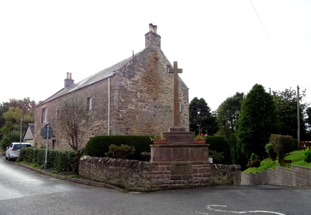
Westgate Hall, Denholm

Westgate Hall is located in Westgate in the village of Denholm, Roxburghshire, in the Scottish Borders. It stands at the western and south-western approaches...
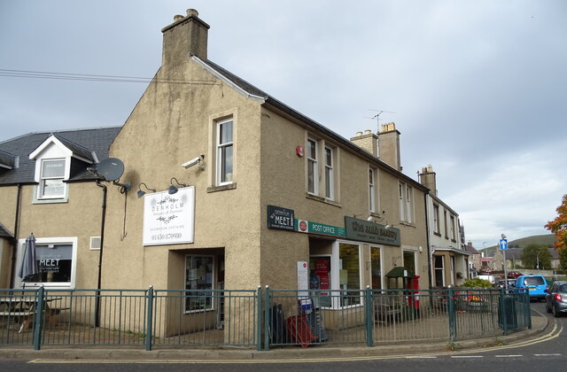
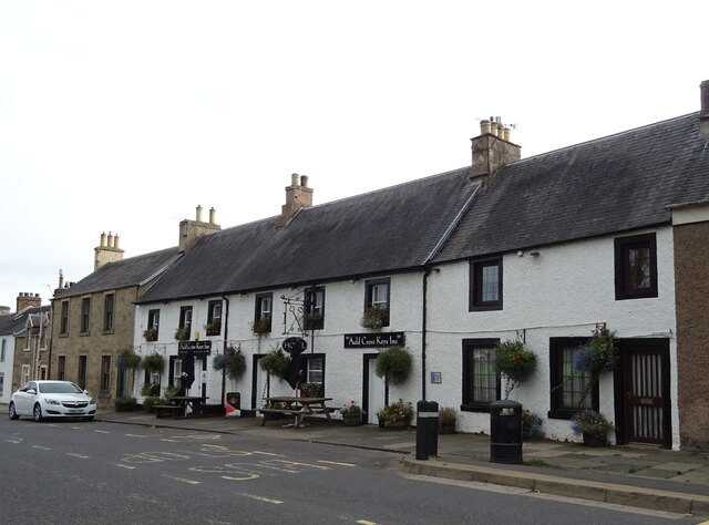
Denholm

Denholm is a small village located between Jedburgh and Hawick in the Scottish Borders region of Scotland, UK. The estimated population of Denholm is 600...

Bedrule Castle

Bedrule Castle is a ruined 13th-century castle in the Rule Valley, in the Scottish Borders area of Scotland.The castle was built in the 13th century by...

Nearby Amenities

Located within 500m of 55.443432,-2.668773
Note: Lack of clearly defined path south of this point, it is possible to continue on the west side of the forest
Lat/Long: 55.4463205/-2.6724969
The data included in this document is from www.openstreetmap.org. The data is made available under ODbL.

Have you been to Ruberslaw Covert?

Leave your review of Ruberslaw Covert below (or comments, questions and feedback).