Whinpark Wood

Wood, Forest in Aberdeenshire

Scotland

Whinpark Wood

Ythanside, near Glencat
Ythanside, near Glencat Credit: Mike Pennington

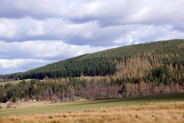
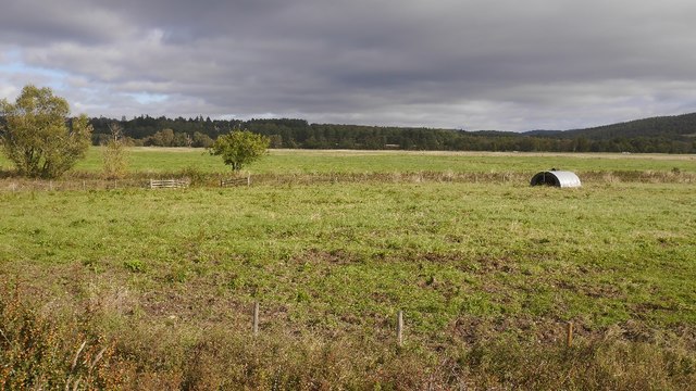
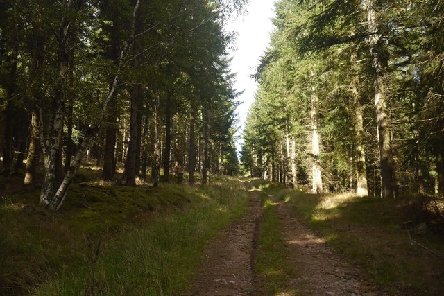
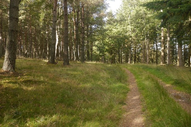
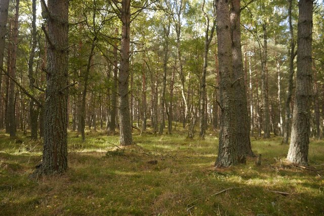
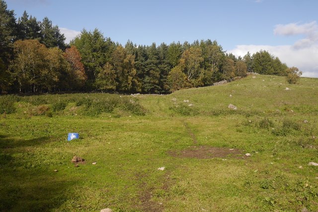
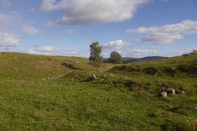
Whinpark Wood is a picturesque woodland located in Aberdeenshire, Scotland. Covering an area of approximately 100 acres, it is a popular destination for nature enthusiasts and outdoor lovers. The wood is nestled in a rural setting, surrounded by rolling hills and scenic landscapes.

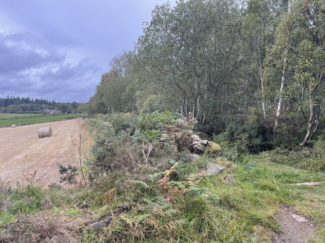
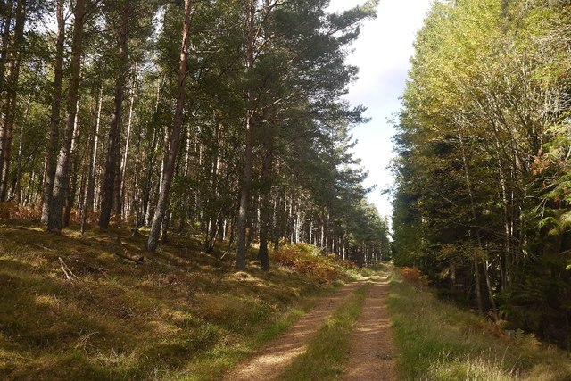
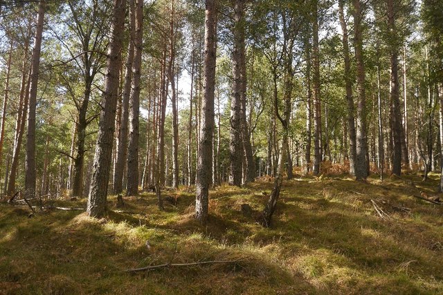
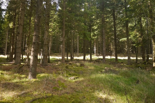
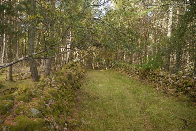
The woodland is primarily composed of native broadleaf trees, such as oak, birch, and rowan, creating a diverse and vibrant ecosystem. The dense canopy provides a habitat for a variety of bird species, including woodpeckers, thrushes, and owls, making it a haven for birdwatchers.

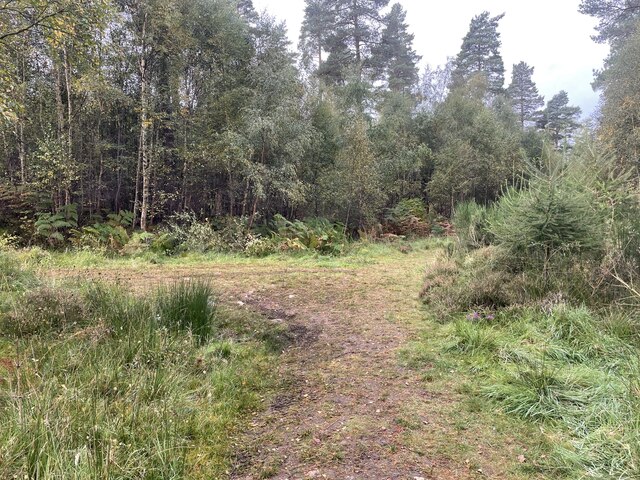
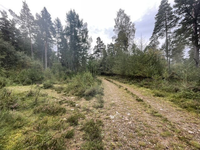
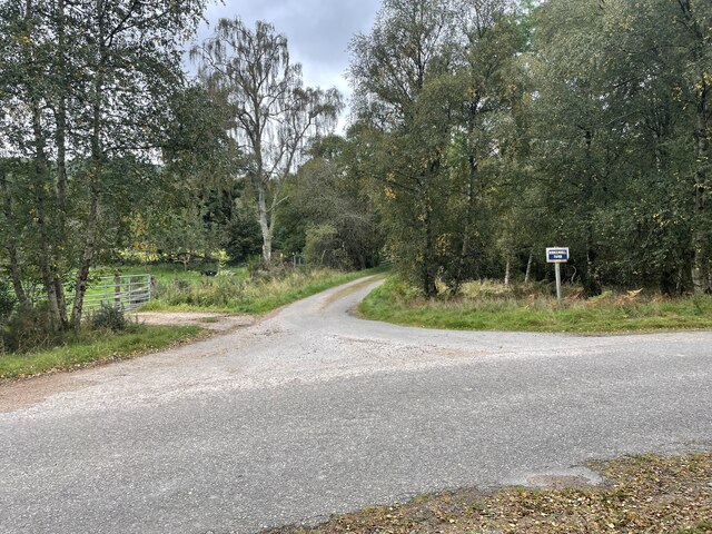
Whinpark Wood offers a network of well-maintained footpaths, allowing visitors to explore the area at their own pace. The paths wind through the wood, providing glimpses of stunning flora and fauna along the way. Bluebells, wild garlic, and ferns carpet the forest floor, adding to its charm.

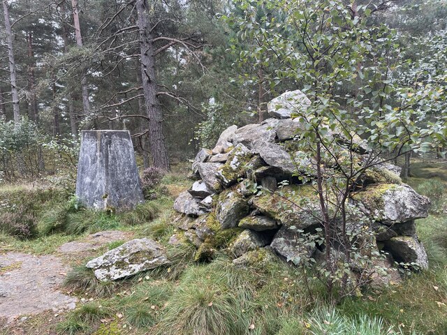
In addition to its natural beauty, Whinpark Wood also has historical significance. The remains of an Iron Age fort can be found within the woodland, offering a glimpse into the area's ancient past. This adds an element of intrigue and fascination for history enthusiasts.

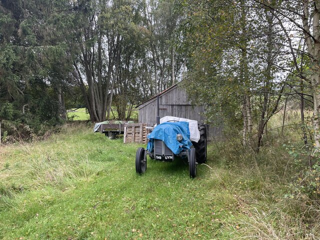
Whinpark Wood is easily accessible, with ample parking and facilities available nearby. Whether it's a leisurely stroll, birdwatching, or simply enjoying the peaceful ambiance, Whinpark Wood offers a delightful escape into nature for visitors of all ages.

If you have any feedback on the listing, please let us know in the comments section below.

Whinpark Wood Images

Images are sourced within 2km of 57.05408/-2.6972681 or Grid Reference NO5796. Thanks to Geograph Open Source API. All images are credited.

Ythanside, near Glencat
Path junction in the forest Geocaching is a type of global treasure hunt of people looking for caches, or hidden stashes of objects. Geocaching may also be described as a series of hide-and-seek games, where hiders provide online clues for seekers. Seekers use global positioning system (GPS) devices to find hidden caches
Path junction in the forest
Geocaching is a type of global treasure hunt of people looking for caches, or hidden stashes of objects. Geocaching may also be described as a series of hide-and-seek games, where hiders provide online clues for seekers. Seekers use global positioning system (GPS) devices to find hidden caches
Path junction in the forest
Craigmore wood Trig Point
Where forest and farm meet
Old Tractor
Old Tractor
Birken Hill farm
Birken Hill farm
Back roads of Aberdeenshire
Pig ark, Haugh A haugh south of the Dee.
Pig ark, Haugh
A haugh south of the Dee.
Canadian Road Named after the World War II lumberjacks who felled almost everything that survived World War I.  Any remaining trees in Balfour Forest were finished off by the gale of January 1953. (The one which killed thousands around the North Sea).
Canadian Road
Named after the World War II lumberjacks who felled almost everything that survived World War I. Any remaining trees in Balfour Forest were finished off by the gale of January 1953. (The one which killed thousands around the North Sea).
Holms Wood Balfour Forest, above Bogieshiel.
Holms Wood
Balfour Forest, above Bogieshiel.
Whitehill Wood Eastern side of Balfour Forest, above the Canadian Road.
Whitehill Wood
Eastern side of Balfour Forest, above the Canadian Road.
The Canadian Road Named after the World War II lumberjacks who felled almost everything that survived World War I.  Any remaining trees in Balfour Forest were finished off by the gale of January 1953. (The one which killed thousands around the North Sea).
The Canadian Road
Named after the World War II lumberjacks who felled almost everything that survived World War I. Any remaining trees in Balfour Forest were finished off by the gale of January 1953. (The one which killed thousands around the North Sea).
Whitehill Wood A beautiful runnable forest, restored after destruction in the mid 20th century. It was felled in both wars and the remnants finished off by the disastrous storm of 1953.
Whitehill Wood
A beautiful runnable forest, restored after destruction in the mid 20th century. It was felled in both wars and the remnants finished off by the disastrous storm of 1953.
Quarry, Achnafoy The Canadian Road ends here in a grassed over quarry. There is a gate at the far side which leads to a disused road in the forest. From here a path leads down to the Balfour to Kinminity road. Goes a treat on a bike, lovely singletrack.
Quarry, Achnafoy
The Canadian Road ends here in a grassed over quarry. There is a gate at the far side which leads to a disused road in the forest. From here a path leads down to the Balfour to Kinminity road. Goes a treat on a bike, lovely singletrack.
Quarry, Auchnafoy A grassed over quarry at the northern end of the Canadian Road.
Quarry, Auchnafoy
A grassed over quarry at the northern end of the Canadian Road.
An old road above Kinminity A fine pair of dykes beside a long disused road near Balfour. Contrary to the Ordnance Survey map there is woodland on both sides.
An old road above Kinminity
A fine pair of dykes beside a long disused road near Balfour. Contrary to the Ordnance Survey map there is woodland on both sides.
Show me another place!

Whinpark Wood is located at Grid Ref: NO5796 (Lat: 57.05408, Lng: -2.6972681)

Unitary Authority: Aberdeenshire

Police Authority: North East

What 3 Words

///squabbles.oblige.loosens. Near Aboyne, Aberdeenshire

Nearby Locations

Ballogie Whinpark Wood

Related Wikis

Ballogie

Ballogie is a rural community and an estate in the Lower Deeside area of Aberdeenshire, Scotland. Most of Ballogie lies within the parish of Birse, although...

Kinminity

Kinminity is a former village located south-east of Birse, Aberdeenshire in Scotland. == History == The property was in hands of the cadet family of Sutherlands...

Birse

Birse (Scottish Gaelic: Braois/Breis) is a parish in the Lower Deeside area of Aberdeenshire, Scotland, which includes the communities of Finzean and Ballogie...

Corsedardar Hill

Corsedardar Hill is a mountain landform in the Grampian Mountains of Aberdeenshire, Scotland. This hill is located in the Lower Deeside region within the...

Dinnie Stones

The Dinnie Stones (also called Stanes or Steens) are a pair of Scottish lifting stones located in Potarch, Aberdeenshire. They were made famous by strongman...

Potarch

Potarch ( pot-ARKH) is a hamlet in Aberdeenshire, Scotland, with a bridge across the River Dee.It is a popular location with tourists and day-trippers...

Belwade Farm

Belwade Farm is a horse stables near Aboyne, Scotland owned by World Horse Welfare. == History == A new visitor centre and indoor arena was opened by Princess...

Kincardine O'Neil Hospital, Aberdeenshire

Kincardine O'Neil Hospital was founded in the 13th century in the village of Kincardine O'Neil in Scotland. Almost certainly it served as a traveler's...

Nearby Amenities

Located within 500m of 57.05408,-2.6972681
Marywell
Place: hamlet
Lat/Long: 57.0535117/-2.6924184
Power: pole
Lat/Long: 57.0511513/-2.6910988
Power: pole
Lat/Long: 57.0508194/-2.6931283
Power: pole
Lat/Long: 57.0506816/-2.6942432
Power: pole
Lat/Long: 57.0503497/-2.6954431
Power: pole
Lat/Long: 57.0500012/-2.6966544
Power: pole
Lat/Long: 57.049624/-2.6976956
Power: pole
Lat/Long: 57.0502674/-2.7015637
Power: pole
Lat/Long: 57.0523445/-2.6901237
Power: pole
Lat/Long: 57.0528759/-2.6905281
Power: pole
Lat/Long: 57.0533897/-2.6909287
Power: pole
Lat/Long: 57.0538871/-2.6913142
Power: pole
Lat/Long: 57.0545176/-2.6917621
Power: pole
Lat/Long: 57.0548681/-2.6928552
Power: pole
Lat/Long: 57.0554518/-2.6932861
Power: pole
Lat/Long: 57.0559779/-2.693681
Power: pole
Lat/Long: 57.0564671/-2.6942895
Power: pole
Lat/Long: 57.0570692/-2.6949206
Power: pole
Lat/Long: 57.0576807/-2.6959051
Power: pole
Lat/Long: 57.0581482/-2.6967366
Waste Basket
Lat/Long: 57.0544576/-2.691869
The data included in this document is from www.openstreetmap.org. The data is made available under ODbL.

Have you been to Whinpark Wood?

Leave your review of Whinpark Wood below (or comments, questions and feedback).