Broadside Plantation

Wood, Forest in Roxburghshire

Scotland

Broadside Plantation

Road approaching Northfield Farm Looking south-westward.
Road approaching Northfield Farm Credit: Peter Wood

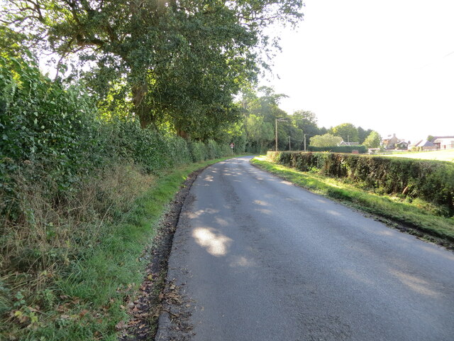
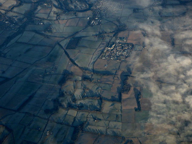
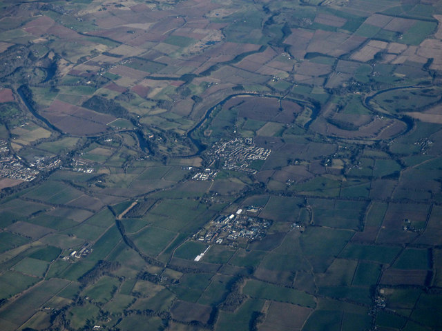
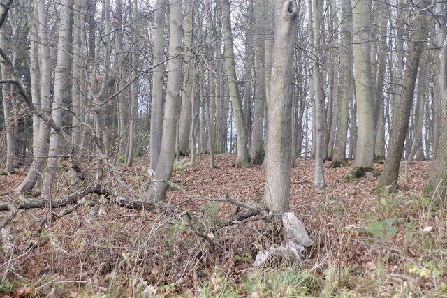
Broadside Plantation, located in Roxburghshire, is a picturesque woodland area known for its abundant natural beauty and diverse flora and fauna. Covering an area of approximately 500 acres, this enchanting forest offers a serene and tranquil escape from the hustle and bustle of everyday life.

The plantation is home to a rich variety of tree species, including oak, birch, pine, and beech, creating a vibrant and colorful landscape throughout the seasons. The dense canopy of trees provides a sheltered habitat for a range of wildlife, such as deer, red squirrels, and a plethora of bird species, making it an ideal destination for nature enthusiasts and birdwatchers.

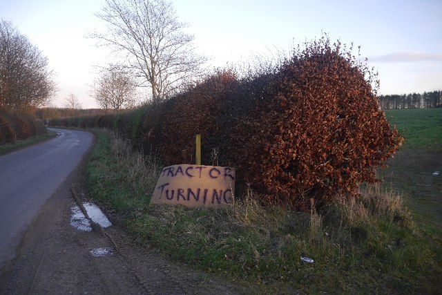
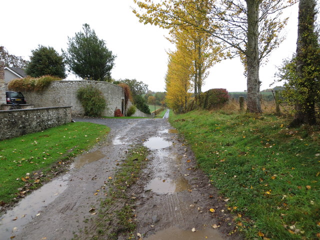
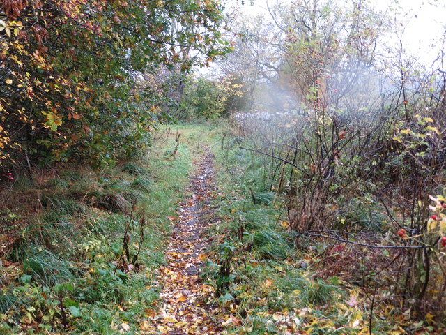
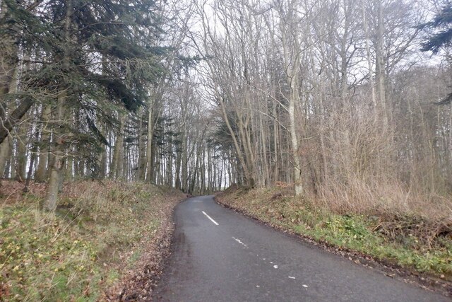
Traversing through Broadside Plantation, visitors can explore a network of well-maintained walking trails, allowing them to immerse themselves in the natural wonders of the woodland. The trails cater to all levels of fitness and offer breathtaking views of the surrounding countryside, with occasional glimpses of the nearby River Teviot.

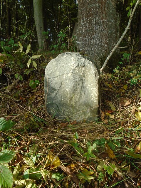
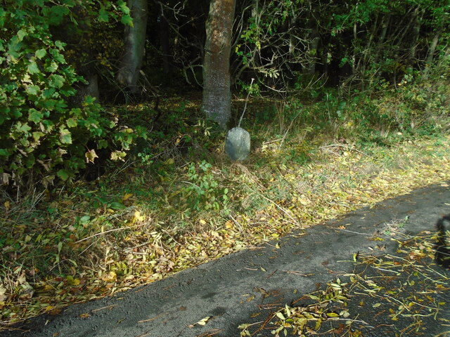
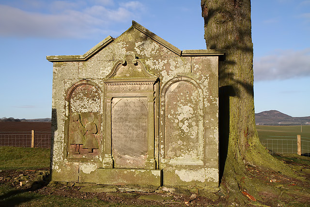
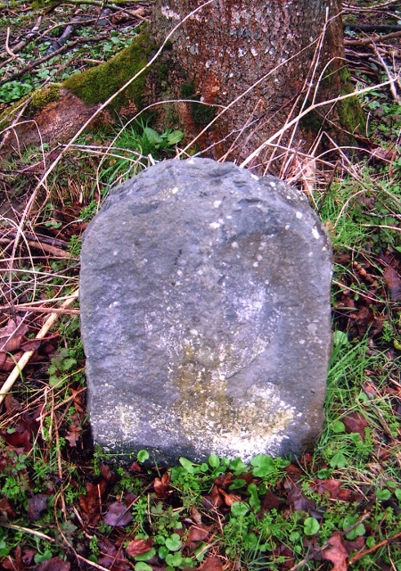
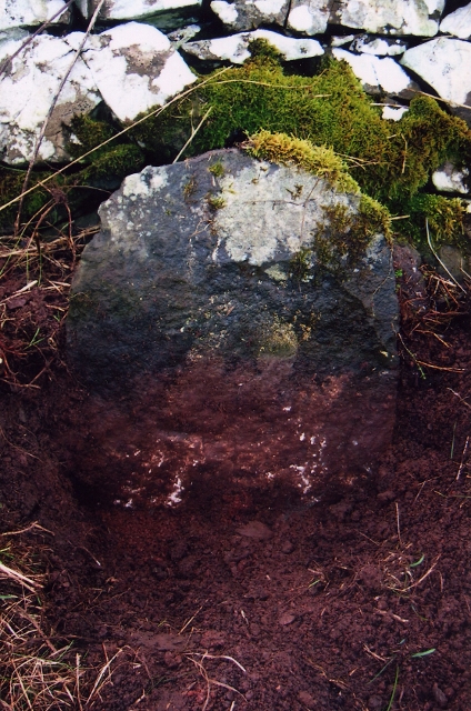
For those interested in history, Broadside Plantation holds significant cultural and historical value. It is believed that the woodland has been in existence for several centuries, and remnants of old structures, including the ruins of a former mill, can still be found within its boundaries. These remnants serve as a reminder of the area's rich heritage and provide a fascinating glimpse into the past.

Whether it's a leisurely stroll, birdwatching, or a desire to connect with nature, Broadside Plantation offers a unique and captivating experience for visitors of all ages. Its tranquil atmosphere and natural beauty make it a cherished destination for locals and tourists alike.

If you have any feedback on the listing, please let us know in the comments section below.

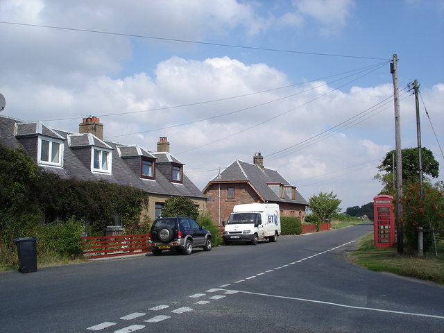
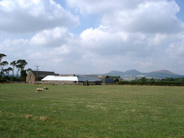
Broadside Plantation Images

Images are sourced within 2km of 55.544665/-2.6718065 or Grid Reference NT5728. Thanks to Geograph Open Source API. All images are credited.

Road approaching Northfield Farm Looking south-westward.
Road approaching Northfield Farm
Looking south-westward.
Old milestone Vegetation cleared from around the old, worn milestone which may once have had a 2 inscribed or painted on as it is 2 miles from St Boswells on the minor road towards Lilliesleaf.
Old milestone
Vegetation cleared from around the old, worn milestone which may once have had a 2 inscribed or painted on as it is 2 miles from St Boswells on the minor road towards Lilliesleaf.
Old milestone The milestone on the narrow verge just after a left-hand bend when approaching from St Boswells.   The small Arniesyde plantation is behind the stone.   This lane joins the B6359 just over a mile further southwest.
Old milestone
The milestone on the narrow verge just after a left-hand bend when approaching from St Boswells. The small Arniesyde plantation is behind the stone. This lane joins the B6359 just over a mile further southwest.
A gravestone at Longnewton Burial Ground This grand stone in the small burial ground is for the Blackie family and is inscribed as follows:

This ston is
Sacred to the Memory of
John Blackie, mason, late
Farmer in Ancrum Mill who
Died 31st May 1772 Aged 66 years
Margrat Riddel his Spouse
Died 9th April 1786 Aged 70 years
Francis Blackie his son died
25th January 1746 Aged 3 yr
Andrew Blackie his Son died
14th June 1747 Aged 5 Months
A gravestone at Longnewton Burial Ground
This grand stone in the small burial ground is for the Blackie family and is inscribed as follows: This ston is Sacred to the Memory of John Blackie, mason, late Farmer in Ancrum Mill who Died 31st May 1772 Aged 66 years Margrat Riddel his Spouse Died 9th April 1786 Aged 70 years Francis Blackie his son died 25th January 1746 Aged 3 yr Andrew Blackie his Son died 14th June 1747 Aged 5 Months
Charlesfield industrial estate from the air Whinfield and Elliston are in the foreground, St Boswells is in the distance.
Charlesfield industrial estate from the air
Whinfield and Elliston are in the foreground, St Boswells is in the distance.
Tractor turning Home made sign near Greenend.
Tractor turning
Home made sign near Greenend.
Track at Birseslees Looking northward.
Track at Birseslees
Looking northward.
A somewhat overgrown, wet and muddy track near Camp Knowes Looking north-westward. The picture was taken on a day when the Met Office had given a 'Yellow' warning of heavy and continuous rain. This proved correct hence the rain spots.
A somewhat overgrown, wet and muddy track near Camp Knowes
Looking north-westward. The picture was taken on a day when the Met Office had given a 'Yellow' warning of heavy and continuous rain. This proved correct hence the rain spots.
Old Milestone by Arniesyde Plantation, near Thornielaw Milestone by the UC road, in parish of St Boswells (Roxburgh District), Northwest of Thornielaw, on verge by Arniesyde Plantation, North side of road.

Inscription once read:-
ST. BOSWELLS
2

Surveyed

Milestone Society National ID: BD_SBLL02
Old Milestone by Arniesyde Plantation, near Thornielaw
Milestone by the UC road, in parish of St Boswells (Roxburgh District), Northwest of Thornielaw, on verge by Arniesyde Plantation, North side of road. Inscription once read:- ST. BOSWELLS 2 Surveyed Milestone Society National ID: BD_SBLL02
Old Milestone near Langside, Bowden parish Milestone by the UC road, in parish of Bowden (Roxburgh District), Langside, on verge in front of drystone wall.

Inscription once read:-
(Newtown)
(3)

Surveyed

Milestone Society National ID: BD_SBLL03
Old Milestone near Langside, Bowden parish
Milestone by the UC road, in parish of Bowden (Roxburgh District), Langside, on verge in front of drystone wall. Inscription once read:- (Newtown) (3) Surveyed Milestone Society National ID: BD_SBLL03
Charlesfield from the air Charlesfield industrial estate is in the foreground with Newton St Boswells and St Boswells on the banks of the Tweed beyond.
Charlesfield from the air
Charlesfield industrial estate is in the foreground with Newton St Boswells and St Boswells on the banks of the Tweed beyond.
Road through Arniesyde Plantation
Arniesyde Plantation
Charlesfield Industrial Estate
Bridge on former Waverley Route south of St Boswells Looking towards Thornielaw Farm through arch.
Bridge on former Waverley Route south of St Boswells
Looking towards Thornielaw Farm through arch.
Part of Charlesfield Industrial Estate The building to the right of the picture is the Goods Vehicle Testing Station. The long building to the left of that is one of the few remaining buildings from the sites former use for military purposes in WW 2.
Part of Charlesfield Industrial Estate
The building to the right of the picture is the Goods Vehicle Testing Station. The long building to the left of that is one of the few remaining buildings from the sites former use for military purposes in WW 2.
Longnewton Off A68 south of St Boswells
Longnewton
Off A68 south of St Boswells
Wellrig Farm Eildon Hills in the background
Wellrig Farm
Eildon Hills in the background
Show me another place!

Broadside Plantation is located at Grid Ref: NT5728 (Lat: 55.544665, Lng: -2.6718065)

Unitary Authority: The Scottish Borders

Police Authority: The Lothians and Scottish Borders

What 3 Words

///outer.cavalier.reshaping. Near Saint Boswells, Scottish Borders

Related Wikis

Charlesfield Halt railway station

Charlesfield Halt railway station served the village of Charlesfield, Melrose, Scotland, from 1942 to 1961 on the Waverley Route. == History == The station...

Belses railway station

Belses railway station served the village of Belses, Scottish Borders, Scotland from 1849 to 1969 on the Waverley Route. == History == The station opened...

Belses

Belses is a village on the Ale Water, in the Scottish Borders area of Scotland the former Selkirkshire. It is situated close to Old Belses, and lies south...

Bowden, Scottish Borders

Bowden is a village in the Roxburghshire area of the Scottish Borders, situated 3 miles (5 kilometres) south of Melrose, 2 miles (3 kilometres) west of...

Greycrook

Greycrook is a village off the A68 and the A699 in the Scottish Borders, approximately 500 m (550 yd) south-east of St Boswells, and close to Dryburgh...

Old Belses

Old Belses is a village by the Ale Water, in the Parish of Ancrum, in the Scottish Borders of Scotland, in the historic county of Roxburghshire. Other...

St Boswells

St Boswells (Scots: Bosels / Bosells; Scottish Gaelic: Cille Bhoisil [ˈçiʎəˈvɔʃɪl]) is a village on the south side of the River Tweed in the Scottish Borders...

Newtown St Boswells

Newtown St Boswells (Scots: Newtoon; Scottish Gaelic: Baile Ùr Bhoisil [ˈpaləˈuːɾˈvɔʃɪl]) is a village in the Scottish Borders council area, in south-east...

Nearby Amenities

Located within 500m of 55.544665,-2.6718065
Natural: peak
Lat/Long: 55.5460511/-2.669893
The data included in this document is from www.openstreetmap.org. The data is made available under ODbL.

Have you been to Broadside Plantation?

Leave your review of Broadside Plantation below (or comments, questions and feedback).