Durnhill Plantation

Wood, Forest in Banffshire

Scotland

Durnhill Plantation

Durn House Stables "At Risk" Grade B Listed: <span class="nowrap"><a title="http://www.buildingsatrisk.org.uk/details/916384" rel="nofollow ugc noopener" href="http://www.buildingsatrisk.org.uk/details/916384">Link</a><img style="margin-left:2px;" alt="External link" title="External link - shift click to open in new window" src="https://s1.geograph.org.uk/img/external.png" width="10" height="10"/></span>
Durn House Stables Credit: valenta

Durnhill Plantation is a picturesque wood located in Banffshire, Scotland. Spanning over a vast area, it is a haven for nature enthusiasts and a popular destination for local residents and tourists alike. The plantation is situated near the charming village of Durnhill, surrounded by rolling hills and stunning landscapes.

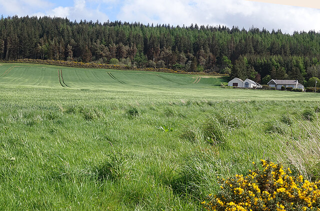
The woodland in Durnhill Plantation is primarily composed of a variety of native tree species, including Scots pine, birch, and oak trees. These trees provide a diverse habitat for a wide range of flora and fauna, attracting numerous bird species, small mammals, and insects. The plantation is home to several walking trails, allowing visitors to explore the natural beauty of the area and immerse themselves in the peaceful ambiance of the wood.

The management of Durnhill Plantation is dedicated to maintaining the ecological balance of the woodland. Regular conservation efforts are undertaken to preserve the natural habitat and protect the rare and endangered species that call the plantation home. These initiatives include tree planting programs, invasive species control, and sustainable forestry practices.

In addition to its natural beauty, Durnhill Plantation offers recreational activities for visitors. The well-maintained trails are perfect for walking, hiking, or cycling, providing opportunities for exercise and relaxation amidst the tranquil surroundings. The plantation also features picnic areas where visitors can enjoy a leisurely lunch while taking in the stunning views.

Durnhill Plantation is a cherished natural gem in Banffshire, providing a serene retreat for those seeking solace in nature. With its rich biodiversity, scenic trails, and commitment to conservation, this woodland is a true testament to the beauty and importance of Scotland's natural landscapes.

If you have any feedback on the listing, please let us know in the comments section below.

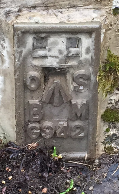
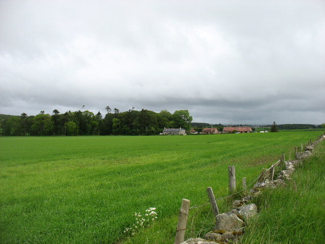
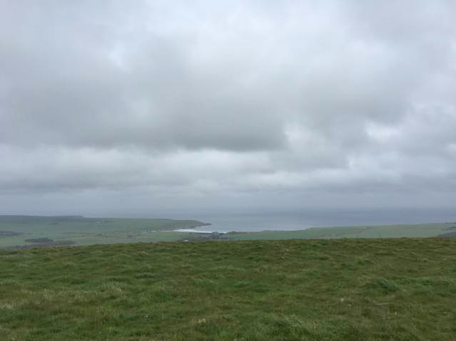
Durnhill Plantation Images

Images are sourced within 2km of 57.66183/-2.7122281 or Grid Reference NJ5763. Thanks to Geograph Open Source API. All images are credited.

Durn House Stables "At Risk" Grade B Listed: <span class="nowrap"><a title="http://www.buildingsatrisk.org.uk/details/916384" rel="nofollow ugc noopener" href="http://www.buildingsatrisk.org.uk/details/916384">Link</a><img style="margin-left:2px;" alt="External link" title="External link - shift click to open in new window" src="https://s1.geograph.org.uk/img/external.png" width="10" height="10"/></span>
Durn House Stables
"At Risk" Grade B Listed: LinkExternal link
Durnhill Quarry This quarry exploited the rodded quartzite which makes up Durn Hill and outcrops on the shore at Portsoy. It is marked on the map as disused, and it certainly looks as if no-one has extracted anything from it for a long time, but there are piles of what looks like crushed rock for road surfacing, and the usual warning notices at the entrance say that it belongs to Aberdeenshire Council
Durnhill Quarry
This quarry exploited the rodded quartzite which makes up Durn Hill and outcrops on the shore at Portsoy. It is marked on the map as disused, and it certainly looks as if no-one has extracted anything from it for a long time, but there are piles of what looks like crushed rock for road surfacing, and the usual warning notices at the entrance say that it belongs to Aberdeenshire Council
Flush Bracket OSBM G942: Damheads Bridge Ordnance Survey Flush Bracket OSBM G942: Damheads Bridge
Flush Bracket OSBM G942: Damheads Bridge
Ordnance Survey Flush Bracket OSBM G942: Damheads Bridge
Fields and houses near Damheads South of Portsoy.
Fields and houses near Damheads
South of Portsoy.
Lay-by with view to South Spade is the location of Portsoy FBM Aux 1 a Berntsen, Berntsen is an American manufacturer of survey equipment. A number of the passive stations installed by the OS, in particular the FBM auxiliaries, used a survey marker from Berntsen.

<span class="nowrap"><a title="http://trigpointing.uk/trig/562" rel="nofollow ugc noopener" href="http://trigpointing.uk/trig/562">Link</a><img style="margin-left:2px;" alt="External link" title="External link - shift click to open in new window" src="https://s1.geograph.org.uk/img/external.png" width="10" height="10"/></span>
Lay-by with view to South
Spade is the location of Portsoy FBM Aux 1 a Berntsen, Berntsen is an American manufacturer of survey equipment. A number of the passive stations installed by the OS, in particular the FBM auxiliaries, used a survey marker from Berntsen. LinkExternal link
Views out to sea from Durn Hill Trig Point
Brae of Fordyce The field of green shoots sweeps up past Brae of Fordyce to the edge of the forestry on Fordycehill.
Brae of Fordyce
The field of green shoots sweeps up past Brae of Fordyce to the edge of the forestry on Fordycehill.
Peacock Butterfly A Peacock butterfly (Inachis io) feeding on a Corn Sow-Thistle (Sonchus arvensis).
Peacock Butterfly
A Peacock butterfly (Inachis io) feeding on a Corn Sow-Thistle (Sonchus arvensis).
Grazing for Cattle The field is at the end of the track through the former quarry in Durn Hill.
Grazing for Cattle
The field is at the end of the track through the former quarry in Durn Hill.
Seafield Shooting Ground Broken clay pigeons are scattered on the ground in one of the five stands that make up the shooting ground.
Seafield Shooting Ground
Broken clay pigeons are scattered on the ground in one of the five stands that make up the shooting ground.
Burn of Durn Looking upstream from the road bridge at Damheads.
Burn of Durn
Looking upstream from the road bridge at Damheads.
Great Willowherb (Epilobium hirsutum) The ditch on the north side of the minor road is lined for a couple of hundred yards with a splendid display of Great Willowherb.
Great Willowherb (Epilobium hirsutum)
The ditch on the north side of the minor road is lined for a couple of hundred yards with a splendid display of Great Willowherb.
Fordyce Primary School The typical Aberdeenshire granite primary school was built in 1923: the school roll (2021-22) is 35 and the school is part of the Banff Academy associated schools' group.
Fordyce Primary School
The typical Aberdeenshire granite primary school was built in 1923: the school roll (2021-22) is 35 and the school is part of the Banff Academy associated schools' group.
Easter Villa, Fordyce The former Free Church manse built in 1846, not long after the Disruption, and B-listed: LB10618 <span class="nowrap"><a title="http://portal.historicenvironment.scot/designation/LB10618" rel="nofollow ugc noopener" href="http://portal.historicenvironment.scot/designation/LB10618">Link</a><img style="margin-left:2px;" alt="External link" title="External link - shift click to open in new window" src="https://s1.geograph.org.uk/img/external.png" width="10" height="10"/></span> .
Easter Villa, Fordyce
The former Free Church manse built in 1846, not long after the Disruption, and B-listed: LB10618 LinkExternal link .
Former Fordyce Parish School Built 1882 and located just north of the present primary school.  The school absorbed the pupils from Fordyce Academy, set up in 1801 due to an eccentric bequest by George Smith to educate boys preferably named 'Smith'.  Note the separate boys' and girls' entrances.  Now apparently in residential use.
Former Fordyce Parish School
Built 1882 and located just north of the present primary school. The school absorbed the pupils from Fordyce Academy, set up in 1801 due to an eccentric bequest by George Smith to educate boys preferably named 'Smith'. Note the separate boys' and girls' entrances. Now apparently in residential use.
House on Durn Road
House on Durn Road
Arnbath and telecoms mast Farm on a lane between Portsoy and Sandend.
Arnbath and telecoms mast
Farm on a lane between Portsoy and Sandend.
The former primary school at Fordyce  This used to be the primary section; it is now a store. The "New Academy " seen in the photo <a href="https://www.geograph.org.uk/photo/1997537">NJ5563 : Fordyce Primary School</a> was in the 1950s and 1960s the Fordyce Academy, ie the senior school. 

Thomas Menzies, Laird of Durn and the founder of Fordyce Castle endowed and built the first school in the village in the late 16th C. Revenues from local farms paid endowments to the schoolmaster.The school is believed to have been sited close to the kirk.

In 1716 the school moved to Glassaugh's House, a later wing of the castle. 

In 1882 a new school was built, known from 1900 as Fordyce Academy. This is the building in this photograph. The adjacent building, the "New Academy" dates from 1924, and is now the local primary school, with only 14 pupils ( at Sept 2011).
The former primary school at Fordyce
This used to be the primary section; it is now a store. The "New Academy " seen in the photo NJ5563 : Fordyce Primary School was in the 1950s and 1960s the Fordyce Academy, ie the senior school. Thomas Menzies, Laird of Durn and the founder of Fordyce Castle endowed and built the first school in the village in the late 16th C. Revenues from local farms paid endowments to the schoolmaster.The school is believed to have been sited close to the kirk. In 1716 the school moved to Glassaugh's House, a later wing of the castle. In 1882 a new school was built, known from 1900 as Fordyce Academy. This is the building in this photograph. The adjacent building, the "New Academy" dates from 1924, and is now the local primary school, with only 14 pupils ( at Sept 2011).
Show me another place!

Durnhill Plantation is located at Grid Ref: NJ5763 (Lat: 57.66183, Lng: -2.7122281)

Unitary Authority: Aberdeenshire

Police Authority: North East

What 3 Words

///pyramid.snowstorm.shifters. Near Portsoy, Aberdeenshire

Related Wikis

Fordyce Academy

Fordyce Academy, known until the mid-19th century as Fordyce School, and also sometimes called Smith's Academy, was a famous grammar school in the village...

Fordyce, Aberdeenshire

Fordyce is a village in Aberdeenshire, Scotland that is slightly inland from the point where the Burn of Fordyce meets the sea between Cullen and Portsoy...

Fordyce Castle

Fordyce Castle is a T-plan castle, its oldest part dating from 1592, about three miles south-west of Portsoy, in the village of Fordyce, Aberdeenshire...

Portsoy railway station

Portsoy railway station was a railway station in Portsoy, in current day Aberdeenshire. Opened in 1859 by the Banff, Portsoy and Strathisla Railway, it...

Glassaugh railway station

Glassaugh railway station was a railway station that served the rural area of Glassaugh and the nearby Glenglassaugh distillery close to Portsoy in Moray...

Campbell Hospital, Portsoy

Campbell Hospital was a National Health Service hospital in Portsoy, Aberdeenshire, Scotland. It was administered by NHS Grampian. == History == The hospital...

Glenglassaugh distillery

Glenglassaugh distillery is a malt scotch whisky distillery which restarted production in November 2008 after being acquired by an independent investment...

Old Town Hall, Portsoy

The Old Town Hall is a municipal building on the north side of The Square in Portsoy, Aberdeenshire, Scotland. The structure, which is used for religious...

Nearby Amenities

Located within 500m of 57.66183,-2.7122281
Power: pole
Lat/Long: 57.6600444/-2.705568
Power: pole
Lat/Long: 57.6601932/-2.7069006
Power: pole
Lat/Long: 57.6603327/-2.7079667
The data included in this document is from www.openstreetmap.org. The data is made available under ODbL.

Have you been to Durnhill Plantation?

Leave your review of Durnhill Plantation below (or comments, questions and feedback).