Standhill Road Strip

Wood, Forest in Roxburghshire

Scotland

Standhill Road Strip

On the Minto Hills Descending the southern Minto Hill with a view to Denholm, the imposing Rubers Law and the distant Cheviot Hills.

This photograph was taken during the Coronavirus (COVID-19) pandemic of 2020/21/22.
On the Minto Hills Credit: James T M Towill

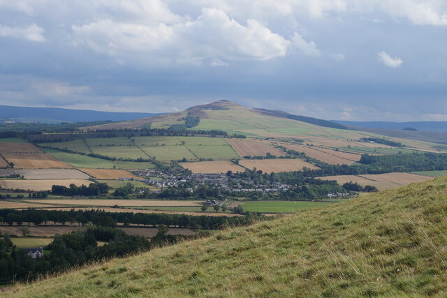
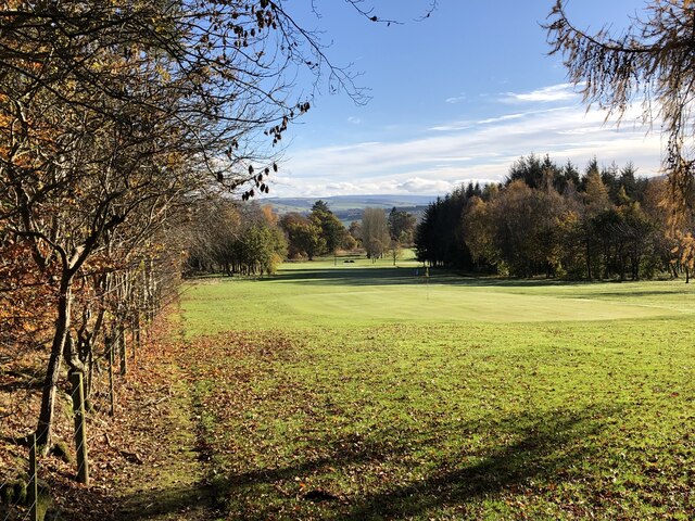
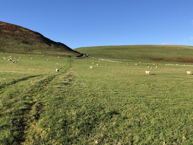
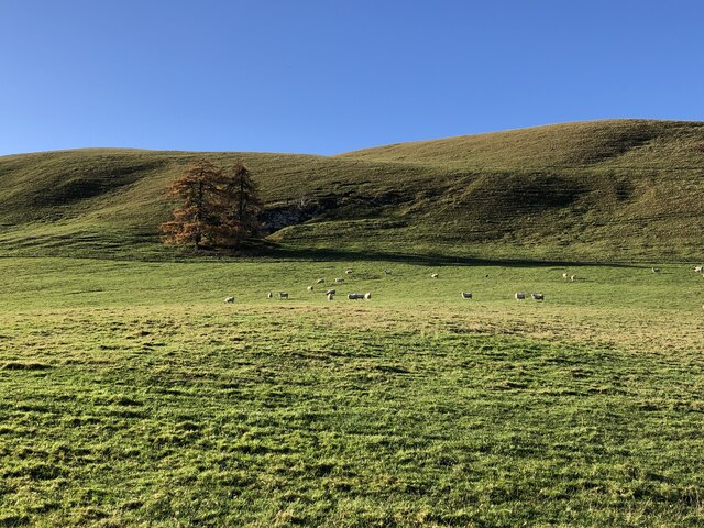
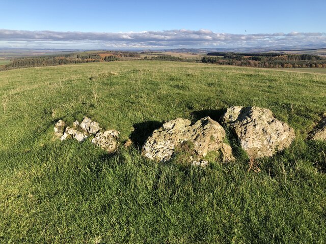
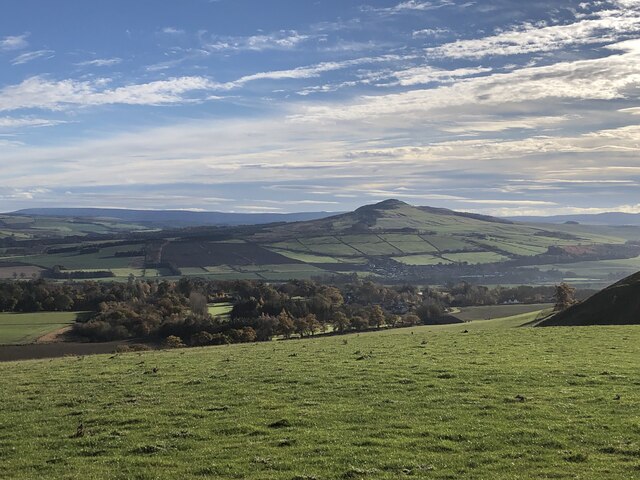
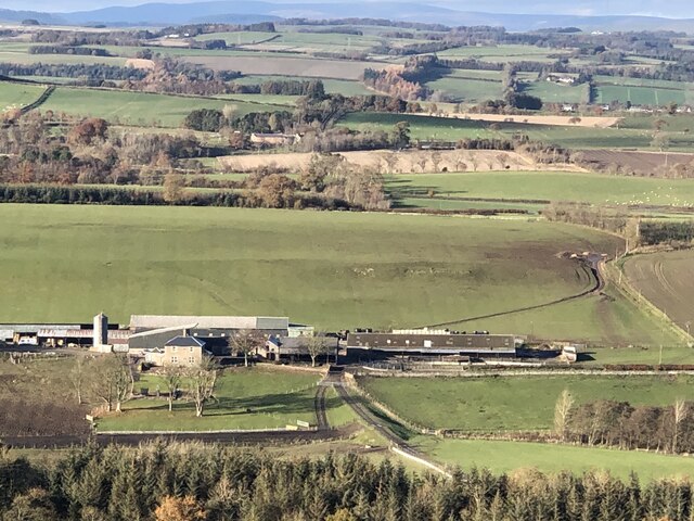
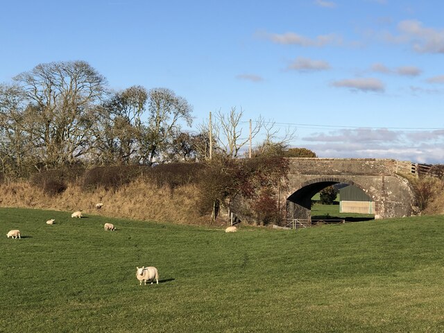
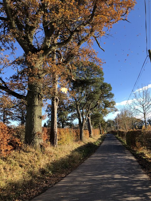
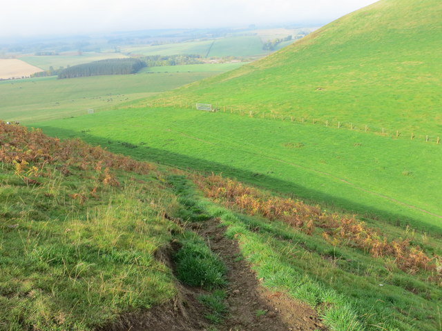
Standhill Road Strip, located in Roxburghshire, is a picturesque wooded area known for its dense forest and natural beauty. Stretching over a considerable distance, the strip is a popular destination for nature enthusiasts, hikers, and those seeking tranquility away from the hustle and bustle of urban life.

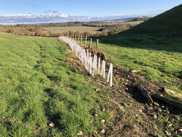
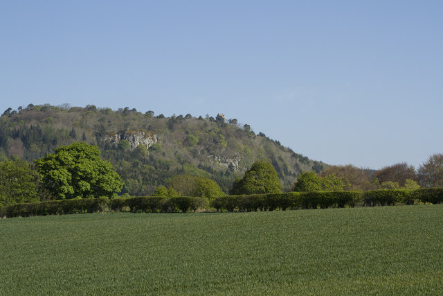
The road strip is characterized by its diverse range of tree species, including oak, beech, and pine, which create a lush canopy overhead. The forest floor is covered in a thick layer of moss, creating a soft and inviting environment for wildlife and visitors alike. The area is home to various species of birds, small mammals, and insects, making it an ideal spot for birdwatching and wildlife observation.

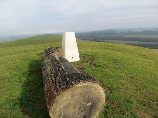
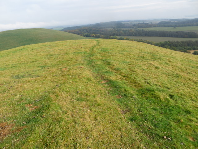
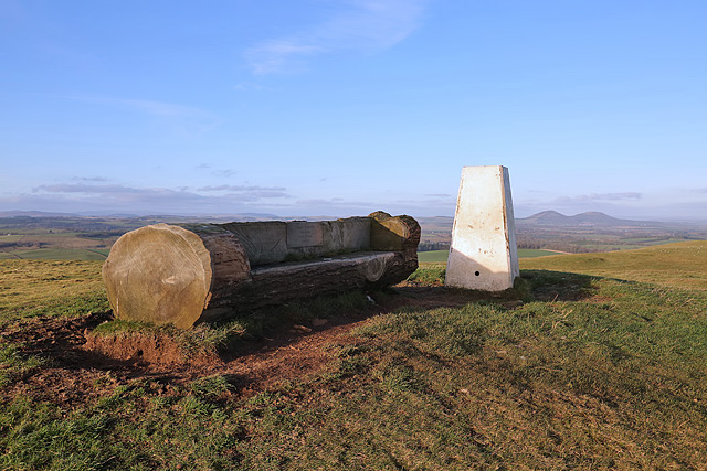
Standhill Road Strip has well-maintained walking trails that wind through the forest, offering visitors an opportunity to explore and appreciate the natural surroundings. The trails are suitable for all levels of fitness, with options for leisurely strolls or more challenging hikes. Along the way, visitors can enjoy stunning views of the surrounding hills and valleys.

In addition to its natural beauty, Standhill Road Strip also holds historical significance. It is believed that the area was once used for timber production, as evidenced by the presence of old logging roads and remnants of sawmills. This adds a unique layer of cultural and historical interest to the experience of exploring the forest.

Overall, Standhill Road Strip in Roxburghshire is a hidden gem, offering visitors a chance to immerse themselves in the tranquility of nature while enjoying its diverse flora and fauna.

If you have any feedback on the listing, please let us know in the comments section below.

Standhill Road Strip Images

Images are sourced within 2km of 55.494599/-2.6908494 or Grid Reference NT5622. Thanks to Geograph Open Source API. All images are credited.

On the Minto Hills Descending the southern Minto Hill with a view to Denholm, the imposing Rubers Law and the distant Cheviot Hills.

This photograph was taken during the Coronavirus (COVID-19) pandemic of 2020/21/22.
On the Minto Hills
Descending the southern Minto Hill with a view to Denholm, the imposing Rubers Law and the distant Cheviot Hills. This photograph was taken during the Coronavirus (COVID-19) pandemic of 2020/21/22.
Minto Golf Course
Minto Golf Course
Path, Minto Hills A tractor track heads for the col from which either top is easily reached.
Path, Minto Hills
A tractor track heads for the col from which either top is easily reached.
Minto Hills A pair of summits somewhat out of character with their surroundings. Made of rock of a volcanic origin, ash infilling volcanic vents.
Minto Hills
A pair of summits somewhat out of character with their surroundings. Made of rock of a volcanic origin, ash infilling volcanic vents.
Cairn, Minto Hills A ring of stones at the North top summit.
Cairn, Minto Hills
A ring of stones at the North top summit.
View of Rubers Law from the Minto Hills Teviotdale igneous features.
View of Rubers Law from the Minto Hills
Teviotdale igneous features.
Minto Kames Farm seen from the Minto Hills.
Minto Kames
Farm seen from the Minto Hills.
Hedge planting, Minto Hills The new hedges already planted are backed up with some hefty electric fences but there are gates.
Hedge planting, Minto Hills
The new hedges already planted are backed up with some hefty electric fences but there are gates.
Waverley Line route, Standhill I had hoped it would have reopened by now.  One day!
Waverley Line route, Standhill
I had hoped it would have reopened by now. One day!
Minor road near Netherraw
A place to sit after climbing to Minto Hill Triangulation Pillar Looking northward.
A place to sit after climbing to Minto Hill Triangulation Pillar
Looking northward.
Path along the ridge of Minto Hill Looking northward.
Path along the ridge of Minto Hill
Looking northward.
Path descending the flank of Minto Hills Looking north-westward.
Path descending the flank of Minto Hills
Looking north-westward.
Lumber awaiting transportation from Kipps Plantation Looking north-eastward from the road.
Lumber awaiting transportation from Kipps Plantation
Looking north-eastward from the road.
Minto Hill trig point A log seat has been placed by the triangulation pillar. A plaque is inscribed:

Happy Memories
Bob Blake
Jackie Graham
Zach Fox
Minto Hill trig point
A log seat has been placed by the triangulation pillar. A plaque is inscribed: Happy Memories Bob Blake Jackie Graham Zach Fox
Hens resting A sign at Burncrooks Farm, Minto, indicating that there are no eggs for sale during the winter months.
Hens resting
A sign at Burncrooks Farm, Minto, indicating that there are no eggs for sale during the winter months.
The Minto Hills This view is from the A698. It shows the imposing Peel tower, just, towards the right hand end of the line of hills.
The Minto Hills
This view is from the A698. It shows the imposing Peel tower, just, towards the right hand end of the line of hills.
The Peel Tower on Minto Hill The tower has had a chequered history but was restored a few years ago.  You cannot enter the tower but the climb up to it offers superb views of the surrounding countryside. Normally it is a very muddy walk up but when we went after an April with almost no rain it was completely dry.
The Peel Tower on Minto Hill
The tower has had a chequered history but was restored a few years ago. You cannot enter the tower but the climb up to it offers superb views of the surrounding countryside. Normally it is a very muddy walk up but when we went after an April with almost no rain it was completely dry.
Show me another place!

Standhill Road Strip is located at Grid Ref: NT5622 (Lat: 55.494599, Lng: -2.6908494)

Unitary Authority: The Scottish Borders

Police Authority: The Lothians and Scottish Borders

What 3 Words

///wishes.crabmeat.alarmed. Near Jedburgh, Scottish Borders

Related Wikis

Craigmount School

Craigmount School was a private school originally for boys, but for most of its history for girls, in Edinburgh. It opened in 1874 and closed in 1966....

Minto, Scottish Borders

Minto is a village and parish in the Scottish Borders area of Scotland in Roxburghshire county. It is located 6 miles (10 kilometres) north-east of Hawick...
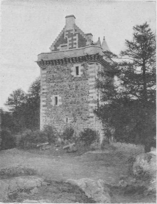
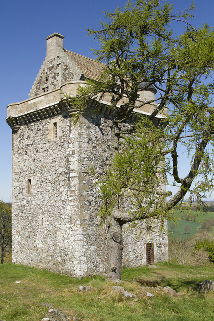
Fatlips Castle

Fatlips Castle is a peel tower in Roxburghshire, in the Scottish Borders. Situated at the top of Minto Crags, above the River Teviot, it was built in the...

Old Belses

Old Belses is a village by the Ale Water, in the Parish of Ancrum, in the Scottish Borders of Scotland, in the historic county of Roxburghshire. Other...

Belses

Belses is a village on the Ale Water, in the Scottish Borders area of Scotland the former Selkirkshire. It is situated close to Old Belses, and lies south...

Belses railway station

Belses railway station served the village of Belses, Scottish Borders, Scotland from 1849 to 1969 on the Waverley Route. == History == The station opened...

Hassendean railway station

Hassendean railway station served the village of Hassendean, Scottish Borders, Scotland from 1850 to 1969 on the Waverley Route. == History == The station...

Barnhills Tower

Barnhills Tower was a 16th century tower house about 4.5 miles (7.2 km) west of Jedburgh in the Scottish Borders, Scotland, north of the River Teviot...

Have you been to Standhill Road Strip?

Leave your review of Standhill Road Strip below (or comments, questions and feedback).