Auchaballa Wood

Wood, Forest in Aberdeenshire

Scotland

Auchaballa Wood

Glencat
Glencat Credit: Mike Pennington

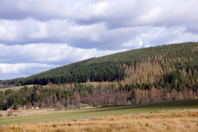
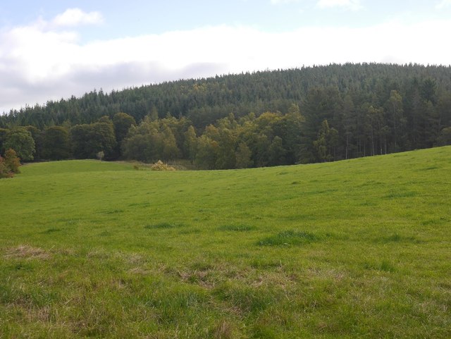
Auchaballa Wood, located in Aberdeenshire, Scotland, is a captivating forest renowned for its natural beauty and diverse ecosystem. Stretching over an area of approximately 500 acres, this ancient woodland is an enchanting destination for nature enthusiasts and outdoor adventurers alike.

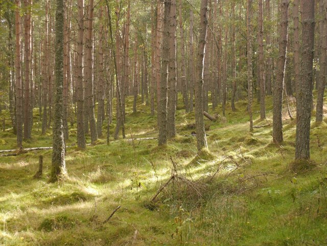
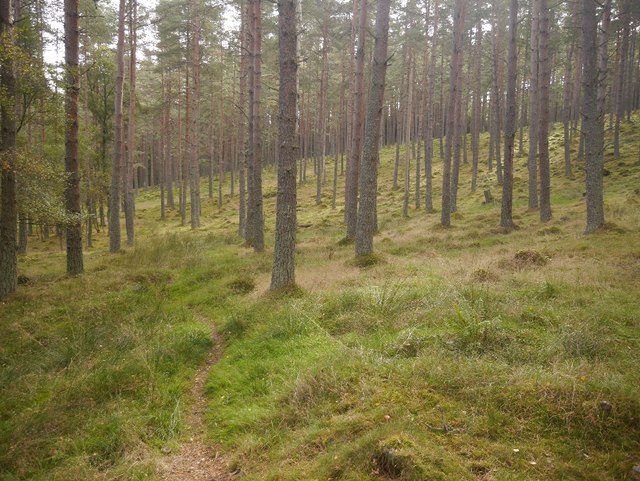
The wood is predominantly composed of native tree species, including oak, birch, and rowan, which create a lush and vibrant canopy throughout the forest. These towering trees provide a habitat for a variety of wildlife, making Auchaballa Wood a haven for birdwatchers and animal lovers. Species such as red squirrels, roe deer, and a plethora of bird species can often be spotted amidst the dense foliage.

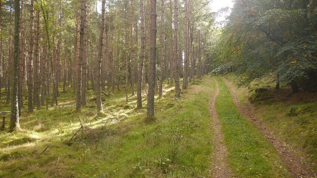
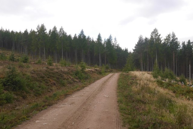
Tranquil walking trails wind their way through the wood, offering visitors an opportunity to immerse themselves in the peaceful ambiance and explore the natural wonders within. The paths are well-maintained and suitable for all fitness levels, making it accessible for families and individuals of all ages.

Auchaballa Wood is also steeped in history, with evidence of human activity dating back thousands of years. The remains of ancient settlements, including stone circles and burial sites, can be found within the wood, adding an intriguing archaeological dimension to the site.

Whether one seeks solace in nature, a chance to spot elusive wildlife, or a historical adventure, Auchaballa Wood in Aberdeenshire is a captivating destination that promises a memorable and enriching experience for all who visit.

If you have any feedback on the listing, please let us know in the comments section below.

Auchaballa Wood Images

Images are sourced within 2km of 57.040321/-2.7298535 or Grid Reference NO5594. Thanks to Geograph Open Source API. All images are credited.

Road through woodland in Glencat
Woodland, Glencat
Woodland, Glencat
Ythanside, near Glencat
Kittling Wood The forest at Balfour, now restored after complete destruction by wartime logging camps and the gale of 1953.  The track leads to a field, but there is a fine bit of singletrack continuing into the woods.
Kittling Wood
The forest at Balfour, now restored after complete destruction by wartime logging camps and the gale of 1953. The track leads to a field, but there is a fine bit of singletrack continuing into the woods.
Woodland, Balfour
Woodland, Balfour
Field, Balfour Between the house and forest.  Black Hill in the background, like most woodland here was stripped of trees by wartime lumber camps and the 1953 gale.
Field, Balfour
Between the house and forest. Black Hill in the background, like most woodland here was stripped of trees by wartime lumber camps and the 1953 gale.
The Bimble Single track in the very runnable Balfour Forest.
The Bimble
Single track in the very runnable Balfour Forest.
Balfour Forest Singletrack, nicknamed The Bimble through very open woodland.  It is a lovely easy run on the bike.
Balfour Forest
Singletrack, nicknamed The Bimble through very open woodland. It is a lovely easy run on the bike.
Old dyke, Balfour Between Ballogie and Balfour in pine woods.  The woodland was felled by wartime lumber camps and the notorious 1953 gale, but is now well established and thriving again.
Old dyke, Balfour
Between Ballogie and Balfour in pine woods. The woodland was felled by wartime lumber camps and the notorious 1953 gale, but is now well established and thriving again.
Balfour Forest I am glad that I had the orienteering map with me, as this old, well established track is omitted from the Ordnance Survey 1:25,000 map. It climbs up to the south of Brown Hill, joining the road network in the former Forestry Commission woodland there.
Balfour Forest
I am glad that I had the orienteering map with me, as this old, well established track is omitted from the Ordnance Survey 1:25,000 map. It climbs up to the south of Brown Hill, joining the road network in the former Forestry Commission woodland there.
Path in Balfour Forest While not shown on the current 1:25,000 map, this is a long established route shown on older maps and still exists on the ground. In places there are parallel gullies suggesting that this once a busy route used over a long period of time.
Path in Balfour Forest
While not shown on the current 1:25,000 map, this is a long established route shown on older maps and still exists on the ground. In places there are parallel gullies suggesting that this once a busy route used over a long period of time.
Balfour Forest Slopes of Creagantoll.  The hill was mostly clear felled in the 20th century, during wartime and survivors wiped out by the catastrophic gale of January 1953.
Balfour Forest
Slopes of Creagantoll. The hill was mostly clear felled in the 20th century, during wartime and survivors wiped out by the catastrophic gale of January 1953.
Balfour Forest The woodland between here and the road to the north is undergoing thinning.  It was very noticeable that the contractors put up the usual "rude man" keep out signs, while the company which owns the community woodland put up their own more reasonable, not one size fits all warnings about staying away from working machinery.  No work was taking place today.
Balfour Forest
The woodland between here and the road to the north is undergoing thinning. It was very noticeable that the contractors put up the usual "rude man" keep out signs, while the company which owns the community woodland put up their own more reasonable, not one size fits all warnings about staying away from working machinery. No work was taking place today.
Ride, Balfour Forest The mapped dyke can be seen in the distance.  Forestry work, thinning the trees, has been going on in recent weeks.
Ride, Balfour Forest
The mapped dyke can be seen in the distance. Forestry work, thinning the trees, has been going on in recent weeks.
Coupit seat One of a couple of seats with a view which were upside down.  I suspect they are new and are awaiting being placed.  The view up the Dee is very good from here, beside a logging road.
Coupit seat
One of a couple of seats with a view which were upside down. I suspect they are new and are awaiting being placed. The view up the Dee is very good from here, beside a logging road.
Logging road, Balfour Forest On the north side of Creagandummie.
Logging road, Balfour Forest
On the north side of Creagandummie.
Path, Balfour Forest The path goes through the woods over to Glencat or along the side of Craig Ferg.
Path, Balfour Forest
The path goes through the woods over to Glencat or along the side of Craig Ferg.
Show me another place!

Auchaballa Wood is located at Grid Ref: NO5594 (Lat: 57.040321, Lng: -2.7298535)

Unitary Authority: Aberdeenshire

Police Authority: North East

What 3 Words

///rush.searching.rises. Near Aboyne, Aberdeenshire

Nearby Locations

Auchaballa Wood

Related Wikis

Ballogie

Ballogie is a rural community and an estate in the Lower Deeside area of Aberdeenshire, Scotland. Most of Ballogie lies within the parish of Birse, although...

Kinminity

Kinminity is a former village located south-east of Birse, Aberdeenshire in Scotland. == History == The property was in hands of the cadet family of Sutherlands...

Birse

Birse (Scottish Gaelic: Braois/Breis) is a parish in the Lower Deeside area of Aberdeenshire, Scotland, which includes the communities of Finzean and Ballogie...

Belwade Farm

Belwade Farm is a horse stables near Aboyne, Scotland owned by World Horse Welfare. == History == A new visitor centre and indoor arena was opened by Princess...

Nearby Amenities

Located within 500m of 57.040321,-2.7298535
Power: pole
Lat/Long: 57.0374559/-2.7237616
The data included in this document is from www.openstreetmap.org. The data is made available under ODbL.

Have you been to Auchaballa Wood?

Leave your review of Auchaballa Wood below (or comments, questions and feedback).