Chaddesden Common

Settlement in Derbyshire

England

Chaddesden Common

Locko Road, Spondon A view northwards along Locko Road, with Royal Hill Road on the left
Locko Road, Spondon Credit: Francis Dolman

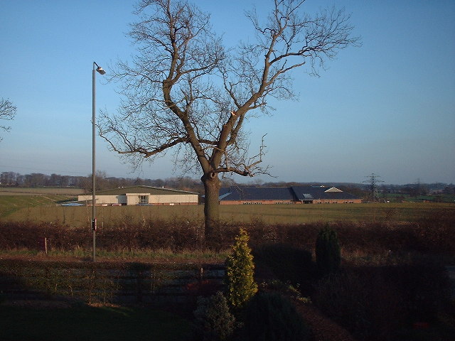
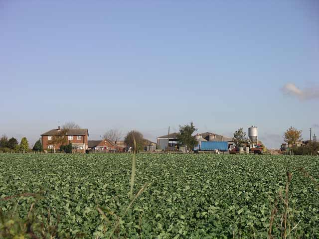
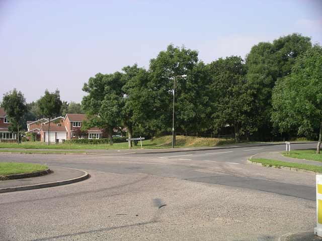
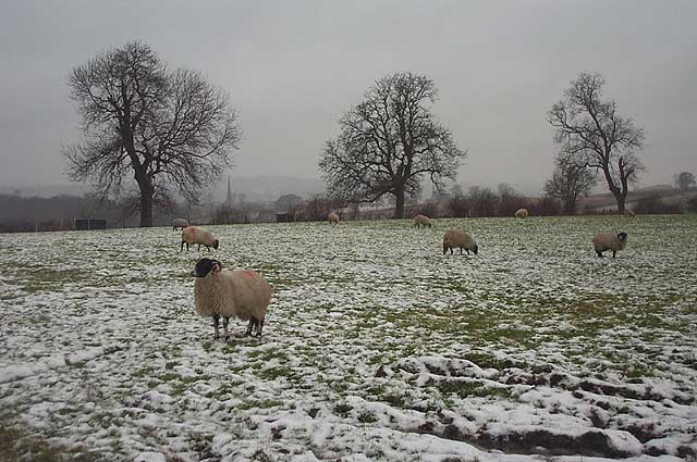
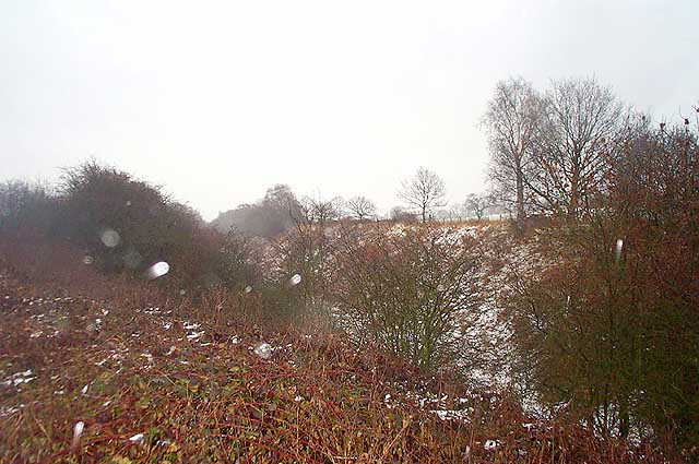
Chaddesden Common is a picturesque area located in the eastern suburbs of Derby, in the county of Derbyshire, England. Covering an area of approximately 100 acres, the common is a beloved green space for both locals and visitors alike.

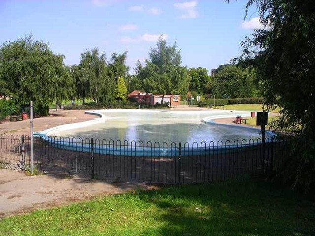
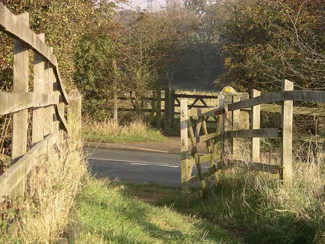
The common is mainly composed of open grassland, interspersed with patches of woodland and a small pond. It provides a peaceful and tranquil environment, perfect for leisurely walks, picnics, and outdoor activities. The well-maintained footpaths and trails make it easy to explore the area and enjoy the natural beauty it offers.

The common is home to a diverse range of wildlife, including various bird species, small mammals, and insects. It is especially popular among birdwatchers, who come to spot species such as woodpeckers, owls, and warblers.

The common also boasts a rich historical heritage. It was once part of the medieval Chaddesden Park, which belonged to the Ferrers family. The remnants of an old deer park wall can still be seen in some parts of the common, adding to its charm and historical significance.

In addition to its natural and historical attractions, Chaddesden Common offers a range of recreational facilities. It has a children's play area, perfect for families, and provides ample space for various sports activities, such as football and cricket.

Overall, Chaddesden Common is a delightful green space, offering a welcome escape from the hustle and bustle of urban life. Its natural beauty, wildlife, and historical features make it a popular destination for nature enthusiasts and those seeking a peaceful retreat.

If you have any feedback on the listing, please let us know in the comments section below.

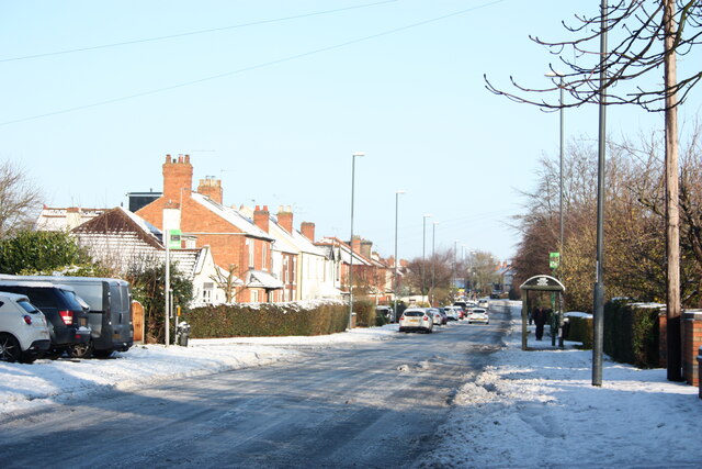
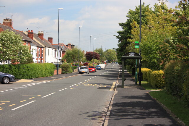
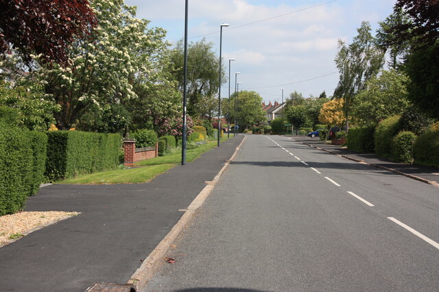
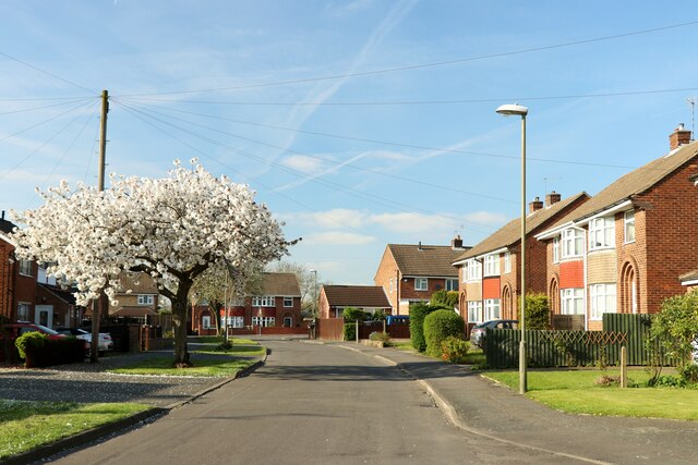
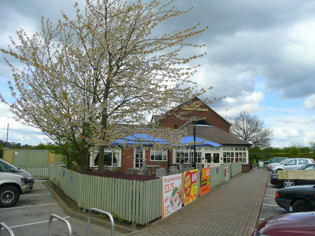
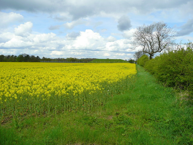
Chaddesden Common Images

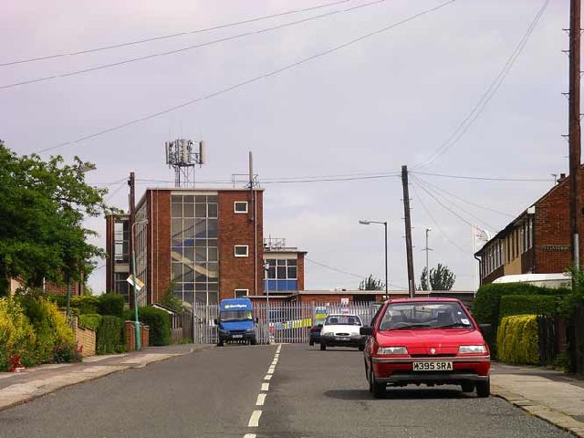
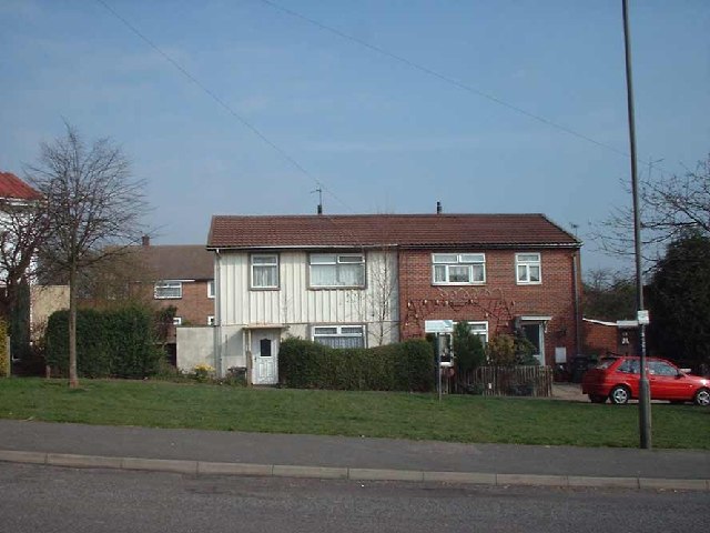
Images are sourced within 2km of 52.937986/-1.4211598 or Grid Reference SK3938. Thanks to Geograph Open Source API. All images are credited.

Locko Road, Spondon A view northwards along Locko Road, with Royal Hill Road on the left
Locko Road, Spondon
A view northwards along Locko Road, with Royal Hill Road on the left
Locko Road, Spondon Looking northwards up Locko Road, with Royal Hill Road on the left
Locko Road, Spondon
Looking northwards up Locko Road, with Royal Hill Road on the left
Locko Road, Spondon A view looking northwards up Locko Road towards Sancroft Road on the right
Locko Road, Spondon
A view looking northwards up Locko Road towards Sancroft Road on the right
Chapel Lane, Spondon A view towards the junction with Sancroft Road, looking from the newsagents on Chapel Lane
Chapel Lane, Spondon
A view towards the junction with Sancroft Road, looking from the newsagents on Chapel Lane
Rams Academy Training Ground Rams academy training ground, the site of the old Moor Farm on Morley Road, Oakwood, Derby

<span class="nowrap"><a title="http://www.picturesofderby.co.uk/area_moor_farm.htm" rel="nofollow ugc noopener" href="http://www.picturesofderby.co.uk/area_moor_farm.htm">Link</a><img style="margin-left:2px;" alt="External link" title="External link - shift click to open in new window" src="https://s1.geograph.org.uk/img/external.png" width="10" height="10"/></span>
Rams Academy Training Ground
Rams academy training ground, the site of the old Moor Farm on Morley Road, Oakwood, Derby LinkExternal link
Cross Roads Farm Cross Roads Farm, junction of Lime lane and Morley Road, the main farmhouse was built in 1972
<span class="nowrap"><a title="https://web.archive.org/web/20060625154440/http://www.picturesofderby.co.uk/area_oakwood.htm" rel="nofollow ugc noopener" href="https://web.archive.org/web/20060625154440/http://www.picturesofderby.co.uk/area_oakwood.htm">Archive Link</a><img style="margin-left:2px;" alt="External link" title="External link - shift click to open in new window" src="https://s1.geograph.org.uk/img/external.png" width="10" height="10"/></span>
Cross Roads Farm
Cross Roads Farm, junction of Lime lane and Morley Road, the main farmhouse was built in 1972 Archive LinkExternal link
Charingworth Road, Oakwood Drive, Bishops Drive and Springwood Road Junction This picture shows the remains on the endless cable tramway, which was the longest one in the world. The coal from the Footrill colliery at Stanley had to be taken to Derby by horse and cart, which was not an ideal situation. At the time the Great Northern Railway, refused to build a siding, so in 1894 a continuous cable conveyor was constructed across country to a landsale wharf on Hill Crest Road, Chaddesden. The plan was to terminate at Derby Canal on Nottingham Road, but the council refused permission to allow the trackway to cross Nottingham Road, This picture is on the junction of Bishops Drive, Springwood Road, Charingworth Road and Oakwood Drive, and clearly show the raised trackway, now protected with a cast iron rail. Coal was carried on trains clipped on to an anchor rope, running over rollers between the tram-rails. 

<span class="nowrap"><a title="https://web.archive.org/web/20060625154440/http://www.picturesofderby.co.uk/area_oakwood.htm" rel="nofollow ugc noopener" href="https://web.archive.org/web/20060625154440/http://www.picturesofderby.co.uk/area_oakwood.htm">Archive Link</a><img style="margin-left:2px;" alt="External link" title="External link - shift click to open in new window" src="https://s1.geograph.org.uk/img/external.png" width="10" height="10"/></span>
Charingworth Road, Oakwood Drive, Bishops Drive and Springwood Road Junction
This picture shows the remains on the endless cable tramway, which was the longest one in the world. The coal from the Footrill colliery at Stanley had to be taken to Derby by horse and cart, which was not an ideal situation. At the time the Great Northern Railway, refused to build a siding, so in 1894 a continuous cable conveyor was constructed across country to a landsale wharf on Hill Crest Road, Chaddesden. The plan was to terminate at Derby Canal on Nottingham Road, but the council refused permission to allow the trackway to cross Nottingham Road, This picture is on the junction of Bishops Drive, Springwood Road, Charingworth Road and Oakwood Drive, and clearly show the raised trackway, now protected with a cast iron rail. Coal was carried on trains clipped on to an anchor rope, running over rollers between the tram-rails. Archive LinkExternal link
Churches Mayfield Road, Chaddesden Places of worship on Mayfield Road, Chaddesden, 
<span class="nowrap"><a title="https://web.archive.org/web/20060625160101/http://www.picturesofderby.co.uk/area_chaddesden%20page%201.htm" rel="nofollow ugc noopener" href="https://web.archive.org/web/20060625160101/http://www.picturesofderby.co.uk/area_chaddesden%20page%201.htm">Archive Link</a><img style="margin-left:2px;" alt="External link" title="External link - shift click to open in new window" src="https://s1.geograph.org.uk/img/external.png" width="10" height="10"/></span>
Churches Mayfield Road, Chaddesden
Places of worship on Mayfield Road, Chaddesden, Archive LinkExternal link
Da Vinci College (Henry Cavendish School) Da Vinci College, which was previously Henry Cavendish School, and one of Derby's top Grammar Schools, just had a multi million re-fit and the entrance moved to face Oakwood, in an attempt to produce better examination results!
Da Vinci College (Henry Cavendish School)
Da Vinci College, which was previously Henry Cavendish School, and one of Derby's top Grammar Schools, just had a multi million re-fit and the entrance moved to face Oakwood, in an attempt to produce better examination results!
Children's paddling pool, Chaddesden Park Chaddesden Park is well-used and contains a paddling pool and children's play area as well as areas for cricket and golf.
<span class="nowrap"><a title="http://www.picturesofderby.co.uk/area_chaddesden" rel="nofollow ugc noopener" href="http://www.picturesofderby.co.uk/area_chaddesden">Link</a><img style="margin-left:2px;" alt="External link" title="External link - shift click to open in new window" src="https://s1.geograph.org.uk/img/external.png" width="10" height="10"/></span> page 1.htm
Children's paddling pool, Chaddesden Park
Chaddesden Park is well-used and contains a paddling pool and children's play area as well as areas for cricket and golf. LinkExternal link page 1.htm
Prefabs Chaddesden Prefabs in Chaddesden, just meant to last a few years after the Second World War still going strong some 60 years later!
<span class="nowrap"><a title="https://web.archive.org/web/20060625160132/http://www.picturesofderby.co.uk/area_chaddesden%20page%203.htm" rel="nofollow ugc noopener" href="https://web.archive.org/web/20060625160132/http://www.picturesofderby.co.uk/area_chaddesden%20page%203.htm">Archive Link</a><img style="margin-left:2px;" alt="External link" title="External link - shift click to open in new window" src="https://s1.geograph.org.uk/img/external.png" width="10" height="10"/></span>

2015 edit: The houses are not traditional post WWII temporary prefabs; they are BISF (British Iron & Steel Federation) houses which were designed and built immediately after the war to be permanent structures. Many still survive around the country. Here is a <span class="nowrap"><a title="https://en.wikipedia.org/wiki/BISF_house" rel="nofollow ugc noopener" href="https://en.wikipedia.org/wiki/BISF_house">Link</a><img style="margin-left:2px;" alt="External link" title="External link - shift click to open in new window" src="https://s1.geograph.org.uk/img/external.png" width="10" height="10"/></span> to the BISF Wikipedia article.
Prefabs Chaddesden
Prefabs in Chaddesden, just meant to last a few years after the Second World War still going strong some 60 years later! Archive LinkExternal link 2015 edit: The houses are not traditional post WWII temporary prefabs; they are BISF (British Iron & Steel Federation) houses which were designed and built immediately after the war to be permanent structures. Many still survive around the country. Here is a LinkExternal link to the BISF Wikipedia article.
Close the gate behind you! This is the bridle path from Chaddesden to Spondon, with a road now scathed through the middle (Acorn Way)
Close the gate behind you!
This is the bridle path from Chaddesden to Spondon, with a road now scathed through the middle (Acorn Way)
Snow White and the Seven Sheep The post Christmas snow was being washed away by some heavy rainfall when I took this photo of a field of  black faced sheep near Breadsall. I can count eight of them in this shot but as it's the pantomime season I thought the title was quite apt! The spire of the church in Breadsall Village in the adjacent square <a href="https://www.geograph.org.uk/gridref/SK3739">SK3739</a> can be seen through the murk just to the right of the tree on the left.
Snow White and the Seven Sheep
The post Christmas snow was being washed away by some heavy rainfall when I took this photo of a field of black faced sheep near Breadsall. I can count eight of them in this shot but as it's the pantomime season I thought the title was quite apt! The spire of the church in Breadsall Village in the adjacent square SK3739 can be seen through the murk just to the right of the tree on the left.
Breadsall Cutting Derby is well known for its railway works. Breadsall is a small village on the northern outskirts of the city and the former GNR line, part of the Derbyshire and North Staffordshire Extension ran through a cutting near the village. The line has long gone but the cutting still remains and although it was raining heavily when I took the photo, the snow lying on the ground helps to highlight the route.
Breadsall Cutting
Derby is well known for its railway works. Breadsall is a small village on the northern outskirts of the city and the former GNR line, part of the Derbyshire and North Staffordshire Extension ran through a cutting near the village. The line has long gone but the cutting still remains and although it was raining heavily when I took the photo, the snow lying on the ground helps to highlight the route.
Locko Road The housing in the background marks the outer reaches of suburban Derby.
Locko Road
The housing in the background marks the outer reaches of suburban Derby.
Revive Healthy Living Centre Opened in 2007 on Roe Farm Lane, Chaddesden.
Revive Healthy Living Centre
Opened in 2007 on Roe Farm Lane, Chaddesden.
The King's Corner, Chaddesley Common A pub at the furthest point of housing development on the north-east edge of Derby.
The King's Corner, Chaddesley Common
A pub at the furthest point of housing development on the north-east edge of Derby.
Rape field by Lime Lane In the distance is the green flat-topped mound of a reservoir.
Rape field by Lime Lane
In the distance is the green flat-topped mound of a reservoir.
Show me another place!

Chaddesden Common is located at Grid Ref: SK3938 (Lat: 52.937986, Lng: -1.4211598)

Unitary Authority: Derby

Police Authority: Derbyshire

What 3 Words

///deep.join.dust. Near Derby, Derbyshire

Nearby Locations

Chaddesden Common

Related Wikis

Lees Brook Community School

Lees Brook Community School (previously Lees Brook Sports College) is a co-educational secondary school and sixth form located in the Chaddesden area of...

Oakwood, Derby

Oakwood is a modern housing estate in Derby, Derbyshire, England that was built mainly in the 1980s and 1990s. At the time of construction, it was one...

St Mary's Church, Chaddesden

St Mary's Church is a Church of England parish church in Chaddesden, a suburb of Derby, England. One of the oldest churches in the city, it is a Grade...

Chaddesden

Chaddesden, also known locally as Chadd, is a large residential suburb of Derby, United Kingdom. Historically a separate village centred on Chaddesden...

Nearby Amenities

Located within 500m of 52.937986,-1.4211598
Traffic Calming: hump
Lat/Long: 52.9343321/-1.424898
Note: Oakwood
Lat/Long: 52.9356242/-1.4241051
Traffic Calming: hump
Lat/Long: 52.9348664/-1.4245534
Check Date: 2022-03-29
Traffic Calming: hump
Lat/Long: 52.9367489/-1.4236408
Check Date: 2022-02-27
Traffic Calming: hump
Lat/Long: 52.9379472/-1.4234059
Traffic Calming: hump
Lat/Long: 52.9397056/-1.4220875
Traffic Calming: hump
Lat/Long: 52.9409162/-1.4209626
Post Box
Check Date: 2022-02-22
Collection Times: Mo-Fr 09:00; Sa 07:00
Operator: Royal Mail
Operator Wikidata: Q638098
Post Box Type: pillar
Ref: DE21 606D
Royal Cypher: GVIR
Royal Cypher Wikidata: Q33102169
Lat/Long: 52.9355514/-1.4240512
Post Box
Operator: Royal Mail
Operator Wikidata: Q638098
Ref: DE21 763
Lat/Long: 52.9394109/-1.4268399
Turning Circle
Lat/Long: 52.9422748/-1.4230782
Turning Circle
Lat/Long: 52.9419532/-1.4234744
Barrier: block
Foot: yes
Horse: yes
Material: stone
Motor Vehicle: no
Lat/Long: 52.9356861/-1.4226815
Noexit: yes
Lat/Long: 52.9346806/-1.4229534
Noexit: yes
Lat/Long: 52.9348948/-1.423136
Entrance: main
Lat/Long: 52.938865/-1.4217604
Entrance: main
Lat/Long: 52.9390686/-1.422183
Kerb: raised
Lat/Long: 52.9357907/-1.4241743
Turning Circle
Lat/Long: 52.9365372/-1.4258145
Noexit: yes
Lat/Long: 52.9345832/-1.423214
Bus Stop
Edwinstowe Road
Bus: yes
Public Transport: platform
Lat/Long: 52.9403969/-1.4263421
Bus Stop
Edwinstowe Road
Bench: yes
Bin: no
Bus: yes
Lit: yes
Naptan AtcoCode: 109000008882
Naptan NaptanCode: dbyagdwm
Public Transport: platform
Shelter: yes
Tactile Paving: no
Lat/Long: 52.940249/-1.4262361
Direction: 230
Generator Method: photovoltaic
Generator Output Electricity: yes
Generator Solar Modules: 12
Generator Source: solar
Generator Type: solar_photovoltaic_panel
Location: roof
Power: generator
Lat/Long: 52.9397393/-1.4257591
Direction: 160
Generator Method: photovoltaic
Generator Output Electricity: yes
Generator Solar Modules: 18
Generator Source: solar
Generator Type: solar_photovoltaic_panel
Location: roof
Power: generator
Lat/Long: 52.9370167/-1.426771
Direction: 140
Generator Method: photovoltaic
Generator Output Electricity: yes
Generator Solar Modules: 15
Generator Source: solar
Generator Type: solar_photovoltaic_panel
Location: roof
Power: generator
Lat/Long: 52.9388452/-1.4266322
Direction: 210
Generator Method: photovoltaic
Generator Output Electricity: yes
Generator Solar Modules: 16
Generator Source: solar
Generator Type: solar_photovoltaic_panel
Location: roof
Power: generator
Lat/Long: 52.9385125/-1.4269018
Direction: 220
Generator Method: photovoltaic
Generator Output Electricity: yes
Generator Solar Modules: 11
Generator Source: solar
Generator Type: solar_photovoltaic_panel
Location: roof
Power: generator
Lat/Long: 52.9420628/-1.4219996
Direction: 200
Generator Method: photovoltaic
Generator Output Electricity: yes
Generator Solar Modules: 8
Generator Source: solar
Generator Type: solar_photovoltaic_panel
Location: roof
Power: generator
Lat/Long: 52.9403626/-1.4271418
Direction: 100
Generator Method: photovoltaic
Generator Output Electricity: yes
Generator Solar Modules: 12
Generator Source: solar
Generator Type: solar_photovoltaic_panel
Location: roof
Power: generator
Lat/Long: 52.942033/-1.4223711
Direction: 215
Generator Method: photovoltaic
Generator Output Electricity: yes
Generator Solar Modules: 18
Generator Source: solar
Generator Type: solar_photovoltaic_panel
Location: roof
Power: generator
Lat/Long: 52.9368628/-1.4282798
Direction: 240
Generator Method: photovoltaic
Generator Output Electricity: yes
Generator Solar Modules: 18
Generator Source: solar
Generator Type: solar_photovoltaic_panel
Location: roof
Power: generator
Lat/Long: 52.9378949/-1.4273152
Direction: 210
Generator Method: photovoltaic
Generator Output Electricity: yes
Generator Solar Modules: 20
Generator Source: solar
Generator Type: solar_photovoltaic_panel
Location: roof
Power: generator
Lat/Long: 52.9417384/-1.4252344
Direction: 170
Generator Method: photovoltaic
Generator Output Electricity: yes
Generator Solar Modules: 12
Generator Source: solar
Generator Type: solar_photovoltaic_panel
Location: roof
Power: generator
Lat/Long: 52.9385546/-1.4253401
Direction: 215
Generator Method: photovoltaic
Generator Output Electricity: yes
Generator Solar Modules: 18
Generator Source: solar
Generator Type: solar_photovoltaic_panel
Location: roof
Power: generator
Lat/Long: 52.9368967/-1.4283618
Direction: 125
Generator Method: photovoltaic
Generator Output Electricity: yes
Generator Solar Modules: 11
Generator Source: solar
Generator Type: solar_photovoltaic_panel
Location: roof
Power: generator
Lat/Long: 52.9383691/-1.4273553
Direction: 190
Generator Method: photovoltaic
Generator Output Electricity: yes
Generator Solar Modules: 6
Generator Source: solar
Generator Type: solar_photovoltaic_panel
Location: roof
Power: generator
Lat/Long: 52.9417914/-1.4220658
Direction: 160
Generator Method: photovoltaic
Generator Output Electricity: yes
Generator Solar Modules: 10
Generator Source: solar
Generator Type: solar_photovoltaic_panel
Location: roof
Power: generator
Lat/Long: 52.9397036/-1.4249149
Direction: 210
Generator Method: photovoltaic
Generator Output Electricity: yes
Generator Solar Modules: 16
Generator Source: solar
Generator Type: solar_photovoltaic_panel
Location: roof
Power: generator
Lat/Long: 52.9410862/-1.4214544
Direction: 200
Generator Method: photovoltaic
Generator Output Electricity: yes
Generator Solar Modules: 18
Generator Source: solar
Generator Type: solar_photovoltaic_panel
Location: roof
Power: generator
Lat/Long: 52.9365124/-1.426552
Direction: 210
Generator Method: photovoltaic
Generator Output Electricity: yes
Generator Solar Modules: 16
Generator Source: solar
Generator Type: solar_photovoltaic_panel
Location: roof
Power: generator
Lat/Long: 52.9388441/-1.4252493
Direction: 215
Generator Method: photovoltaic
Generator Output Electricity: yes
Generator Solar Modules: 18
Generator Source: solar
Generator Type: solar_photovoltaic_panel
Location: roof
Power: generator
Lat/Long: 52.9366419/-1.4278222
Direction: 200
Generator Method: photovoltaic
Generator Output Electricity: yes
Generator Solar Modules: 10
Generator Source: solar
Generator Type: solar_photovoltaic_panel
Location: roof
Power: generator
Lat/Long: 52.9392626/-1.4232119
Direction: 180
Generator Method: photovoltaic
Generator Output Electricity: yes
Generator Solar Modules: 18
Generator Source: solar
Generator Type: solar_photovoltaic_panel
Location: roof
Power: generator
Lat/Long: 52.9382652/-1.4279761
Direction: 135
Generator Method: photovoltaic
Generator Output Electricity: yes
Generator Solar Modules: 18
Generator Source: solar
Generator Type: solar_photovoltaic_panel
Location: roof
Power: generator
Lat/Long: 52.9391197/-1.4266854
Direction: 200
Generator Method: photovoltaic
Generator Output Electricity: yes
Generator Solar Modules: 18
Generator Source: solar
Generator Type: solar_photovoltaic_panel
Location: roof
Power: generator
Lat/Long: 52.9365326/-1.4266193
Direction: 180
Generator Method: photovoltaic
Generator Output Electricity: yes
Generator Solar Modules: 18
Generator Source: solar
Generator Type: solar_photovoltaic_panel
Location: roof
Power: generator
Lat/Long: 52.9381993/-1.4256894
Direction: 165
Generator Method: photovoltaic
Generator Output Electricity: yes
Generator Solar Modules: 18
Generator Source: solar
Generator Type: solar_photovoltaic_panel
Location: roof
Power: generator
Lat/Long: 52.9353378/-1.4259489
Direction: 165
Generator Method: photovoltaic
Generator Output Electricity: yes
Generator Solar Modules: 18
Generator Source: solar
Generator Type: solar_photovoltaic_panel
Location: roof
Power: generator
Lat/Long: 52.9353207/-1.426083
Direction: 200
Generator Method: photovoltaic
Generator Output Electricity: yes
Generator Solar Modules: 16
Generator Source: solar
Generator Type: solar_photovoltaic_panel
Location: roof
Power: generator
Lat/Long: 52.9374455/-1.4279199
Direction: 240
Generator Method: photovoltaic
Generator Output Electricity: yes
Generator Solar Modules: 14
Generator Source: solar
Generator Type: solar_photovoltaic_panel
Location: roof
Power: generator
Lat/Long: 52.9379917/-1.4273932
Direction: 180
Generator Method: photovoltaic
Generator Output Electricity: yes
Generator Solar Modules: 18
Generator Source: solar
Generator Type: solar_photovoltaic_panel
Location: roof
Power: generator
Lat/Long: 52.9381636/-1.4260048
Direction: 220
Generator Method: photovoltaic
Generator Output Electricity: yes
Generator Solar Modules: 18
Generator Source: solar
Generator Type: solar_photovoltaic_panel
Location: roof
Power: generator
Lat/Long: 52.9358825/-1.42695
Bus Stop
Acorn Way
Bus: yes
Public Transport: platform
Lat/Long: 52.9419741/-1.4197214
Bus Stop
Besthorpe Close
Bus: yes
Naptan AtcoCode: 109000008887
Naptan NaptanCode: dbyapajt
Public Transport: platform
Lat/Long: 52.9385776/-1.4228898
Bus Stop
Besthorpe Close
Bus: yes
Public Transport: platform
Lat/Long: 52.9386978/-1.4228934
Bus Stop
Morley Gardens
Bench: no
Bin: no
Bus: yes
Flag: yes
Lit: yes
Naptan AtcoCode: 109000009480
Naptan NaptanCode: dbyadmwt
Public Transport: platform
Ref Signed: no
Shelter: no
Lat/Long: 52.9352382/-1.4244877
Bus Stop
Morley Gardens
Bench: yes
Bin: no
Bus: yes
Flag: yes
Lit: no
Public Transport: platform
Ref Signed: no
Shelter: yes
Lat/Long: 52.9354322/-1.424251
Direction: 215
Generator Method: photovoltaic
Generator Output Electricity: yes
Generator Solar Modules: 5
Generator Source: solar
Generator Type: solar_photovoltaic_panel
Location: roof
Power: generator
Lat/Long: 52.938399/-1.4273024
Barrier: stile
Material: wood
Stile: stepover
Lat/Long: 52.9380329/-1.423187
Noexit: yes
Lat/Long: 52.9347124/-1.4233886
The data included in this document is from www.openstreetmap.org. The data is made available under ODbL.

Have you been to Chaddesden Common?

Leave your review of Chaddesden Common below (or comments, questions and feedback).