Parkhill Plantation

Wood, Forest in Berwickshire

Scotland

Parkhill Plantation

Reentrant, Snawdon Burn A change from the usual uncomplecated, smooth contours found in the Lammermuir Hills. The hollow was probably a former watercourse.  The grassland is rich in wildflowers.
Reentrant, Snawdon Burn Credit: Richard Webb

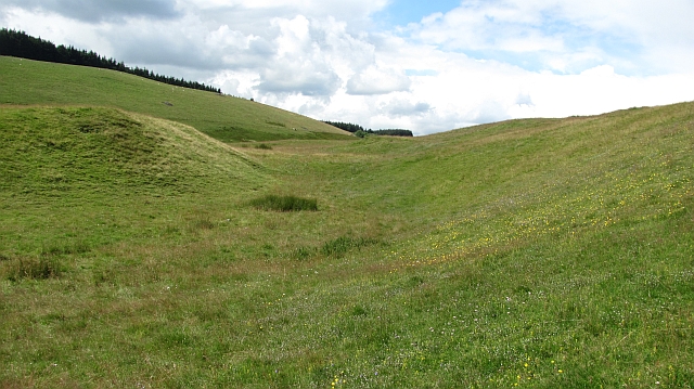
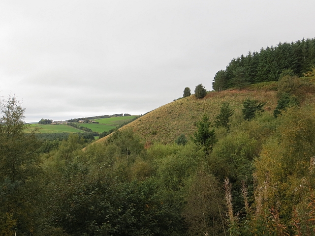
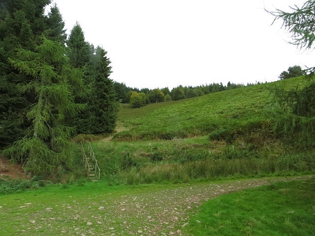
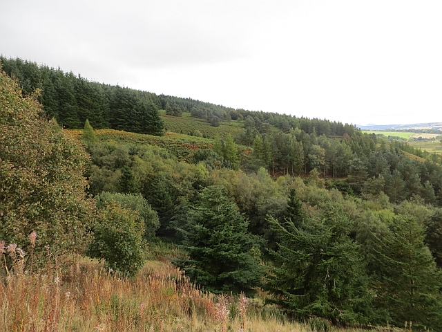
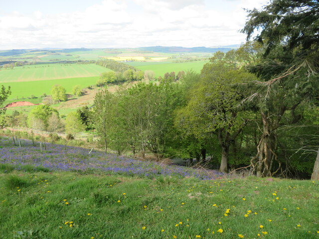
Parkhill Plantation is a picturesque woodland area located in Berwickshire, Scotland. Stretching over a vast expanse of land, this plantation is a haven for nature enthusiasts and outdoor lovers alike. The woodland is predominantly composed of a variety of trees, including oak, beech, and pine, creating a diverse and vibrant ecosystem.

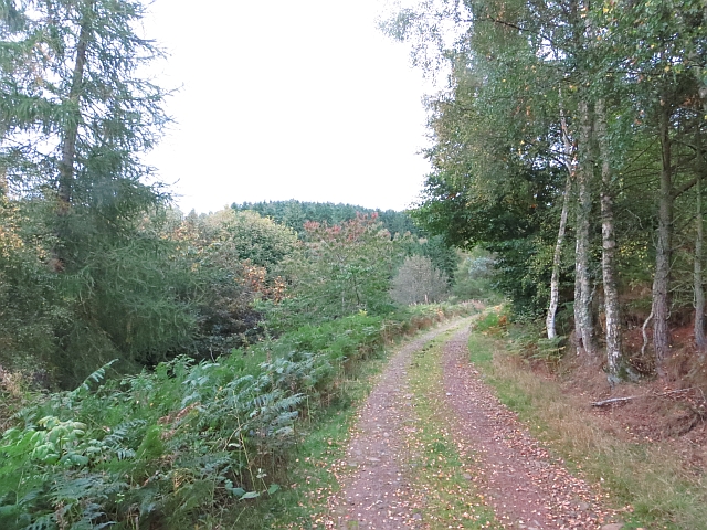
The plantation offers a network of well-maintained trails that wind through the forest, providing visitors with the opportunity to explore the natural beauty of the area. These trails vary in difficulty, catering to both casual walkers and more experienced hikers. Along the way, visitors can enjoy the tranquil atmosphere and immerse themselves in the sights and sounds of the woodland.

Parkhill Plantation is not only a recreational space but also serves as an important habitat for various wildlife species. The forest provides a home for a range of bird species, including woodpeckers, owls, and thrushes. Additionally, small mammals such as squirrels and rabbits can often be spotted scurrying through the undergrowth.

The plantation is open to the public throughout the year, with no admission fee, making it a popular destination for locals and tourists alike. It offers ample parking facilities and is easily accessible by car or public transport. Whether one is seeking a peaceful stroll in the woods, a family picnic, or an opportunity to observe wildlife, Parkhill Plantation is an idyllic location that offers something for everyone.

If you have any feedback on the listing, please let us know in the comments section below.

Parkhill Plantation Images

Images are sourced within 2km of 55.730626/-2.7136434 or Grid Reference NT5548. Thanks to Geograph Open Source API. All images are credited.

Reentrant, Snawdon Burn A change from the usual uncomplecated, smooth contours found in the Lammermuir Hills. The hollow was probably a former watercourse.  The grassland is rich in wildflowers.
Reentrant, Snawdon Burn
A change from the usual uncomplecated, smooth contours found in the Lammermuir Hills. The hollow was probably a former watercourse. The grassland is rich in wildflowers.
The gathering ground of the Snawdon Burn Head of the Snawdon Burn, an area of meadows. The edge of Edgarhope Wood can be seen in the background.
--
2013
Most of the woodland has now been felled and replanted.
The gathering ground of the Snawdon Burn
Head of the Snawdon Burn, an area of meadows. The edge of Edgarhope Wood can be seen in the background. -- 2013 Most of the woodland has now been felled and replanted.
Edgarhope Wood A few years earlier some big blocks of woodland were felled and not replaced. There are a lot of pheasants here - for now.
Edgarhope Wood
A few years earlier some big blocks of woodland were felled and not replaced. There are a lot of pheasants here - for now.
Edgarhope Moor High level grazing in the Lammermuirs.
Edgarhope Moor
High level grazing in the Lammermuirs.
Edgarhope Wood The road in from the A68.
Edgarhope Wood
The road in from the A68.
Reentrant,  Edgarhope Wood Uphill view from a road junction. There are now a lot of big bracken filled clearings within the wood.
Reentrant, Edgarhope Wood
Uphill view from a road junction. There are now a lot of big bracken filled clearings within the wood.
Edge of Edgarhope Wood There is a gate at the corner of the dyke and woodland fence.
Edge of Edgarhope Wood
There is a gate at the corner of the dyke and woodland fence.
Flight pond, Snawdon Burn The water is now all but hidden behind the fast growing trees which surround the pond.
Flight pond, Snawdon Burn
The water is now all but hidden behind the fast growing trees which surround the pond.
Edgarhope Wood A view along the spurs of Edgarhope Wood. There are now numerous clearings in the wood.
Edgarhope Wood
A view along the spurs of Edgarhope Wood. There are now numerous clearings in the wood.
Edgarhope Wood A block of Sitka spruce.
Edgarhope Wood
A block of Sitka spruce.
Edge of Edgarhope Wood View along the ridge to Dabshead Hill.
Edge of Edgarhope Wood
View along the ridge to Dabshead Hill.
Clear felled area, Edgarhope Wood Recently replanted.
Clear felled area, Edgarhope Wood
Recently replanted.
From Edgarhope Wood A view west from above the Earnscleugh Water.
From Edgarhope Wood
A view west from above the Earnscleugh Water.
Bank erosion on the Earnscleugh Water Looking down from a track in Edgarhope Wood.
Bank erosion on the Earnscleugh Water
Looking down from a track in Edgarhope Wood.
Track in Edgarhope Wood Looking south, with the valley of Earnscleugh Water on the right.
Track in Edgarhope Wood
Looking south, with the valley of Earnscleugh Water on the right.
Landscape from Edgarhope Wood A view just north of west over the Earnscleugh Valley. Burncastle is at top right.
Landscape from Edgarhope Wood
A view just north of west over the Earnscleugh Valley. Burncastle is at top right.
Lauderdale from Edgarhope Wood A view westwards.
Lauderdale from Edgarhope Wood
A view westwards.
Quadbike track on the Southern Upland Way
Show me another place!

Parkhill Plantation is located at Grid Ref: NT5548 (Lat: 55.730626, Lng: -2.7136434)

Unitary Authority: The Scottish Borders

Police Authority: The Lothians and Scottish Borders

What 3 Words

///soak.fond.starters. Near Lauder, Scottish Borders

Related Wikis

Thirlestane Castle

Thirlestane Castle is a castle set in extensive parklands near Lauder in the Borders of Scotland. The site is aptly named Castle Hill, as it stands upon...

Lauderdale

Lauderdale is the valley of the Leader Water (a tributary of the Tweed) in the Scottish Borders. It contains the town of Lauder, as well as Earlston. The...

Lauder Town Hall

Lauder Town Hall is a municipal structure in the Market Place in Lauder, Scottish Borders, Scotland. The structure, which is used as the local registrar...

Lauder

The former Royal Burgh of Lauder (, Scottish Gaelic: Labhdar) is a town in the Scottish Borders in the historic county of Berwickshire. On the Southern...

Lauder railway station

Lauder railway station served the town of Lauder, Berwickshire, Scotland, from 1901 to 1958. It was situated on the Lauder Light Railway. == History... ==

Boon Farm

Boon is a farm and former barony located near Lauder, Scotland. == History == === Name origins === Boon (aka "Boune" or "Bounn"), derives from the Breton...

Whitslaid Tower

Whitslaid Tower was an ancient Berwickshire seat of the Lauder family for over 300 years. It is today a ruin high above the eastern bank of the Leader...

Addinston

Addinston is a farming village, off the A697, close to the Carfraemill roundabout, with two hill forts and settlements, in Lauderdale in the Scottish...

Nearby Amenities

Located within 500m of 55.730626,-2.7136434
Park Hill
Ele: 322
Natural: peak
Lat/Long: 55.731104/-2.7116063
Communication Mobile Phone: yes
Height: 14
Man Made: mast
Tower Construction: lattice_steel
Tower Type: communication
Lat/Long: 55.7285794/-2.7159887
Barrier: stile
Lat/Long: 55.7332056/-2.7095177
The data included in this document is from www.openstreetmap.org. The data is made available under ODbL.

Have you been to Parkhill Plantation?

Leave your review of Parkhill Plantation below (or comments, questions and feedback).