Craigneuk Wood

Wood, Forest in Aberdeenshire

Scotland

Craigneuk Wood

Knockespoch House Seen from the viewpoint on Suie Hill, with the aid of a telephoto lens. Parts of it date from the 16th or 17th century, but it has been extensively altered and extended in the ensuing centuries. It was a seat of the Gordons. It is Category B listed, but the citation <span class="nowrap"><a title="http://portal.historicenvironment.scot/designation/LB2911" rel="nofollow ugc noopener" href="http://portal.historicenvironment.scot/designation/LB2911">Link</a><img style="margin-left:2px;" alt="External link" title="External link - shift click to open in new window" src="https://s1.geograph.org.uk/img/external.png" width="10" height="10"/></span> is unusually lacking in information. However the listings at <span class="nowrap"><a title="https://canmore.org.uk/site/75332/knockespock-house" rel="nofollow ugc noopener" href="https://canmore.org.uk/site/75332/knockespock-house">Link</a><img style="margin-left:2px;" alt="External link" title="External link - shift click to open in new window" src="https://s1.geograph.org.uk/img/external.png" width="10" height="10"/></span> and <span class="nowrap"><a title="https://online.aberdeenshire.gov.uk/smrpub/master/detail.aspx?tab=main&refno=NJ52SW0017" rel="nofollow ugc noopener" href="https://online.aberdeenshire.gov.uk/smrpub/master/detail.aspx?tab=main&refno=NJ52SW0017">Link</a><img style="margin-left:2px;" alt="External link" title="External link - shift click to open in new window" src="https://s1.geograph.org.uk/img/external.png" width="10" height="10"/></span> are more enlightening.
Knockespoch House Credit: Anne Burgess

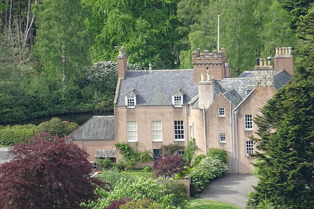
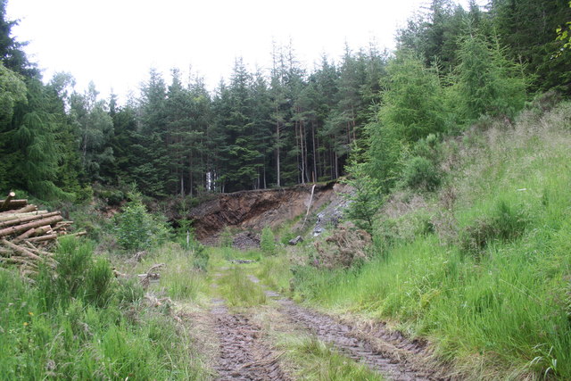
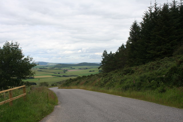
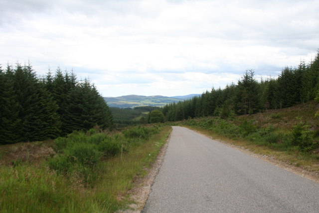
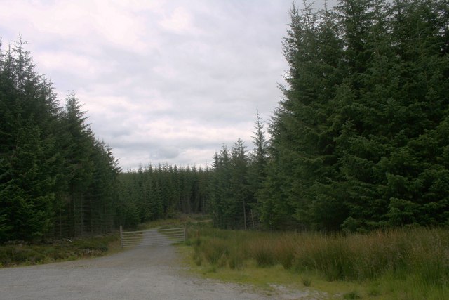
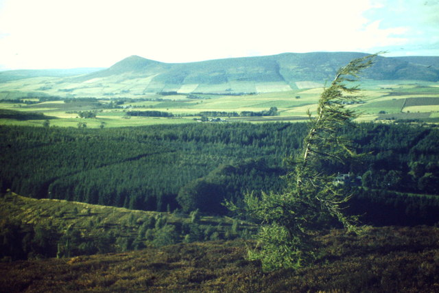
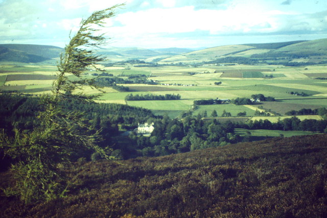
Craigneuk Wood is a picturesque woodland located in Aberdeenshire, Scotland. Covering an area of approximately 100 hectares, it is a popular destination for nature enthusiasts and outdoor adventurers alike. The wood is situated on the outskirts of a small village called Craigneuk, which adds to its charm and accessibility.

The wood is predominantly made up of native broadleaf trees, including oak, birch, and beech. These trees create a dense canopy that provides shelter to a diverse range of wildlife, making it an ideal habitat for birds, small mammals, and insects. The wood is also home to a variety of plant species, such as bluebells and wild garlic, which add bursts of color and fragrance during the spring and summer months.

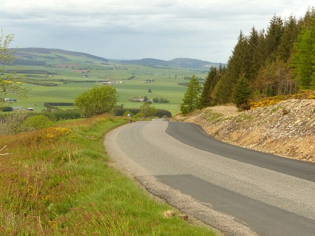
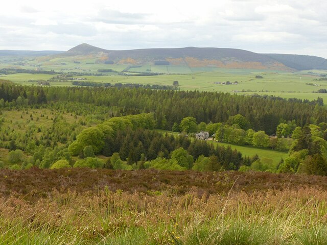
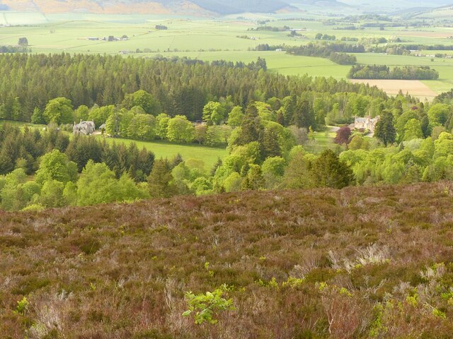
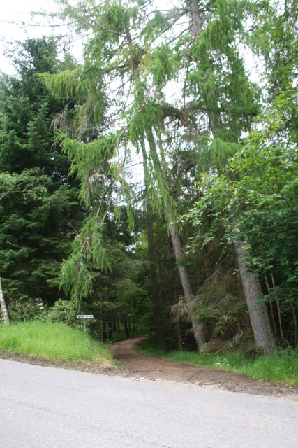
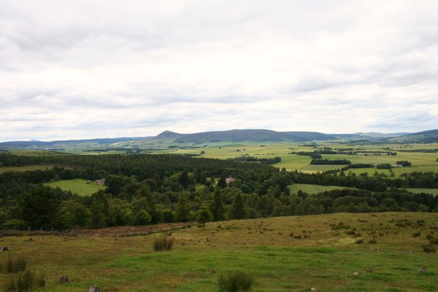
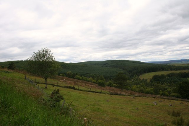
Several well-maintained walking trails wind their way through the wood, offering visitors the opportunity to explore its natural beauty. These paths vary in difficulty, catering to both casual strollers and more experienced hikers. Along the way, walkers can enjoy the tranquil atmosphere and take in stunning views of the surrounding countryside.

Craigneuk Wood is a popular spot for outdoor activities, including picnicking, birdwatching, and photography. The wood also offers opportunities for educational visits, with guided tours and information boards providing insights into the local flora and fauna.

Overall, Craigneuk Wood is a haven for nature lovers, providing a peaceful and immersive experience in the heart of Aberdeenshire's countryside.

If you have any feedback on the listing, please let us know in the comments section below.

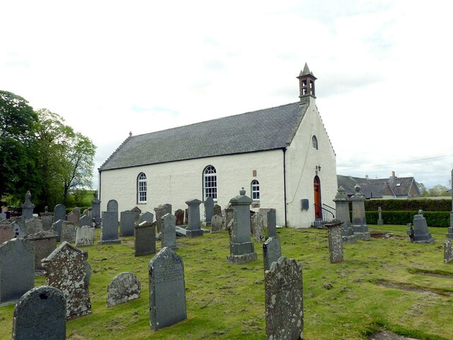
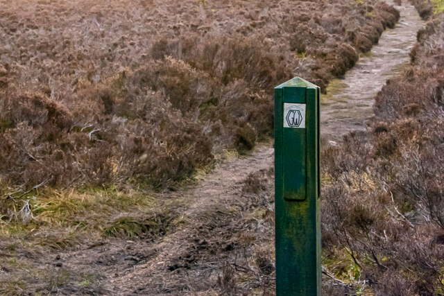
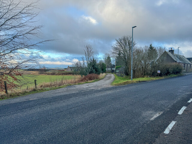
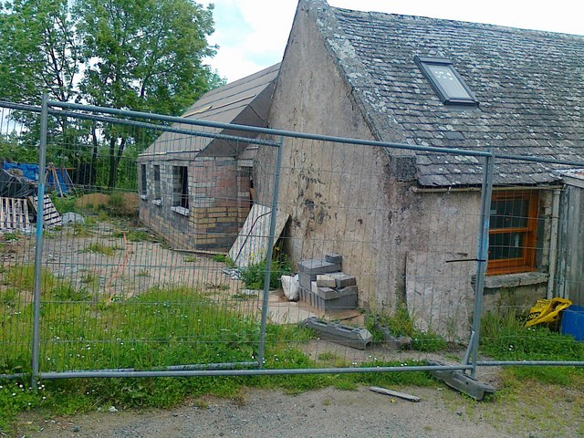
Craigneuk Wood Images

Images are sourced within 2km of 57.306021/-2.7642236 or Grid Reference NJ5424. Thanks to Geograph Open Source API. All images are credited.

Knockespoch House Seen from the viewpoint on Suie Hill, with the aid of a telephoto lens. Parts of it date from the 16th or 17th century, but it has been extensively altered and extended in the ensuing centuries. It was a seat of the Gordons. It is Category B listed, but the citation <span class="nowrap"><a title="http://portal.historicenvironment.scot/designation/LB2911" rel="nofollow ugc noopener" href="http://portal.historicenvironment.scot/designation/LB2911">Link</a><img style="margin-left:2px;" alt="External link" title="External link - shift click to open in new window" src="https://s1.geograph.org.uk/img/external.png" width="10" height="10"/></span> is unusually lacking in information. However the listings at <span class="nowrap"><a title="https://canmore.org.uk/site/75332/knockespock-house" rel="nofollow ugc noopener" href="https://canmore.org.uk/site/75332/knockespock-house">Link</a><img style="margin-left:2px;" alt="External link" title="External link - shift click to open in new window" src="https://s1.geograph.org.uk/img/external.png" width="10" height="10"/></span> and <span class="nowrap"><a title="https://online.aberdeenshire.gov.uk/smrpub/master/detail.aspx?tab=main&refno=NJ52SW0017" rel="nofollow ugc noopener" href="https://online.aberdeenshire.gov.uk/smrpub/master/detail.aspx?tab=main&refno=NJ52SW0017">Link</a><img style="margin-left:2px;" alt="External link" title="External link - shift click to open in new window" src="https://s1.geograph.org.uk/img/external.png" width="10" height="10"/></span> are more enlightening.
Knockespoch House
Seen from the viewpoint on Suie Hill, with the aid of a telephoto lens. Parts of it date from the 16th or 17th century, but it has been extensively altered and extended in the ensuing centuries. It was a seat of the Gordons. It is Category B listed, but the citation LinkExternal link is unusually lacking in information. However the listings at LinkExternal link and LinkExternal link are more enlightening.
Suie Road, above Knockespoch The road has been recently widened to allow 2-way traffic over the length of the gradient – compare with <a title="https://www.geograph.org.uk/photo/923415" href="https://www.geograph.org.uk/photo/923415">Link</a> . The area is popular with walkers, being the western end of the Gordon Way long distance footpath
Suie Road, above Knockespoch
The road has been recently widened to allow 2-way traffic over the length of the gradient – compare with Link . The area is popular with walkers, being the western end of the Gordon Way long distance footpath
Knockespoch policies from Suie Road viewpoint The obvious rows of broadleaf trees in spring colouration mark the basic outline of the policies which are described in the Aberdeenshire Historic Environment Record entry as “Remains of a 17th to 19th century designed landscape.”

The distinctive peak of Tap o'Noth rises in the distance.
Knockespoch policies from Suie Road viewpoint
The obvious rows of broadleaf trees in spring colouration mark the basic outline of the policies which are described in the Aberdeenshire Historic Environment Record entry as “Remains of a 17th to 19th century designed landscape.” The distinctive peak of Tap o'Noth rises in the distance.
Knockespoch policies from Suie Road viewpoint The obvious rows of broadleaf trees mark the basic outline of the policies which are described in the Aberdeenshire Historic Environment Record entry as “Remains of a 17th to 19th century designed landscape.” For a close view of the house, see <a title="https://www.geograph.org.uk/photo/7181322" href="https://www.geograph.org.uk/photo/7181322">Link</a>
Knockespoch policies from Suie Road viewpoint
The obvious rows of broadleaf trees mark the basic outline of the policies which are described in the Aberdeenshire Historic Environment Record entry as “Remains of a 17th to 19th century designed landscape.” For a close view of the house, see Link
Clatt Kirk Listed Category B, it dates in its current state from 1799, although it incorporates earlier material, including a lintel dated 1778. An original church foundation on the site can be dated back to 612AD.
Clatt Kirk
Listed Category B, it dates in its current state from 1799, although it incorporates earlier material, including a lintel dated 1778. An original church foundation on the site can be dated back to 612AD.
Waymarker on the Gordon Way
Gadie Burn The little Gadie Burn runs to the north and east of the mountain of Bennachie.

John Strachan sings Where the Gadie Rins
O gin I were where Gadie rins, where Gadie rins, where Gadie rins,
O gin I were where Gadie rins, at the back o Bennachie.

O I never there come back again, come back again, come back again,
O, I should ne’er come back again, yer Lowland lads tae see.

I never hid but twa rieht lads, but twa rieht lads, but twa rieht lads,
I never hid but twa rieht lads that dearly loved me.

The teen was killed in Lowrin Fair, in Lowrin Fair, in Lowrin Fair,
The teen was killed in Lowrin Fair and the tither was drooned in Dee.

Hid they gien my lovie man for man, man for man, man for man,
Hid they gien my lovie man for man, or yet’s the man for three.

He widna lyin so low the day, so low the day, so low the day,
He widna lyin so low the day at the fit o yonder tree.
[Spoken:] Good enough.
Gadie Burn
The little Gadie Burn runs to the north and east of the mountain of Bennachie. John Strachan sings Where the Gadie Rins O gin I were where Gadie rins, where Gadie rins, where Gadie rins, O gin I were where Gadie rins, at the back o Bennachie. O I never there come back again, come back again, come back again, O, I should ne’er come back again, yer Lowland lads tae see. I never hid but twa rieht lads, but twa rieht lads, but twa rieht lads, I never hid but twa rieht lads that dearly loved me. The teen was killed in Lowrin Fair, in Lowrin Fair, in Lowrin Fair, The teen was killed in Lowrin Fair and the tither was drooned in Dee. Hid they gien my lovie man for man, man for man, man for man, Hid they gien my lovie man for man, or yet’s the man for three. He widna lyin so low the day, so low the day, so low the day, He widna lyin so low the day at the fit o yonder tree. [Spoken:] Good enough.
Main road of Clatt
Main road of Clatt
Old and new buildings, Clatt
Old Quarry An old quarry off the Suie road being used to store tree thinnings.
Old Quarry
An old quarry off the Suie road being used to store tree thinnings.
Road to Knockespock An access road to knockespock House off the Suie road.
Road to Knockespock
An access road to knockespock House off the Suie road.
View to Tap O' Noth The view from the Suie viewpoint to Tap o' Noth looking over moorland Craigneuk Wood and Knockespock House.
View to Tap O' Noth
The view from the Suie viewpoint to Tap o' Noth looking over moorland Craigneuk Wood and Knockespock House.
Suie Hillside Grouse moor and Suie Woods.
Suie Hillside
Grouse moor and Suie Woods.
Downhill from Suie The road downhill to Knockespock and beyond.
Downhill from Suie
The road downhill to Knockespock and beyond.
Forest Road The road passing through Whitehaugh Wood on the left and Knockespock on the right.
Forest Road
The road passing through Whitehaugh Wood on the left and Knockespock on the right.
Forest Road A forestry road off the Suie road.
Forest Road
A forestry road off the Suie road.
Craigneuk Wood The wood at the foot of Suie Hill looks to be fairly impenetrable from this aspect. On the skyline is the distinctive Tap o' Noth with its hillfort.
Craigneuk Wood
The wood at the foot of Suie Hill looks to be fairly impenetrable from this aspect. On the skyline is the distinctive Tap o' Noth with its hillfort.
Suie Foot Fields beside Knockespock House, Clatt at the foot of Suie Hill. The layby on the hillside is a popular viewpoint.
Suie Foot
Fields beside Knockespock House, Clatt at the foot of Suie Hill. The layby on the hillside is a popular viewpoint.
Show me another place!

Craigneuk Wood is located at Grid Ref: NJ5424 (Lat: 57.306021, Lng: -2.7642236)

Unitary Authority: Aberdeenshire

Police Authority: North East

What 3 Words

///fake.stammer.situation. Near Alford, Aberdeenshire

Related Wikis

Clatt

Clatt (Gaelic cleithecode: gla promoted to code: gd , 'concealed'), is a village in Aberdeenshire, Scotland. The remains of a morthouse are located in...

Druminnor Castle

Druminnor Castle is an L-plan castle, dating from the early 15th century, about two miles east of Rhynnie, in a steep valley by the Keron burn, in Aberdeenshire...

Ardlair Stone

The Ardlair Stone is a class I Pictish stone that stands in a field in Ardlair, Kennethmont, Aberdeenshire, Scotland. It is associated with a number of...

Terpersie Castle

Terpersie Castle (originally built as Dalpersie House) is a 16th-century tower house in Tullynessle, Aberdeenshire, Scotland, located 5 kilometres (3...

Nearby Amenities

Located within 500m of 57.306021,-2.7642236
Power: pole
Lat/Long: 57.3073576/-2.7717949
Power: pole
Lat/Long: 57.3067898/-2.7715523
Power: pole
Lat/Long: 57.3061974/-2.7712732
Power: pole
Lat/Long: 57.3055847/-2.7709852
Power: pole
Lat/Long: 57.3049744/-2.7706972
Power: pole
Lat/Long: 57.3043509/-2.7703914
Power: pole
Lat/Long: 57.3036501/-2.7700314
Power: pole
Lat/Long: 57.3085299/-2.762484
Power: pole
Lat/Long: 57.3085667/-2.761835
Power: pole
Lat/Long: 57.3085815/-2.7610758
Power: pole
Lat/Long: 57.3086663/-2.7602792
Power: pole
Lat/Long: 57.308726/-2.7593798
Power: pole
Lat/Long: 57.3088061/-2.7583561
The data included in this document is from www.openstreetmap.org. The data is made available under ODbL.

Have you been to Craigneuk Wood?

Leave your review of Craigneuk Wood below (or comments, questions and feedback).