Boghead Wood

Wood, Forest in Aberdeenshire

Scotland

Boghead Wood

The Ringing Stane Recumbent Stone Circle (1) The gentle mound is the ground originally surrounded by the circle. In the foreground are three stones lying flat, which are not thought to be in the original circle, though they might have been displaced from it. The taller stone on the left is the recumbent, with a stubby outcrop of rock beside it. See <span class="nowrap"><a title="https://canmore.org.uk/site/17827/the-ringing-stone" rel="nofollow ugc noopener" href="https://canmore.org.uk/site/17827/the-ringing-stone">Link</a><img style="margin-left:2px;" alt="External link" title="External link - shift click to open in new window" src="https://s1.geograph.org.uk/img/external.png" width="10" height="10"/></span> for more details. <a href="https://www.geograph.org.uk/photo/4742648">NJ5345 : The Ringing Stane Recumbent Stone Circle (2)</a>
The Ringing Stane Recumbent Stone Circle (1) Credit: Anne Burgess

Boghead Wood is a picturesque forest located in Aberdeenshire, Scotland. Covering an area of approximately 50 hectares, it is a popular destination for nature enthusiasts and outdoor lovers. The wood is situated near the village of Auchleven, offering convenient access for visitors.

The forest is characterized by a diverse range of tree species, including native Scots pine, birch, oak, and rowan. These towering trees create a dense canopy, providing a habitat for a variety of wildlife. Visitors to Boghead Wood can often spot red squirrels, roe deer, and a wide array of bird species, making it a haven for birdwatching enthusiasts.

Several well-maintained trails wind through the woodland, allowing visitors to explore its beauty on foot. The paths are clearly marked and offer different levels of difficulty, catering to both casual walkers and more experienced hikers. Along the way, there are designated rest areas where visitors can take a break and appreciate the tranquility of the surroundings.

Boghead Wood also boasts a vibrant springtime display of bluebells, creating a breathtaking carpet of color. This attracts many visitors during the blooming season, who come to capture the natural beauty through photography or simply enjoy a peaceful walk amidst the floral spectacle.

Overall, Boghead Wood is a scenic and ecologically diverse forest that offers an immersive experience in the heart of Aberdeenshire. Whether it's for a leisurely stroll or a wildlife adventure, this enchanting woodland has something to offer for everyone.

If you have any feedback on the listing, please let us know in the comments section below.

Boghead Wood Images

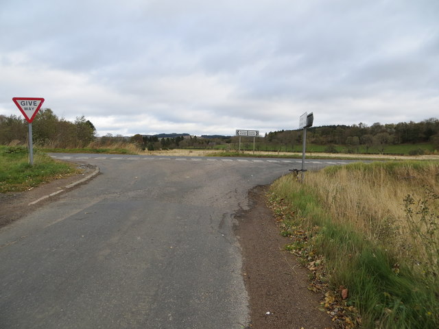
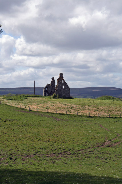
Images are sourced within 2km of 57.492683/-2.7693717 or Grid Reference NJ5344. Thanks to Geograph Open Source API. All images are credited.

The Ringing Stane Recumbent Stone Circle (1) The gentle mound is the ground originally surrounded by the circle. In the foreground are three stones lying flat, which are not thought to be in the original circle, though they might have been displaced from it. The taller stone on the left is the recumbent, with a stubby outcrop of rock beside it. See <span class="nowrap"><a title="https://canmore.org.uk/site/17827/the-ringing-stone" rel="nofollow ugc noopener" href="https://canmore.org.uk/site/17827/the-ringing-stone">Link</a><img style="margin-left:2px;" alt="External link" title="External link - shift click to open in new window" src="https://s1.geograph.org.uk/img/external.png" width="10" height="10"/></span> for more details. <a href="https://www.geograph.org.uk/photo/4742648">NJ5345 : The Ringing Stane Recumbent Stone Circle (2)</a>
The Ringing Stane Recumbent Stone Circle (1)
The gentle mound is the ground originally surrounded by the circle. In the foreground are three stones lying flat, which are not thought to be in the original circle, though they might have been displaced from it. The taller stone on the left is the recumbent, with a stubby outcrop of rock beside it. See LinkExternal link for more details. NJ5345 : The Ringing Stane Recumbent Stone Circle (2)
The Ringing Stane Recumbent Stone Circle (2) On the left is the recumbent, with a natural outcrop in front of it. On the right are three stones which may have been part of the original circle, but are not in original positions. The prominent distant hill is Knock Hill. See <span class="nowrap"><a title="https://canmore.org.uk/site/17827/the-ringing-stone" rel="nofollow ugc noopener" href="https://canmore.org.uk/site/17827/the-ringing-stone">Link</a><img style="margin-left:2px;" alt="External link" title="External link - shift click to open in new window" src="https://s1.geograph.org.uk/img/external.png" width="10" height="10"/></span> for more details. <a href="https://www.geograph.org.uk/photo/4742653">NJ5345 : The Ringing Stane Recumbent Stone Circle (3)</a> (Sorry about my shadow - I couldn't avoid it!)
The Ringing Stane Recumbent Stone Circle (2)
On the left is the recumbent, with a natural outcrop in front of it. On the right are three stones which may have been part of the original circle, but are not in original positions. The prominent distant hill is Knock Hill. See LinkExternal link for more details. NJ5345 : The Ringing Stane Recumbent Stone Circle (3) (Sorry about my shadow - I couldn't avoid it!)
The Ringing Stane Recumbent Stone Circle (3) The large stone here is the recumbent, and it is the only stone still standing. The farmer who farms the land told me that it might have fallen over too, but his grandfather had added some stones to keep it upright. To its right is a natural outcrop, though I am surprised that the latter managed to survive the Ice Age.  See <span class="nowrap"><a title="https://canmore.org.uk/site/17827/the-ringing-stone" rel="nofollow ugc noopener" href="https://canmore.org.uk/site/17827/the-ringing-stone">Link</a><img style="margin-left:2px;" alt="External link" title="External link - shift click to open in new window" src="https://s1.geograph.org.uk/img/external.png" width="10" height="10"/></span> for more details. <a href="https://www.geograph.org.uk/photo/4742657">NJ5345 : The Ringing Stane Recumbent Stone Circle (4)</a>
The Ringing Stane Recumbent Stone Circle (3)
The large stone here is the recumbent, and it is the only stone still standing. The farmer who farms the land told me that it might have fallen over too, but his grandfather had added some stones to keep it upright. To its right is a natural outcrop, though I am surprised that the latter managed to survive the Ice Age. See LinkExternal link for more details. NJ5345 : The Ringing Stane Recumbent Stone Circle (4)
The Ringing Stane Recumbent Stone Circle (4) The recumbent is on the left, and from this angle you can see that the natural outcrop is a few feet from the recumbent. See <span class="nowrap"><a title="https://canmore.org.uk/site/17827/the-ringing-stone" rel="nofollow ugc noopener" href="https://canmore.org.uk/site/17827/the-ringing-stone">Link</a><img style="margin-left:2px;" alt="External link" title="External link - shift click to open in new window" src="https://s1.geograph.org.uk/img/external.png" width="10" height="10"/></span> for more details. <a href="https://www.geograph.org.uk/photo/4742661">NJ5345 : The Ringing Stane Recumbent Stone Circle (5)</a>
The Ringing Stane Recumbent Stone Circle (4)
The recumbent is on the left, and from this angle you can see that the natural outcrop is a few feet from the recumbent. See LinkExternal link for more details. NJ5345 : The Ringing Stane Recumbent Stone Circle (5)
The Ringing Stane Recumbent Stone Circle (5) This is the side of the recumbent that faces into the circle. The stones it sits on, and several others that are possibly not original, can be clearly seen. The rock on the left edge of the picture is a natural rock outcrop. See <span class="nowrap"><a title="https://canmore.org.uk/site/17827/the-ringing-stone" rel="nofollow ugc noopener" href="https://canmore.org.uk/site/17827/the-ringing-stone">Link</a><img style="margin-left:2px;" alt="External link" title="External link - shift click to open in new window" src="https://s1.geograph.org.uk/img/external.png" width="10" height="10"/></span> for more details. <a href="https://www.geograph.org.uk/photo/4742663">NJ5345 : The Ringing Stane Recumbent Stone Circle (6)</a>
The Ringing Stane Recumbent Stone Circle (5)
This is the side of the recumbent that faces into the circle. The stones it sits on, and several others that are possibly not original, can be clearly seen. The rock on the left edge of the picture is a natural rock outcrop. See LinkExternal link for more details. NJ5345 : The Ringing Stane Recumbent Stone Circle (6)
The Ringing Stane Recumbent Stone Circle (6) This is the recumbent, seen end-on. It is also known as the Iron Stane, and the name is because of the ringing sound it makes when struck. See <span class="nowrap"><a title="https://canmore.org.uk/site/17827/the-ringing-stone" rel="nofollow ugc noopener" href="https://canmore.org.uk/site/17827/the-ringing-stone">Link</a><img style="margin-left:2px;" alt="External link" title="External link - shift click to open in new window" src="https://s1.geograph.org.uk/img/external.png" width="10" height="10"/></span> for more details. <a href="https://www.geograph.org.uk/photo/4742671">NJ5345 : The Ringing Stane Recumbent Stone Circle (7)</a>
The Ringing Stane Recumbent Stone Circle (6)
This is the recumbent, seen end-on. It is also known as the Iron Stane, and the name is because of the ringing sound it makes when struck. See LinkExternal link for more details. NJ5345 : The Ringing Stane Recumbent Stone Circle (7)
The Ringing Stane Recumbent Stone Circle (7) If the stone in the foreground was part of the circle, it has been moved, and a row of wedge holes has been bored into it. In the background is the recumbent, seen end-on, with a natural rock outcrop to the left. See <span class="nowrap"><a title="https://canmore.org.uk/site/17827/the-ringing-stone" rel="nofollow ugc noopener" href="https://canmore.org.uk/site/17827/the-ringing-stone">Link</a><img style="margin-left:2px;" alt="External link" title="External link - shift click to open in new window" src="https://s1.geograph.org.uk/img/external.png" width="10" height="10"/></span> for more details. <a href="https://www.geograph.org.uk/photo/4742675">NJ5345 : The Ringing Stane Recumbent Stone Circle (8)</a>
The Ringing Stane Recumbent Stone Circle (7)
If the stone in the foreground was part of the circle, it has been moved, and a row of wedge holes has been bored into it. In the background is the recumbent, seen end-on, with a natural rock outcrop to the left. See LinkExternal link for more details. NJ5345 : The Ringing Stane Recumbent Stone Circle (8)
The Ringing Stane Recumbent Stone Circle (8) These stones, although lying close to the circle, are not part of it. In 1871, at least two of them were not where they are now, and the nearer one has had wedge holes bored into it.  See <span class="nowrap"><a title="https://canmore.org.uk/site/17827/the-ringing-stone" rel="nofollow ugc noopener" href="https://canmore.org.uk/site/17827/the-ringing-stone">Link</a><img style="margin-left:2px;" alt="External link" title="External link - shift click to open in new window" src="https://s1.geograph.org.uk/img/external.png" width="10" height="10"/></span> for more details. <a href="https://www.geograph.org.uk/photo/4742681">NJ5345 : The Ringing Stane Recumbent Stone Circle (9)</a>
The Ringing Stane Recumbent Stone Circle (8)
These stones, although lying close to the circle, are not part of it. In 1871, at least two of them were not where they are now, and the nearer one has had wedge holes bored into it. See LinkExternal link for more details. NJ5345 : The Ringing Stane Recumbent Stone Circle (9)
The Ringing Stane Recumbent Stone Circle (9) Apart from the recumbent, this is the only stone in its original position, though it is no longer standing.  See <span class="nowrap"><a title="https://canmore.org.uk/site/17827/the-ringing-stone" rel="nofollow ugc noopener" href="https://canmore.org.uk/site/17827/the-ringing-stone">Link</a><img style="margin-left:2px;" alt="External link" title="External link - shift click to open in new window" src="https://s1.geograph.org.uk/img/external.png" width="10" height="10"/></span> for more details. <a href="https://www.geograph.org.uk/photo/4742689">NJ5345 : The Ringing Stane Recumbent Stone Circle (10)</a>
The Ringing Stane Recumbent Stone Circle (9)
Apart from the recumbent, this is the only stone in its original position, though it is no longer standing. See LinkExternal link for more details. NJ5345 : The Ringing Stane Recumbent Stone Circle (10)
The Ringing Stane Recumbent Stone Circle (10) This grassy mound is what remains of the cairn inside the stone circle. It has been cultivated, but the farmer said that the bedrock is so close to the surface that it's only really suitable for grazing.  See <span class="nowrap"><a title="https://canmore.org.uk/site/17827/the-ringing-stone" rel="nofollow ugc noopener" href="https://canmore.org.uk/site/17827/the-ringing-stone">Link</a><img style="margin-left:2px;" alt="External link" title="External link - shift click to open in new window" src="https://s1.geograph.org.uk/img/external.png" width="10" height="10"/></span> for more details. <a href="https://www.geograph.org.uk/photo/4742641">NJ5345 : The Ringing Stane Recumbent Stone Circle (1)</a>
The Ringing Stane Recumbent Stone Circle (10)
This grassy mound is what remains of the cairn inside the stone circle. It has been cultivated, but the farmer said that the bedrock is so close to the surface that it's only really suitable for grazing. See LinkExternal link for more details. NJ5345 : The Ringing Stane Recumbent Stone Circle (1)
Tillytarmont Railway Bridge The bridge carries the Aberdeen and Inverness railway over the River Deveron. The Wood of Avochie is beyond the railway, and the farm on top of the hill is Dykehead, in the next square.
Tillytarmont Railway Bridge
The bridge carries the Aberdeen and Inverness railway over the River Deveron. The Wood of Avochie is beyond the railway, and the farm on top of the hill is Dykehead, in the next square.
Rail bridge over the Deveron
Rothiemay railway station (site), Aberdeenshire Opened in 1856 on the Great North of Scotland Railway's line from Aberdeen to Keith, this station closed in 1968. The line was later singled.
View north towards Cairnie Junction and Keith. A wall is still visible in the undergrowth.
Rothiemay railway station (site), Aberdeenshire
Opened in 1856 on the Great North of Scotland Railway's line from Aberdeen to Keith, this station closed in 1968. The line was later singled. View north towards Cairnie Junction and Keith. A wall is still visible in the undergrowth.
River Deveron
River Deveron
Road from Ruthven joining the B9022 at Bridge of Isla Looking north-eastward.
Road from Ruthven joining the B9022 at Bridge of Isla
Looking north-eastward.
Railway Bridge over River Deveron. The Bridge carries the Aberdeen to Inverness single track railway across the River Deveron a few miles north of Huntly.
Railway Bridge over River Deveron.
The Bridge carries the Aberdeen to Inverness single track railway across the River Deveron a few miles north of Huntly.
A Riverside Cottage As viewed from the B9022 on the other side of the River Deveron.
A Riverside Cottage
As viewed from the B9022 on the other side of the River Deveron.
Hard times? Located adjacent to Midplough farm, this is the ruined Avochie Castle.
Hard times?
Located adjacent to Midplough farm, this is the ruined Avochie Castle.
Show me another place!

Boghead Wood is located at Grid Ref: NJ5344 (Lat: 57.492683, Lng: -2.7693717)

Unitary Authority: Aberdeenshire

Police Authority: North East

What 3 Words

///offshore.trophy.masterful. Near Huntly, Aberdeenshire

Nearby Locations

Boghead Wood

Related Wikis

Rothiemay railway station

Rothiemay railway station served the village of Milltown of Rothiemay, Aberdeenshire, Scotland from 1856 to 1968 on the Great North of Scotland Railway...

Avochie Castle

Avochie Castle is a ruined tower house, dating from the 16th century, or early 17th century, around 4.5 miles (7.2 km) north of Huntly, east of the river...

Mountains Burn

Mountains Burn is a burn which marks the boundary of the parish of Huntly, Aberdeenshire, Scotland. == References ==

River Isla, Moray

The River Isla (Scottish Gaelic: Uisge Ìle) is a tributary of the River Deveron in North-East Scotland. The area surrounding it is known as Strathisla...

Nearby Amenities

Located within 500m of 57.492683,-2.7693717
Power: pole
Lat/Long: 57.4940943/-2.7674888
Power: pole
Lat/Long: 57.4936017/-2.7674486
Power: pole
Lat/Long: 57.4930875/-2.7674025
Power: pole
Lat/Long: 57.492498/-2.7670382
Power: pole
Lat/Long: 57.4919003/-2.7666528
Power: pole
Lat/Long: 57.4912861/-2.7662769
Power: pole
Lat/Long: 57.4906791/-2.765878
Power: pole
Lat/Long: 57.4900556/-2.7654907
Power: pole
Lat/Long: 57.4894413/-2.7650976
Boghead
Place: isolated_dwelling
Lat/Long: 57.4943702/-2.7677497
Lower Auchmill
Place: isolated_dwelling
Lat/Long: 57.4889156/-2.7658614
The data included in this document is from www.openstreetmap.org. The data is made available under ODbL.

Have you been to Boghead Wood?

Leave your review of Boghead Wood below (or comments, questions and feedback).