Blinkbonny Wood

Wood, Forest in East Lothian

Scotland

Blinkbonny Wood

Heading up the Law Autumn morning heading up the track to Lammer Law - the high ground in the centre of photo.
Heading up the Law Credit: Adam Ward

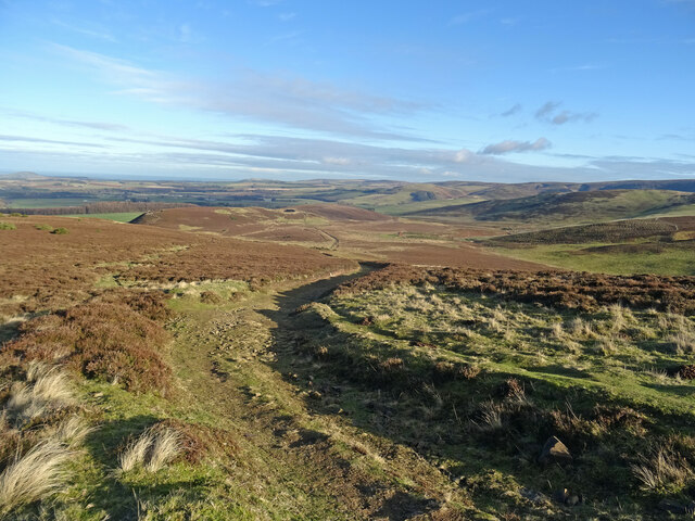
Blinkbonny Wood is a charming forest located in East Lothian, Scotland. Covering an area of approximately 50 hectares, it is a prominent natural attraction in the region. The wood is situated near the village of East Saltoun, offering a peaceful and serene environment for visitors to explore and enjoy.

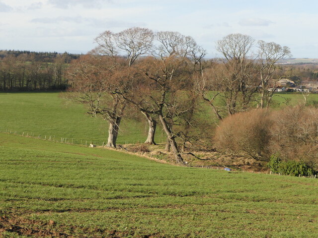
With a rich diversity of flora and fauna, Blinkbonny Wood is a haven for nature enthusiasts. The forest is predominantly composed of native broadleaf trees such as oak, birch, and ash, creating a vibrant and colorful landscape throughout the year. In spring, the woodland floor is adorned with a carpet of bluebells, while in autumn, the leaves transform into a stunning array of reds, oranges, and golds.

The wood is home to a wide range of wildlife, including deer, badgers, foxes, and a variety of bird species. Birdwatchers can spot woodpeckers, owls, and many other feathered friends. The tranquil atmosphere and abundance of natural habitats make it an ideal spot for birdwatching and wildlife photography.

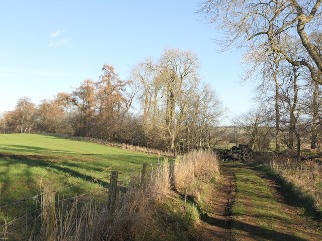
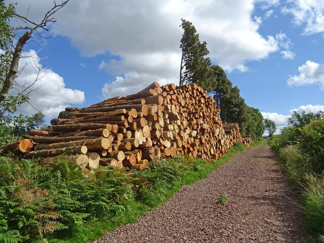
For outdoor enthusiasts, Blinkbonny Wood offers a network of well-maintained walking trails, allowing visitors to explore the forest at their own pace. These trails cater to all levels of fitness, providing options for short, leisurely strolls or more challenging hikes. The wood also connects to the wider countryside, offering opportunities for longer walks and exploration of the surrounding East Lothian countryside.

Overall, Blinkbonny Wood is a picturesque and diverse forest, providing a tranquil escape from the hustle and bustle of everyday life. Whether it's for a leisurely walk, wildlife spotting, or simply enjoying the beauty of nature, this woodland is a must-visit destination in East Lothian.

If you have any feedback on the listing, please let us know in the comments section below.

Blinkbonny Wood Images

Images are sourced within 2km of 55.869287/-2.7392281 or Grid Reference NT5364. Thanks to Geograph Open Source API. All images are credited.

Heading up the Law Autumn morning heading up the track to Lammer Law - the high ground in the centre of photo.
Heading up the Law
Autumn morning heading up the track to Lammer Law - the high ground in the centre of photo.
Track Bend, Lammermuirs A rough path coming directly from Lammer Law summit joins the track at this bend. Looking northeast to the countryside south of Gifford.
Track Bend, Lammermuirs
A rough path coming directly from Lammer Law summit joins the track at this bend. Looking northeast to the countryside south of Gifford.
Benign Winter Lammermuirs This track traverses the Lammermuirs from Blinkbonny near Gifford to Carfraemill at the A68/A69 junction, becoming a surfaced road from Tollishill. Very different conditions to Richard's picture in 2021 taken from almost the same location at the same time of year - you can just see the snow covered gorse:-
<a title="https://www.geograph.org.uk/photo/6739558" href="https://www.geograph.org.uk/photo/6739558">Link</a>
Benign Winter Lammermuirs
This track traverses the Lammermuirs from Blinkbonny near Gifford to Carfraemill at the A68/A69 junction, becoming a surfaced road from Tollishill. Very different conditions to Richard's picture in 2021 taken from almost the same location at the same time of year - you can just see the snow covered gorse:- Link
Disused sluice, Gamuelston Near a pond.
Disused sluice, Gamuelston
Near a pond.
Pond, Gamuelston
Pond, Gamuelston
Track, Gamuelston Bound for Yester woodlands.
Track, Gamuelston
Bound for Yester woodlands.
Saugh Wood, Yester
Saugh Wood, Yester
On Crow Cairn, Lammermuirs Crow Cairn above Hopes Reservoir in the Lammermuirs looking to Lammer Law with the heather starting to bloom.
On Crow Cairn, Lammermuirs
Crow Cairn above Hopes Reservoir in the Lammermuirs looking to Lammer Law with the heather starting to bloom.
Harvested Field above Yester Wheat field recently harvested south of Yester Mains near Gifford.
Harvested Field above Yester
Wheat field recently harvested south of Yester Mains near Gifford.
Timber Pile at Wester Wood Wester Wood near Gifford which seems to be systematically felled at the moment. Timber pile on the southern edge of the woodland.
Timber Pile at Wester Wood
Wester Wood near Gifford which seems to be systematically felled at the moment. Timber pile on the southern edge of the woodland.
Direction Sign – Signpost at Longyester Located on the southwest side of the T junction at Longyester. 4 arms and ball finial. See also <a title="https://www.geograph.org.uk/photo/4184232" href="https://www.geograph.org.uk/photo/4184232">Link</a> and <a title="https://www.geograph.org.uk/photo/4184227" href="https://www.geograph.org.uk/photo/4184227">Link</a>.
Direction Sign – Signpost at Longyester
Located on the southwest side of the T junction at Longyester. 4 arms and ball finial. See also Link and Link.
Field and Moorland Boundary Contrasting habitat - and colour - in the Lammermuirs, between moorland left of the fence and grassy field right of fence very often with livestock in it, most recently cows. Looking to Threep Law and Lammer Law from White Knowe.
Field and Moorland Boundary
Contrasting habitat - and colour - in the Lammermuirs, between moorland left of the fence and grassy field right of fence very often with livestock in it, most recently cows. Looking to Threep Law and Lammer Law from White Knowe.
Fungi Detail White fungi about 20cm across seen in close up, looking like the surface of a moon. Quite possibly
Peppery Milkcap (Lactarius piperatus), though that is normally found in Deciduous Woodland.
Being no expert is why I personally would not pick fungi to eat - Peppery Milkcap is apparently just unpleasant to eat though can cause irritant reaction on lips and tongue.
Fungi Detail
White fungi about 20cm across seen in close up, looking like the surface of a moon. Quite possibly Peppery Milkcap (Lactarius piperatus), though that is normally found in Deciduous Woodland. Being no expert is why I personally would not pick fungi to eat - Peppery Milkcap is apparently just unpleasant to eat though can cause irritant reaction on lips and tongue.
Farm track, Scarhill Wood
Road to Hopes Near Longyester with an old traditional road sign at the corner.
Road to Hopes
Near Longyester with an old traditional road sign at the corner.
Road to Lammer Law The point where it passes through Blinkbonny Wood (to the right) and Fawn's Wood (to the left).
Road to Lammer Law
The point where it passes through Blinkbonny Wood (to the right) and Fawn's Wood (to the left).
Lower slopes of Hare Law An area of distinct contrasts: Land suitable for sheep grazing in the foreground and beyond the wall moorland with thick heather.
Lower slopes of Hare Law
An area of distinct contrasts: Land suitable for sheep grazing in the foreground and beyond the wall moorland with thick heather.
Junction of Tracks on the Track to Lammer Law The main track to Lammer Law continues straight ahead. Despite appearing a more main track, the track to the left only leads to a farm building.
Junction of Tracks on the Track to Lammer Law
The main track to Lammer Law continues straight ahead. Despite appearing a more main track, the track to the left only leads to a farm building.
Show me another place!

Blinkbonny Wood is located at Grid Ref: NT5364 (Lat: 55.869287, Lng: -2.7392281)

Unitary Authority: East Lothian

Police Authority: The Lothians and Scottish Borders

What 3 Words

///advantage.princes.point. Near Haddington, East Lothian

Related Wikis

Hopes Reservoir

Hopes Reservoir is a small reservoir in East Lothian, Scotland, in the Lammermuir Hills. It is located in the parish of Yester, 6 km (3.7 mi) south of...

Yester Chapel

Yester Chapel is situated on the estate of Yester House, at the south-east edge of the village of Gifford in East Lothian, Scotland. The chapel is situated...

Yester House

Yester House is an early 18th-century mansion near Gifford in East Lothian, Scotland. It was the home of the Hay family, later Marquesses of Tweeddale...

Yester Castle

Yester Castle is a ruined castle, located 1+1⁄2 miles (2.5 kilometres) southeast of the village of Gifford in East Lothian, Scotland. The only remaining...

Gifford, East Lothian

Gifford is a village in the parish of Yester in East Lothian, Scotland. It lies approximately 4 miles (6.4 km) south of Haddington and 25 miles (40 km...

Gifford Town Hall

Gifford Town Hall is a municipal building in The Square, Gifford, East Lothian, Scotland. The structure, which is used as a community events venue, is...

Yester Parish Church

Yester Parish Church is a church of the Church of Scotland in the village of Gifford, East Lothian, Scotland. The village forms part of Yester, Bolton...

Lammermuir Hills

The Lammermuirs are a range of hills in southern Scotland, forming a natural boundary between East Lothian and the Borders. The name "Lammermuir" comes...

Nearby Amenities

Located within 500m of 55.869287,-2.7392281
Blinkbonny Wood Campsite
Fee: yes
Tourism: camp_site
Website: http://blinkbonnywood.com/
Lat/Long: 55.8698613/-2.7366715
Power: pole
Lat/Long: 55.8736365/-2.7397108
Power: pole
Lat/Long: 55.8726101/-2.7409652
Power: pole
Lat/Long: 55.8714913/-2.7423216
Power: pole
Lat/Long: 55.8707817/-2.7439427
Power: pole
Lat/Long: 55.8700662/-2.7455951
Power: pole
Lat/Long: 55.8691239/-2.7469078
The data included in this document is from www.openstreetmap.org. The data is made available under ODbL.

Have you been to Blinkbonny Wood?

Leave your review of Blinkbonny Wood below (or comments, questions and feedback).