Woodheads Strips

Wood, Forest in Berwickshire

Scotland

Woodheads Strips

Along the Lauder Burn View from near Thriepmuir Bridge.
Along the Lauder Burn Credit: Richard Webb

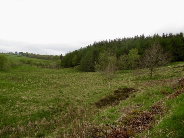
Woodheads Strips is a picturesque area located in Berwickshire, a historic county in the Scottish Borders region of Scotland. Situated amidst the natural beauty of the region, Woodheads Strips is a dense forested area that offers breathtaking views and a serene environment for nature enthusiasts and hikers.

Covering an expansive area, Woodheads Strips is home to a diverse range of trees, including oak, birch, and pine. The forest is known for its dense vegetation, creating a unique ecosystem that supports a wide variety of wildlife. Visitors to Woodheads Strips may encounter native species such as red squirrels, roe deer, and a plethora of bird species.

The forest is crisscrossed with numerous well-maintained walking trails and paths that allow visitors to explore the area at their own pace. These trails cater to both casual walkers and more experienced hikers, offering a range of difficulty levels. Along the trails, visitors can enjoy the tranquility of the forest, breathe in the fresh air, and immerse themselves in the beauty of the surroundings.

Woodheads Strips also boasts a rich history, with evidence of human settlement dating back centuries. The forest has remnants of ancient structures, including stone circles and burial sites, providing a glimpse into the area's past.

Overall, Woodheads Strips in Berwickshire is a haven for nature lovers, offering a chance to escape the hustle and bustle of everyday life and immerse oneself in the beauty of the Scottish woodlands.

If you have any feedback on the listing, please let us know in the comments section below.

Woodheads Strips Images

Images are sourced within 2km of 55.698636/-2.7559067 or Grid Reference NT5245. Thanks to Geograph Open Source API. All images are credited.

Along the Lauder Burn View from near Thriepmuir Bridge.
Along the Lauder Burn
View from near Thriepmuir Bridge.
Road near Nether Blainslie - slippier than it looks
Upper Blainslie Cottages And grass field, with dry-stone wall.
Upper Blainslie Cottages
And grass field, with dry-stone wall.
The Stell at Upper Blainslie A house by the farm cottages. Seen across a grass field and dry-stone wall.
The Stell at Upper Blainslie
A house by the farm cottages. Seen across a grass field and dry-stone wall.
Field track at Upper Blainslie A grass field, with drystone wall and track alongside.
Field track at Upper Blainslie
A grass field, with drystone wall and track alongside.
Enclosed track descending to Lauder Barns and the A68 Looking north-eastward.
Enclosed track descending to Lauder Barns and the A68
Looking north-eastward.
The stubble remains of a harvested field near Lauder Barns Looking north-westward.
The stubble remains of a harvested field near Lauder Barns
Looking north-westward.
The course of Milsie Burn viewed from Milsieburn Bridge Looking north-eastward downstream.
The course of Milsie Burn viewed from Milsieburn Bridge
Looking north-eastward downstream.
Milsieburn Bridge The small burn is a tributary of the Leader Water and is crossed by the walker along the quiet country road between Lauder and Blainslie.
Milsieburn Bridge
The small burn is a tributary of the Leader Water and is crossed by the walker along the quiet country road between Lauder and Blainslie.
Southern Upland Way above Lauder The Way follows a green track towards Chester Hill, with here a view back to newer houses on the SE side of the town.
Southern Upland Way above Lauder
The Way follows a green track towards Chester Hill, with here a view back to newer houses on the SE side of the town.
Southern Upland Way near Chester Hill The Way heads S for Melrose, here skirting the edge of Lauder golf course and passing to the right of the plantation.
Southern Upland Way near Chester Hill
The Way heads S for Melrose, here skirting the edge of Lauder golf course and passing to the right of the plantation.
Southern Upland Way above Lauderdale The path contours past a plantation, not named on the 1:25,000 map. Lauderdale is in the background.
Southern Upland Way above Lauderdale
The path contours past a plantation, not named on the 1:25,000 map. Lauderdale is in the background.
The Lauder Burn below Woodheads Hill The Southern Upland Way turns left past the wall to climb just E of the summit of Woodheads Hill.
The Lauder Burn below Woodheads Hill
The Southern Upland Way turns left past the wall to climb just E of the summit of Woodheads Hill.
Footbridge over the Lauder Burn The red clinging mud is a reminder that there is an area of Old Red Sandstone in this part of Lauderdale. There is similar geology further east around Dunbar and St Abbs, where ploughed fields show the same colour.
Footbridge over the Lauder Burn
The red clinging mud is a reminder that there is an area of Old Red Sandstone in this part of Lauderdale. There is similar geology further east around Dunbar and St Abbs, where ploughed fields show the same colour.
This way to Cuckoo Wood, Lauder Burn Cuckoo Wood is a small plantation on the SE side of Staunchley Hill, signposted here at the footbridge over the burn. The LPN sign refers to Lauderdale Paths Network with an acknowledgement to part-funding by the European Union. A useful guide to footpaths around Lauder can be found at <span class="nowrap"><a title="http://www.scotborders.gov.uk/life/environment/outdooraccess/33455.html" rel="nofollow ugc noopener" href="http://www.scotborders.gov.uk/life/environment/outdooraccess/33455.html">Link</a><img style="margin-left:2px;" alt="External link" title="External link - shift click to open in new window" src="https://s1.geograph.org.uk/img/external.png" width="10" height="10"/></span>
This way to Cuckoo Wood, Lauder Burn
Cuckoo Wood is a small plantation on the SE side of Staunchley Hill, signposted here at the footbridge over the burn. The LPN sign refers to Lauderdale Paths Network with an acknowledgement to part-funding by the European Union. A useful guide to footpaths around Lauder can be found at LinkExternal link
Lauder Common Circular route, Staunchley Hill An old roller in the foreground near the field gate to Lauder Common.
Lauder Common Circular route, Staunchley Hill
An old roller in the foreground near the field gate to Lauder Common.
Power lines crossing Lauder Common Under a 400 kV grid line that exports megawatts to England. There are three pairs of conductors each side with an overhead ground wire on top to help protect the towers and line from lightning damage. Smaller towers on the left carry a 132 kV line.
Power lines crossing Lauder Common
Under a 400 kV grid line that exports megawatts to England. There are three pairs of conductors each side with an overhead ground wire on top to help protect the towers and line from lightning damage. Smaller towers on the left carry a 132 kV line.
Burn draining Lauder Common A burn, unnamed on the 1:25,000 map, that drains eastwards to join the Lauder Burn near the footbridge in NT5145.
Burn draining Lauder Common
A burn, unnamed on the 1:25,000 map, that drains eastwards to join the Lauder Burn near the footbridge in NT5145.
Show me another place!

Woodheads Strips is located at Grid Ref: NT5245 (Lat: 55.698636, Lng: -2.7559067)

Unitary Authority: The Scottish Borders

Police Authority: The Lothians and Scottish Borders

What 3 Words

///mountains.already.funnels. Near Lauder, Scottish Borders

Related Wikis

Lauder Town Hall

Lauder Town Hall is a municipal structure in the Market Place in Lauder, Scottish Borders, Scotland. The structure, which is used as the local registrar...

Lauder

The former Royal Burgh of Lauder (, Scottish Gaelic: Labhdar) is a town in the Scottish Borders in the historic county of Berwickshire. On the Southern...

Thirlestane Castle

Thirlestane Castle is a castle set in extensive parklands near Lauder in the Borders of Scotland. The site is aptly named Castle Hill, as it stands upon...

Lauder railway station

Lauder railway station served the town of Lauder, Berwickshire, Scotland, from 1901 to 1958. It was situated on the Lauder Light Railway. == History... ==

Nearby Amenities

Located within 500m of 55.698636,-2.7559067
Woodheads Hill
Ele: 303
Natural: peak
Lat/Long: 55.6986578/-2.7590942
The data included in this document is from www.openstreetmap.org. The data is made available under ODbL.

Have you been to Woodheads Strips?

Leave your review of Woodheads Strips below (or comments, questions and feedback).