Little Wood

Wood, Forest in Aberdeenshire

Scotland

Little Wood

Trees of Craigs of Logie Seen on a dull, misty, autumnal day, coniferous trees cloak the hill, Craigs of Logie as seen from the edge of farmland close to the Burn of Logie.
Trees of Craigs of Logie Credit: Trevor Littlewood

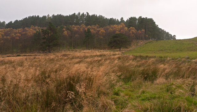
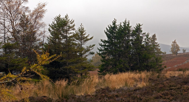
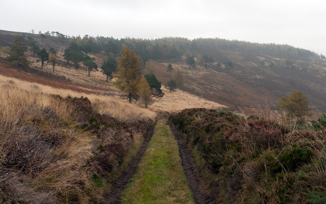
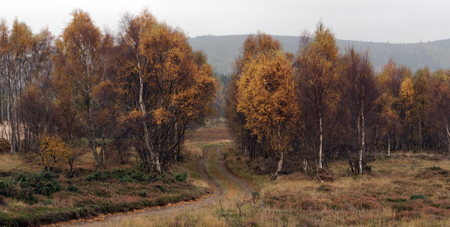
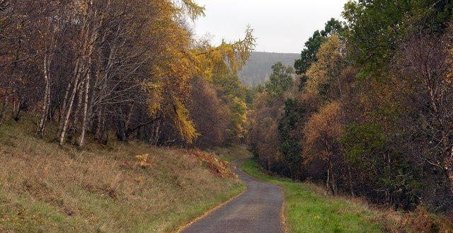
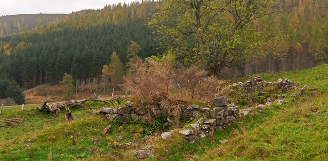
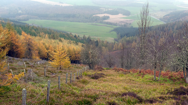
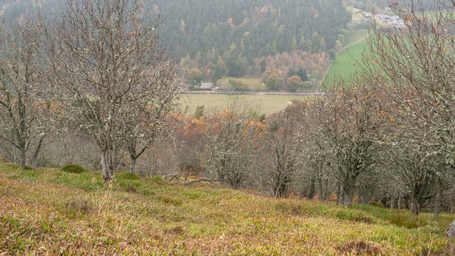
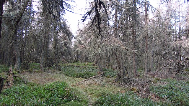
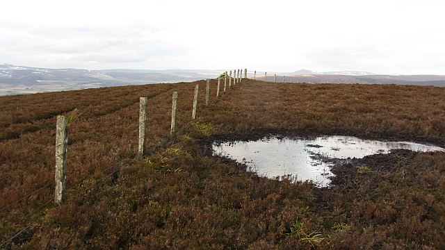
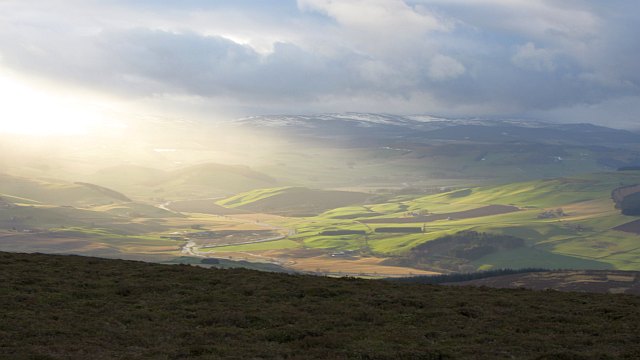
Little Wood is a small forest located in Aberdeenshire, Scotland. It covers an area of approximately 50 acres and is situated near the village of Wood. The forest is known for its diverse range of plant and animal species, making it a popular spot for nature enthusiasts and wildlife photographers.

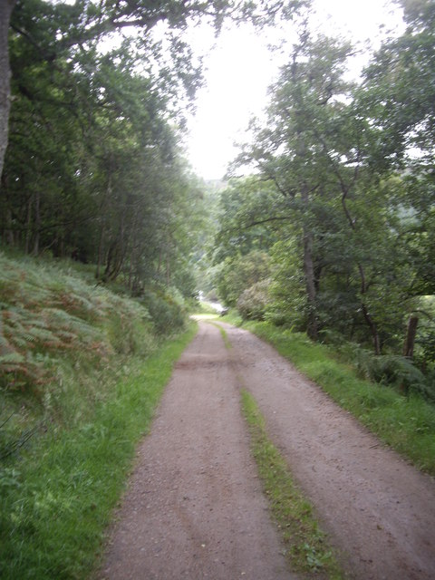
The woodland is primarily composed of native trees such as oak, birch, and Scots pine, which provide a lush and scenic landscape. The dense canopy of the trees creates a shaded environment, perfect for leisurely walks and picnics.

Little Wood is home to a variety of wildlife, including red squirrels, badgers, and numerous bird species. The forest's tranquil ambiance and ample food sources make it an ideal habitat for these creatures. Birdwatchers can spot species like the great spotted woodpecker, tawny owl, and various songbirds.

Visitors to Little Wood can explore the forest through a network of well-maintained footpaths and trails. These paths wind their way through the woodland, offering stunning views and opportunities to spot wildlife. The forest is also equipped with picnic areas and benches, allowing visitors to relax and enjoy the peaceful surroundings.

Little Wood is well-connected to the nearby village of Wood, making it easily accessible to both locals and tourists. Its natural beauty, diverse ecosystem, and tranquil atmosphere make it a must-visit destination for anyone seeking a peaceful retreat into nature in Aberdeenshire.

If you have any feedback on the listing, please let us know in the comments section below.

Little Wood Images

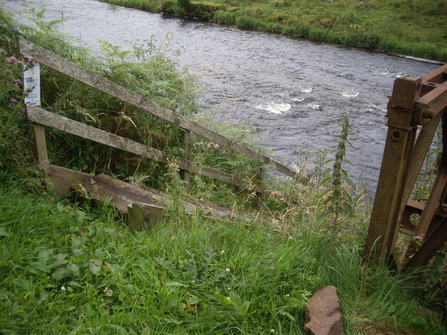
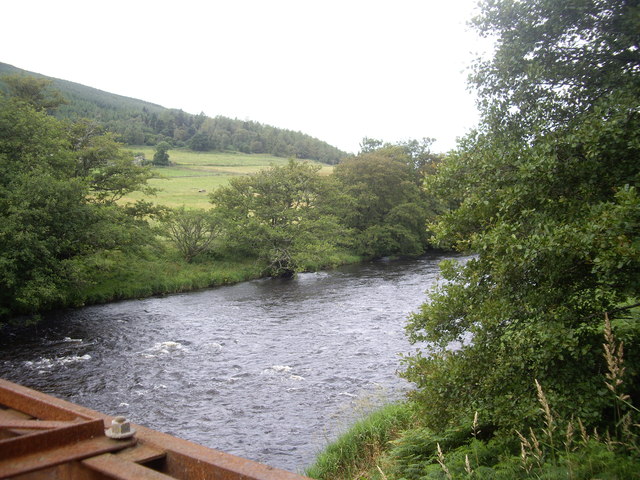
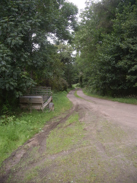
Images are sourced within 2km of 57.247279/-2.8019009 or Grid Reference NJ5117. Thanks to Geograph Open Source API. All images are credited.

Trees of Craigs of Logie Seen on a dull, misty, autumnal day, coniferous trees cloak the hill, Craigs of Logie as seen from the edge of farmland close to the Burn of Logie.
Trees of Craigs of Logie
Seen on a dull, misty, autumnal day, coniferous trees cloak the hill, Craigs of Logie as seen from the edge of farmland close to the Burn of Logie.
Trees with ruined wall on heather moorland South-west of the Marilyn, Lord Arthur's Hill a finger of forest reaches towards a col; photographed on a dismal October day!
Trees with ruined wall on heather moorland
South-west of the Marilyn, Lord Arthur's Hill a finger of forest reaches towards a col; photographed on a dismal October day!
Estate road descending from Lord Arthur's Hill A number of access roads exist on Lord Arthur's Hill; this one is on the south side; the view is eastwards towards Black Hill.
Estate road descending from Lord Arthur's Hill
A number of access roads exist on Lord Arthur's Hill; this one is on the south side; the view is eastwards towards Black Hill.
Estate and farm road approaching group of birch trees The road is on the south side of Lord Arthur's Hill and north of the valley of the River Don. The hills seen dimly in the distance are on the south side of the Don valley.
Estate and farm road approaching group of birch trees
The road is on the south side of Lord Arthur's Hill and north of the valley of the River Don. The hills seen dimly in the distance are on the south side of the Don valley.
Access road for Littlewood Park Littlewood Park is a large house <a title="https://www.geograph.org.uk/photo/649151" href="https://www.geograph.org.uk/photo/649151">Link</a> in a minor valley feeding into the River Don. It's approached from the A944 by the long drive seen here; the house is behind the camera, by some way!
Access road for Littlewood Park
Littlewood Park is a large house Link in a minor valley feeding into the River Don. It's approached from the A944 by the long drive seen here; the house is behind the camera, by some way!
Ruined building in field south of Bithnie On the lower eastern slopes of Coiliochbhar Hill, below the forestry there, is this ruin, one of at least two; no name can be found on OS maps.
Ruined building in field south of Bithnie
On the lower eastern slopes of Coiliochbhar Hill, below the forestry there, is this ruin, one of at least two; no name can be found on OS maps.
Forest edge on east side of Coiliochbhar Hill Plantation trees are to the left of the fence, those to the right are presumably regenerating naturally. The valley of the River Don lies below.
Forest edge on east side of Coiliochbhar Hill
Plantation trees are to the left of the fence, those to the right are presumably regenerating naturally. The valley of the River Don lies below.
Woodland on the north side of Coiliochbhar Hill The woodland on the north side of Coiliochbhar Hill is largely deciduous and open. OS mapping at the location of the recording of this image suggests no tree cover and it's possible that the short specimens seen here are the result of natural regeneration. There's evidence on the ground that this is an old wooded area - the low level vegetation is greater woodrush.
The valley below is that of the River Don, the river flowing unseen at the foot of the trees.
Woodland on the north side of Coiliochbhar Hill
The woodland on the north side of Coiliochbhar Hill is largely deciduous and open. OS mapping at the location of the recording of this image suggests no tree cover and it's possible that the short specimens seen here are the result of natural regeneration. There's evidence on the ground that this is an old wooded area - the low level vegetation is greater woodrush. The valley below is that of the River Don, the river flowing unseen at the foot of the trees.
Track from Bithnie Bridge to A97
Bithnie Bridge Over the River Don near Littlewood Park.
Bithnie Bridge
Over the River Don near Littlewood Park.
Downstream River Don From Bithnie Bridge.
Downstream River Don
From Bithnie Bridge.
Gated-track to Bithnie farm Crossing the Don, via a bridge with a lockable gate.
Gated-track to Bithnie farm
Crossing the Don, via a bridge with a lockable gate.
Fishermen's steps to the River Don On the downstream side of Bithnie Bridge.
Fishermen's steps to the River Don
On the downstream side of Bithnie Bridge.
Upstream River Don From Bithnie Bridge.
Upstream River Don
From Bithnie Bridge.
A farm trailer Parked by Bithnie Bridge.
A farm trailer
Parked by Bithnie Bridge.
Larch wood, Coiliochbhar Hill An old plantation with a somewhat scary appearance. On the ground, it is a lovely place.
Larch wood, Coiliochbhar Hill
An old plantation with a somewhat scary appearance. On the ground, it is a lovely place.
Summit, Coiliochbhar Hill Cairn and fence just outside the wood.
Summit, Coiliochbhar Hill
Cairn and fence just outside the wood.
Winter sunshine View up Strathdon from the summit of  Coiliochbhar Hill.
Winter sunshine
View up Strathdon from the summit of Coiliochbhar Hill.
Show me another place!

Little Wood is located at Grid Ref: NJ5117 (Lat: 57.247279, Lng: -2.8019009)

Unitary Authority: Aberdeenshire

Police Authority: North East

What 3 Words

///bordering.dash.goats. Near Alford, Aberdeenshire

Nearby Locations

Little Wood

Related Wikis

Brux Castle

Brux Castle was a castle of the Forbeses, about 1.5 miles (2.4 km) east of Kildrummy, Aberdeenshire, Scotland, south of the river Don. The castle was...

Marr, Scotland

Marr (Scottish Gaelic: Màrr) is one of six committee areas in Aberdeenshire, Scotland. It has a population of 34,038 (2001 Census). Someone from Marr...

Asloun Castle

Asloun Castle is a castle, formerly Z-plan, dating from the 16th century, 2 miles (3.2 km) south-west of Alford, in Aberdeenshire, Scotland, of which only...

Terpersie Castle

Terpersie Castle (originally built as Dalpersie House) is a 16th-century tower house in Tullynessle, Aberdeenshire, Scotland, located 5 kilometres (3...

Nearby Amenities

Located within 500m of 57.247279,-2.8019009
Parking
Access: yes
Capacity: 4
Fee: yes
Parking: lane
Payment None: yes
Surface: asphalt
Lat/Long: 57.2487257/-2.8048415
Power: pole
Lat/Long: 57.2433338/-2.8057338
Power: pole
Lat/Long: 57.2440338/-2.8063607
Power: pole
Lat/Long: 57.2445828/-2.807687
Power: pole
Lat/Long: 57.2450338/-2.8087524
The data included in this document is from www.openstreetmap.org. The data is made available under ODbL.

Have you been to Little Wood?

Leave your review of Little Wood below (or comments, questions and feedback).