Cellan

Settlement in Cardiganshire

Wales

Cellan

Ordnance Survey Cut Mark This OS cut mark can be found on the porch of All Saints Church. It marks a point 135.740m above mean sea level.
Ordnance Survey Cut Mark Credit: Adrian Dust

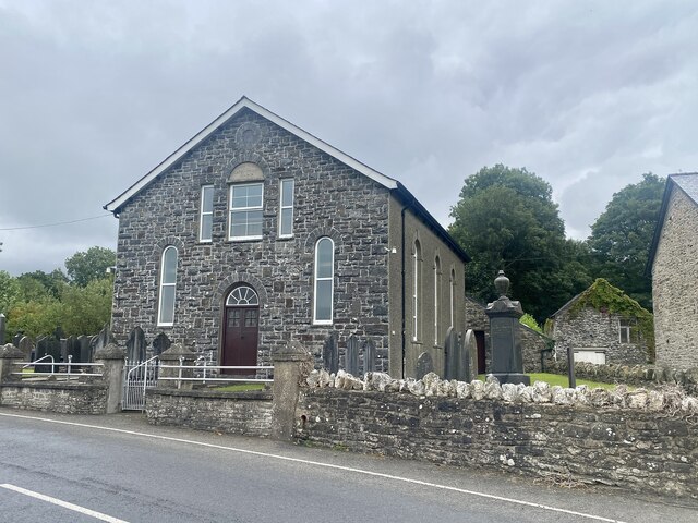
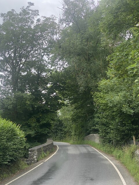
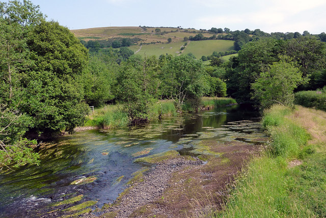
Cellan is a small village located in the county of Cardiganshire, Wales. Situated approximately 4 miles southeast of Aberystwyth, it lies on the eastern bank of the river Teifi. The village is nestled amidst the picturesque Welsh countryside, surrounded by rolling hills and farmland.

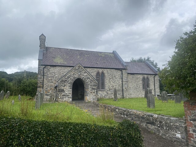
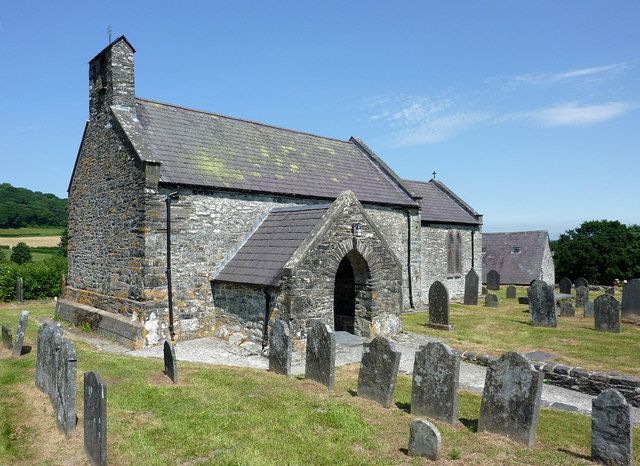
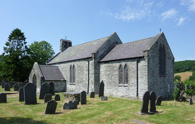
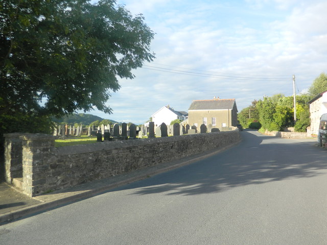
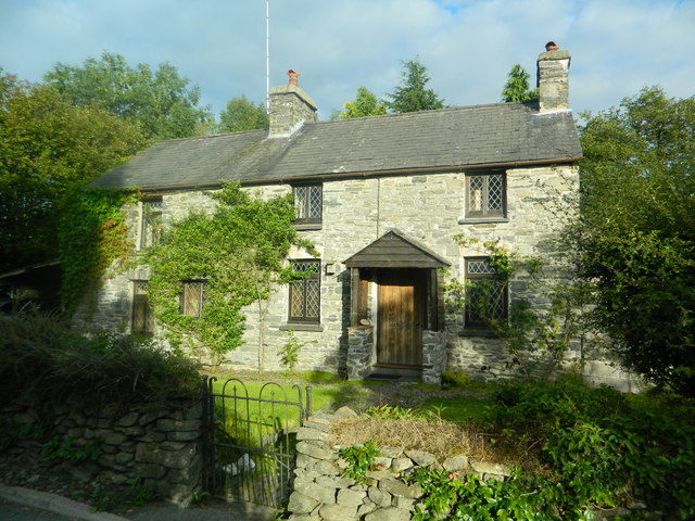
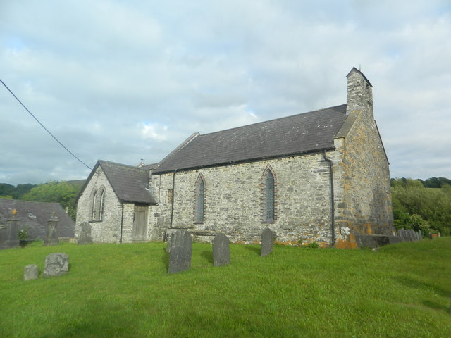
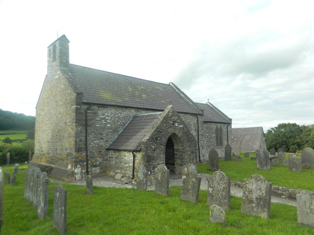
With a population of around 500 residents, Cellan is a close-knit community that exudes a peaceful and welcoming atmosphere. The village boasts a rich history that dates back centuries, evident in its traditional stone buildings and historic landmarks. Notable points of interest include St. Padarn's Church, a 13th-century structure renowned for its beautiful architecture and stained glass windows.

Although small in size, Cellan offers a range of amenities to its residents. These include a local primary school, a community hall, and a quaint village pub where locals gather to socialize. The village also benefits from excellent transport links, with regular bus services connecting it to nearby towns and cities.

Nature enthusiasts are drawn to Cellan for its scenic beauty and opportunities for outdoor activities. The surrounding countryside offers ample hiking and walking trails, allowing visitors to explore the stunning Welsh landscape. Additionally, the river Teifi is popular among anglers, attracting fishing enthusiasts from far and wide.

In conclusion, Cellan is a charming village that harmoniously blends history, community spirit, and natural beauty. Its idyllic location and range of amenities make it an attractive place to live for those seeking a tranquil and picturesque lifestyle.

If you have any feedback on the listing, please let us know in the comments section below.
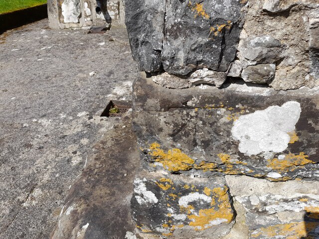
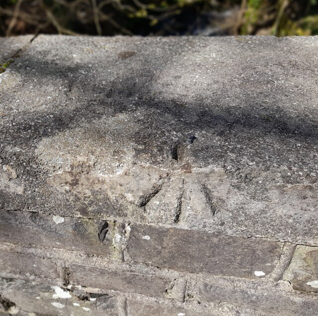
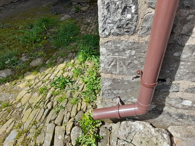
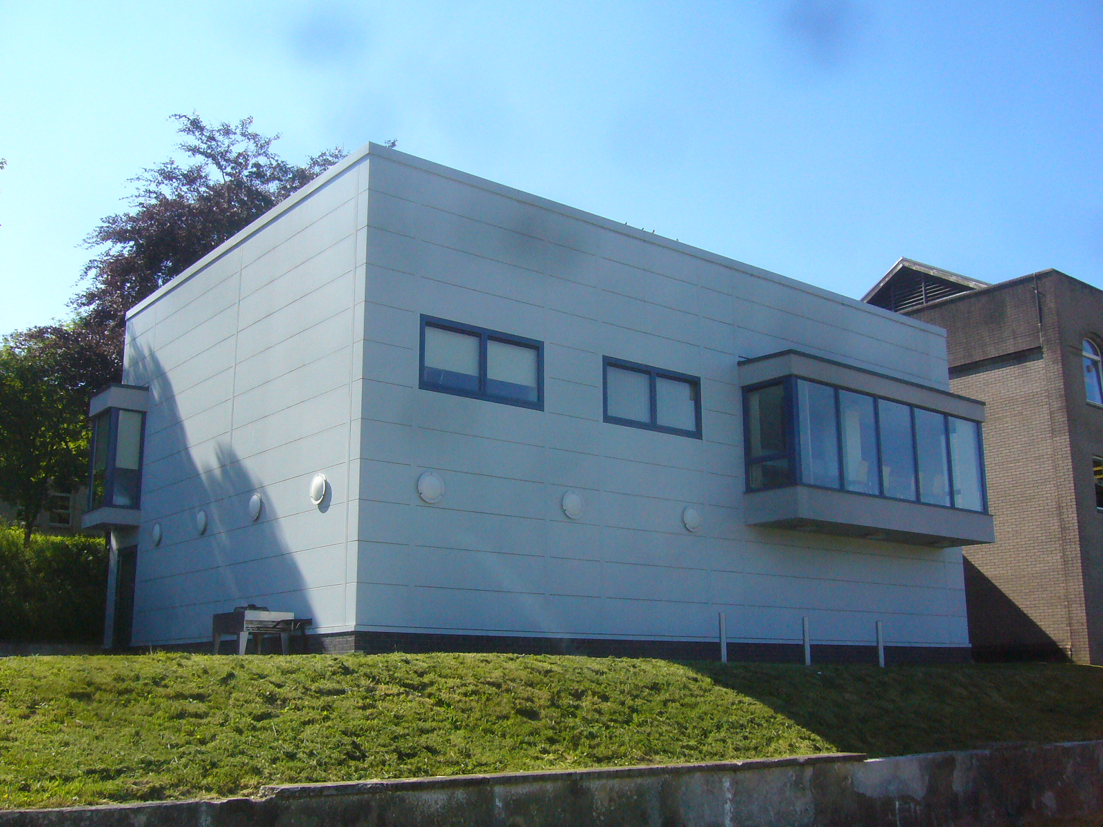
Cellan Images

Images are sourced within 2km of 52.120741/-4.03785 or Grid Reference SN6048. Thanks to Geograph Open Source API. All images are credited.

Ordnance Survey Cut Mark This OS cut mark can be found on the porch of All Saints Church. It marks a point 135.740m above mean sea level.
Ordnance Survey Cut Mark
This OS cut mark can be found on the porch of All Saints Church. It marks a point 135.740m above mean sea level.
Ordnance Survey Rivet This OS rivet can be found on the east parapet of the bridge. It marks a point 148.215m above mean sea level.
Ordnance Survey Rivet
This OS rivet can be found on the east parapet of the bridge. It marks a point 148.215m above mean sea level.
Ordnance Survey Cut Mark This OS cut mark can be found on Ty-pentrefelin. It marks a point 154.561m above mean sea level.
Ordnance Survey Cut Mark
This OS cut mark can be found on Ty-pentrefelin. It marks a point 154.561m above mean sea level.
Ordnance Survey Rivet This OS rivet can be found on the NW parapet of the bridge. It marks a point 135.792m above mean sea level.
Ordnance Survey Rivet
This OS rivet can be found on the NW parapet of the bridge. It marks a point 135.792m above mean sea level.
Ordnance Survey Cut Mark This OS cut mark can be found on Chapel House. It marks a point 138.401m above mean sea level.
Ordnance Survey Cut Mark
This OS cut mark can be found on Chapel House. It marks a point 138.401m above mean sea level.
Capel yr Erw Independent Welsh Chapel, built in 1811, rebuilt in 1863 and renewed in 1933
Capel yr Erw
Independent Welsh Chapel, built in 1811, rebuilt in 1863 and renewed in 1933
Pont Faen Bridge over Ffrwd Cynon.
Pont Faen
Bridge over Ffrwd Cynon.
All Saints Church, Cellan
Entrance to Llysybarcud
Church of All Saints at Cellan, Ceredigion The church of All Saints, erected in 1668, is a building of stone, in the Gothic style.......restored in 1865, and affords 90 sittings. (from Genuki <span class="nowrap"><a title="http://www.genuki.org.uk/big/wal/CGN/Cellan/Kellys1910.html" rel="nofollow ugc noopener" href="http://www.genuki.org.uk/big/wal/CGN/Cellan/Kellys1910.html">Link</a><img style="margin-left:2px;" alt="External link" title="External link - shift click to open in new window" src="https://s1.geograph.org.uk/img/external.png" width="10" height="10"/></span> )
Church of All Saints at Cellan, Ceredigion
The church of All Saints, erected in 1668, is a building of stone, in the Gothic style.......restored in 1865, and affords 90 sittings. (from Genuki LinkExternal link )
The Afon Teifi near Cellan, Ceredigion This is the Afon Teifi looking south-east from the footbridge. Very little rain has fallen for the last few weeks.
The Afon Teifi near Cellan, Ceredigion
This is the Afon Teifi looking south-east from the footbridge. Very little rain has fallen for the last few weeks.
Capel-yr-Erw, Cellan Welsh Independent (i.e. Congregationalist)
Capel-yr-Erw, Cellan
Welsh Independent (i.e. Congregationalist)
Capel-yr-Erw, Cellan
Capel Caeronnen & its burial ground, Cellan
Cottage in Cellan
Cottage in Cellan
Church of All Saints, Cellan
Show me another place!

Cellan is located at Grid Ref: SN6048 (Lat: 52.120741, Lng: -4.03785)

Unitary Authority: Ceredigion

Police Authority: Dyfed Powys

What 3 Words

///computers.appendix.fortunes. Near Lampeter, Ceredigion

Nearby Locations

Cellan

Related Wikis

Pentrefelin, Ceredigion

Pentrefelin, Ceredigion is a hamlet in the community of Llanfair Clydogau, Ceredigion, Wales, which is 57.3 miles (92.3 km) from Cardiff and 171.9 miles...

Lampeter railway station

Lampeter railway station, on the Carmarthen to Aberystwyth Line in Wales, was built to serve the town of Lampeter. It opened in 1866, six years after the...

A482 road

The A482 road is in Ceredigion and Carmarthenshire, Wales. It links Aberaeron at the junction with the A487 road with the A40 road at Llanwrda near Llandovery...

A485 road

The A485 is an A road linking Tanerdy near Carmarthen to Llanfarian near Aberystwyth in Wales. Settlements along the route include: Tanerdy Peniel Rhydargaeau...

Derry Ormond railway station

Derry Ormond railway station served the hamlet and rural locale of Betws Bledrws near Llangybi, as well as the mansion and estate of Derry Ormond (demolished...

University of Wales, Lampeter

University of Wales, Lampeter (Welsh: Prifysgol Cymru, Llanbedr Pont Steffan) was a university in Lampeter, Wales. Founded in 1822, and incorporated by...

Lampeter Castle

Lampeter Castle (Welsh: Castell Llanbedr), sometimes known as Stephen's Castle, was built during the Norman expansion into Wales at the end of the eleventh...

Roderic Bowen Library and Archive

The Roderic Bowen Library and Archives (or RBLA), housing university archives and special collections, is located inside the library building of the University...

Nearby Amenities

Located within 500m of 52.120741,-4.03785
Source: npe
Lat/Long: 52.1222845/-4.0445721
Cellan
Is In: Ceredigion, Wales, UK
Place: village
Source: NPE
Wikidata: Q13126981
Lat/Long: 52.1208289/-4.0381519
Power: pole
Lat/Long: 52.1169123/-4.0386826
Power: pole
Lat/Long: 52.1181179/-4.0372932
Power: pole
Lat/Long: 52.1200843/-4.0351367
Power: pole
Lat/Long: 52.1211679/-4.0338975
Power: pole
Lat/Long: 52.1219486/-4.0328246
Cellan War Memorial
Description: Two-stepped paved base surmounted by a square plinth and obelisk. Inscriptions on two sides of obelisk.
Historic: memorial
Memorial: war_memorial
Memorial Conflict: WW1;WW2
Url: https://www.iwm.org.uk/memorials/item/memorial/36642
Lat/Long: 52.1206749/-4.0380012
Power: pole
Lat/Long: 52.1178758/-4.0322399
Power: pole
Lat/Long: 52.1175431/-4.0332082
Power: pole
Lat/Long: 52.1170391/-4.0347505
Power: pole
Lat/Long: 52.1166669/-4.0358368
Power: pole
Lat/Long: 52.1162798/-4.0370411
Public Bookcase
Booth: K6
Disused Amenity: telephone
Man Made: telephone_box
Public Bookcase Type: phone_box
Lat/Long: 52.1208594/-4.0388953
Post Box
Post Box Type: lamp
Lat/Long: 52.1208512/-4.0388336
Direction: 215
Generator Method: photovoltaic
Generator Output Electricity: yes
Generator Solar Modules: 16
Generator Source: solar
Generator Type: solar_photovoltaic_panel
Location: roof
Power: generator
Lat/Long: 52.1188277/-4.0430895
Bus Stop
Bus: yes
Public Transport: platform
Lat/Long: 52.1205839/-4.0377965
The data included in this document is from www.openstreetmap.org. The data is made available under ODbL.

Have you been to Cellan?

Leave your review of Cellan below (or comments, questions and feedback).