Ceiswyn

Settlement in Merionethshire

Wales

Ceiswyn

Hen gapel, Cwm Ratgoed The old Ratgoed Methodist chapel, long roofless, but a little tidied up (as is the whole valley) of late. An artist added stained glass to the small windows above the door and on the day of my visit, Christmas Eve, a couple were decking it out for a community get-together that evening, with carols and festive food and drink.
Hen gapel, Cwm Ratgoed Credit: Mike Parker

The requested URL returned error: 429 Too Many Requests

If you have any feedback on the listing, please let us know in the comments section below.

Ceiswyn Images

Images are sourced within 2km of 52.69706/-3.808725 or Grid Reference SH7712. Thanks to Geograph Open Source API. All images are credited.

Hen gapel, Cwm Ratgoed The old Ratgoed Methodist chapel, long roofless, but a little tidied up (as is the whole valley) of late. An artist added stained glass to the small windows above the door and on the day of my visit, Christmas Eve, a couple were decking it out for a community get-together that evening, with carols and festive food and drink.
Hen gapel, Cwm Ratgoed
The old Ratgoed Methodist chapel, long roofless, but a little tidied up (as is the whole valley) of late. An artist added stained glass to the small windows above the door and on the day of my visit, Christmas Eve, a couple were decking it out for a community get-together that evening, with carols and festive food and drink.
Dolgoed The footpath goes past Dolgoed, a beautiful C17 farm house at the top of Cwm Ratgoed.
Dolgoed
The footpath goes past Dolgoed, a beautiful C17 farm house at the top of Cwm Ratgoed.
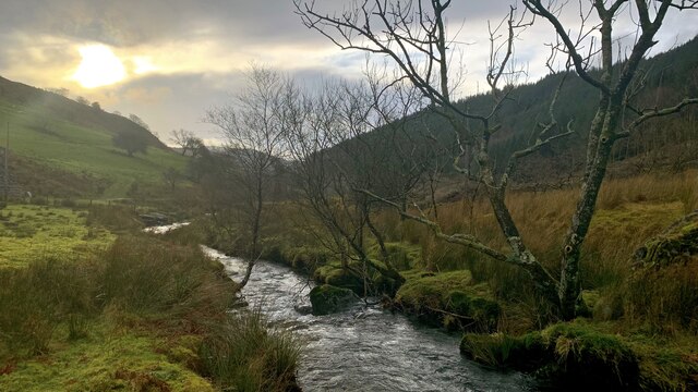
Nant Ceiswyn The view along the river, Nant Ceiswyn, that runs the length of the old slate quarrying valley of Cwm Ratgoed.
Nant Ceiswyn
The view along the river, Nant Ceiswyn, that runs the length of the old slate quarrying valley of Cwm Ratgoed.
Crach Fynydd View across the head of the Afon Llefenni valley towards Crach Fynydd.
Crach Fynydd
View across the head of the Afon Llefenni valley towards Crach Fynydd.
Waenllefenni Ruined house at Waenllefenni.
Waenllefenni
Ruined house at Waenllefenni.
Fotty-y-waun
Fotty-y-waun
Fron-fraith
Fron-fraith
Crach Fynydd Road through the forest at Crach Fynydd.
Crach Fynydd
Road through the forest at Crach Fynydd.
Turning point on the road For those who don't wish to travel further. Marked as a track on the OS maps, it is a decent surfaced road that continues on the right, although with very few passing places, and with gates to open. The track on the left doubles back to Fron-fraith dwelling.
Turning point on the road
For those who don't wish to travel further. Marked as a track on the OS maps, it is a decent surfaced road that continues on the right, although with very few passing places, and with gates to open. The track on the left doubles back to Fron-fraith dwelling.
The remains of Waunllefenni farmstead Still with a roof of sorts, but essentially derelict. The odd outbuilding may still be used.
The road can just be seen snaking up the hill behind.
The remains of Waunllefenni farmstead
Still with a roof of sorts, but essentially derelict. The odd outbuilding may still be used. The road can just be seen snaking up the hill behind.
Old slate tip above Waunllefenni One of several small tips high up.
Old slate tip above Waunllefenni
One of several small tips high up.
Mynydd Ceiswyn Cerddwyr yn mynd i lawr o Fynydd Cesiwyn. Yn y pellter mae Cader Idris.

Walkers descending Mynydd Ceiswyn. Cader Idris can be seen in the distance.
Mynydd Ceiswyn
Cerddwyr yn mynd i lawr o Fynydd Cesiwyn. Yn y pellter mae Cader Idris. Walkers descending Mynydd Ceiswyn. Cader Idris can be seen in the distance.
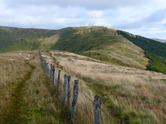
Mynydd Ceiswyn Cerddwyr yn dilyn cefnen o'r enw Mynydd Ceiswyn.

Walkers following a ridge known as Mynydd Ceiswyn.
Mynydd Ceiswyn
Cerddwyr yn dilyn cefnen o'r enw Mynydd Ceiswyn. Walkers following a ridge known as Mynydd Ceiswyn.
Clear Felled Area Above the valley of Nant Ceiswyn
Clear Felled Area
Above the valley of Nant Ceiswyn
Log Pile One of many by the track
Log Pile
One of many by the track
Footbridge over Nant Ceiswyn Small trout were darting up and down the stream
Footbridge over Nant Ceiswyn
Small trout were darting up and down the stream
Ffynnon Badarn Cottage by Nant Ceiswyn
Ffynnon Badarn
Cottage by Nant Ceiswyn
Small Fall, Cwm Ratgoed Marked on the map seen from the forest track
Small Fall, Cwm Ratgoed
Marked on the map seen from the forest track
Show me another place!

Ceiswyn is located at Grid Ref: SH7712 (Lat: 52.69706, Lng: -3.808725)

Unitary Authority: Gwynedd

Police Authority: North Wales

What 3 Words

///shook.revived.evaporate. Near Corris, Gwynedd

Nearby Locations

Ceiswyn

Related Wikis

Ratgoed quarry

Ratgoed quarry (also known as Alltgoed quarry) was the northernmost of the slate quarries served by the Corris Railway. It is one mile north of Aberllefenni...

Yellow Aster Mine

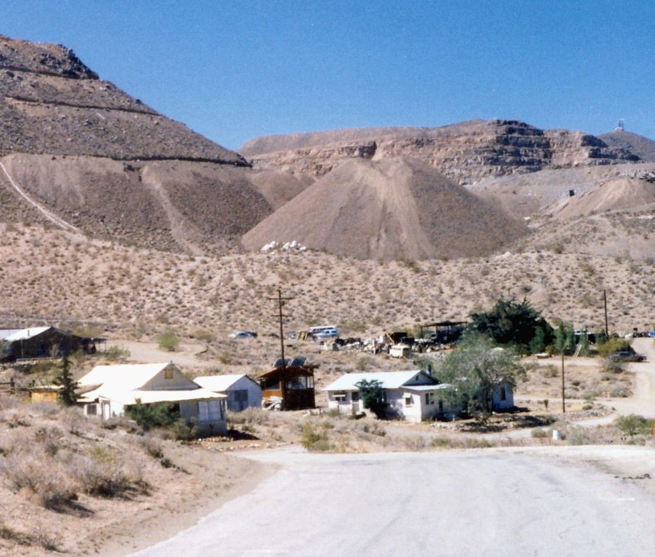
Yellow Aster Mine was a large gold mine in Southern California. == Discovery == In 1894, prospectors Frederic Mooers and William Langdon ventured into...

Cymerau quarry

Cymerau quarry was a slate quarry served by the Ratgoed Tramway, a horse-worked section of the Corris Railway. It is located about half a mile north of...

Mynydd Ceiswyn

Mynydd Ceiswyn is a mountain in Wales. It is the peak south of Waun-oer in the Dyfi Hills. On the east side of the mountain is the valley of the Nant Ceiswyn...

Have you been to Ceiswyn?

Leave your review of Ceiswyn below (or comments, questions and feedback).