Cefn-y-coed

Settlement in Montgomeryshire

Wales

Cefn-y-coed

Castell y Gwynt Now a converted farmhouse complete with pond and summerhouse.
Castell y Gwynt Credit: Jeremy Bolwell

The requested URL returned error: 429 Too Many Requests

If you have any feedback on the listing, please let us know in the comments section below.
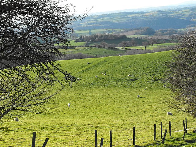
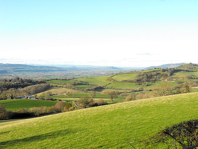
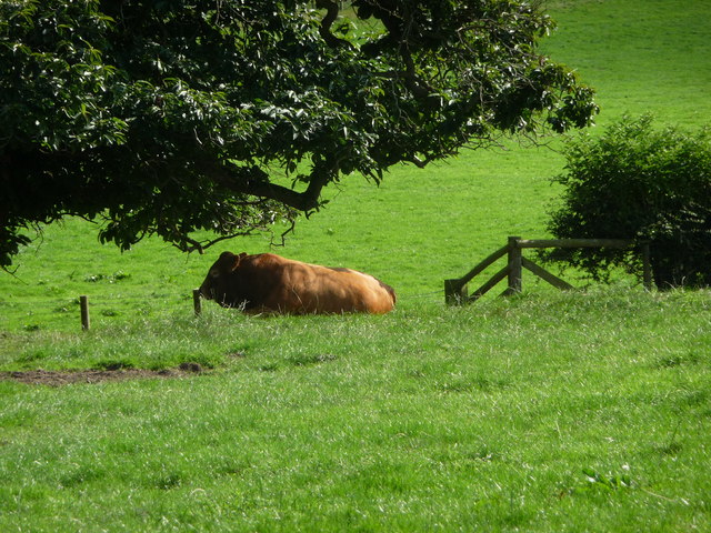
Cefn-y-coed Images

Images are sourced within 2km of 52.534848/-3.174986 or Grid Reference SO2093. Thanks to Geograph Open Source API. All images are credited.

Castell y Gwynt Now a converted farmhouse complete with pond and summerhouse.
Castell y Gwynt
Now a converted farmhouse complete with pond and summerhouse.
View NW from Cefn y Coed near White Hall Farm The NW corner of this grid square is in the woodland below. Beyond in the middle distance, right of centre is Henfron in <a href="https://www.geograph.org.uk/gridref/SO1896">SO1896</a> about 3km away, seen here <a title="https://www.geograph.org.uk/photo/2866026" href="https://www.geograph.org.uk/photo/2866026">Link</a> from Llandyssil bridge. The mound crowned with two oaks in that other shot is also visible in this photo, down to the left.
I'm not sure what that structure is in the foreground - more investigation required as it hasn't made it to the maps yet.
View NW from Cefn y Coed near White Hall Farm
The NW corner of this grid square is in the woodland below. Beyond in the middle distance, right of centre is Henfron in SO1896 about 3km away, seen here Link from Llandyssil bridge. The mound crowned with two oaks in that other shot is also visible in this photo, down to the left. I'm not sure what that structure is in the foreground - more investigation required as it hasn't made it to the maps yet.
View NNW from Cefn y Coed near White Hall Farm Llandyssil lies out of sight in the dip beyond the steep wooded bank.
The Berwyns on the horizon.
View NNW from Cefn y Coed near White Hall Farm
Llandyssil lies out of sight in the dip beyond the steep wooded bank. The Berwyns on the horizon.
Small quarry on Cefn y Coed near White Hall Farm It seems to have been used as a silage store over the winter.
Small quarry on Cefn y Coed near White Hall Farm
It seems to have been used as a silage store over the winter.
Pasture on Cefn y Coed Ewes and lambs on rolling pasture.
Pasture on Cefn y Coed
Ewes and lambs on rolling pasture.
View towards Montgomery from Cefn y Coed The hilltop left of centre in the middle distance with two close groups of trees is Town Hill <a href="https://www.geograph.org.uk/gridref/SO2195">SO2195</a> (2.4km away). The trees frame the Montgomery war memorial which is barely visible against the sky. Montgomery lies in the valley on the far side of the hill.
The larger group of trees on the further hill top is Beacon Ring <a href="https://www.geograph.org.uk/gridref/SJ2605">SJ2605</a> (13.5km away). The trees, when viewed from the air, show the Royal monogram EIIR and were planted in 1953 to mark the coronation. They are due to be felled soon.
For a closer view of the two hilltops see <a title="https://www.geograph.org.uk/photo/2868200" href="https://www.geograph.org.uk/photo/2868200">Link</a>.
View towards Montgomery from Cefn y Coed
The hilltop left of centre in the middle distance with two close groups of trees is Town Hill SO2195 (2.4km away). The trees frame the Montgomery war memorial which is barely visible against the sky. Montgomery lies in the valley on the far side of the hill. The larger group of trees on the further hill top is Beacon Ring SJ2605 (13.5km away). The trees, when viewed from the air, show the Royal monogram EIIR and were planted in 1953 to mark the coronation. They are due to be felled soon. For a closer view of the two hilltops see Link.
View to Welshpool from Cefn y Coed A view across the Severn valley to Welshpool <a href="https://www.geograph.org.uk/gridref/SJ2207">SJ2207</a> which is framed by two minor pointed hills. On the horizon are the Berwyns.
The hilltop on the right with two close groups of trees is Town Hill. The trees frame the Montgomery war memorial. Montgomery lies in the valley on the far side of the hill. See <a title="https://www.geograph.org.uk/photo/2868200" href="https://www.geograph.org.uk/photo/2868200">Link</a>.
View to Welshpool from Cefn y Coed
A view across the Severn valley to Welshpool SJ2207 which is framed by two minor pointed hills. On the horizon are the Berwyns. The hilltop on the right with two close groups of trees is Town Hill. The trees frame the Montgomery war memorial. Montgomery lies in the valley on the far side of the hill. See Link.
View to Welshpool from Cefn y Coed I have chosen a point around the centre of this shot for the subject position of this photo.
Beyond, across the Severn valley and to the left of Yr Allt <a href="https://www.geograph.org.uk/gridref/SJ2410">SJ2410</a> lies Welshpool <a href="https://www.geograph.org.uk/gridref/SJ2207">SJ2207</a> and its backdrop is the Berwyn Range.
For a wider view see <a title="https://www.geograph.org.uk/photo/2868216" href="https://www.geograph.org.uk/photo/2868216">Link</a>.
View to Welshpool from Cefn y Coed
I have chosen a point around the centre of this shot for the subject position of this photo. Beyond, across the Severn valley and to the left of Yr Allt SJ2410 lies Welshpool SJ2207 and its backdrop is the Berwyn Range. For a wider view see Link.
Part of Fron farm An old timber framed farmhouse and old barns and outbuildings make this a characterful spot.
Part of Fron farm
An old timber framed farmhouse and old barns and outbuildings make this a characterful spot.
View to the Montgomeryshire War Memorial A useful navaigational aid when crossing field paths in the area.
View to the Montgomeryshire War Memorial
A useful navaigational aid when crossing field paths in the area.
Old barns at Cefnllan farm Much patched and full of character.
Old barns at Cefnllan farm
Much patched and full of character.
Pasture at Gwern-yr-ychain farm near Montgomery A dozing bull nods in shade on a hot August afternoon.
Pasture at Gwern-yr-ychain farm near Montgomery
A dozing bull nods in shade on a hot August afternoon.
Caeliber Isaf Early morning bag into wheat field access from Camp Farm then fields. Dry with watery sun.
Name: Caeliber Isaf
Hill number: 2202
Height: 355m / 1165ft
Area: 31B: Welshpool to Hay-on-Wye
Class: Ma
Grid ref: SO 21165 93414
Summit feature: no feature: pasture
Drop: 172m
Col: 183m  SO206908
Caeliber Isaf
Early morning bag into wheat field access from Camp Farm then fields. Dry with watery sun. Name: Caeliber Isaf Hill number: 2202 Height: 355m / 1165ft Area: 31B: Welshpool to Hay-on-Wye Class: Ma Grid ref: SO 21165 93414 Summit feature: no feature: pasture Drop: 172m Col: 183m SO206908
Phone box near Upper Pentre
Minor road to Fron From junction at phone box
Minor road to Fron
From junction at phone box
View E from path on Caeliber Isaf towards A489
The church at Llandyssil St Tyssil's parish and village church.
The church at Llandyssil
St Tyssil's parish and village church.
The war memorial at Llandyssil Lots of Royal Welch Fusiliers listed from WWI. Amongst others.

Their names liveth for evermore.
The war memorial at Llandyssil
Lots of Royal Welch Fusiliers listed from WWI. Amongst others. Their names liveth for evermore.
Show me another place!

Cefn-y-coed is located at Grid Ref: SO2093 (Lat: 52.534848, Lng: -3.174986)

Unitary Authority: Powys

Police Authority: Dyfed Powys

What 3 Words

///pages.soap.ghost. Near Mainstone, Shropshire

Nearby Locations

Cefn-y-coed

Related Wikis

Llandyssil

Llandyssil (Welsh: Llandysul) is a village in the community of Abermule with Llandyssil, in Powys, Wales, in the traditional county of Montgomeryshire...

Montgomeryshire County War Memorial

The Montgomeryshire County War Memorial, located on the summit of Town Hill, south-west of the town of Montgomery, stands tribute to commemorate those...

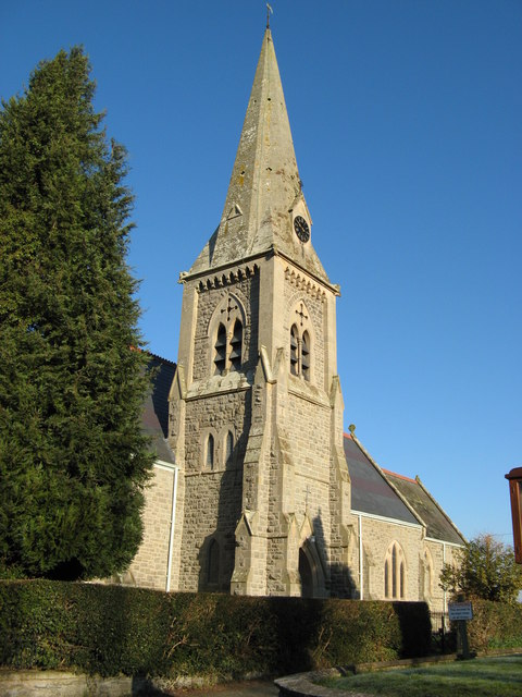
Holy Trinity Church, Sarn

Holy Trinity Church is a Church of England parish church in Sarn, Powys, Wales. It was constructed in 1860 and is one of a small number of churches in...

Sarn, Powys

Sarn is a small village in Powys, Wales. The village lies on the A489 road 6.4 miles (10.3 km) east of Newtown. There is a bus service through the village...

Nearby Amenities

Located within 500m of 52.534848,-3.174986
Barrier: cattle_grid
Lat/Long: 52.538266/-3.1724407
Direction: 235
Generator Method: photovoltaic
Generator Output Electricity: yes
Generator Solar Modules: 8
Generator Source: solar
Generator Type: solar_photovoltaic_panel
Location: roof
Power: generator
Lat/Long: 52.5360879/-3.1820615
Direction: 254
Generator Method: photovoltaic
Generator Output Electricity: yes
Generator Solar Modules: 20
Generator Source: solar
Generator Type: solar_photovoltaic_panel
Location: roof
Power: generator
Lat/Long: 52.531721/-3.1744453
Direction: SE
Generator Method: photovoltaic
Generator Output Electricity: yes
Generator Solar Modules: 14
Generator Source: solar
Generator Type: solar_photovoltaic_panel
Location: roof
Power: generator
Lat/Long: 52.5328125/-3.1747457
The data included in this document is from www.openstreetmap.org. The data is made available under ODbL.

Have you been to Cefn-y-coed?

Leave your review of Cefn-y-coed below (or comments, questions and feedback).