Riddellshiel Moss

Wood, Forest in Roxburghshire

Scotland

Riddellshiel Moss

A horse reflection at Riddell A large pond formed in this horse field after periods of heavy rain. I walked by here two days previously and there was no lying water in the field.
A horse reflection at Riddell Credit: Walter Baxter

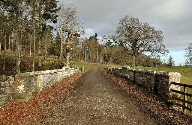
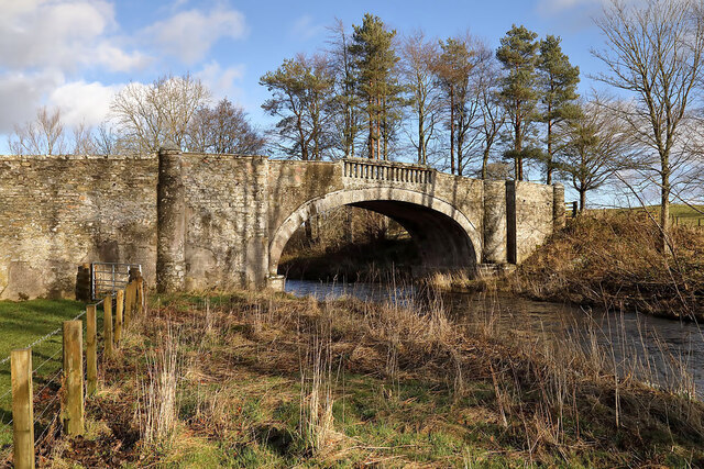
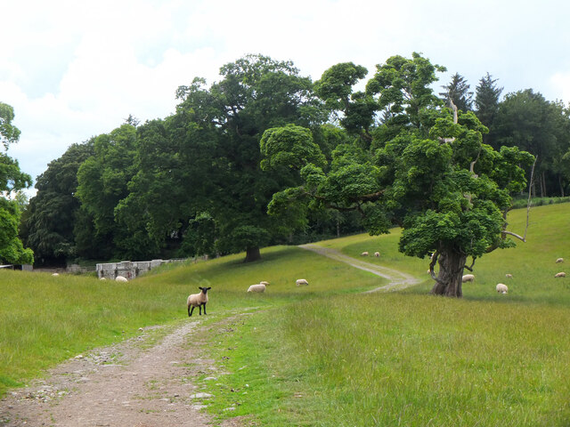
Riddellshiel Moss is a woodland area located in Roxburghshire, Scotland. Covering an extensive area, it is known for its rich biodiversity and scenic beauty. The moss is characterized by a mix of deciduous and coniferous trees, creating a diverse and vibrant ecosystem.

The woodland is home to a wide range of flora and fauna. Oak, birch, beech, and pine trees dominate the landscape, providing shelter and food for various species. The forest floor is adorned with a carpet of mosses, ferns, and wildflowers, adding to the picturesque charm of the area.

Riddellshiel Moss is a haven for wildlife enthusiasts and nature lovers. It is a sanctuary for numerous bird species, including woodpeckers, owls, and songbirds, making it an ideal spot for birdwatching. The forest also provides habitat for mammals such as deer, foxes, badgers, and squirrels, adding to the diverse wildlife population.

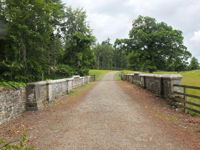
The moss offers an array of recreational activities for visitors. Hiking and walking trails crisscross the woodland, allowing visitors to explore the serene beauty of the forest. There are also designated picnic areas, perfect for enjoying a meal amidst the tranquil surroundings. The moss is a popular destination for nature photography, providing ample opportunities to capture stunning landscapes and wildlife.

Riddellshiel Moss is not only a natural treasure but also plays a vital role in the local ecosystem. It serves as a carbon sink, absorbing carbon dioxide and reducing greenhouse gases. The woodland also helps in maintaining soil health and preventing erosion.

Overall, Riddellshiel Moss in Roxburghshire is a remarkable woodland area, offering a blend of natural beauty, wildlife diversity, and recreational opportunities for visitors to enjoy and appreciate.

If you have any feedback on the listing, please let us know in the comments section below.

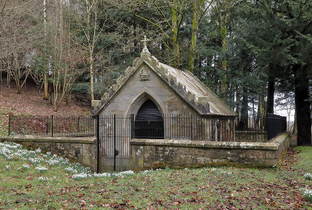
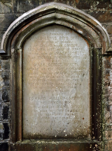
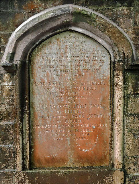
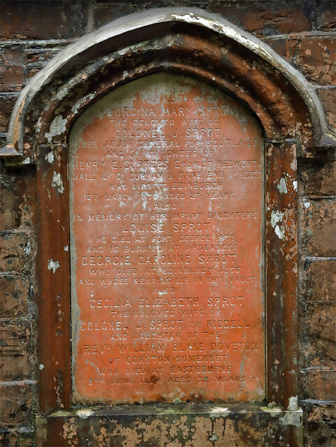
Riddellshiel Moss Images

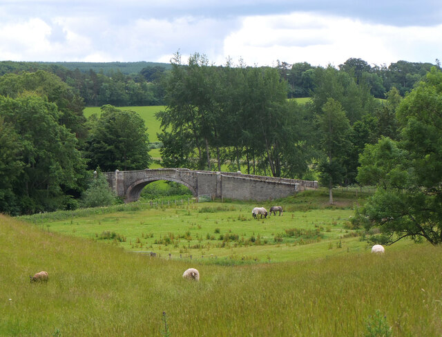
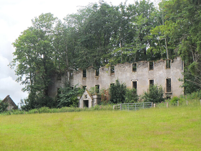
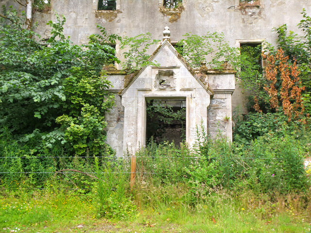
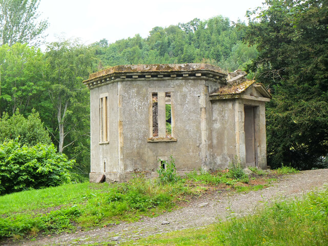
Images are sourced within 2km of 55.517494/-2.7905338 or Grid Reference NT5025. Thanks to Geograph Open Source API. All images are credited.

A horse reflection at Riddell A large pond formed in this horse field after periods of heavy rain. I walked by here two days previously and there was no lying water in the field.
A horse reflection at Riddell
A large pond formed in this horse field after periods of heavy rain. I walked by here two days previously and there was no lying water in the field.
The General’s Tower at Riddell This 25m high observation tower, surrounded by trees, was built in memory of the Sprot family on a medieval motte and bailey in 1885 by A. Herbertson & Son for Major-General John Sprot. An internal vertiginous metal spiral staircase in one corner leads to a caphouse and corbelled parapet walkway. For a long distance autumnal view, see <a href="https://www.geograph.org.uk/photo/2142196">NT5224 : The General's Tower at Riddell</a>.
The General’s Tower at Riddell
This 25m high observation tower, surrounded by trees, was built in memory of the Sprot family on a medieval motte and bailey in 1885 by A. Herbertson & Son for Major-General John Sprot. An internal vertiginous metal spiral staircase in one corner leads to a caphouse and corbelled parapet walkway. For a long distance autumnal view, see NT5224 : The General's Tower at Riddell.
The caphouse on the General’s Tower at Riddell The caphouse and corbelled parapet walkway can be accessed by an internal vertiginous metal spiral staircase. For a wider view of the 25m high tower, see <a href="https://www.geograph.org.uk/photo/7098037">NT5224 : The General’s Tower at Riddell</a>.
The caphouse on the General’s Tower at Riddell
The caphouse and corbelled parapet walkway can be accessed by an internal vertiginous metal spiral staircase. For a wider view of the 25m high tower, see NT5224 : The General’s Tower at Riddell.
A crest above the entrance door to the general’s Tower The crest features a heron, three fish and a boar’s head. The initials J. S. stand for Major-General John Sprot who commissioned the tower. For a view of the tower, see <a href="https://www.geograph.org.uk/photo/7098037">NT5224 : The General’s Tower at Riddell</a>.
A crest above the entrance door to the general’s Tower
The crest features a heron, three fish and a boar’s head. The initials J. S. stand for Major-General John Sprot who commissioned the tower. For a view of the tower, see NT5224 : The General’s Tower at Riddell.
The Sprot family mausoleum This small mortuary chapel surrounded by a locked iron railed enclosure is situated about 80m south of the General’s Tower on the Riddell Estate. Three window tablets are inscribed with details of Sprot family members.
The Sprot family mausoleum
This small mortuary chapel surrounded by a locked iron railed enclosure is situated about 80m south of the General’s Tower on the Riddell Estate. Three window tablets are inscribed with details of Sprot family members.
A window tablet on the Sprot family mausoleum The inscription reads:-

IN
THIS VAULT REST
THE REMAINS OF
JAMES LEWIS BOYD SPROT,
WHO DIED AT SCHOOL
AT EALING NEAR LONDON,
25TH APRIL 1857 AGED 13 YEARS.
THIRD SON OF MARK SPROT,
OF RIDDELL, ROXBURGHSHIRE.
ALSO
MARK GEORGE SPROT,
CAPTAIN OF THE 93RD HIGHLANDERS
SECOND SON ON MARK SPROT,
WHO AFTER A LONG ILLNESS
DEPARTED THIS LIFE AT THE
HOTEL BYRON, LAKE GENEVA
ON 16TH SEPTEMBER 1853
AGED 28 YEARS.
ALSO
EDWARD WILLIAM SPROT,
OF DRYGRANGE
FOURTH SON OF MARK SPROT
WHO DIED AT DRYGRANGE
1ST FEBRUARY 1898
AGED 52 YEARS
AND IS BURIED AT MELROSE.

For a wider view of the mausoleum, see <a href="https://www.geograph.org.uk/photo/7098055">NT5224 : The Sprot family mausoleum</a>.
A window tablet on the Sprot family mausoleum
The inscription reads:- IN THIS VAULT REST THE REMAINS OF JAMES LEWIS BOYD SPROT, WHO DIED AT SCHOOL AT EALING NEAR LONDON, 25TH APRIL 1857 AGED 13 YEARS. THIRD SON OF MARK SPROT, OF RIDDELL, ROXBURGHSHIRE. ALSO MARK GEORGE SPROT, CAPTAIN OF THE 93RD HIGHLANDERS SECOND SON ON MARK SPROT, WHO AFTER A LONG ILLNESS DEPARTED THIS LIFE AT THE HOTEL BYRON, LAKE GENEVA ON 16TH SEPTEMBER 1853 AGED 28 YEARS. ALSO EDWARD WILLIAM SPROT, OF DRYGRANGE FOURTH SON OF MARK SPROT WHO DIED AT DRYGRANGE 1ST FEBRUARY 1898 AGED 52 YEARS AND IS BURIED AT MELROSE. For a wider view of the mausoleum, see NT5224 : The Sprot family mausoleum.
A window tablet on the Sprot family mausoleum The inscription reads:-

IN
THIS VAULT REST
THE REMAINS OF
ELIZABETH,
THE BELOVED WIFE OF MARK SPROT,
RIDDELL, AND ELDEST DAUGHTER OF
JOHN SHEWELL OF CLAPHAM COMMON
WHO DIED SUDDENLY AT EDINBURGH
MUCH REGRETTED 9TH FEBY 1871
AGED 60 YEARS.
ALSO
MARK SPROT ESQR OF RIDDELL
WHO DIED AT EDINBURGH
21ST NOVEMBER 1883,
AGED 82 YEARS.
ALSO
LIEUT. GENERAL JOHN SPROT,
OF RIDDELL,
ELDEST SON OF MARK SPROT,
OF RIDDELL,
LATE 83RD FOOT AND 91ST HIGHLANDERS
WHO DIED AT RIDDELL
19TH MARCH 1907
AGED 77 YEARS.

For a wider view of the mausoleum, see <a href="https://www.geograph.org.uk/photo/7098055">NT5224 : The Sprot family mausoleum</a>.
A window tablet on the Sprot family mausoleum
The inscription reads:- IN THIS VAULT REST THE REMAINS OF ELIZABETH, THE BELOVED WIFE OF MARK SPROT, RIDDELL, AND ELDEST DAUGHTER OF JOHN SHEWELL OF CLAPHAM COMMON WHO DIED SUDDENLY AT EDINBURGH MUCH REGRETTED 9TH FEBY 1871 AGED 60 YEARS. ALSO MARK SPROT ESQR OF RIDDELL WHO DIED AT EDINBURGH 21ST NOVEMBER 1883, AGED 82 YEARS. ALSO LIEUT. GENERAL JOHN SPROT, OF RIDDELL, ELDEST SON OF MARK SPROT, OF RIDDELL, LATE 83RD FOOT AND 91ST HIGHLANDERS WHO DIED AT RIDDELL 19TH MARCH 1907 AGED 77 YEARS. For a wider view of the mausoleum, see NT5224 : The Sprot family mausoleum.
A window tablet on the Sprot family mausoleum The inscription reads:-

IN
THIS VAULT REST
THE REMAINS OF
GEORGINA MARY SPROT,
THE BELOVED WIFE OF 
COLONEL JAMES SPROT,
ASST ADJUT GENERAL FOR SCOTLAND
AND THIRD DAUGHTER OF
HENRY E. SURTEES ESQR OF REDWORTH
HALL & CO DURHAM & DANE END & HERTS
WHO DIED AT EDINBURGH
16TH MARCH 1876 AGED 27 YEARS.
ALSO
IN MEMORY OF HER INFANT DAUGHTERS
LOUISE SPROT,
WHO DIED AT FORT GEORGE 1873
AND IS BURRIED AT ARDERSEER
GEORGIE CAROLINE SPROT,
WHO DIED AT EDINBURGH 1876
AND WHOSE REMAINS LIE IN THIS VAULT
ALSO
CECELIA ELIZABETH SPROT
THE BELOVED WIFE OF
COLONEL J. SPROT OF RIDDELL,
AND DAUGHTER OF THE
REVD. WILLIAM BLAKE DOVETON
OF CORSTON SOMERSET
WHO DIED AT EASTBOURNE
8TH JUNE 1884 AGED 32 YEARS.

For a wider view of the mausoleum, see <a href="https://www.geograph.org.uk/photo/7098055">NT5224 : The Sprot family mausoleum</a>.
A window tablet on the Sprot family mausoleum
The inscription reads:- IN THIS VAULT REST THE REMAINS OF GEORGINA MARY SPROT, THE BELOVED WIFE OF COLONEL JAMES SPROT, ASST ADJUT GENERAL FOR SCOTLAND AND THIRD DAUGHTER OF HENRY E. SURTEES ESQR OF REDWORTH HALL & CO DURHAM & DANE END & HERTS WHO DIED AT EDINBURGH 16TH MARCH 1876 AGED 27 YEARS. ALSO IN MEMORY OF HER INFANT DAUGHTERS LOUISE SPROT, WHO DIED AT FORT GEORGE 1873 AND IS BURRIED AT ARDERSEER GEORGIE CAROLINE SPROT, WHO DIED AT EDINBURGH 1876 AND WHOSE REMAINS LIE IN THIS VAULT ALSO CECELIA ELIZABETH SPROT THE BELOVED WIFE OF COLONEL J. SPROT OF RIDDELL, AND DAUGHTER OF THE REVD. WILLIAM BLAKE DOVETON OF CORSTON SOMERSET WHO DIED AT EASTBOURNE 8TH JUNE 1884 AGED 32 YEARS. For a wider view of the mausoleum, see NT5224 : The Sprot family mausoleum.
A farm road on the Riddell Estate This is Park Bridge which spans a small burn and culvert.
A farm road on the Riddell Estate
This is Park Bridge which spans a small burn and culvert.
Riddell South Bridge The bridge spans the Ale Water on the Riddell Estate. There is a sign at the junction of the estate road to the southeast and the B6400 warning of a maximum weight of two tonnes for this bridge.
Riddell South Bridge
The bridge spans the Ale Water on the Riddell Estate. There is a sign at the junction of the estate road to the southeast and the B6400 warning of a maximum weight of two tonnes for this bridge.
A crest and Celtic cross detail at the Sprot Mausoleum For a view of the mausoleum, see <a href="https://www.geograph.org.uk/photo/7098055">NT5224 : The Sprot family mausoleum</a>.
A crest and Celtic cross detail at the Sprot Mausoleum
For a view of the mausoleum, see NT5224 : The Sprot family mausoleum.
Sheep grazing near Riddell Estate land near the ruined house at Riddell. Left of centre is a stone bridge taking the track over a minor burn.
Sheep grazing near Riddell
Estate land near the ruined house at Riddell. Left of centre is a stone bridge taking the track over a minor burn.
Ale Water bridge at Riddell A handsome single arched stone bridge in the Riddell estate.
Ale Water bridge at Riddell
A handsome single arched stone bridge in the Riddell estate.
Remains of the former Riddell House The gaunt remains of the house, a roofless ruin with substantial tree growth within. The house is on the site of an old peel tower which might date back to the 14th century. The house was extended and changed over the years but burnt down in 1943 to leave this shell standing. Further details can be found on the Canmore website at <span class="nowrap"><a title="https://canmore.org.uk/site/55483/riddell" rel="nofollow ugc noopener" href="https://canmore.org.uk/site/55483/riddell">Link</a><img style="margin-left:2px;" alt="External link" title="External link - shift click to open in new window" src="https://s1.geograph.org.uk/img/external.png" width="10" height="10"/></span>
Remains of the former Riddell House
The gaunt remains of the house, a roofless ruin with substantial tree growth within. The house is on the site of an old peel tower which might date back to the 14th century. The house was extended and changed over the years but burnt down in 1943 to leave this shell standing. Further details can be found on the Canmore website at LinkExternal link
Doorway to the former Riddell House The doorway on the south side of the ruined house, destroyed by fire in 1943. It appears that a plaque or stone above the door has been removed. The ruin is of course fenced off as it is clearly in a potentially dangerous state.

For more details see the Canmore website at <span class="nowrap"><a title="https://canmore.org.uk/site/55483/riddell" rel="nofollow ugc noopener" href="https://canmore.org.uk/site/55483/riddell">Link</a><img style="margin-left:2px;" alt="External link" title="External link - shift click to open in new window" src="https://s1.geograph.org.uk/img/external.png" width="10" height="10"/></span>.
Doorway to the former Riddell House
The doorway on the south side of the ruined house, destroyed by fire in 1943. It appears that a plaque or stone above the door has been removed. The ruin is of course fenced off as it is clearly in a potentially dangerous state. For more details see the Canmore website at LinkExternal link.
Deer Larder, Riddell House According to the Canmore website at <span class="nowrap"><a title="https://canmore.org.uk/site/55483/riddell" rel="nofollow ugc noopener" href="https://canmore.org.uk/site/55483/riddell">Link</a><img style="margin-left:2px;" alt="External link" title="External link - shift click to open in new window" src="https://s1.geograph.org.uk/img/external.png" width="10" height="10"/></span> this outbuilding by the old Riddell House was a deer larder.
Deer Larder, Riddell House
According to the Canmore website at LinkExternal link this outbuilding by the old Riddell House was a deer larder.
Park Bridge, Riddell Estate A bridge taking the track from Lilliesleaf across a tributary of the Ale Water. It is referred to as Park Bridge in the Canmore website entry for Riddell House: <span class="nowrap"><a title="https://canmore.org.uk/site/55483/riddell" rel="nofollow ugc noopener" href="https://canmore.org.uk/site/55483/riddell">Link</a><img style="margin-left:2px;" alt="External link" title="External link - shift click to open in new window" src="https://s1.geograph.org.uk/img/external.png" width="10" height="10"/></span>.
Park Bridge, Riddell Estate
A bridge taking the track from Lilliesleaf across a tributary of the Ale Water. It is referred to as Park Bridge in the Canmore website entry for Riddell House: LinkExternal link.
Estate bridge over the Ale Water, Riddell A closer view of the bridge shown in <a href="https://www.geograph.org.uk/photo/7215637">NT5124 : Ale Water bridge at Riddell</a>. It is subject to a 2-ton weight limit.
Estate bridge over the Ale Water, Riddell
A closer view of the bridge shown in NT5124 : Ale Water bridge at Riddell. It is subject to a 2-ton weight limit.
Show me another place!

Riddellshiel Moss is located at Grid Ref: NT5025 (Lat: 55.517494, Lng: -2.7905338)

Unitary Authority: The Scottish Borders

Police Authority: The Lothians and Scottish Borders

What 3 Words

///brass.hippy.regulator. Near Selkirk, Scottish Borders

Related Wikis

Lothian and Borders

Lothian and Borders is an area in Scotland consisting of the East Lothian, City of Edinburgh, Midlothian, West Lothian council areas (collectively known...

Bowismiln

Bowismiln is a village in the Scottish Borders area of Scotland. == See also == List of places in the Scottish Borders List of places in Scotland ��2...

Lilliesleaf

Lilliesleaf is a small village and civil parish 7 miles (11 km) south east of Selkirk in the Roxburghshire area of Scottish Borders of Scotland. Other...

Selkirk transmitting station

The Selkirk transmitting station is a telecommunications facility located next to Lindean Loch, near Selkirk in the Scottish Borders. It includes a 229...

Nearby Amenities

Located within 500m of 55.517494,-2.7905338
Power: tower
Lat/Long: 55.5183673/-2.7978457
Clerklands
Place: hamlet
Lat/Long: 55.5134349/-2.7879787
Riddellshiel
Place: isolated_dwelling
Lat/Long: 55.5166856/-2.7885228
Power: tower
Lat/Long: 55.5209627/-2.7913438
Power: tower
Lat/Long: 55.5197264/-2.794441
Power: tower
Lat/Long: 55.5162894/-2.7979191
Power: pole
Lat/Long: 55.5136925/-2.7863299
Power: pole
Lat/Long: 55.5134169/-2.7875865
Power: pole
Lat/Long: 55.5131574/-2.7896362
Power: pole
Lat/Long: 55.5136633/-2.7899555
Power: pole
Lat/Long: 55.5141736/-2.7902902
Power: pole
Lat/Long: 55.5145381/-2.7901357
Power: pole
Lat/Long: 55.5154099/-2.7897443
Power: pole
Lat/Long: 55.5162963/-2.7893375
The data included in this document is from www.openstreetmap.org. The data is made available under ODbL.

Have you been to Riddellshiel Moss?

Leave your review of Riddellshiel Moss below (or comments, questions and feedback).