Eldbotle Braes

Wood, Forest in East Lothian

Scotland

Eldbotle Braes

East Lothian Townscape : ELCC Fingerpost at West Fenton Road, Gullane An attractive single-finger ELCC post, unfortunately marked.
East Lothian Townscape : ELCC Fingerpost at West Fenton Road, Gullane Credit: Richard West

Eldbotle Braes is a beautiful woodland area located in East Lothian, Scotland. Situated just a few miles south of the town of Haddington, this enchanting forest is a popular destination for nature lovers and outdoor enthusiasts.

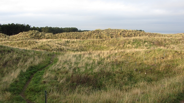
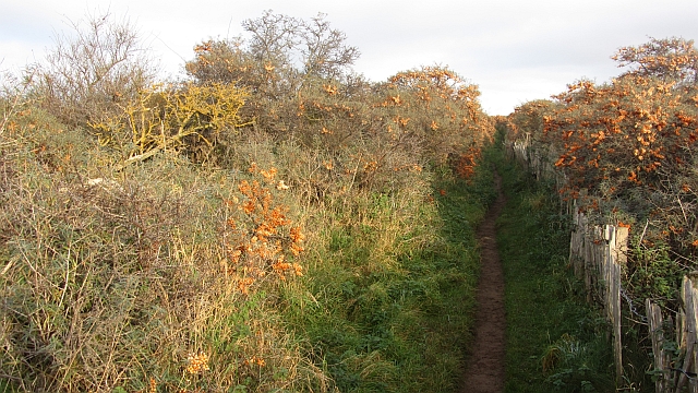
Covering an area of approximately 200 acres, Eldbotle Braes is characterized by its dense canopy of trees, predominantly oak and beech. The woodland is known for its rich biodiversity, with a wide range of flora and fauna thriving within its boundaries. Visitors can expect to encounter a variety of wildflowers, ferns, and mosses, creating a vibrant and picturesque landscape.

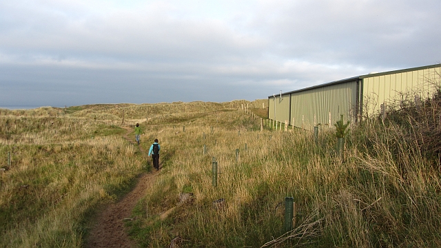
The forest is crisscrossed by a network of well-maintained walking trails, making it an ideal location for leisurely strolls and hikes. These paths offer visitors the opportunity to explore the forest's diverse ecosystem, as well as enjoy breathtaking views of the surrounding countryside.

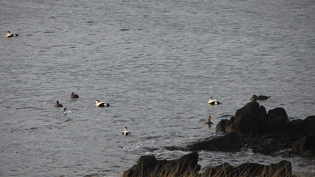
Eldbotle Braes is also home to a number of bird species, including woodpeckers, buzzards, and owls. Birdwatchers flock to the area to observe and study these magnificent creatures in their natural habitat.

In addition to its natural beauty, the woodland has a rich historical significance. Ruins of an ancient castle, believed to date back to the 14th century, can be found within its boundaries. These remnants serve as a reminder of the area's intriguing past, adding an element of intrigue to the overall experience.

Overall, Eldbotle Braes offers a peaceful and idyllic retreat from the hustle and bustle of everyday life. Its combination of scenic beauty, diverse wildlife, and historical significance make it a must-visit destination for anyone seeking a true connection with nature.

If you have any feedback on the listing, please let us know in the comments section below.

Eldbotle Braes Images

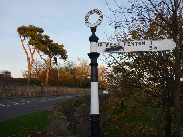
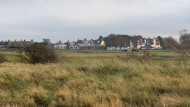
Images are sourced within 2km of 56.051646/-2.8026481 or Grid Reference NT5084. Thanks to Geograph Open Source API. All images are credited.

East Lothian Townscape : ELCC Fingerpost at West Fenton Road, Gullane An attractive single-finger ELCC post, unfortunately marked.
East Lothian Townscape : ELCC Fingerpost at West Fenton Road, Gullane
An attractive single-finger ELCC post, unfortunately marked.
Jamie's Neuk The woodland has mostly been felled, but it appears that replanting has taken place. It used to look like this: <a href="https://www.geograph.org.uk/photo/382171">NT4884 : Knoll, Jamie's Neuk</a>

--
2021
The young trees starting to get established here have now all been cut down.
Jamie's Neuk
The woodland has mostly been felled, but it appears that replanting has taken place. It used to look like this: NT4884 : Knoll, Jamie's Neuk -- 2021 The young trees starting to get established here have now all been cut down.
West Links Poor old dunes; if the golfers don't get them, the buckthorn will.  Sea buckthorn is getting established on the dunes between Muirfield and the beach.

--
2016
This buckthorn was cleared in December 2016.
West Links
Poor old dunes; if the golfers don't get them, the buckthorn will. Sea buckthorn is getting established on the dunes between Muirfield and the beach. -- 2016 This buckthorn was cleared in December 2016.
Path, Jamie's Neuk The path passes between former conifer woods on dunes and a greenkeepers building at Muirfield.
Path, Jamie's Neuk
The path passes between former conifer woods on dunes and a greenkeepers building at Muirfield.
West Links A roe deer makes a run for it across the dunes. Raids on Gullane and Dirleton's gardens have made the deer unpopular and the population is to be reduced.
West Links
A roe deer makes a run for it across the dunes. Raids on Gullane and Dirleton's gardens have made the deer unpopular and the population is to be reduced.
Muirfield View towards the clubhouse from the buckthorn jungle on the dunes.
Muirfield
View towards the clubhouse from the buckthorn jungle on the dunes.
Path, Gullane Bents A path through buckthorn beside the Muirfield golf course.
Path, Gullane Bents
A path through buckthorn beside the Muirfield golf course.
Muirfield Looking across the course to the surviving woodland at Archerfield.
Muirfield
Looking across the course to the surviving woodland at Archerfield.
Rocks, Freshwater Haven Outcrops on one of Gullane's beaches.
Rocks, Freshwater Haven
Outcrops on one of Gullane's beaches.
Eider, Black Rocks A familiar inhabitant of the Firth of Forth.
Eider, Black Rocks
A familiar inhabitant of the Firth of Forth.
Black Rocks One of the beaches at Gullane. Temperatures were similar to the previous Summer, but the light is Winter red.
Black Rocks
One of the beaches at Gullane. Temperatures were similar to the previous Summer, but the light is Winter red.
SW gable, Muirfield Gate, adjacent to Muirfield Golf Course, Gullane
Eyebroughy A small island in the Firth of Forth.  The rocks in the foreground appear to be a basalt formation.
Eyebroughy
A small island in the Firth of Forth. The rocks in the foreground appear to be a basalt formation.
Muirfield Park Residential street in Gullane.
Muirfield Park
Residential street in Gullane.
Halfmoon Plantation Some surviving bits of the depleted Archerfield woodlands.
Halfmoon Plantation
Some surviving bits of the depleted Archerfield woodlands.
Sand and rocks The coast W of Wreaklaw Rocks with the island of Fidra coming into view. The Isle of May is on the horizon, about 21km away.
Sand and rocks
The coast W of Wreaklaw Rocks with the island of Fidra coming into view. The Isle of May is on the horizon, about 21km away.
Fidra A small island of basalt lava, said to be the model for Stevenson's 'Treasure Island'. The detached rock of North Dog is to the left and part of the Isle of May is on the horizon, about 21km away.
Fidra
A small island of basalt lava, said to be the model for Stevenson's 'Treasure Island'. The detached rock of North Dog is to the left and part of the Isle of May is on the horizon, about 21km away.
John Muir Way joins the A198 The Way reaches the A198 road here to the east of Gullane.
John Muir Way joins the A198
The Way reaches the A198 road here to the east of Gullane.
Show me another place!

Eldbotle Braes is located at Grid Ref: NT5084 (Lat: 56.051646, Lng: -2.8026481)

Unitary Authority: East Lothian

Police Authority: The Lothians and Scottish Borders

What 3 Words

///carver.ties.countries. Near Gullane, East Lothian

Related Wikis

Archerfield Estate and Links

Archerfield and Archerfield Links are a country house (now hotel) and pair of golf courses in the parish of Dirleton, East Lothian, Scotland. An older...

Renaissance Club

The Renaissance Club is a golf club in Scotland, located in North Berwick, twenty miles (30 km) east of Edinburgh. It hosted the 2017 Scottish Senior Open...

Women's Scottish Open

The FreeD Group Women's Scottish Open is a women's professional golf tournament in Scotland on the Ladies European Tour (LET). First played in 1986, it...

Scottish Open (golf)

The Genesis Scottish Open is a professional golf tournament in Scotland, and is one of five tournaments that are part of the Rolex Series, which identifies...

Nearby Amenities

Located within 500m of 56.051646,-2.8026481
Turning Circle
Lat/Long: 56.055579/-2.8011
Turning Circle
Lat/Long: 56.0506332/-2.7994002
Picture frame
Survey Date: 2019-10-26
Tourism: artwork
Lat/Long: 56.0475676/-2.8039689
Willow Spiral
Survey Date: 2019-10-26
Tourism: artwork
Lat/Long: 56.0474198/-2.8047407
Waste Basket
Survey Date: 2019-10-26
Lat/Long: 56.0476145/-2.8054819
Picture frame with butterfly wings
Survey Date: 2019-10-26
Tourism: artwork
Lat/Long: 56.0479511/-2.8045199
Bench
View Pews
Backrest: yes
Seats: 4
Survey Date: 2019-10-26
Lat/Long: 56.0475817/-2.8041842
Tree Swing
Leisure: playground
Playground: swing
Survey Date: 2019-10-26
Lat/Long: 56.0481184/-2.8037123
The data included in this document is from www.openstreetmap.org. The data is made available under ODbL.

Have you been to Eldbotle Braes?

Leave your review of Eldbotle Braes below (or comments, questions and feedback).