Knights Ward Wood

Wood, Forest in Fife

Scotland

Knights Ward Wood

Dismantled railway cutting The view of the railway (dismantled) as seen from the end of the railway embankment which runs from Lochty.
Dismantled railway cutting Credit: Sandy Gemmill

Knights Ward Wood is a scenic woodland located in Fife, Scotland. Covering an area of approximately 500 acres, this enchanting forest is nestled between the towns of Cupar and Auchtermuchty. The wood is part of the larger Falkland Estate, which is renowned for its natural beauty and historical significance.

As visitors enter Knights Ward Wood, they are greeted by a diverse range of flora and fauna. The forest is predominantly composed of native Scottish trees such as oak, birch, and rowan, which create a vibrant and captivating canopy. Underneath the dense foliage, a rich understory of plants, including bluebells and wild garlic, adds to the woodland's allure.

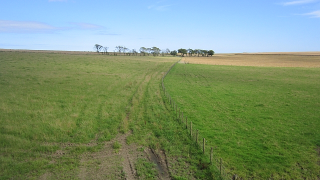
The wood is renowned for its extensive network of walking trails, making it a popular destination for nature enthusiasts and hikers. These well-maintained paths wind through the forest, offering breathtaking views of the surrounding countryside and providing ample opportunities to spot wildlife. Visitors may encounter a variety of bird species, including woodpeckers, owls, and jays, as well as mammals like red squirrels and roe deer.

In addition to its natural beauty, Knights Ward Wood also holds historical significance. The forest was once part of the hunting grounds for the Stuart kings, and remnants of old hunting lodges and gamekeepers' cottages can still be found within its boundaries. These historical landmarks add an extra layer of intrigue for those exploring the forest.

Overall, Knights Ward Wood is a captivating woodland that offers a serene escape into nature. With its diverse wildlife, picturesque trails, and historical remnants, it is a must-visit destination for anyone seeking tranquility and natural beauty in Fife.

If you have any feedback on the listing, please let us know in the comments section below.

Knights Ward Wood Images

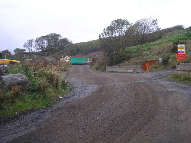
Images are sourced within 2km of 56.2617/-2.8070572 or Grid Reference NO5007. Thanks to Geograph Open Source API. All images are credited.

Dismantled railway cutting The view of the railway (dismantled) as seen from the end of the railway embankment which runs from Lochty.
Dismantled railway cutting
The view of the railway (dismantled) as seen from the end of the railway embankment which runs from Lochty.
View from the railway embankment The view of farmland as seen from the railway (disused) embankment.
View from the railway embankment
The view of farmland as seen from the railway (disused) embankment.
Dismantled railway line The view of a footpath/farm track which follows the route of the dismantled railway line as it crosses a railway embankment.
Dismantled railway line
The view of a footpath/farm track which follows the route of the dismantled railway line as it crosses a railway embankment.
Bridge over a dismantled railway line The view from the east of a bridge, presumably built for farm use, which crosses a cutting through which a now dismantled railway line once ran.  Unfortunately the railway cutting is very wet underfoot and it is difficult to follow its route on foot.  This view is from the banking on the south side of the cutting.
Bridge over a dismantled railway line
The view from the east of a bridge, presumably built for farm use, which crosses a cutting through which a now dismantled railway line once ran. Unfortunately the railway cutting is very wet underfoot and it is difficult to follow its route on foot. This view is from the banking on the south side of the cutting.
Bridge over a dismantled railway line The view of the road bridge as seen from the fields across which a railway line used to run.  The road can be viewed in <a href="https://www.geograph.org.uk/photo/1212225">NO5007 : Bridge over nothing</a>.
Bridge over a dismantled railway line
The view of the road bridge as seen from the fields across which a railway line used to run. The road can be viewed in NO5007 : Bridge over nothing.
Farm track to dismantled railway bridge The view of a farm track which leads to the dismantled bridge which once carried the East Fife Central Railway from near Leven to Lochty.  The line was only used for freight and closed in 1964.  More details at <span class="nowrap"><a title="http://www.railbrit.co.uk/East_Fife_Central_Railway/frame.htm" rel="nofollow ugc noopener" href="http://www.railbrit.co.uk/East_Fife_Central_Railway/frame.htm">Link</a><img style="margin-left:2px;" alt="External link" title="External link - shift click to open in new window" src="https://s1.geograph.org.uk/img/external.png" width="10" height="10"/></span>
Farm track to dismantled railway bridge
The view of a farm track which leads to the dismantled bridge which once carried the East Fife Central Railway from near Leven to Lochty. The line was only used for freight and closed in 1964. More details at LinkExternal link
Dismantled railway bridge The view of the dismantled railway line as seen from the western side of the dismantled bridge <a href="https://www.geograph.org.uk/photo/2669490">NO5007 : Farm track to dismantled railway bridge</a>.
Dismantled railway bridge
The view of the dismantled railway line as seen from the western side of the dismantled bridge NO5007 : Farm track to dismantled railway bridge.
Farm track The view of the farm track with newly built kennels on the left.
Farm track
The view of the farm track with newly built kennels on the left.
Belliston quarry The view of the quarry and the mast on Baldutho Craig.
Belliston quarry
The view of the quarry and the mast on Baldutho Craig.
Wooden bridge The bridge over the dismantled East Fife Central railway line. The bridge is used in connection with work on the adjacent farm land.
Wooden bridge
The bridge over the dismantled East Fife Central railway line. The bridge is used in connection with work on the adjacent farm land.
Strip wood A roadside strip near West Lingo.
Strip wood
A roadside strip near West Lingo.
Another council tenancy Anarchy symbol painted (recently, not in the early 1980s anarchist heyday) on an isolated lum.  There may have been a wooden hut here, the hut has gone, but its chimney has remained.

Have no fear - it is on Santa's database as an untenanted chimney and no vital nanoseconds are wasted here on Christmas Eve.
Another council tenancy
Anarchy symbol painted (recently, not in the early 1980s anarchist heyday) on an isolated lum. There may have been a wooden hut here, the hut has gone, but its chimney has remained. Have no fear - it is on Santa's database as an untenanted chimney and no vital nanoseconds are wasted here on Christmas Eve.
A field beside Lingo Den The Lingo Den is on the left,and is as often the case, a very attractive woodland. The field, tenanted by cattle is very wet and getting into this grid square involved some delicate tussock hopping above a rather foul mire.
A field beside Lingo Den
The Lingo Den is on the left,and is as often the case, a very attractive woodland. The field, tenanted by cattle is very wet and getting into this grid square involved some delicate tussock hopping above a rather foul mire.
Strip wood, West Lingo A road side strip with some lovely old trees.
Strip wood, West Lingo
A road side strip with some lovely old trees.
Cattle, Lingo Looking over the Lingo burn towards grazing cattle.
Cattle, Lingo
Looking over the Lingo burn towards grazing cattle.
Field by Pittarthie A big grass field showing wear after a very wet Summer.
Field by Pittarthie
A big grass field showing wear after a very wet Summer.
Field by Pittarthie Grassland on higher ground in the centre of the East Neuk. On a clear day there is a good view of East Lothian.
Field by Pittarthie
Grassland on higher ground in the centre of the East Neuk. On a clear day there is a good view of East Lothian.
East Fife Central Railway Very little evidence of the railway here other than the bridge that I am standing on. The railway served a few coal mines and was never completed.
East Fife Central Railway
Very little evidence of the railway here other than the bridge that I am standing on. The railway served a few coal mines and was never completed.
Show me another place!

Knights Ward Wood is located at Grid Ref: NO5007 (Lat: 56.2617, Lng: -2.8070572)

Unitary Authority: Fife

Police Authority: Fife

What 3 Words

///fact.cobble.grad. Near St Monans, Fife

Nearby Locations

Knights Ward Wood

Related Wikis

Riggin o Fife

The Riggin o Fife is an upland area of Fife, Scotland which runs eastward from the Markinch Gap and the Howe of Fife to form the elevated hinterland to...

Pittarthie Castle

Pittarthie Castle is the remains of what was a laird’s tower house in Fife, Scotland dating to the end of the sixteenth century. The ruins of the structure...

Lathones

Lathones (/lə'θonz/) is a village in Fife, Scotland, located approximately six miles (10 km) south west of St Andrews, in the parish of Cameron in the...

Largoward

Largoward is a village in East Fife, Scotland, lying on the road from Leven to St Andrews in the Riggin o Fife, 4½ miles north-east of Lower Largo and...

Nearby Amenities

Located within 500m of 56.2617,-2.8070572
Material: wood
Power: pole
Lat/Long: 56.264502/-2.8022057
Power: pole
Lat/Long: 56.2644246/-2.8040162
Material: wood
Power: pole
Lat/Long: 56.2643337/-2.8058669
Material: wood
Power: pole
Lat/Long: 56.2642518/-2.8076747
Material: wood
Power: pole
Lat/Long: 56.2641698/-2.8094664
Material: wood
Power: pole
Lat/Long: 56.2640775/-2.8113601
The data included in this document is from www.openstreetmap.org. The data is made available under ODbL.

Have you been to Knights Ward Wood?

Leave your review of Knights Ward Wood below (or comments, questions and feedback).