Pitairlie Den Plantation

Wood, Forest in Angus

Scotland

Pitairlie Den Plantation

Looking east from the side of the Monikie Reservoirs Looking down on the small hamlet of Craigton, it’s school and cherry trees in bloom. I wonder what the outline of the rectangular building in the foreground used to be?
Looking east from the side of the Monikie Reservoirs Credit: Andrew Shannon

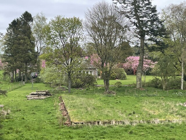
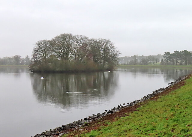
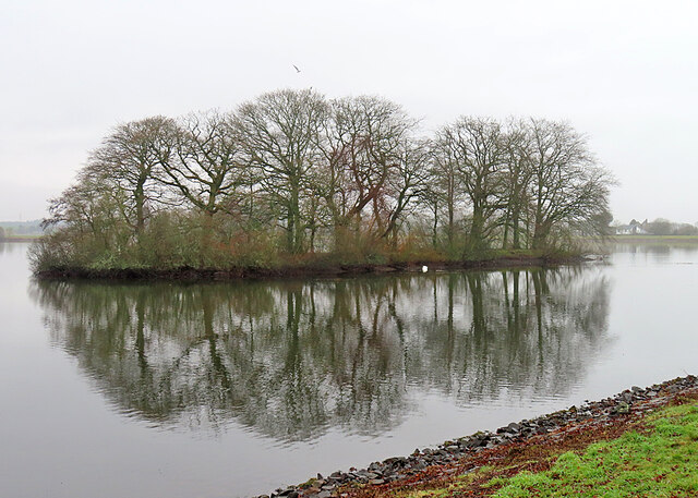
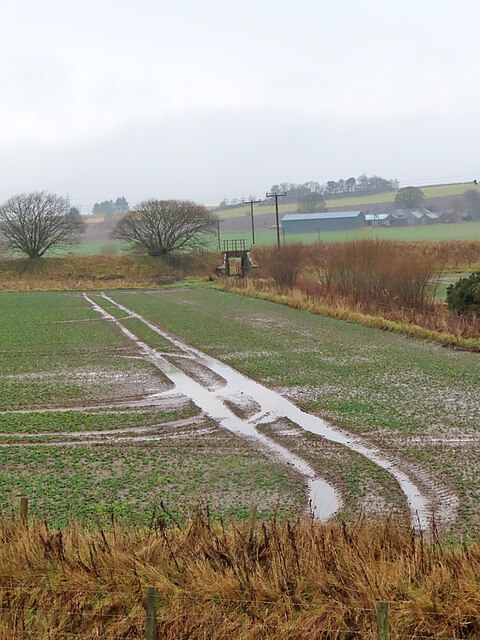
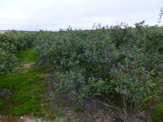
Pitairlie Den Plantation is a picturesque woodland located in Angus, Scotland. Situated near the village of Friockheim, this forested area covers an approximate area of 100 hectares. The plantation is characterized by its dense growth of various tree species, creating a thriving ecosystem that supports a diverse range of flora and fauna.

The dominant tree species found in Pitairlie Den Plantation include Scots pine, silver birch, and oak, with scattered clusters of other deciduous and coniferous trees. The mixture of tree species creates a visually striking landscape, especially during the autumn months when the leaves turn vibrant shades of red, orange, and gold.

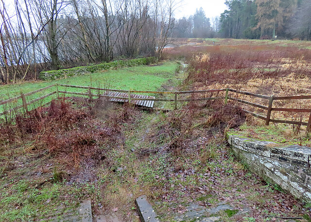
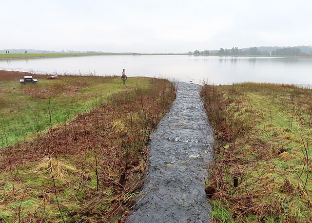
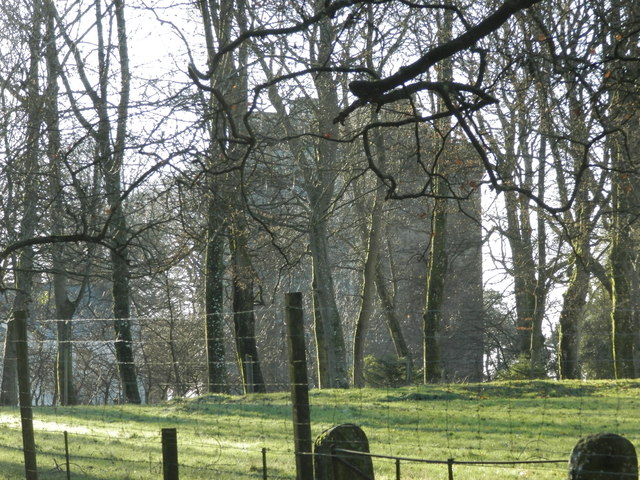
The woodland is crisscrossed by a network of well-maintained paths, allowing visitors to explore and appreciate its natural beauty. These paths also provide access to the Den Burn, a small stream that runs through the plantation, adding to the overall charm of the area.

Pitairlie Den Plantation is not only a haven for nature enthusiasts but also serves as an important habitat for wildlife. The woodland is home to a variety of bird species, including woodpeckers, owls, and various songbirds. It is also a habitat for squirrels, deer, and other small mammals.

The plantation is managed by the local forestry commission, which ensures the preservation and sustainable management of the woodland. It offers a serene and tranquil environment for visitors to enjoy nature, go for walks, or engage in activities such as birdwatching and photography. Pitairlie Den Plantation truly exemplifies the natural beauty and biodiversity that Scotland's woodlands have to offer.

If you have any feedback on the listing, please let us know in the comments section below.

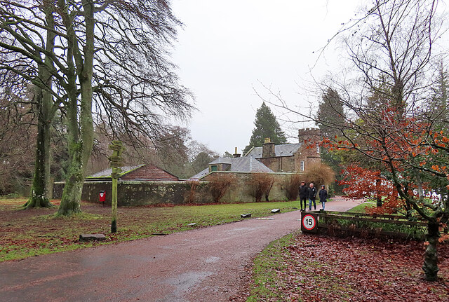
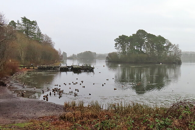
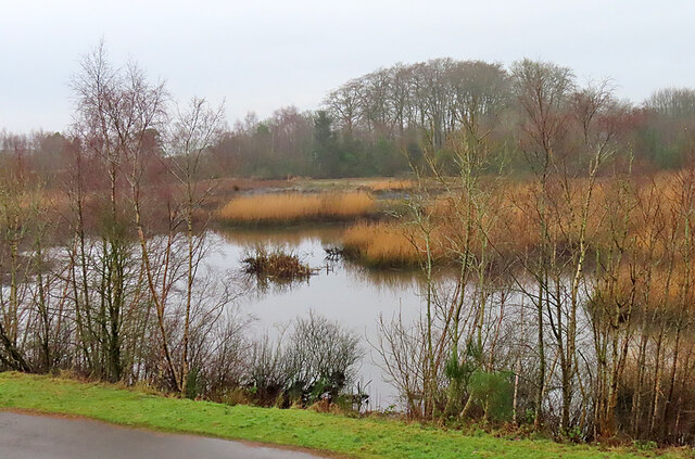
Pitairlie Den Plantation Images

Images are sourced within 2km of 56.525665/-2.8204811 or Grid Reference NO4937. Thanks to Geograph Open Source API. All images are credited.

Looking east from the side of the Monikie Reservoirs Looking down on the small hamlet of Craigton, it’s school and cherry trees in bloom. I wonder what the outline of the rectangular building in the foreground used to be?
Looking east from the side of the Monikie Reservoirs
Looking down on the small hamlet of Craigton, it’s school and cherry trees in bloom. I wonder what the outline of the rectangular building in the foreground used to be?
Monikie Reservoirs Country Park A trio of walkers approaches the reservoirs from the direction of the car park.
Monikie Reservoirs Country Park
A trio of walkers approaches the reservoirs from the direction of the car park.
Monikie Reservoirs The beach at the north-west corner of the largest of the Monikie reservoirs, which is evidently popular with the flock of Mallards.
Monikie Reservoirs
The beach at the north-west corner of the largest of the Monikie reservoirs, which is evidently popular with the flock of Mallards.
Denfind Pond This is the smallest of the three reservoirs at Monikie, and as far as I can see is the only one with a name of its own. It seems to have a long and gruesome history, being derived from 'Fiend's Den'. 

The following is from A J Warden's five-volume set of books about Angus or Forfarshire: "The lands of Denfind were included in the barony of Downie, but, like other portions of the barony, Denfind was for a long time a distinct estate, and had its castle, the residence of the laird. The lands remain but the tower or castle disappeared long ago.

"A little to the west of the farmhouse of Denfind, formerly Dunfind, there is a deep ravine called Denfiend, through which a rivulet runs. It is called the Fiend's Den, because a brigand with his family dwelt in it. He had an execrable fashion to all young men and children that he could steal or obtain by other means, and take them home and eat them. The younger they were he held them the more tender and delicate. For these acts he was burned with his wife, bairns, and family, except a young lass of one year old, who was saved and taken to Dundee, where she was brought up, but when she came to women's years, she was condemned and burned quick for the same crime her father and mother were convicted of. A great crowd, chiefly women, attended at the execution, cursing her for her crimes. To them she said, 'Why chide ye me as if I had committed a crime. Give me credit, if ye had the experience of eating human flesh you would think it so delicious that you would never forbear it again'. And so she died, without sign of repentance."
Denfind Pond
This is the smallest of the three reservoirs at Monikie, and as far as I can see is the only one with a name of its own. It seems to have a long and gruesome history, being derived from 'Fiend's Den'. The following is from A J Warden's five-volume set of books about Angus or Forfarshire: "The lands of Denfind were included in the barony of Downie, but, like other portions of the barony, Denfind was for a long time a distinct estate, and had its castle, the residence of the laird. The lands remain but the tower or castle disappeared long ago. "A little to the west of the farmhouse of Denfind, formerly Dunfind, there is a deep ravine called Denfiend, through which a rivulet runs. It is called the Fiend's Den, because a brigand with his family dwelt in it. He had an execrable fashion to all young men and children that he could steal or obtain by other means, and take them home and eat them. The younger they were he held them the more tender and delicate. For these acts he was burned with his wife, bairns, and family, except a young lass of one year old, who was saved and taken to Dundee, where she was brought up, but when she came to women's years, she was condemned and burned quick for the same crime her father and mother were convicted of. A great crowd, chiefly women, attended at the execution, cursing her for her crimes. To them she said, 'Why chide ye me as if I had committed a crime. Give me credit, if ye had the experience of eating human flesh you would think it so delicious that you would never forbear it again'. And so she died, without sign of repentance."
Monikie Reservoirs The wooded island is one of three in the southern part of the main Monikie reservoirs.
Monikie Reservoirs
The wooded island is one of three in the southern part of the main Monikie reservoirs.
Mirrored Island An almost monochrome view on a very dreich day.
Mirrored Island
An almost monochrome view on a very dreich day.
Corbelled Turret This is a modern house with a traditional feature, a square turret on corbels on a round turret.
Corbelled Turret
This is a modern house with a traditional feature, a square turret on corbels on a round turret.
Craigton Coach Inn That's what the maps name it as, but it's actually the former Craigton Coach Inn. It was originally the manse belonging to the United Free Church next door, which has since been demolished. It was a popular pub, but closed down in 2019, blaming 'greedy discount voucher firms' for its demise, though it may be that its location and the rules on drink-driving may have played their part.
Craigton Coach Inn
That's what the maps name it as, but it's actually the former Craigton Coach Inn. It was originally the manse belonging to the United Free Church next door, which has since been demolished. It was a popular pub, but closed down in 2019, blaming 'greedy discount voucher firms' for its demise, though it may be that its location and the rules on drink-driving may have played their part.
Monikie Reservoirs On the right is the North Settling Reservoir and to the left is the South Settling Reservoir, the two separated by a raised causeway. The Monikie reservoirs were built in the mid-19th century as part of the provision of clean water for the city of Dundee, but have been superseded by larger, more recent reservoirs.
Monikie Reservoirs
On the right is the North Settling Reservoir and to the left is the South Settling Reservoir, the two separated by a raised causeway. The Monikie reservoirs were built in the mid-19th century as part of the provision of clean water for the city of Dundee, but have been superseded by larger, more recent reservoirs.
Monikie Reservoirs I'm sure there must be a specific term for walkways like this that give access to where water is drawn off reservoirs.
Monikie Reservoirs
I'm sure there must be a specific term for walkways like this that give access to where water is drawn off reservoirs.
Waterlogged Field Most of the fields in the area are just as soggy as this one, following several spells of wet weather. Beyond the field is the embankment that carried the Dundee and Forfar railway line, and the farm in the background is West Hillhead.
Waterlogged Field
Most of the fields in the area are just as soggy as this one, following several spells of wet weather. Beyond the field is the embankment that carried the Dundee and Forfar railway line, and the farm in the background is West Hillhead.
Reservoir Overflow This channel seems to be the overflow that controls the water level in the North Settling Pond. It discharges into a ditch that drains into the Monikie Burn.
Reservoir Overflow
This channel seems to be the overflow that controls the water level in the North Settling Pond. It discharges into a ditch that drains into the Monikie Burn.
Reservoir Feeder This burn seems to be the principal feeder into the North Settling Pond at Monikie Reservoirs.
Reservoir Feeder
This burn seems to be the principal feeder into the North Settling Pond at Monikie Reservoirs.
Reservoir Infrastructure It looks as if this may have been a draw-off tower when the reservoirs were being used for their original purpose of suuplying clean water to the city of Dundee.
Reservoir Infrastructure
It looks as if this may have been a draw-off tower when the reservoirs were being used for their original purpose of suuplying clean water to the city of Dundee.
Downieken Farm with impressive outbuildings.
With pick your own blueberries, but only on Sundays!
Downieken
Farm with impressive outbuildings. With pick your own blueberries, but only on Sundays!
Field of blueberries at Downieken Available on Sundays for 'pick your own'.
For closer view see: <a title="https://www.geograph.org.uk/photo/4656750" href="https://www.geograph.org.uk/photo/4656750">Link</a>
Field of blueberries at Downieken
Available on Sundays for 'pick your own'. For closer view see: Link
Blueberries Some of a fieldful!
Blueberries
Some of a fieldful!
Turn off to Carlungie A farm in a fertile area with the cereals ripening.
Turn off to Carlungie
A farm in a fertile area with the cereals ripening.
Show me another place!

Pitairlie Den Plantation is located at Grid Ref: NO4937 (Lat: 56.525665, Lng: -2.8204811)

Unitary Authority: Angus

Police Authority: Tayside

What 3 Words

///silent.reward.shrub. Near Monifieth, Angus

Related Wikis

Dundee East (UK Parliament constituency)

Dundee East is a constituency of the House of Commons of the Parliament of the United Kingdom (at Westminster). Created for the 1950 general election,...

Newbigging, Angus

Newbigging is a village in Angus, Scotland, two miles (three kilometres) northeast of Dundee. The name "Newbigging" originally referred to a "new bigging...

Monikie

Monikie is a village and civil parish in Angus, Scotland, north-east of Dundee. == History == The village grew from small beginnings as just one of many...

Affleck Castle

Affleck Castle, also known as Auchenleck Castle, is a tall L-plan tower house dating from the 15th century, 4 miles (6.4 km) north of Monifieth and 1 mile...

Related Videos

CWU Training Week6 4k

A short update on training progress for the upcoming Cape Wrath Ultra in May 2024.

Cloudy Early Summer Road Trip Drive B961 Road To Parish Church Monikie Angus Scotland

Tour Scotland travel video of a cloudy early Summer road trip drive, with Scottish bagpipes and drums music, on the B961 cross ...

Monikie Reservoir by Drone.

Monikie Reservoir Monikie Country Park Dundee.

Nearby Amenities

Located within 500m of 56.525665,-2.8204811
Power: pole
Lat/Long: 56.526852/-2.8135089
Power: pole
Lat/Long: 56.5265483/-2.8144458
Power: pole
Lat/Long: 56.5261392/-2.8156921
Power: pole
Lat/Long: 56.5258887/-2.816425
Power: pole
Lat/Long: 56.5254385/-2.8177964
Power: pole
Lat/Long: 56.5247426/-2.8182001
Power: pole
Lat/Long: 56.5240406/-2.8186126
Power: pole
Lat/Long: 56.5233495/-2.8190185
Power: pole
Lat/Long: 56.5227589/-2.8199862
Power: pole
Lat/Long: 56.5221767/-2.8209209
Power: pole
Lat/Long: 56.5217083/-2.8216603
Power: pole
Lat/Long: 56.5215207/-2.8229045
Power: pole
Lat/Long: 56.5228037/-2.8181847
Power: pole
Lat/Long: 56.5222409/-2.8174014
Power: pole
Lat/Long: 56.5217023/-2.8166378
The data included in this document is from www.openstreetmap.org. The data is made available under ODbL.

Have you been to Pitairlie Den Plantation?

Leave your review of Pitairlie Den Plantation below (or comments, questions and feedback).