Muirton Wood

Wood, Forest in Aberdeenshire

Scotland

Muirton Wood

OS Rivet, Bridge near Culsh
OS Rivet, Bridge near Culsh Credit: thejackrustles

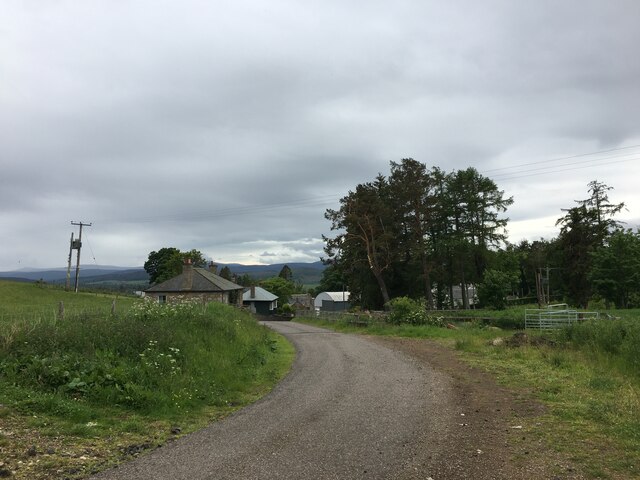
Muirton Wood is a picturesque forest located in Aberdeenshire, Scotland. Spanning an area of approximately 100 acres, this woodland is a popular destination for nature lovers, hikers, and outdoor enthusiasts.

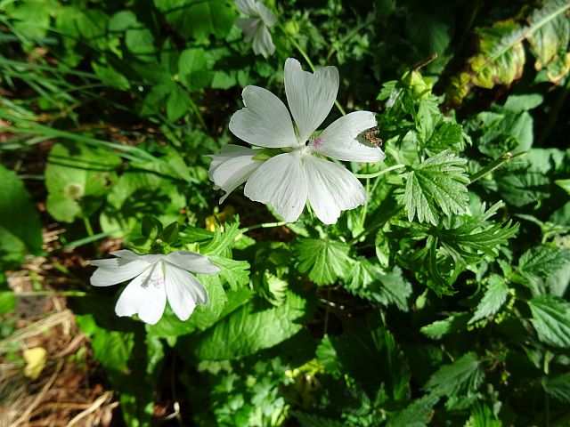
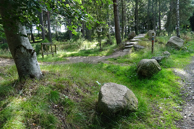
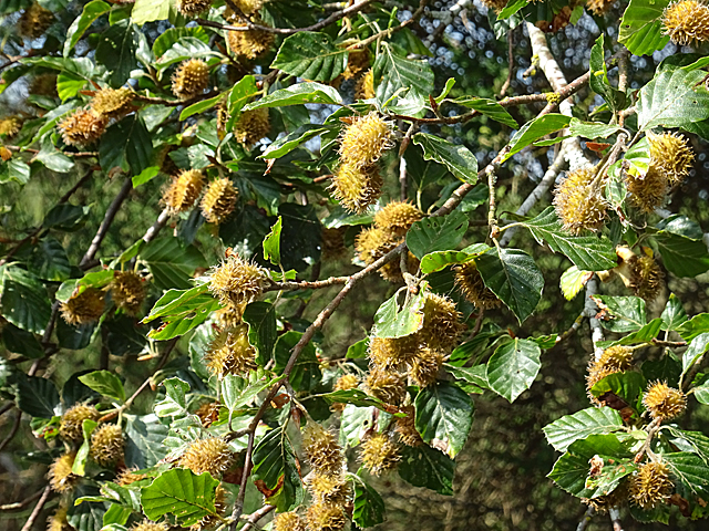
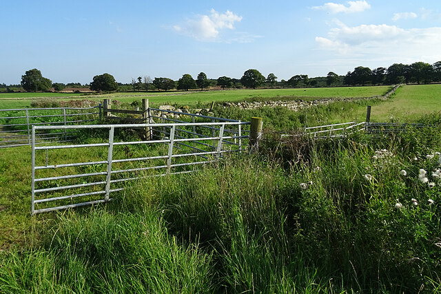
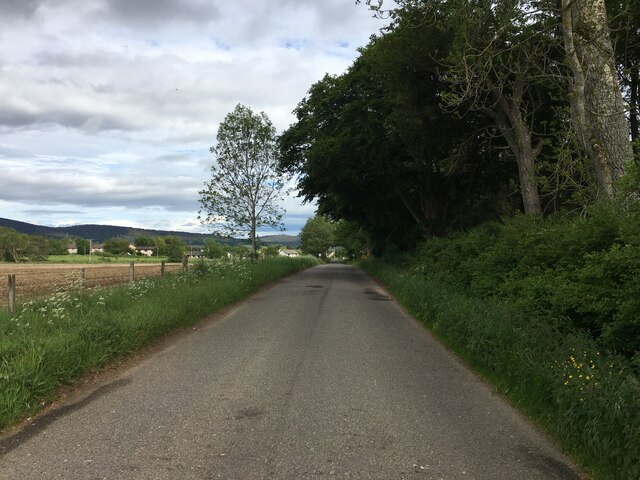
The wood is characterized by its diverse range of tree species, including oak, birch, and pine. These towering trees create a dense canopy overhead, providing a tranquil and shaded environment for visitors to explore. Additionally, the forest floor is covered in a lush carpet of ferns, wildflowers, and moss, adding to its natural beauty.

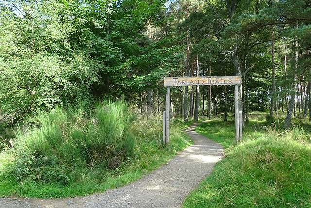
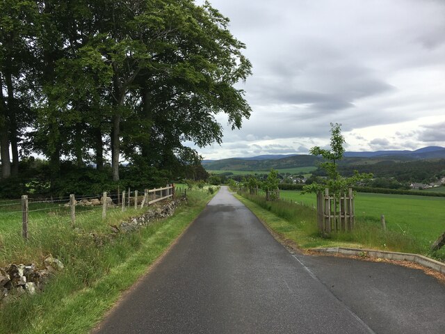
Numerous walking trails wind their way through Muirton Wood, offering visitors the opportunity to immerse themselves in the peaceful ambiance and observe the local wildlife. Squirrels, rabbits, and a variety of bird species are commonly spotted within the forest, making it a haven for animal enthusiasts and birdwatchers alike.

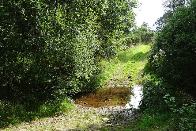
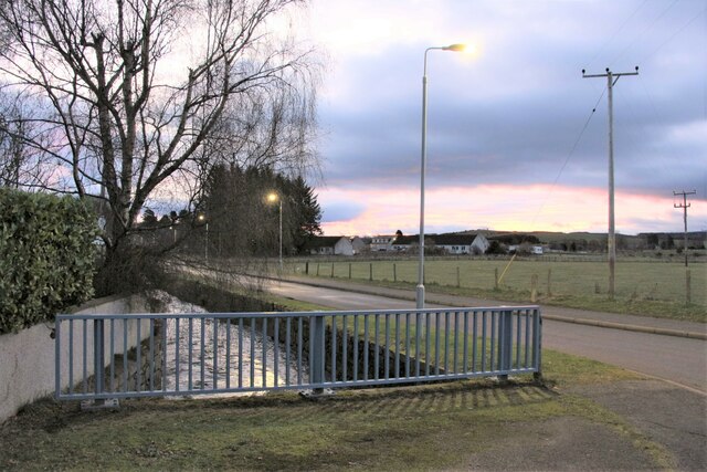
One notable feature of Muirton Wood is the presence of a small stream that meanders through the woodland. This babbling brook not only adds to the aesthetic appeal of the forest but also provides a source of water for the local wildlife.

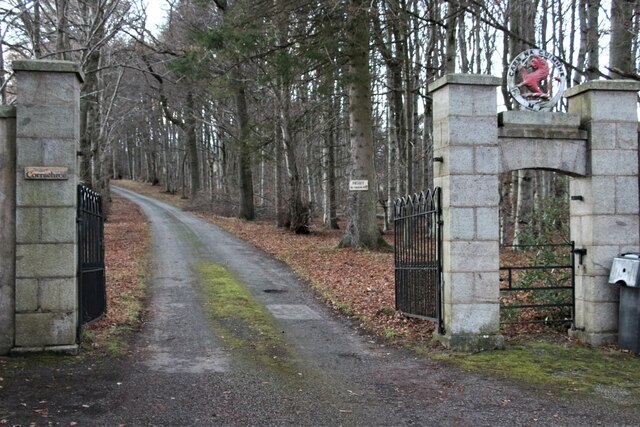
The wood is easily accessible and provides ample parking for visitors. It is often recommended to wear appropriate footwear and bring along insect repellent, as the forest is home to various insects and ticks. Furthermore, there are designated picnic areas within the wood, allowing visitors to relax and enjoy a meal amidst the serene surroundings.

Overall, Muirton Wood in Aberdeenshire offers a tranquil retreat for nature enthusiasts, providing a stunning backdrop for hiking, wildlife observation, and peaceful picnics.

If you have any feedback on the listing, please let us know in the comments section below.

Muirton Wood Images

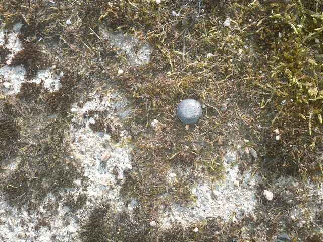
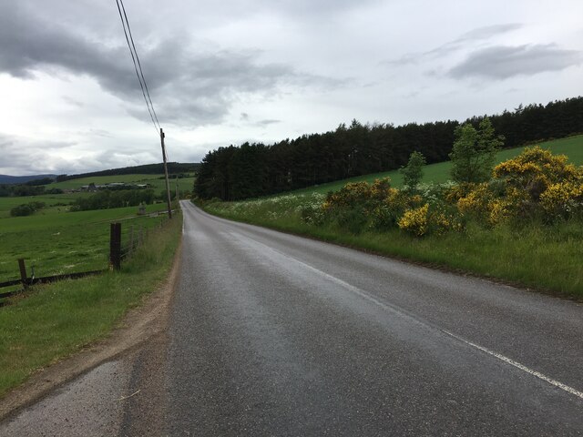
Images are sourced within 2km of 57.130647/-2.8499601 or Grid Reference NJ4804. Thanks to Geograph Open Source API. All images are credited.

OS Rivet, Bridge near Culsh
Bridge, near Culsh
Bridge, near Culsh
B9119 towards Tarland
Mallow (Malva moschata) Mallow normally has pink flowers, but this is an unusual white variant.
Mallow (Malva moschata)
Mallow normally has pink flowers, but this is an unusual white variant.
Drummy Wood Trails A mountain bike trail comes down from the right, and crosses the path into the wood from the track along the edge of the wood.
Drummy Wood Trails
A mountain bike trail comes down from the right, and crosses the path into the wood from the track along the edge of the wood.
The Red Squirrel The Red Squirrel is the name given to the most challenging of the short set of mountain bike trails in Drummy Wood. It descends the rough steps right of centre and crosses a path here.
The Red Squirrel
The Red Squirrel is the name given to the most challenging of the short set of mountain bike trails in Drummy Wood. It descends the rough steps right of centre and crosses a path here.
Tarland Trails This is the access point to the three mountain bike trails in Drummy Wood. See <span class="nowrap"><a title="https://www.trailforks.com/region/tarland-trails/?activitytype=1&z=14.6&lat=57.12239&lon=-2.87007" rel="nofollow ugc noopener" href="https://www.trailforks.com/region/tarland-trails/?activitytype=1&z=14.6&lat=57.12239&lon=-2.87007">Link</a><img style="margin-left:2px;" alt="External link" title="External link - shift click to open in new window" src="https://s1.geograph.org.uk/img/external.png" width="10" height="10"/></span> for details.
Tarland Trails
This is the access point to the three mountain bike trails in Drummy Wood. See LinkExternal link for details.
Beech Mast This beech tree was well laden with seed pods, known as beech mast.
Beech Mast
This beech tree was well laden with seed pods, known as beech mast.
Ford at Drummy I hadn't quite made up my mind which way I was going to go at this point, but the sight of the ford decided me and I went the other way. The track through the ford isn't shown on all the maps; it goes on to a farm named either Strathweltie or Wester Strathweltie, depending on which map you believe.
Ford at Drummy
I hadn't quite made up my mind which way I was going to go at this point, but the sight of the ford decided me and I went the other way. The track through the ford isn't shown on all the maps; it goes on to a farm named either Strathweltie or Wester Strathweltie, depending on which map you believe.
Harvesting at Netherton The combine harvester was park outside the house when I first saw it, but it began to move as I approached it, providing a much better photograph.
Harvesting at Netherton
The combine harvester was park outside the house when I first saw it, but it began to move as I approached it, providing a much better photograph.
Gates and Dykes Quite a large collection of field gates where field entrances converge on the track.
Gates and Dykes
Quite a large collection of field gates where field entrances converge on the track.
Gate to Corrachree
Gate to Corrachree
Camp and caravan site at Tarland
Tarland Square at dawn
Tarland Burn at Burnside Road
Minor road through Douneside
Minor road near Tarland
Road from Tarland to Logie Coldstone
Show me another place!

Muirton Wood is located at Grid Ref: NJ4804 (Lat: 57.130647, Lng: -2.8499601)

Unitary Authority: Aberdeenshire

Police Authority: North East

What 3 Words

///goggles.galloping.victory. Near Aboyne, Aberdeenshire

Nearby Locations

Muirton Wood

Related Wikis

Tarland

Tarland (Gaelic: Turlann) is a village in Aberdeenshire, Scotland and is located 5 miles (8 km) northwest of Aboyne, and 30 miles (50 km) west of Aberdeen...

Tomnaverie stone circle

Tomnaverie stone circle is a recumbent stone circle set on the top of a small hill in lowland northeast Scotland. Construction started from about 2500...

Coull Castle

Coull Castle was a 13th-century castle to the south of Coull, Aberdeenshire, Scotland. == History == The castle occupies an important and commanding position...

Blelack

Blelack (, Scottish Gaelic: Blàth Bholg) is a place in Aberdeenshire, Scotland, the location of Blelack House, a Scottish mansion house with origins in...

Nearby Amenities

Located within 500m of 57.130647,-2.8499601
Post Box
Brand: Royal Mail
Brand Wikidata: Q638098
Collection Times: Mo-Fr 12:30; Sa 12:00
Operator: Royal Mail
Operator Wikidata: Q638098
Post Box Type: lamp
Ref: AB34 405
Royal Cypher: GVIR
Royal Cypher Wikidata: Q33102169
Lat/Long: 57.1305081/-2.8546354
Fountain
Lat/Long: 57.1313661/-2.8429403
Generator Method: photovoltaic
Generator Output Electricity: yes
Generator Source: solar
Generator Type: solar_photovoltaic_panel
Location: roof
Power: generator
Lat/Long: 57.1291439/-2.8556487
Generator Method: photovoltaic
Generator Output Electricity: yes
Generator Source: solar
Generator Type: solar_photovoltaic_panel
Location: roof
Power: generator
Lat/Long: 57.1318093/-2.8554381
Generator Method: photovoltaic
Generator Output Electricity: yes
Generator Source: solar
Generator Type: solar_photovoltaic_panel
Location: roof
Power: generator
Lat/Long: 57.132206/-2.8546536
Generator Method: photovoltaic
Generator Output Electricity: yes
Generator Source: solar
Generator Type: solar_photovoltaic_panel
Location: roof
Power: generator
Lat/Long: 57.1314636/-2.8556111
Generator Method: photovoltaic
Generator Output Electricity: yes
Generator Source: solar
Generator Type: solar_photovoltaic_panel
Location: roof
Power: generator
Lat/Long: 57.1302612/-2.8554448
Bench
Lat/Long: 57.1289008/-2.8468926
Man Made: flagpole
Lat/Long: 57.1294874/-2.8548675
Golf: pin
Lat/Long: 57.1296945/-2.8491065
Golf: pin
Lat/Long: 57.1281427/-2.8449353
Golf: pin
Lat/Long: 57.1286529/-2.8466365
Golf: pin
Lat/Long: 57.1290034/-2.8453316
Golf: pin
Lat/Long: 57.1297575/-2.8429793
Golf: pin
Lat/Long: 57.129114/-2.8543626
Golf: pin
Lat/Long: 57.1278759/-2.8513947
Give Way
Direction: backward
Lat/Long: 57.1316582/-2.8543681
Bus Stop
Bus: yes
Naptan AtcoCode: 630066531
Naptan CommonName: Cromar Court
Naptan Indicator: opp
Naptan NaptanCode: 23628535
Naptan Verified: no
Public Transport: platform
Lat/Long: 57.1294634/-2.8561583
Waste Basket
Waste: dog_excrement
Lat/Long: 57.1306604/-2.8543029
Stop
Direction: backward
Lat/Long: 57.1306493/-2.8545593
Power: pole
Lat/Long: 57.1306347/-2.8499082
Power: pole
Lat/Long: 57.1298245/-2.850453
Power: pole
Lat/Long: 57.1291272/-2.8509669
Power: pole
Lat/Long: 57.128441/-2.851432
Power: pole
Lat/Long: 57.1277785/-2.8518919
Power: pole
Lat/Long: 57.1273839/-2.8531253
Power: pole
Lat/Long: 57.1269826/-2.8543708
The data included in this document is from www.openstreetmap.org. The data is made available under ODbL.

Have you been to Muirton Wood?

Leave your review of Muirton Wood below (or comments, questions and feedback).