Liberty Hall South Wood

Wood, Forest in East Lothian

Scotland

Liberty Hall South Wood

Looking south to Mid Mains With a grass crop in the foreground and cereals and oilseed rape in the distance.
Looking south to Mid Mains Credit: M J Richardson

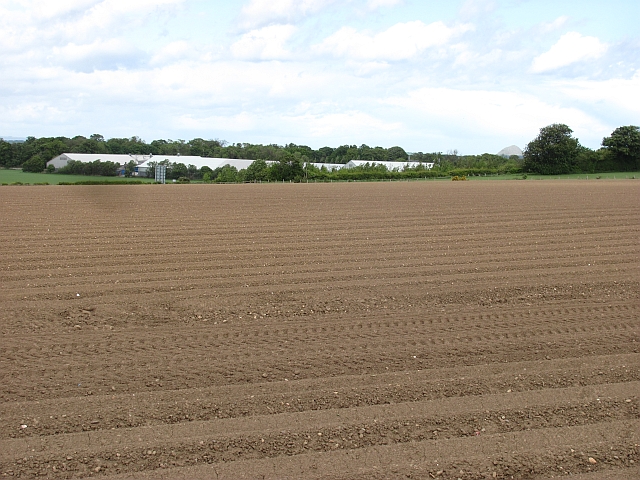
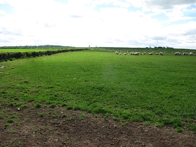
Liberty Hall South Wood is a picturesque forest located in East Lothian, Scotland. Covering a vast area of land, this woodland is renowned for its natural beauty and rich biodiversity. The forest is situated in close proximity to the small village of Wood, making it easily accessible for visitors from nearby towns and cities.

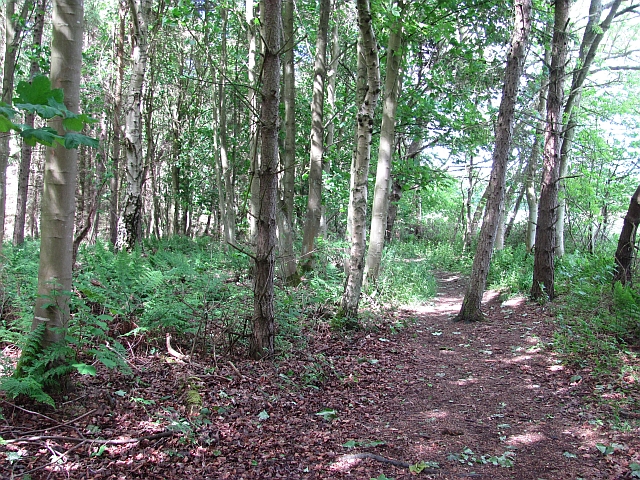
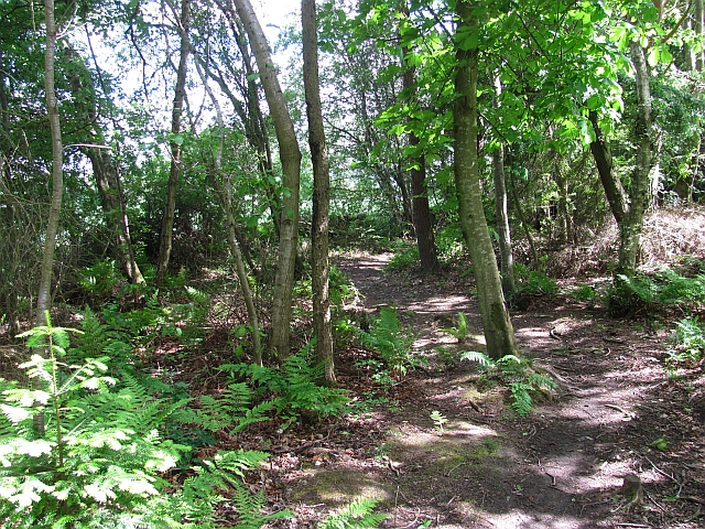
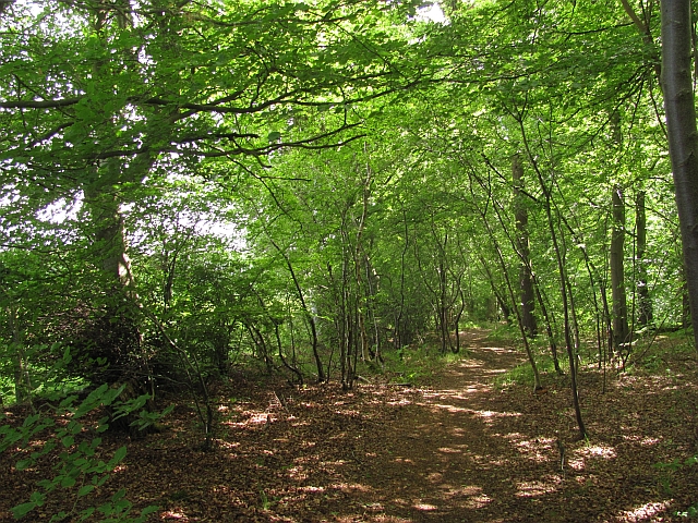
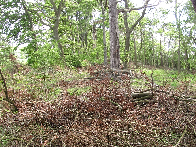
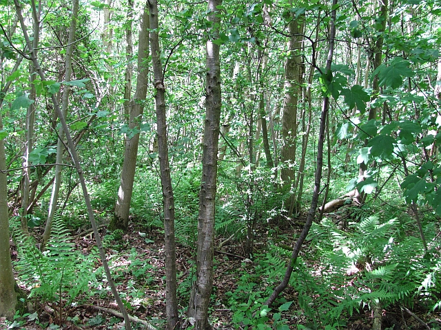
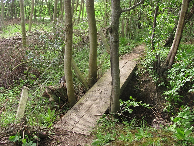
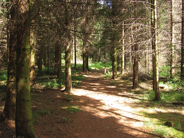
The woodland is characterized by its dense canopy of mature trees, including oak, beech, and pine, which provide a serene and tranquil environment. The forest floor is adorned with a vibrant carpet of wildflowers and ferns, adding to its enchanting appeal. The diverse range of flora and fauna found within Liberty Hall South Wood attracts nature enthusiasts, birdwatchers, and photographers alike.

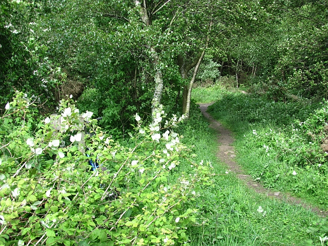
Visitors can explore the forest through a network of well-maintained walking trails, allowing them to immerse themselves in the natural splendor of the surroundings. These trails cater to all levels of fitness and provide opportunities for leisurely strolls or more challenging hikes.

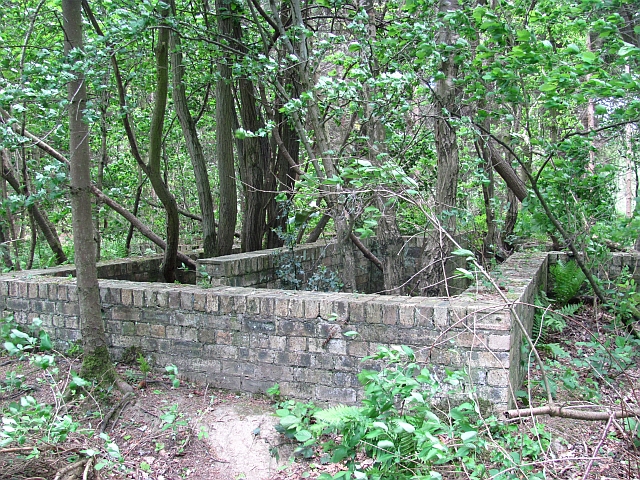
Liberty Hall South Wood also offers recreational facilities such as picnic areas and designated camping spots, making it an ideal destination for families and outdoor enthusiasts. Additionally, the forest hosts educational events and workshops to promote environmental awareness and conservation.

With its idyllic setting and abundance of natural wonders, Liberty Hall South Wood is an oasis of tranquility, providing a respite from the bustling city life. Whether it be for leisurely walks, wildlife spotting, or simply enjoying the serenity of the forest, this woodland is a must-visit destination for nature lovers in East Lothian.

If you have any feedback on the listing, please let us know in the comments section below.

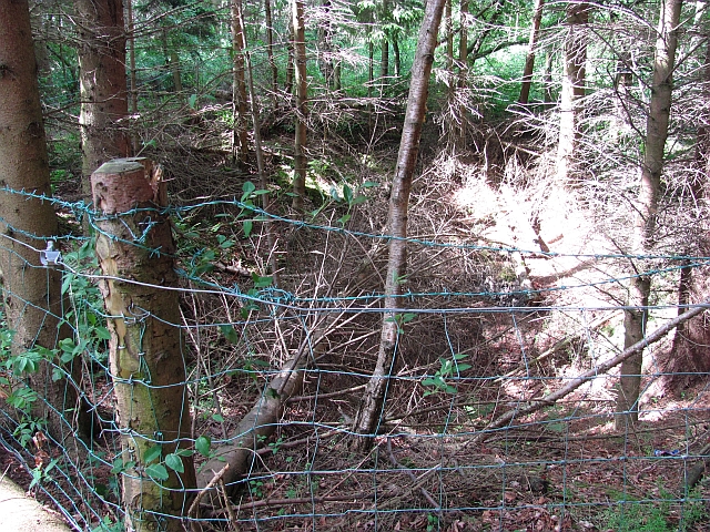
Liberty Hall South Wood Images

Images are sourced within 2km of 55.940865/-2.8528984 or Grid Reference NT4672. Thanks to Geograph Open Source API. All images are credited.

Looking south to Mid Mains With a grass crop in the foreground and cereals and oilseed rape in the distance.
Looking south to Mid Mains
With a grass crop in the foreground and cereals and oilseed rape in the distance.
Spring barley near Samuelston Looking north alongside the road to Samuelston Loanhead.
Spring barley near Samuelston
Looking north alongside the road to Samuelston Loanhead.
Newly cultivated field, Gladsmuir A field between the old and new A1 roads.
Newly cultivated field, Gladsmuir
A field between the old and new A1 roads.
Butterdean Woods A path runs around the perimeter of the wood.
Butterdean Woods
A path runs around the perimeter of the wood.
Butterdean Wood Path running around the perimeter of the woodland.
Butterdean Wood
Path running around the perimeter of the woodland.
Path, Butterdean Wood A path which runs around the perimeter of the wood.
Path, Butterdean Wood
A path which runs around the perimeter of the wood.
Strip wood, Butterdean A strip joins Cuddie Wood and Butterdean Wood.
Strip wood, Butterdean
A strip joins Cuddie Wood and Butterdean Wood.
Butterdean Woods Dense deciduous woodland in the care of the Woodland Trust.
Butterdean Woods
Dense deciduous woodland in the care of the Woodland Trust.
Depression, Butterdean Woods A fenced off hole. There is a history of coal mining in the area and this is probably a mineshaft.
--
2022
I have seen a Coal Authority Secured Site notice on a nearby fenced depression, so definitely mine shafts. No maps show any colliery infrastructure here so I suspect that these were trials>
Depression, Butterdean Woods
A fenced off hole. There is a history of coal mining in the area and this is probably a mineshaft. -- 2022 I have seen a Coal Authority Secured Site notice on a nearby fenced depression, so definitely mine shafts. No maps show any colliery infrastructure here so I suspect that these were trials>
Path, Butterdean Wood - core path 113 A path leads from a gate in the wood's perimeter fence.
Path, Butterdean Wood - core path 113
A path leads from a gate in the wood's perimeter fence.
Footbridge, Butterdean Woods On the perimeter path.
Footbridge, Butterdean Woods
On the perimeter path.
Butterdean Wood A coniferous area of the woods which are largely broadleaved.
Butterdean Wood
A coniferous area of the woods which are largely broadleaved.
Farmland, Penston Looking out of Butterdean Wood.
Farmland, Penston
Looking out of Butterdean Wood.
Ruin, Butterdean Wood A brick structure with a baffled design which suggests a military origin. A relic of the air base at Macmerry.
Ruin, Butterdean Wood
A brick structure with a baffled design which suggests a military origin. A relic of the air base at Macmerry.
Roadside, Liberty Hall The scrub has been removed from this verge.
Roadside, Liberty Hall
The scrub has been removed from this verge.
Green Gates Wood Oak woods along a path between Liberty Hall and Letham Holdings.  East Lothian core path no. 110.
Green Gates Wood
Oak woods along a path between Liberty Hall and Letham Holdings. East Lothian core path no. 110.
East Lothian core path no.110 A wide field margin, prone to being muddy, but very dry today.
East Lothian core path no.110
A wide field margin, prone to being muddy, but very dry today.
Woodland, Letham Stripwoods, offset at this point. On the path between Letham Holdings and Liberty Hall. (East Lothian core path 110).
Woodland, Letham
Stripwoods, offset at this point. On the path between Letham Holdings and Liberty Hall. (East Lothian core path 110).
Show me another place!

Liberty Hall South Wood is located at Grid Ref: NT4672 (Lat: 55.940865, Lng: -2.8528984)

Unitary Authority: East Lothian

Police Authority: The Lothians and Scottish Borders

What 3 Words

///become.screaming.happily. Near Macmerry, East Lothian

Related Wikis

Gladsmuir

Gladsmuir is a village and parish in East Lothian, Scotland, situated on the A199 and near Tranent and Prestonpans. == Description == Gladsmuir's principal...

Samuelston

Samuelston (Scots: Sammelstoun) is a small town just outside of Haddington, East Lothian. It has a population of 957. George Ker, laird of Samuelston,...

Herdmanston House

Herdmanston House was a castle and later tower house located in the parish of Saltoun, East Lothian in Scotland.The lands of Herdmanston were held by the...

RAF Macmerry

Royal Air Force Macmerry or more simply RAF Macmerry is a former Royal Air Force satellite station located 4.5 miles (7.2 km) west of Haddington, East...

Haddington line

The Haddington line was a branch railway line connecting the Burgh of Haddington to the main line railway network at Longniddry. It was the first branch...

Macmerry

Macmerry is a village located on the old A1 (now renumbered the A199) just east of Tranent. The village has a primary school with a roll of around 100...

Macmerry railway station

Macmerry railway station served the village of Macmerry, East Lothian, Scotland, from 1872 to 1925 on the Macmerry Branch. == History == The station was...

East Lothian Community Hospital

East Lothian Community Hospital is a hospital located on Station Road, Haddington, East Lothian, Scotland. The hospital is operated by NHS Lothian. �...

Nearby Amenities

Located within 500m of 55.940865,-2.8528984
Nairns Mains Airstrip
Aeroway: airstrip
Lat/Long: 55.9376982/-2.8497587
Hopefield
Place: locality
Lat/Long: 55.9431378/-2.8586391
Power: pole
Lat/Long: 55.9414188/-2.8606393
Power: pole
Lat/Long: 55.9441948/-2.8576409
Power: pole
Lat/Long: 55.9446312/-2.8560323
Power: pole
Lat/Long: 55.945063/-2.8543611
Power: pole
Lat/Long: 55.9452695/-2.8526775
Power: pole
Lat/Long: 55.9442718/-2.8498208
Power: pole
Lat/Long: 55.9435846/-2.849777
Power: pole
Lat/Long: 55.9394396/-2.8521962
Power: pole
Lat/Long: 55.9402471/-2.8514127
Power: pole
Lat/Long: 55.9406976/-2.8512127
Power: pole
Lat/Long: 55.9412513/-2.8509606
Power: pole
Lat/Long: 55.9422228/-2.8503771
Power: pole
Lat/Long: 55.9419521/-2.8482643
Power: pole
Lat/Long: 55.941826/-2.8470058
Power: pole
Lat/Long: 55.9417793/-2.8454617
The data included in this document is from www.openstreetmap.org. The data is made available under ODbL.

Have you been to Liberty Hall South Wood?

Leave your review of Liberty Hall South Wood below (or comments, questions and feedback).