Ba Muir

Wood, Forest in Aberdeenshire

Scotland

Ba Muir

Cairnie Burn A tributary of the River Isla.  The buildings on the hill are the old farm at the Een.
Cairnie Burn Credit: Alan O'Dowd

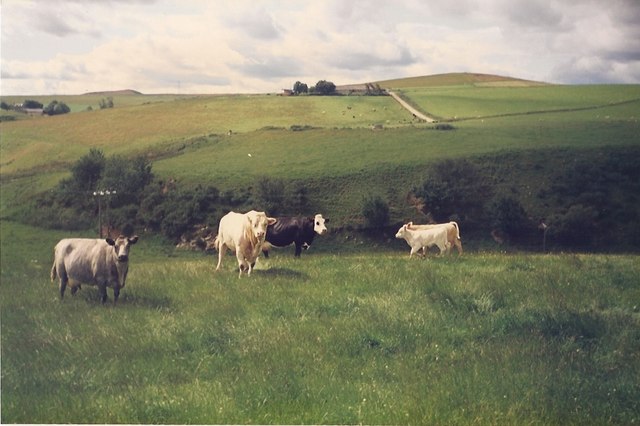
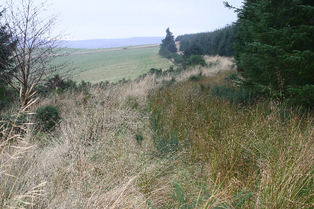
Ba Muir is a small village located in Aberdeenshire, Scotland, known for its enchanting wood and forest landscapes. Situated amidst the picturesque countryside, it offers a tranquil retreat for nature lovers and outdoor enthusiasts.

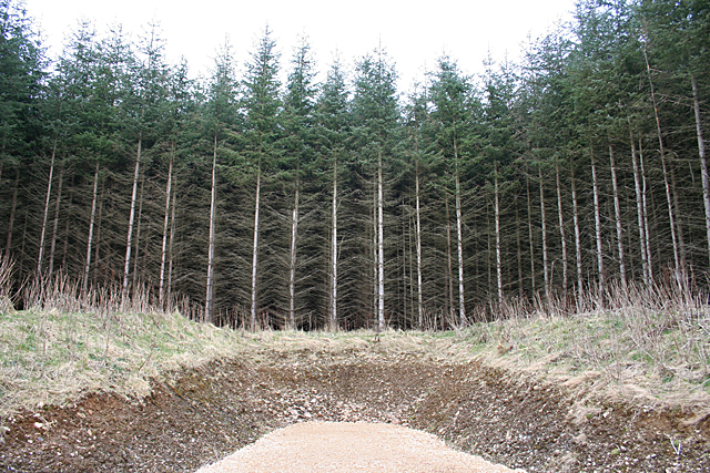
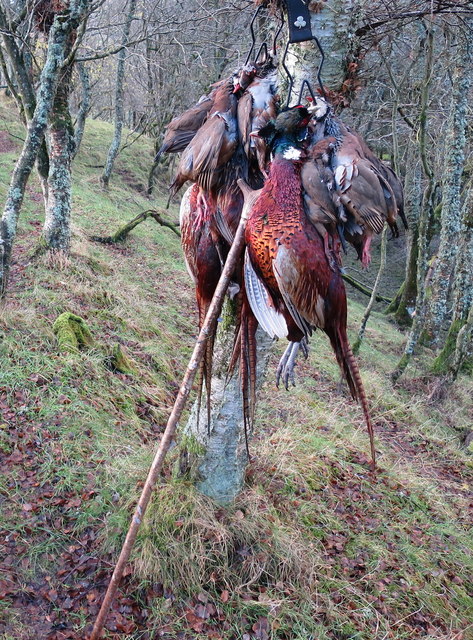
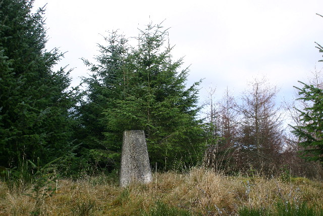
The village is surrounded by dense woodlands, which are home to a diverse range of flora and fauna. The forest consists mainly of native species such as oak, birch, and pine trees, creating a rich and vibrant ecosystem. The area is also known for its abundant wildlife, including red squirrels, roe deer, and various species of birds.

Ba Muir is a popular destination for hiking and walking enthusiasts, with numerous trails and paths winding through the woods. These routes offer breathtaking views of the surrounding countryside, making it a perfect location for photography and nature appreciation.

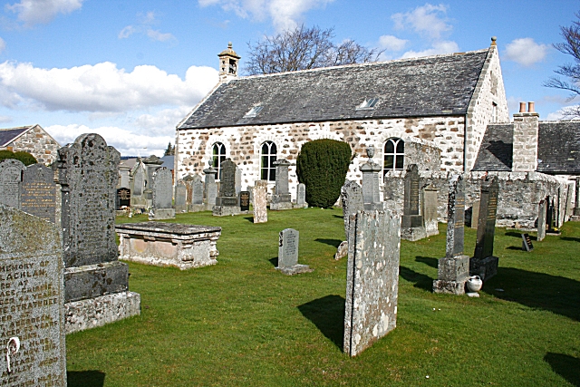
In addition to its natural beauty, Ba Muir is also steeped in history. The village is known for its ancient stone circles and standing stones, providing a glimpse into the region's past. Visitors can explore these historical sites, which are believed to have served as ceremonial or spiritual gathering places in ancient times.

Despite its rural setting, Ba Muir is easily accessible by road, with good transport links to neighboring towns and cities. It also offers a range of amenities, including local shops, cafes, and accommodation options for those wishing to stay and explore the area further.

Overall, Ba Muir in Aberdeenshire is a captivating village that offers a perfect blend of natural beauty, outdoor activities, and historical intrigue, making it a must-visit destination for nature enthusiasts and history buffs alike.

If you have any feedback on the listing, please let us know in the comments section below.

Ba Muir Images

Images are sourced within 2km of 57.474225/-2.8918738 or Grid Reference NJ4643. Thanks to Geograph Open Source API. All images are credited.

Cairnie Burn A tributary of the River Isla.  The buildings on the hill are the old farm at the Een.
Cairnie Burn
A tributary of the River Isla. The buildings on the hill are the old farm at the Een.
Cows in field at Botary Mains View over to Smallburn and Heatheryfield (and its road up the hillside) on the opposite side of the Cairnie Burn.
Cows in field at Botary Mains
View over to Smallburn and Heatheryfield (and its road up the hillside) on the opposite side of the Cairnie Burn.
Site of Hill of Milleath Recumbent Stone Circle I was rather dreading the challenge of finding this spot, because I was aware from the descriptions of the stone circle here that it had been destroyed in the late 1860s and the site subsequently planted with forestry. After checking the First Edition six-inch map and the satellite view, I fully expected to have to crawl through dense stands of Sitka Spruce after a long wet trek up the hill, with no GPS reception to confirm that I was in the right place. In the event, to my pleasure and great relief, I discovered that the Forestry Commission has constructed a fine new road right to the very spot, which (according to my GPS) is just in the trees in the middle of this view. I did peer more closely into the gloom, but can confirm that there is nothing to be seen of the circle. It is one of three RSCs of which no trace is now visible on the ground, but where there is sufficient documentary evidence to show that there was at one time a recumbent setting, the others being <a href="https://www.geograph.org.uk/photo/4799781">NJ7520 : Site of Ardtannes Cottages Recumbent Stone Circle</a> and <a href="https://www.geograph.org.uk/photo/4712009">NJ5226 : Site of Bankhead Recumbent Stone Circle (1)</a>. See <span class="nowrap"><a title="https://canmore.org.uk/site/17326/hill-of-milleath" rel="nofollow ugc noopener" href="https://canmore.org.uk/site/17326/hill-of-milleath">Link</a><img style="margin-left:2px;" alt="External link" title="External link - shift click to open in new window" src="https://s1.geograph.org.uk/img/external.png" width="10" height="10"/></span> for more details.
Site of Hill of Milleath Recumbent Stone Circle
I was rather dreading the challenge of finding this spot, because I was aware from the descriptions of the stone circle here that it had been destroyed in the late 1860s and the site subsequently planted with forestry. After checking the First Edition six-inch map and the satellite view, I fully expected to have to crawl through dense stands of Sitka Spruce after a long wet trek up the hill, with no GPS reception to confirm that I was in the right place. In the event, to my pleasure and great relief, I discovered that the Forestry Commission has constructed a fine new road right to the very spot, which (according to my GPS) is just in the trees in the middle of this view. I did peer more closely into the gloom, but can confirm that there is nothing to be seen of the circle. It is one of three RSCs of which no trace is now visible on the ground, but where there is sufficient documentary evidence to show that there was at one time a recumbent setting, the others being NJ7520 : Site of Ardtannes Cottages Recumbent Stone Circle and NJ5226 : Site of Bankhead Recumbent Stone Circle (1). See LinkExternal link for more details.
A mixed bag on Alehousehillock This has been the first drive of the day and the birds have been flying well but alas the guns have been in good form. Pheasant and Red-legged partridge are the quarry of the day. It is forbidden to shoot ground game on these occasions.
A mixed bag on Alehousehillock
This has been the first drive of the day and the birds have been flying well but alas the guns have been in good form. Pheasant and Red-legged partridge are the quarry of the day. It is forbidden to shoot ground game on these occasions.
Minor road at the entrance to Craig Hithan Looking westward.
Minor road at the entrance to Craig Hithan
Looking westward.
The New Drive complete Beaters exit the gamecrop on completion of this drive. It's late in the season and as the birds have become skittish the drives have become more demanding for these flushers of game.
The New Drive complete
Beaters exit the gamecrop on completion of this drive. It's late in the season and as the birds have become skittish the drives have become more demanding for these flushers of game.
Hill of Milleath trig
Forest track on Hill of Milleath Looking S from position
Forest track on Hill of Milleath
Looking S from position
Farmland near Botary Mains
Craig Hithan
Craig Hithan
Boghead
Boghead
Track Near Tullochwhinty It isn't clear from the map what Tullochwhinty is, but it is named on the map to the east (left in this view) of the burn. The grass track is very wet underfoot.
Track Near Tullochwhinty
It isn't clear from the map what Tullochwhinty is, but it is named on the map to the east (left in this view) of the burn. The grass track is very wet underfoot.
Ardonald Lime Kiln The kiln has evidently not been used for some time, though it seems to have been at the heart of an extensive area of workings. It made use of the band of Dalradian limestone which extends intermittently from the coast near Portsoy all the way south-west to Kintyre.
Ardonald Lime Kiln
The kiln has evidently not been used for some time, though it seems to have been at the heart of an extensive area of workings. It made use of the band of Dalradian limestone which extends intermittently from the coast near Portsoy all the way south-west to Kintyre.
Tullochwhinty The burn divides and flows round both sides of the mound in the middle ground. Unfortunately this was definitely a day when wellington boots would have been a good idea, so I was unable to investigate it properly.
Tullochwhinty
The burn divides and flows round both sides of the mound in the middle ground. Unfortunately this was definitely a day when wellington boots would have been a good idea, so I was unable to investigate it properly.
Ruined Building This looks like an abandoned croft house.
Ruined Building
This looks like an abandoned croft house.
Ruins at Ardonald This rickle of stanes is part of the ruins of what may have been a croft house.
Ruins at Ardonald
This rickle of stanes is part of the ruins of what may have been a croft house.
Ardonald The trees are part of a small clump amid the fields here.
Ardonald
The trees are part of a small clump amid the fields here.
Blackhillock This is Blackhillock in the parish of Cairnie, not to be confused with Blackhillock in the next-door parish of Keith.
Blackhillock
This is Blackhillock in the parish of Cairnie, not to be confused with Blackhillock in the next-door parish of Keith.
Show me another place!

Ba Muir is located at Grid Ref: NJ4643 (Lat: 57.474225, Lng: -2.8918738)

Unitary Authority: Aberdeenshire

Police Authority: North East

What 3 Words

///withdraws.solar.gullible. Near Huntly, Aberdeenshire

Nearby Locations

Ba Muir Green Hill

Related Wikis

Ardonald

Ardonald is a rural area near Cairnie in Aberdeenshire, Scotland. == References ==

Cairnie

Cairnie, also written Cairney, (Scottish Gaelic: CĂ rnaidh/A' ChĂ rnaich) is a village in Aberdeenshire, Scotland. It is in the district of Huntly. It has...

Torry Burn, Huntly

Torry Burn is a burn which marks the boundary of the parish of Huntly, Aberdeenshire, Scotland. == References ==

Pitlurg Castle

Pitlurg Castle was a 16th-century keep, about 3.5 miles (5.6 km) south of Keith, Banffshire, Scotland, north of the Burn of Davidston, at Mains of Pitlurg...

Nearby Amenities

Located within 500m of 57.474225,-2.8918738
Design: barrel
Power: tower
Lat/Long: 57.4784547/-2.8942951
Design: barrel
Power: tower
Lat/Long: 57.475951/-2.8903173
Design: barrel
Power: tower
Lat/Long: 57.4741184/-2.8874058
Generator Method: wind_turbine
Generator Source: wind
Generator Type: horizontal_axis
Power: generator
Lat/Long: 57.4715085/-2.8937709
Blackhill
Place: locality
Lat/Long: 57.4709898/-2.8914645
Gingomyres
Place: locality
Lat/Long: 57.4767332/-2.8912488
Hill of Milleath
Alt Name: Gingomyres
Archaeological Site: megalith
Historic: archaeological_site
Megalith Type: stone_circle
Ref Canmore: 17326
Lat/Long: 57.4735979/-2.888831
The data included in this document is from www.openstreetmap.org. The data is made available under ODbL.

Have you been to Ba Muir?

Leave your review of Ba Muir below (or comments, questions and feedback).