Junctionhaugh Plantation

Wood, Forest in Selkirkshire

Scotland

Junctionhaugh Plantation

Path,Haining
Path,Haining Credit: Richard Webb

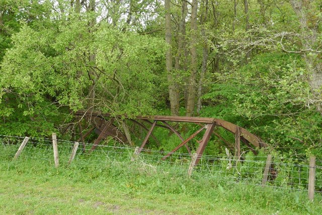
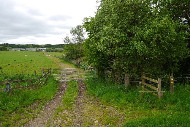
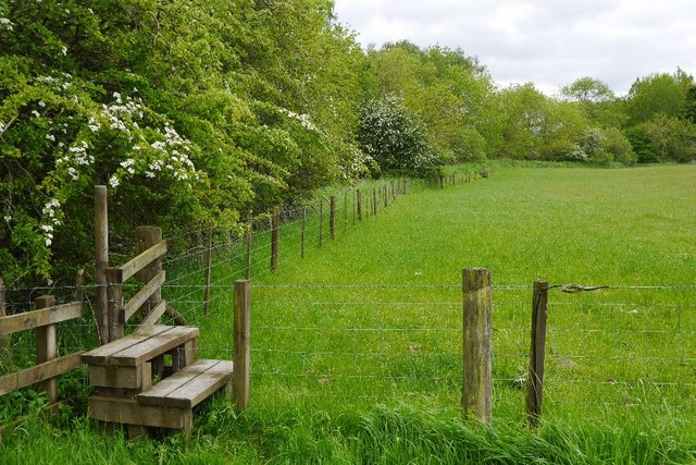
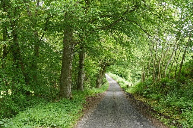
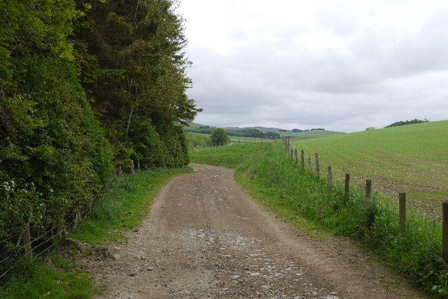
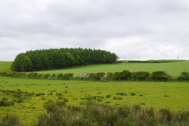
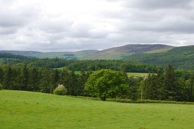
Junctionhaugh Plantation is a well-preserved woodland located in Selkirkshire, Scotland. Spanning over a vast area, this plantation is renowned for its diverse range of flora and fauna, making it an ideal destination for nature enthusiasts and conservationists alike.

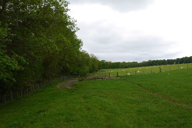
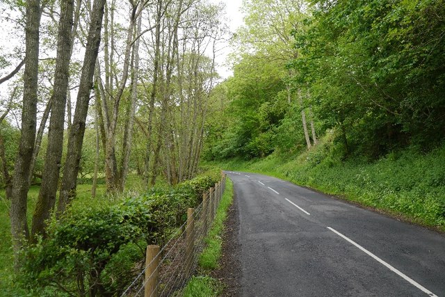
The woodland is primarily composed of native tree species, including oak, birch, and rowan, which create a picturesque and vibrant landscape throughout the year. The dense canopy provides a refuge for various bird species such as woodpeckers, thrushes, and owls, making it a haven for birdwatchers.

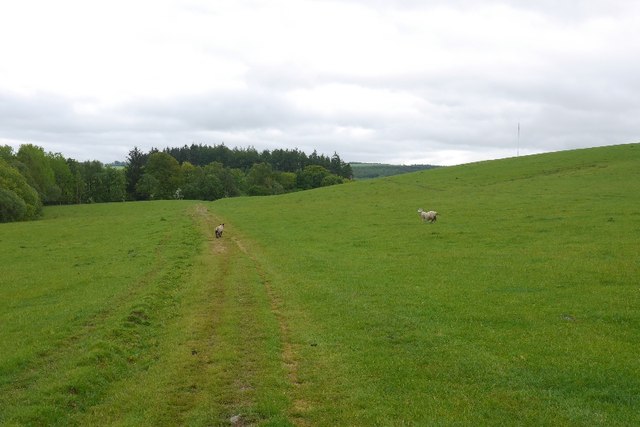
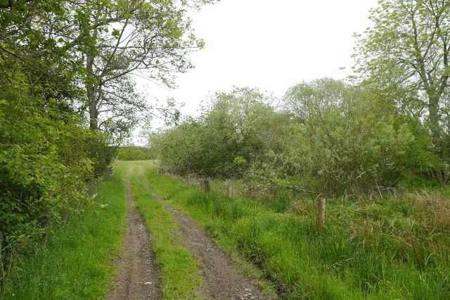
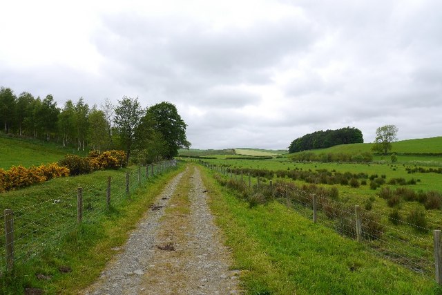
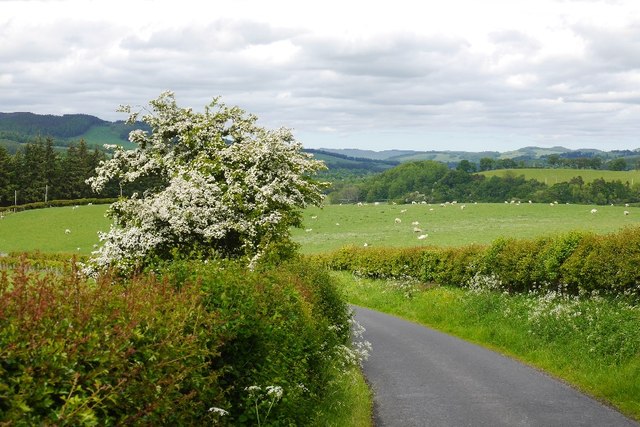
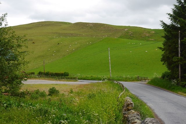
The plantation is intersected by several walking trails, allowing visitors to explore its natural beauty at their own pace. These paths wind through the woodland, offering stunning views of the surrounding countryside and the nearby Ettrick Water, a charming river that adds to the plantation's tranquillity.

Moreover, Junctionhaugh Plantation is also home to a rich diversity of wildlife. Red squirrels, badgers, and roe deer are commonly spotted within the woodland, providing opportunities for wildlife photography and observation. Additionally, the plantation hosts numerous species of insects, including butterflies and dragonflies, adding to the area's ecological significance.

As a designated Site of Special Scientific Interest (SSSI), the conservation efforts in Junctionhaugh Plantation are of utmost importance. The local authorities and conservation organizations collaborate to ensure the preservation of this unique ecosystem, safeguarding its biodiversity and natural heritage for future generations to enjoy.

Overall, Junctionhaugh Plantation offers a captivating experience for nature lovers, offering a peaceful retreat amidst the Scottish countryside and an opportunity to immerse oneself in the beauty of a well-preserved woodland ecosystem.

If you have any feedback on the listing, please let us know in the comments section below.

Junctionhaugh Plantation Images

Images are sourced within 2km of 55.538069/-2.8766395 or Grid Reference NT4427. Thanks to Geograph Open Source API. All images are credited.

Path,Haining
Path,Haining
Remains of a railway waggon, Haining Moss
Haining Moss
Haining Moss
Haining Moss
Haining Moss
Farm track, Hartwoodburn
Stile, Hartwoodburn
Stile, Hartwoodburn
Minor road, Middlestead
Farm road, Middlestead
Small wood, Middlestead
Farm road, Middlestead
Burn crossing, Middlestead
View over Carterhaugh Across the Ettrick towards heather covered hills above Bowhill woods.
View over Carterhaugh
Across the Ettrick towards heather covered hills above Bowhill woods.
The road from Woll Rig A hilly road, beloved of roadies, links Ashkirk and Ettrick Dale.
The road from Woll Rig
A hilly road, beloved of roadies, links Ashkirk and Ettrick Dale.
B7009 The Ettrick road passing beneath the steep and wooded Howden Bank. There is a lade amongst the alders on the flat side of the road.
B7009
The Ettrick road passing beneath the steep and wooded Howden Bank. There is a lade amongst the alders on the flat side of the road.
Howden Hill A small steep hill with thin soils above Howden.
Howden Hill
A small steep hill with thin soils above Howden.
The A707 on Selkirk Bridge The railings on the right have been adorned with knitted street art. A group of over 40 knitters called the Selkirk Yarn Bombers, including one aged 104, have covered landmarks in Selkirk and Ettrickbridge with colourful knitted street art which has attracted visitors to admire their handiwork. It was done to promote the Yarrow, Ettrick and Selkirk Festival of Contemporary Arts.
The A707 on Selkirk Bridge
The railings on the right have been adorned with knitted street art. A group of over 40 knitters called the Selkirk Yarn Bombers, including one aged 104, have covered landmarks in Selkirk and Ettrickbridge with colourful knitted street art which has attracted visitors to admire their handiwork. It was done to promote the Yarrow, Ettrick and Selkirk Festival of Contemporary Arts.
The Selkirk Yarn Bombers handiwork on Selkirk Bridge A group of over 40 knitters called the Selkirk Yarn Bombers, including one aged 104, have covered landmarks in Selkirk and Ettrickbridge with colourful knitted street art which has attracted visitors to admire their handiwork. It was done to promote the Yarrow, Ettrick and Selkirk Festival of Contemporary Arts. For a wider view of the bridge, see <a href="https://www.geograph.org.uk/photo/4664154">NT4628 : The A707 on Selkirk Bridge</a>.
The Selkirk Yarn Bombers handiwork on Selkirk Bridge
A group of over 40 knitters called the Selkirk Yarn Bombers, including one aged 104, have covered landmarks in Selkirk and Ettrickbridge with colourful knitted street art which has attracted visitors to admire their handiwork. It was done to promote the Yarrow, Ettrick and Selkirk Festival of Contemporary Arts. For a wider view of the bridge, see NT4628 : The A707 on Selkirk Bridge.
Show me another place!

Junctionhaugh Plantation is located at Grid Ref: NT4427 (Lat: 55.538069, Lng: -2.8766395)

Unitary Authority: The Scottish Borders

Police Authority: The Lothians and Scottish Borders

What 3 Words

///client.baguette.lighter. Near Selkirk, Scottish Borders

Related Wikis

Battle of Philiphaugh

The Battle of Philiphaugh was fought on 13 September 1645 during the Wars of the Three Kingdoms near Selkirk in the Scottish Borders. The Royalist army...

Philiphaugh

Philiphaugh is a village by the Yarrow Water, on the outskirts of Selkirk, in the Scottish Borders. Places nearby include Bowhill, Broadmeadows, the Ettrick...

Carterhaugh

Carterhaugh is a wood and farm near the confluence of the Yarrow Water and the Ettrick Water near Selkirk in the Scottish Borders. This real location...

Bowhill, Scottish Borders

Bowhill is a village off the A708, in the Scottish Borders area of Scotland, near Selkirk, by the Yarrow Water Other places nearby include Bowhill House...

Nearby Amenities

Located within 500m of 55.538069,-2.8766395
Barrier: block
Bicycle: yes
Foot: yes
Lat/Long: 55.5381241/-2.8744807
Cafe
The Waterwheel Cafe
Addr City: Selkirk
Addr Housename: East Lodge, Philiphaugh Old Mill Farm
Addr Postcode: TD7 5LU
Lat/Long: 55.5409021/-2.8721591
Generator Source: hydro
Generator Type: hydrodynamic_screw
Power: generator
Lat/Long: 55.5380334/-2.8747112
Generator Source: hydro
Generator Type: hydrodynamic_screw
Power: generator
Lat/Long: 55.5379962/-2.8747058
Power: pole
Lat/Long: 55.5373693/-2.8833994
Power: pole
Lat/Long: 55.537568/-2.8824386
Power: pole
Lat/Long: 55.5377274/-2.8816607
Power: pole
Lat/Long: 55.5379808/-2.880456
Power: pole
Lat/Long: 55.5382246/-2.8792429
Power: pole
Lat/Long: 55.5384935/-2.8779353
Power: pole
Lat/Long: 55.538666/-2.8770922
Power: pole
Lat/Long: 55.5383829/-2.8761503
Power: pole
Lat/Long: 55.5382163/-2.8756016
Power: pole
Lat/Long: 55.53834/-2.87409
Power: pole
Lat/Long: 55.5387255/-2.8732427
Power: pole
Lat/Long: 55.5391038/-2.8723913
Power: pole
Lat/Long: 55.5394809/-2.8715293
Power: pole
Lat/Long: 55.5399044/-2.8703394
The data included in this document is from www.openstreetmap.org. The data is made available under ODbL.

Have you been to Junctionhaugh Plantation?

Leave your review of Junctionhaugh Plantation below (or comments, questions and feedback).