Bankhead Moss

Wood, Forest in Fife

Scotland

Bankhead Moss

Barley and sky Only a thin layer of information separates the vastness of the barley field from the vastness of the summer sky.
Barley and sky Credit: Aleks Scholz

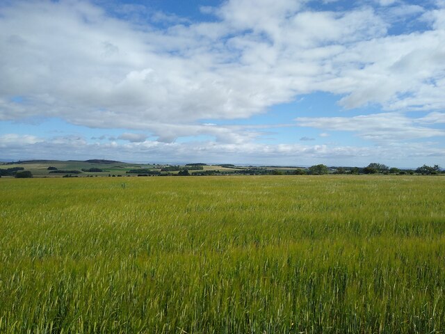
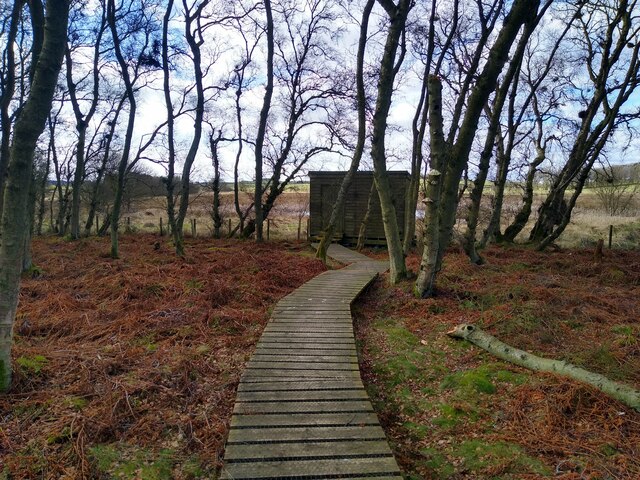
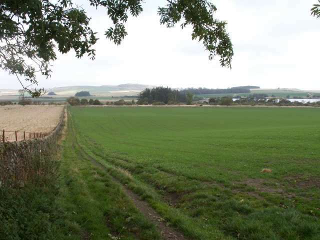
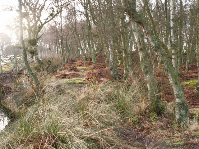
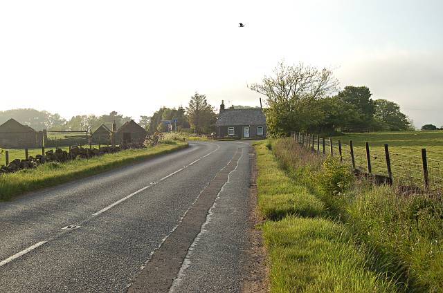
Bankhead Moss is a woodland area located in Fife, Scotland. Spanning over a vast expanse of land, it is renowned for its lush greenery and diverse flora and fauna, making it a popular destination for nature enthusiasts and outdoor lovers.

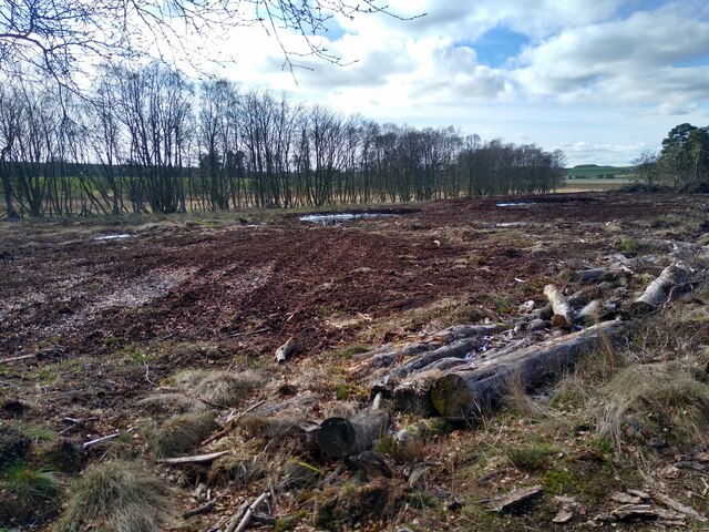
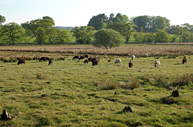
The moss is situated on the outskirts of the small village of Bankhead, providing a serene and tranquil escape from the hustle and bustle of urban life. The forest is primarily composed of native species such as oak, birch, and pine, creating a diverse and vibrant ecosystem. The dense canopy provided by the trees offers shade and shelter for a variety of wildlife, including roe deer, red squirrels, and numerous species of birds.

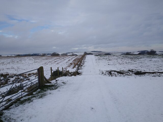
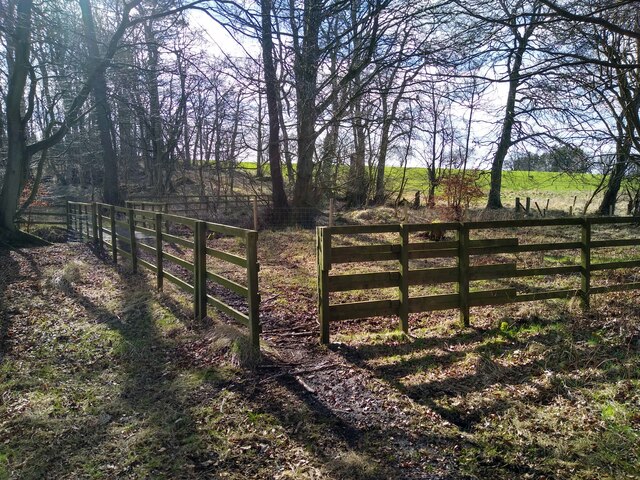
Traversing through Bankhead Moss, visitors can explore a network of well-maintained walking trails that wind through the woodland, offering breathtaking views of the surrounding landscape. The paths are suitable for all fitness levels, with options for shorter, leisurely strolls or longer, more challenging hikes.

The moss is also home to several natural features, including a small stream that meanders through the forest, enhancing the area's natural beauty. The tranquil ambiance and picturesque scenery make it an ideal spot for picnics, photography, and simply immersing oneself in nature.

Bankhead Moss is a testament to the importance of preserving and protecting natural habitats. The enchanting woodland offers a sanctuary for both wildlife and humans, providing a peaceful retreat where visitors can reconnect with nature.

If you have any feedback on the listing, please let us know in the comments section below.

Bankhead Moss Images

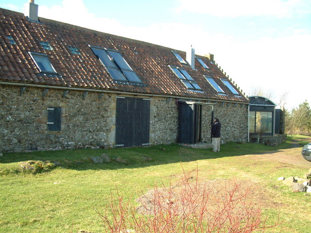
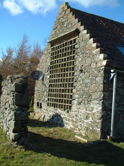
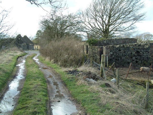
Images are sourced within 2km of 56.279848/-2.8934922 or Grid Reference NO4410. Thanks to Geograph Open Source API. All images are credited.

Barley and sky Only a thin layer of information separates the vastness of the barley field from the vastness of the summer sky.
Barley and sky
Only a thin layer of information separates the vastness of the barley field from the vastness of the summer sky.
View towards Nether Radernie This field track is JUST on the western side of the boundary between two squares. The gate, from which this picture was taken, as well. This area around Cameron Reservoir often is the first appearance of snow when driving up from the East Neuk coast.
View towards Nether Radernie
This field track is JUST on the western side of the boundary between two squares. The gate, from which this picture was taken, as well. This area around Cameron Reservoir often is the first appearance of snow when driving up from the East Neuk coast.
Ruins along the roadside Hidden in the bushes and trees next to the road are these derelict steadings. I'm guessing these used to be steadings.
Ruins along the roadside
Hidden in the bushes and trees next to the road are these derelict steadings. I'm guessing these used to be steadings.
Walls and not much else A set of ruined buildings, on the grassland on the outskirts of Peat Inn, if Peat Inn even has outskirts.
Walls and not much else
A set of ruined buildings, on the grassland on the outskirts of Peat Inn, if Peat Inn even has outskirts.
Bird hide in Bankhead Moss Well placed, at the margins of woodland, and looking out over a small bit of wetland.
Bird hide in Bankhead Moss
Well placed, at the margins of woodland, and looking out over a small bit of wetland.
Regeneration project This patch is an attempt to regenerate peat land.
Regeneration project
This patch is an attempt to regenerate peat land.
Core path to Bankhead Moss Most people probably visit Bankhead Moss from the north, directly from a small car park. But there is a core path from the south (this one here) which starts at the farm track from Peat Inn to Larennie.
Core path to Bankhead Moss
Most people probably visit Bankhead Moss from the north, directly from a small car park. But there is a core path from the south (this one here) which starts at the farm track from Peat Inn to Larennie.
Mistletoe scene in Bankhead Moss This is the view towards the west, from the renegerated peat land towards the wet land.
Mistletoe scene in Bankhead Moss
This is the view towards the west, from the renegerated peat land towards the wet land.
Sheep and lambs Sheep with lambs in a field south of Cameron Reservoir.
Sheep and lambs
Sheep with lambs in a field south of Cameron Reservoir.
Fields by Cairnhill, Radernie Looking more or less NW across this square from the high ground near Cairnhill down towards the flats of the Cameron Burn and the reservoir to right of photo. This square is all fields and farm tracks. The highest point on the skyline is Drum Carrow, 217 mts, some 3ks away.
Fields by Cairnhill, Radernie
Looking more or less NW across this square from the high ground near Cairnhill down towards the flats of the Cameron Burn and the reservoir to right of photo. This square is all fields and farm tracks. The highest point on the skyline is Drum Carrow, 217 mts, some 3ks away.
Birch wood, Bankhead Moss A small area of Birch wood in the Bankhead Moss reserve
Birch wood, Bankhead Moss
A small area of Birch wood in the Bankhead Moss reserve
Percy Baldinnie Farm
West Mains Principal farm on Greigston House estate
West Mains
Principal farm on Greigston House estate
Bruntshiels Residential conversion of former farm buildings
Bruntshiels
Residential conversion of former farm buildings
Nesting boxes The architecy of the conversion of Bruntshield has preserved the pigeon nesting boxes that once formed part of a doocot here.
Nesting boxes
The architecy of the conversion of Bruntshield has preserved the pigeon nesting boxes that once formed part of a doocot here.
Ruined cottages Two of the several ruins around near where the walking track from Cameron Reservoir reaches Crossgate
Ruined cottages
Two of the several ruins around near where the walking track from Cameron Reservoir reaches Crossgate
Grazing land by Larennie Sheep grazing in the evening sunlight near Larennie Farm in the background.
Grazing land by Larennie
Sheep grazing in the evening sunlight near Larennie Farm in the background.
Crossgates, Peat Inn The road splits here with the left side going to Cupar and Perth and the right side bound for Guardbridge, the Tay coast and Dundee.
Crossgates, Peat Inn
The road splits here with the left side going to Cupar and Perth and the right side bound for Guardbridge, the Tay coast and Dundee.
Show me another place!

Bankhead Moss is located at Grid Ref: NO4410 (Lat: 56.279848, Lng: -2.8934922)

Unitary Authority: Fife

Police Authority: Fife

What 3 Words

///pocket.ruin.validated. Near Lundin Links, Fife

Nearby Locations

Bankhead Moss

Related Wikis

Peat Inn

Peat Inn is a hamlet in Fife, Scotland, around 7 miles (11 kilometres) southeast of Cupar on the B940 and 6 miles (10 kilometres) southwest of St Andrews...
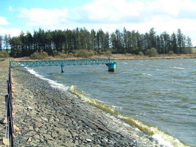
Cameron Reservoir

Cameron Reservoir is an artificial loch in the parish of Cameron in east Fife, Scotland. Covering an area of 69 hectares, it serves as a domestic water...

Largoward

Largoward is a village in East Fife, Scotland, lying on the road from Leven to St Andrews in the Riggin o Fife, 4½ miles north-east of Lower Largo and...

Pitscottie

Pitscottie is a village in the Parish of Ceres, Fife, situated on the Ceres Burn at a road junction to the south of Dura Den and 3 miles (5 km) southeast...

Nearby Amenities

Located within 500m of 56.279848,-2.8934922
Power: pole
Lat/Long: 56.2836677/-2.8975417
Power: pole
Lat/Long: 56.2835912/-2.8963563
Power: pole
Lat/Long: 56.2835114/-2.8951973
Power: pole
Lat/Long: 56.2834293/-2.8940301
Power: pole
Lat/Long: 56.2833719/-2.8929785
Power: pole
Lat/Long: 56.2832999/-2.8918843
Power: pole
Lat/Long: 56.2832291/-2.8908144
Power: pole
Lat/Long: 56.2831605/-2.8892217
Power: pole
Lat/Long: 56.2831571/-2.8888124
Power: pole
Lat/Long: 56.2830311/-2.8883686
Power: pole
Lat/Long: 56.2828995/-2.8879168
Power: pole
Lat/Long: 56.2759196/-2.8907556
Power: pole
Lat/Long: 56.2761097/-2.8896736
Power: pole
Lat/Long: 56.2763268/-2.888476
Power: pole
Lat/Long: 56.2765001/-2.8902794
Power: pole
Lat/Long: 56.2770738/-2.8898397
Power: pole
Lat/Long: 56.277688/-2.8893271
Power: pole
Lat/Long: 56.2793242/-2.8888367
Power: pole
Lat/Long: 56.2792781/-2.888085
Power: pole
Lat/Long: 56.2792331/-2.8873636
Power: pole
Lat/Long: 56.2791937/-2.8866726
Power: pole
Lat/Long: 56.2791532/-2.8859594
Power: pole
Lat/Long: 56.2776132/-2.8933878
Power: pole
Lat/Long: 56.27681/-2.8932784
Power: pole
Lat/Long: 56.2760124/-2.8931274
Power: pole
Lat/Long: 56.2760023/-2.8919663
Power: pole
Lat/Long: 56.2760293/-2.8943533
Power: pole
Lat/Long: 56.2760349/-2.8953259
Power: pole
Lat/Long: 56.2762385/-2.8963067
Power: pole
Lat/Long: 56.2764748/-2.8972752
Power: pole
Lat/Long: 56.2767223/-2.8982803
Power: pole
Lat/Long: 56.2769169/-2.8990523
Parking
Access: yes
Capacity: 3
Surface: gravel
Lat/Long: 56.2840792/-2.8936068
The data included in this document is from www.openstreetmap.org. The data is made available under ODbL.

Have you been to Bankhead Moss?

Leave your review of Bankhead Moss below (or comments, questions and feedback).