Blackcock Spinny

Wood, Forest in Selkirkshire

Scotland

Blackcock Spinny

New footbridge over the Long Philip Burn, Selkirk Part of the flood protection works where the burn, prone to flash flooding from heavy rainfall in the hills around the Three Brethren, enters sediment ponds before continuing to the Ettrick Water through the landscaped area shown in <a href="https://www.geograph.org.uk/photo/5224909">NT4528 : Flood relief area, Long Philip Burn, Selkirk</a>. This new path starts by the A707 bridge on Linglie Road and emerges on Corbylinn Road.
New footbridge over the Long Philip Burn, Selkirk Credit: Jim Barton

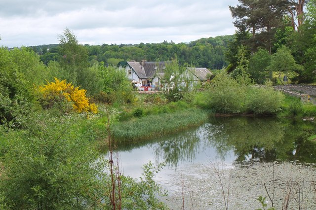
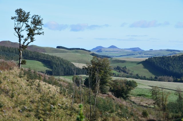
Blackcock Spinny is a picturesque woodland located in Selkirkshire, Scotland. Spanning over a vast area, this enchanting forest is known for its diverse flora and fauna, making it a popular destination for nature enthusiasts and hikers alike.

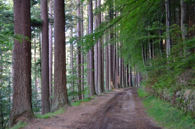
The woodland is predominantly composed of native species such as oak, birch, and Scots pine trees, which create a dense canopy and provide a habitat for various wildlife. The forest floor is carpeted with mosses, ferns, and wildflowers, adding to its natural beauty.

Blackcock Spinny is particularly renowned for its bird population, including the iconic black grouse, commonly known as "blackcock." These birds can often be spotted displaying their elaborate mating rituals during the breeding season, adding a touch of spectacle to the woodland experience.

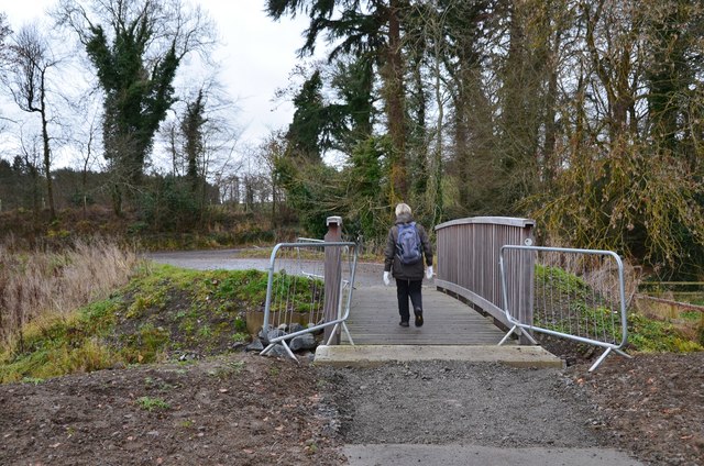
Numerous well-maintained trails wind through the woodland, allowing visitors to explore its hidden gems. These paths offer breathtaking views of the surrounding countryside and provide opportunities for birdwatching and photography. Additionally, the forest is home to several picnic areas, providing a tranquil spot for visitors to relax and enjoy the serene atmosphere.

The woodland is well-preserved and managed by local authorities, ensuring the conservation of its natural resources and promoting sustainable tourism. Interpretive signs and educational exhibits are scattered throughout the area, offering insights into the local flora, fauna, and history of the woodland.

Blackcock Spinny is a haven for those seeking tranquility, natural beauty, and a chance to immerse themselves in the wonders of Scotland's woodlands.

If you have any feedback on the listing, please let us know in the comments section below.

Blackcock Spinny Images

Images are sourced within 2km of 55.562054/-2.8801228 or Grid Reference NT4430. Thanks to Geograph Open Source API. All images are credited.

New footbridge over the Long Philip Burn, Selkirk Part of the flood protection works where the burn, prone to flash flooding from heavy rainfall in the hills around the Three Brethren, enters sediment ponds before continuing to the Ettrick Water through the landscaped area shown in <a href="https://www.geograph.org.uk/photo/5224909">NT4528 : Flood relief area, Long Philip Burn, Selkirk</a>. This new path starts by the A707 bridge on Linglie Road and emerges on Corbylinn Road.
New footbridge over the Long Philip Burn, Selkirk
Part of the flood protection works where the burn, prone to flash flooding from heavy rainfall in the hills around the Three Brethren, enters sediment ponds before continuing to the Ettrick Water through the landscaped area shown in NT4528 : Flood relief area, Long Philip Burn, Selkirk. This new path starts by the A707 bridge on Linglie Road and emerges on Corbylinn Road.
Pond near the Long Philip Burn, Selkirk From the new footbridge and rerouted path forming part of the flood protection scheme.
Pond near the Long Philip Burn, Selkirk
From the new footbridge and rerouted path forming part of the flood protection scheme.
Avenue on Corbylinn Road, Philiphaugh Some fine trees line the track on the way to the reservoir.
Avenue on Corbylinn Road, Philiphaugh
Some fine trees line the track on the way to the reservoir.
Approach to Tibby Tamson's grave The easiest way to find the grave is to follow the fence up from the reservoir to the wooden stile just visible at the centre of the image. Note that the name given on the OS map is 'Tibby' but 'Tibbie' is used on the graveside plaque and in the local footpath guide.
Approach to Tibby Tamson's grave
The easiest way to find the grave is to follow the fence up from the reservoir to the wooden stile just visible at the centre of the image. Note that the name given on the OS map is 'Tibby' but 'Tibbie' is used on the graveside plaque and in the local footpath guide.
Eildon Hills from Tibby Tamson's Plantation A view characteristic of the Scottish Borders with upland pasture, plantations and shelter belts with the volcanic hills enlivening the skyline.
Eildon Hills from Tibby Tamson's Plantation
A view characteristic of the Scottish Borders with upland pasture, plantations and shelter belts with the volcanic hills enlivening the skyline.
Selkirk from Traquair Plantation, Philiphaugh Looking across Philiphaugh estate to the town of Selkirk with the Lindean transmitting mast on the left.
Selkirk from Traquair Plantation, Philiphaugh
Looking across Philiphaugh estate to the town of Selkirk with the Lindean transmitting mast on the left.
Track to Montrose Plantation, Philiphaugh One of the waymarked routes in Philiphaugh Estate. The wooded hillside is Manor Hill Plantation across the valley of the Long Philip Burn.
Track to Montrose Plantation, Philiphaugh
One of the waymarked routes in Philiphaugh Estate. The wooded hillside is Manor Hill Plantation across the valley of the Long Philip Burn.
Track in Battlepark Plantation, Philiphaugh Track between dense woodlands above the A708.
Track in Battlepark Plantation, Philiphaugh
Track between dense woodlands above the A708.
Philipburn House Hotel, Selkirk The hotel has a function room on the left for weddings etc. We had a pleasant stay in a comfortable room away from the main house; the room had a French window, a patio with chairs, and a view over the lawn.
Philipburn House Hotel, Selkirk
The hotel has a function room on the left for weddings etc. We had a pleasant stay in a comfortable room away from the main house; the room had a French window, a patio with chairs, and a view over the lawn.
Strip plantations at Corby Linn Foulshiels Hill is in the background in this telephoto shot taken from Selkirk golf course.
Strip plantations at Corby Linn
Foulshiels Hill is in the background in this telephoto shot taken from Selkirk golf course.
Corbylinn Road at Manorhill Plantation The track to the reservoir passes these fine specimens of trees on the Philiphaugh Estate.
Corbylinn Road at Manorhill Plantation
The track to the reservoir passes these fine specimens of trees on the Philiphaugh Estate.
Waymarks near Corby Linn Philiphaugh Estate have waymarked some of the routes around the Long Philip Burn. The red arrow designates the route to Tibbie Tamson's grave.
Waymarks near Corby Linn
Philiphaugh Estate have waymarked some of the routes around the Long Philip Burn. The red arrow designates the route to Tibbie Tamson's grave.
Track above Corby Linn The track to the reservoir on the Long Philip Burn, part of the walk up to Tibbie Tamson's grave.
Track above Corby Linn
The track to the reservoir on the Long Philip Burn, part of the walk up to Tibbie Tamson's grave.
Tibbie Tamson's grave Bracken is encroaching the area around the grave. Note that her name is given as Tibby Tamson on the OS map, but is Tibbie Tamson on the sign at the grave: <a href="https://www.geograph.org.uk/photo/625954">NT4329 : The resting place of Tibbie Tamson</a>.
Tibbie Tamson's grave
Bracken is encroaching the area around the grave. Note that her name is given as Tibby Tamson on the OS map, but is Tibbie Tamson on the sign at the grave: NT4329 : The resting place of Tibbie Tamson.
Path in Tibbie Tamson's Plantation The return route through mixed woodlands and fields to the car park at Corbylinn Road on the waymarked circular walk to Tibbie Tamson's grave.
Path in Tibbie Tamson's Plantation
The return route through mixed woodlands and fields to the car park at Corbylinn Road on the waymarked circular walk to Tibbie Tamson's grave.
Gate near Fox Covert plantation On the circular walk to Tibbie Tamson's grave from the car park at Corbylinn Road on the Philiphaugh Estate.
Gate near Fox Covert plantation
On the circular walk to Tibbie Tamson's grave from the car park at Corbylinn Road on the Philiphaugh Estate.
Gate and stile, Traquair Plantation Access to the track heading down to Corbylinn Road on the Philiphaugh Estate, completing the circular walk up to Tibbie Tamson's grave.
Gate and stile, Traquair Plantation
Access to the track heading down to Corbylinn Road on the Philiphaugh Estate, completing the circular walk up to Tibbie Tamson's grave.
Barn and sheep pens, Philiphaugh Farm building by the track down to Corbylinn Road on the Philiphaugh Estate.
Barn and sheep pens, Philiphaugh
Farm building by the track down to Corbylinn Road on the Philiphaugh Estate.
Show me another place!

Blackcock Spinny is located at Grid Ref: NT4430 (Lat: 55.562054, Lng: -2.8801228)

Unitary Authority: The Scottish Borders

Police Authority: The Lothians and Scottish Borders

What 3 Words

///stint.backed.quicksand. Near Selkirk, Scottish Borders

Nearby Locations

Blackcock Spinny Peat Law

Related Wikis

Philiphaugh Stadium

Philiphaugh is a rugby union ground in the Royal Burgh of Selkirk, Scotland with a capacity of approximately 6,000. It is the home of Selkirk Rugby Football...

Yarrow Water

The Yarrow Water is a river in the Borders in the south east of Scotland. It is a tributary of the Ettrick Water (itself a tributary of the Tweed) and...

Selkirk railway station

Selkirk railway station served the town of Selkirk, Scottish Borders, Scotland, from 1856 to 1964 on the Selkirk and Galashiels Railway. == History... ==

Battle of Philiphaugh

The Battle of Philiphaugh was fought on 13 September 1645 during the Wars of the Three Kingdoms near Selkirk in the Scottish Borders. The Royalist army...

Have you been to Blackcock Spinny?

Leave your review of Blackcock Spinny below (or comments, questions and feedback).