Fala Mains Wood

Wood, Forest in Midlothian

Scotland

Fala Mains Wood

The Dean Burn Looking south from Deanburn House.
The Dean Burn Credit: M J Richardson

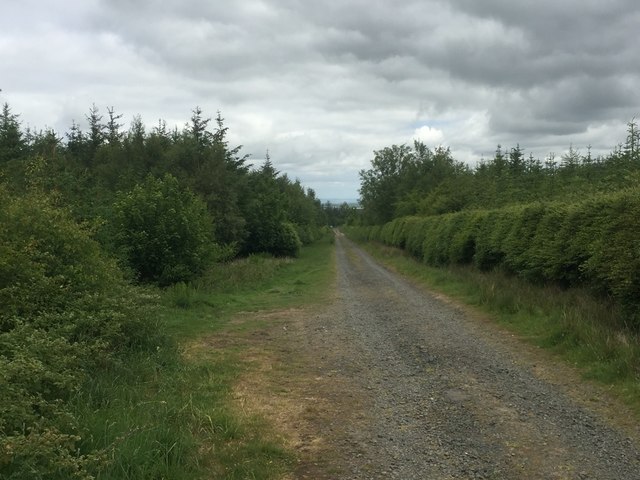
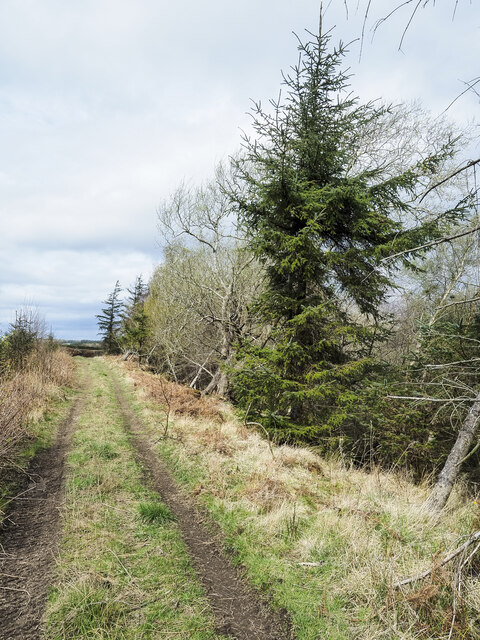
Fala Mains Wood is a picturesque woodland located in the Midlothian region of Scotland. Situated in the small village of Fala, this woodland is a popular destination for nature lovers and outdoor enthusiasts. Spanning an area of approximately 200 acres, Fala Mains Wood is characterized by its dense and diverse forest cover, with a variety of tree species including oak, beech, ash, and birch.

The woodland is crisscrossed by a network of well-maintained trails, making it an ideal spot for walking, hiking, and cycling. These paths offer visitors the opportunity to explore the wood at their own pace, immersing themselves in the tranquil atmosphere and enjoying the sights and sounds of nature. Along the way, visitors may encounter a range of wildlife, including red squirrels, badgers, and numerous bird species such as woodpeckers and owls.

Fala Mains Wood is not only a haven for flora and fauna, but it also holds historical significance. The wood is home to the remains of Fala Tower, a 16th-century fortified house that was once the residence of the Borthwick family. Exploring the ruins provides a glimpse into the area's rich past and offers a unique blend of nature and history.

The wood is open to the public throughout the year and is easily accessible from nearby towns and cities. With its stunning natural beauty, diverse wildlife, and historical charm, Fala Mains Wood offers a fulfilling and enriching experience for all who visit.

If you have any feedback on the listing, please let us know in the comments section below.

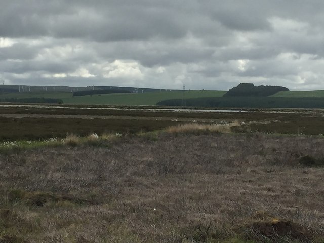
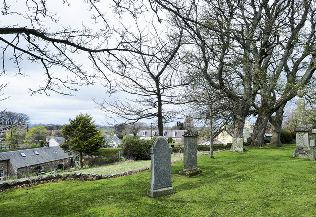
Fala Mains Wood Images

Images are sourced within 2km of 55.83144/-2.9048452 or Grid Reference NT4360. Thanks to Geograph Open Source API. All images are credited.

The Dean Burn Looking south from Deanburn House.
The Dean Burn
Looking south from Deanburn House.
The A68 at Dean Burn Looking southeast as it heads to Soutra.
The A68 at Dean Burn
Looking southeast as it heads to Soutra.
The A68 near Fala Heading northwest towards Fala Mains and Pathhead.
The A68 near Fala
Heading northwest towards Fala Mains and Pathhead.
The A68 crossing the Dean Burn Looking southeast to Soutra Mains.
The A68 crossing the Dean Burn
Looking southeast to Soutra Mains.
Pasture at Dean Burn Looking west to Fala Mains Wood.
Pasture at Dean Burn
Looking west to Fala Mains Wood.
Cotton grass, Fala Moor The heather has been cut here rather than burned.
Cotton grass, Fala Moor
The heather has been cut here rather than burned.
Moor Road The road over Fala Moor descends through Fala Mains Wood.  Taken from the gate onto the moor.
Moor Road
The road over Fala Moor descends through Fala Mains Wood. Taken from the gate onto the moor.
Moor Road At the northern end of Fala Moor.
Moor Road
At the northern end of Fala Moor.
Fala Moor With the cotton grass out.
Fala Moor
With the cotton grass out.
Fala Moor
Fala Moor
The Moor Road, Fala Moor Some tar still survives up here from when this was a better maintained road.
The Moor Road, Fala Moor
Some tar still survives up here from when this was a better maintained road.
Fala Moor Looking towards Fala Flow Loch
Fala Moor
Looking towards Fala Flow Loch
Cotton grass, Fala Moor
Fala Moor View over the cotton grass towards the northern end of the Pentland Hills.
Fala Moor
View over the cotton grass towards the northern end of the Pentland Hills.
Track between road and Routing Glen The track is rising towards a minor road north of the small settlement at Fala; it's not shown on OS maps. Routing Glen falling to the right, is remarkably steep-sided and deep for a lowland area.
Track between road and Routing Glen
The track is rising towards a minor road north of the small settlement at Fala; it's not shown on OS maps. Routing Glen falling to the right, is remarkably steep-sided and deep for a lowland area.
Fala, from its churchyard A view over the small settlement of Fala seen past gravestones in the graveyard. There's a warning at the entrance of the danger of unstable gravestones but no warning that there's a drop beyond the line of edging stones over which the unwary could fall.
Fala, from its churchyard
A view over the small settlement of Fala seen past gravestones in the graveyard. There's a warning at the entrance of the danger of unstable gravestones but no warning that there's a drop beyond the line of edging stones over which the unwary could fall.
Track across field heading towards tree The field, north-east of the A68 has a track north of a minor road which appears to end at the prominent tree. Of course it doesn't, the ground falls away and out of view the track turns to pass the tree.
Track across field heading towards tree
The field, north-east of the A68 has a track north of a minor road which appears to end at the prominent tree. Of course it doesn't, the ground falls away and out of view the track turns to pass the tree.
Trees on Little Law Little Law is a minor feature, a low hill amid cultivated land to the east of the valley of the Dean Burn.
Trees on Little Law
Little Law is a minor feature, a low hill amid cultivated land to the east of the valley of the Dean Burn.
Show me another place!

Fala Mains Wood is located at Grid Ref: NT4360 (Lat: 55.83144, Lng: -2.9048452)

Unitary Authority: Midlothian

Police Authority: The Lothians and Scottish Borders

What 3 Words

///toast.together.snowmen. Near Pencaitland, East Lothian

Nearby Locations

Fala Fala Mains Wood

Related Wikis

Fala, Midlothian

Fala is a hamlet in the south-eastern corner of Midlothian, Scotland, and about 15 miles from Edinburgh. == Location == The parish of the same name is...

Fala Flow

Fala Flow is an area of upland blanket bog on the edge of the Lammermuir Hills, in Midlothian, Scotland. Located north of the village of Fala, around 15...

Cakemuir Castle

Cakemuir Castle is an historic house situated 4 miles (6.4 km) southeast of Pathhead, in the Lammermuir Hills, Midlothian, Scotland. The name may be connected...

Soutra Aisle

Soutra Aisle, (the present structure lies just within the boundary of the Scottish Borders from Midlothian) not far from Fala, is the remains of the House...

Nearby Amenities

Located within 500m of 55.83144,-2.9048452
Design: barrel
Power: tower
Lat/Long: 55.8282123/-2.9097691
Design: barrel
Power: tower
Lat/Long: 55.827134/-2.9046394
Design: barrel
Power: tower
Lat/Long: 55.8307808/-2.9117956
The data included in this document is from www.openstreetmap.org. The data is made available under ODbL.

Have you been to Fala Mains Wood?

Leave your review of Fala Mains Wood below (or comments, questions and feedback).