Pirnie Braes

Wood, Forest in East Lothian

Scotland

Pirnie Braes

Railway path, Ormiston The site of Ormiston Station, land here has been put to good use as a garden.
Railway path, Ormiston Credit: Richard Webb

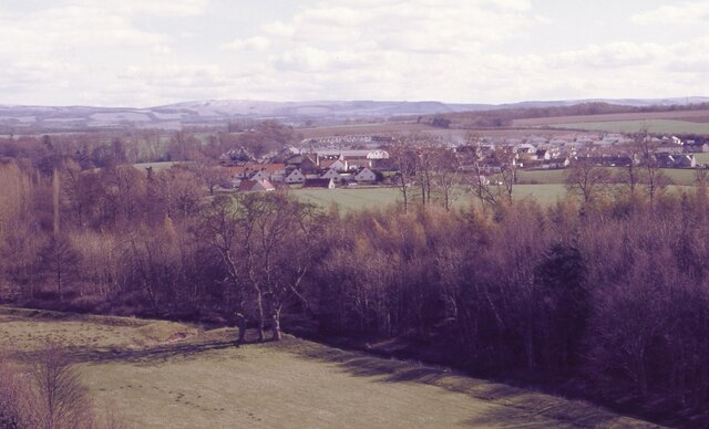
Pirnie Braes is a picturesque wood located in East Lothian, Scotland. Situated just outside the village of Gifford, it covers an area of approximately 100 acres. The wood is a popular destination for nature enthusiasts, hikers, and those seeking a tranquil escape from the hustle and bustle of daily life.

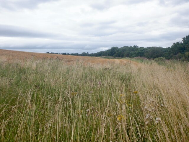
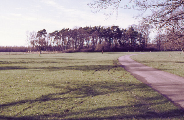
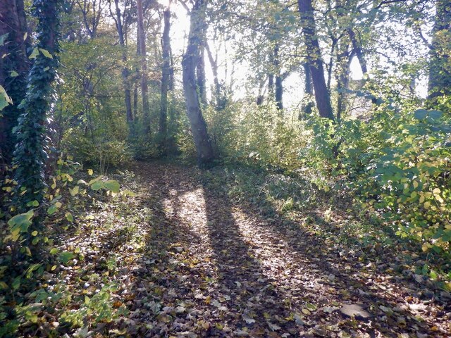
Pirnie Braes is characterized by its diverse range of tree species, including oak, beech, and birch. The lush greenery creates a serene atmosphere, with sunlight filtering through the dense canopy above. The forest floor is adorned with an array of wildflowers, adding bursts of color to the landscape.

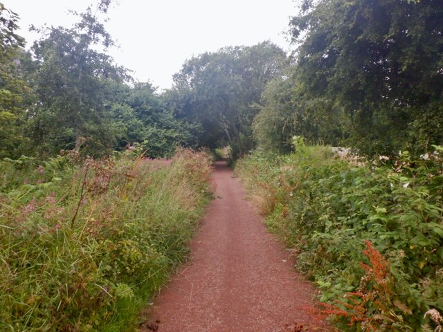
Trails wind their way through the wood, offering visitors the opportunity to explore its natural beauty. These paths cater to different fitness levels, with options for leisurely strolls or more challenging hikes. Along the way, walkers may encounter wildlife such as squirrels, rabbits, and a variety of bird species.

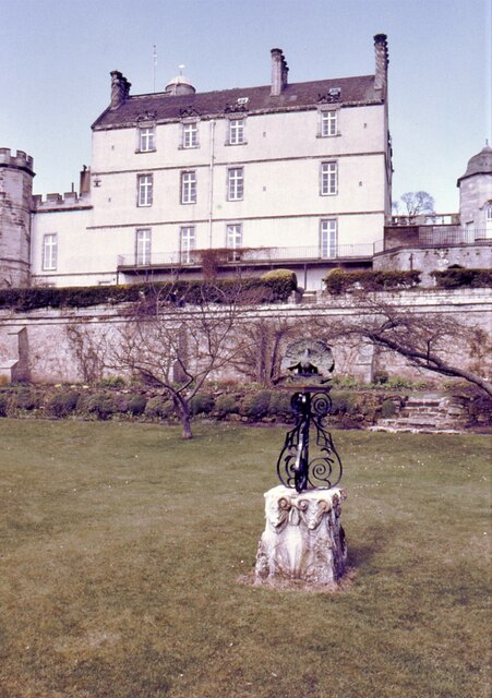
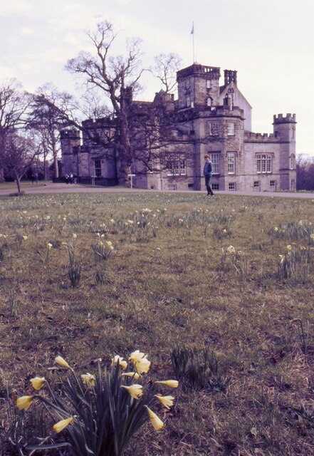
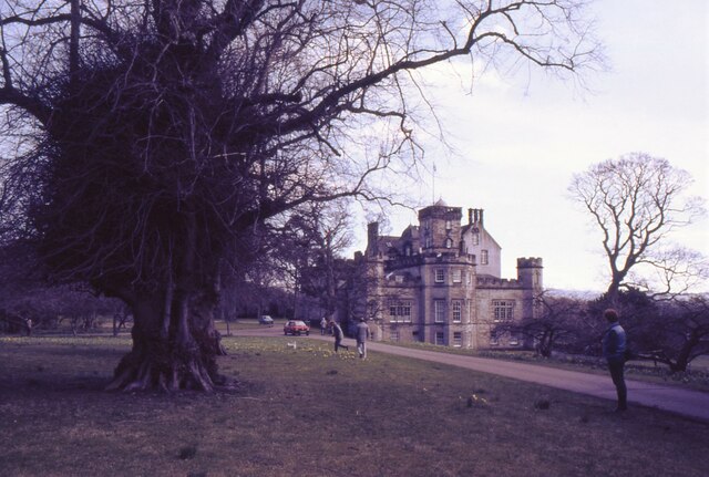
The wood also boasts a rich history, dating back centuries. Ruins of an old castle can be found within its boundaries, providing an intriguing glimpse into the past. Additionally, there are remnants of ancient settlements, adding an archaeological element to the area.

Pirnie Braes is a cherished spot in East Lothian, attracting visitors throughout the year. Whether it's a leisurely walk, a family picnic, or an opportunity to connect with nature, this wood offers a serene and captivating experience for all who venture within its borders.

If you have any feedback on the listing, please let us know in the comments section below.
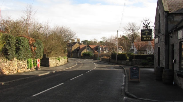
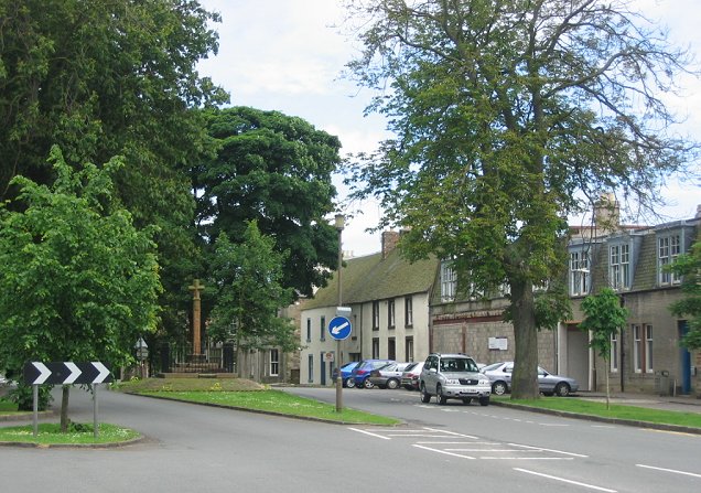
Pirnie Braes Images

Images are sourced within 2km of 55.912526/-2.9129885 or Grid Reference NT4369. Thanks to Geograph Open Source API. All images are credited.

Railway path, Ormiston The site of Ormiston Station, land here has been put to good use as a garden.
Railway path, Ormiston
The site of Ormiston Station, land here has been put to good use as a garden.
Wheat field, Ormiston
Ormiston Station The site of Ormiston Station, land here has been put to good use as a garden.
Ormiston Station
The site of Ormiston Station, land here has been put to good use as a garden.
Winton House Early 17th century house, with large additions about 1805. At the time the photograph was taken it was known as Winton House, but is now known as Winton Castle.
It is Category A listed <span class="nowrap"><a title="http://portal.historicenvironment.scot/designation/LB18948" rel="nofollow ugc noopener" href="http://portal.historicenvironment.scot/designation/LB18948">Link</a><img style="margin-left:2px;" alt="External link" title="External link - shift click to open in new window" src="https://s1.geograph.org.uk/img/external.png" width="10" height="10"/></span>.

Scanned from an AGFA colour transparency.
Winton House
Early 17th century house, with large additions about 1805. At the time the photograph was taken it was known as Winton House, but is now known as Winton Castle. It is Category A listed LinkExternal link. Scanned from an AGFA colour transparency.
Pencaitland Seen from Winton House.

Scanned from an AGFA colour transparency.
Pencaitland
Seen from Winton House. Scanned from an AGFA colour transparency.
Grass and woodland, Winton House The driveway leads from the house to the B6355.
Grass and woodland, Winton House
The driveway leads from the house to the B6355.
Winton House Early 17th century house, with large additions about 1805. At the time the photograph was taken it was known as Winton House, but is now known as Winton Castle.
It is Category A listed <span class="nowrap"><a title="http://portal.historicenvironment.scot/designation/LB18948" rel="nofollow ugc noopener" href="http://portal.historicenvironment.scot/designation/LB18948">Link</a><img style="margin-left:2px;" alt="External link" title="External link - shift click to open in new window" src="https://s1.geograph.org.uk/img/external.png" width="10" height="10"/></span>.

The garden ornament features a peacock.

Scanned from an AGFA colour transparency.
Winton House
Early 17th century house, with large additions about 1805. At the time the photograph was taken it was known as Winton House, but is now known as Winton Castle. It is Category A listed LinkExternal link. The garden ornament features a peacock. Scanned from an AGFA colour transparency.
Daffodil time At Winton House. The house dates from the early 17th century, with large additions about 1805. At the time the photograph was taken it was known as Winton House, but is now known as Winton Castle.
It is Category A listed <span class="nowrap"><a title="http://portal.historicenvironment.scot/designation/LB18948" rel="nofollow ugc noopener" href="http://portal.historicenvironment.scot/designation/LB18948">Link</a><img style="margin-left:2px;" alt="External link" title="External link - shift click to open in new window" src="https://s1.geograph.org.uk/img/external.png" width="10" height="10"/></span>.

Scanned from an AGFA colour transparency.
Daffodil time
At Winton House. The house dates from the early 17th century, with large additions about 1805. At the time the photograph was taken it was known as Winton House, but is now known as Winton Castle. It is Category A listed LinkExternal link. Scanned from an AGFA colour transparency.
An interesting tree Beside the drive approaching Wilton House. The house dates from the early 17th century, with large additions about 1805. At the time the photograph was taken it was known as Winton House, but is now known as Winton Castle.
It is Category A listed <span class="nowrap"><a title="http://portal.historicenvironment.scot/designation/LB18948" rel="nofollow ugc noopener" href="http://portal.historicenvironment.scot/designation/LB18948">Link</a><img style="margin-left:2px;" alt="External link" title="External link - shift click to open in new window" src="https://s1.geograph.org.uk/img/external.png" width="10" height="10"/></span>.

Scanned from an AGFA colour transparency.
An interesting tree
Beside the drive approaching Wilton House. The house dates from the early 17th century, with large additions about 1805. At the time the photograph was taken it was known as Winton House, but is now known as Winton Castle. It is Category A listed LinkExternal link. Scanned from an AGFA colour transparency.
Arthur McLeod Pavilion Changing facilities at the football pitch in Pencaitland.
Arthur McLeod Pavilion
Changing facilities at the football pitch in Pencaitland.
Cemetery, Pencaitland
Football pitch, Pencaitland
Vinefields, Pencaitland
Vinefields, Easter Pencaitland
Strip wood, Easter Pencaitland The wood predates the housing on former farmland on either side. There is now a path down it.
Strip wood, Easter Pencaitland
The wood predates the housing on former farmland on either side. There is now a path down it.
The Green, Pencaitland
Winton Arms, Pencaitland Undergoing some major building work. Unsure if this is a permanent closure or not at this time.
--
2023
Now open again
Winton Arms, Pencaitland
Undergoing some major building work. Unsure if this is a permanent closure or not at this time. -- 2023 Now open again
Woodhall Place, Wester Pencaitland
Show me another place!

Pirnie Braes is located at Grid Ref: NT4369 (Lat: 55.912526, Lng: -2.9129885)

Unitary Authority: East Lothian

Police Authority: The Lothians and Scottish Borders

What 3 Words

///vaccines.stalemate.began. Near Pencaitland, East Lothian

Nearby Locations

Pirnie Braes

Related Wikis

Nearby Amenities

Located within 500m of 55.912526,-2.9129885
Barrier: kissing_gate
Lat/Long: 55.9150803/-2.9068534
Barrier: kissing_gate
Lat/Long: 55.9147223/-2.9067157
Power: pole
Lat/Long: 55.9083155/-2.9105207
Power: pole
Lat/Long: 55.9086646/-2.9093307
Power: pole
Lat/Long: 55.9165274/-2.9115509
Power: pole
Lat/Long: 55.9159155/-2.9111258
Power: pole
Lat/Long: 55.9153583/-2.9107425
Power: pole
Lat/Long: 55.9145873/-2.9101898
Power: pole
Lat/Long: 55.9139718/-2.9097694
Power: pole
Lat/Long: 55.9132656/-2.908694
Power: pole
Lat/Long: 55.9126336/-2.907737
Power: pole
Lat/Long: 55.9120083/-2.9067918
Power: pole
Lat/Long: 55.9113787/-2.9058249
Power: pole
Lat/Long: 55.9160551/-2.9178634
Power: pole
Lat/Long: 55.9161216/-2.9171216
Power: pole
Lat/Long: 55.9155716/-2.9168341
Power: pole
Lat/Long: 55.9150754/-2.9165965
Power: pole
Lat/Long: 55.9146305/-2.916259
The data included in this document is from www.openstreetmap.org. The data is made available under ODbL.

Have you been to Pirnie Braes?

Leave your review of Pirnie Braes below (or comments, questions and feedback).