Colin's Plantation

Wood, Forest in Selkirkshire

Scotland

Colin's Plantation

Minor road, Hartwoodmyres
Minor road, Hartwoodmyres Credit: Richard Webb

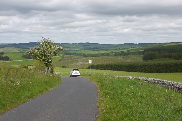
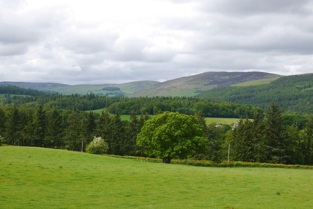
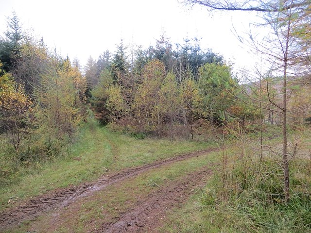
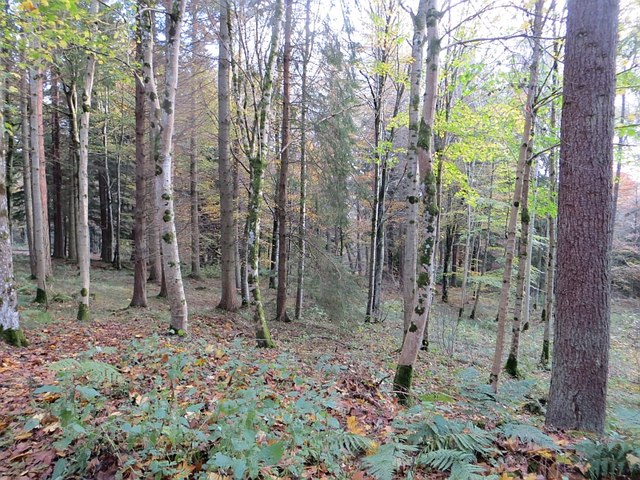
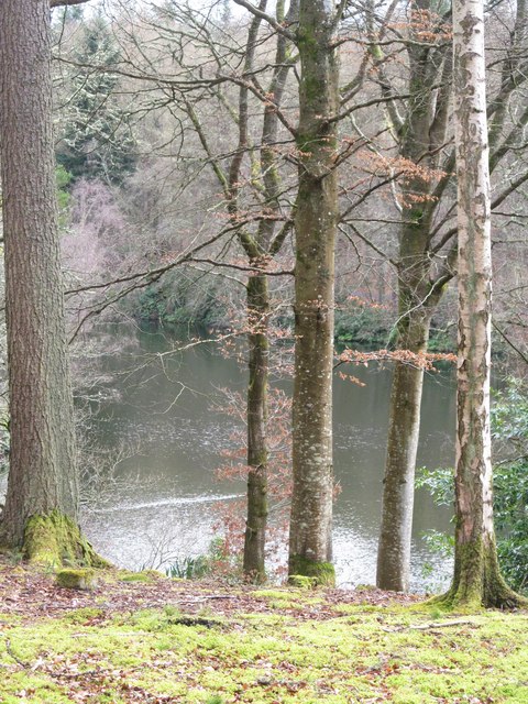
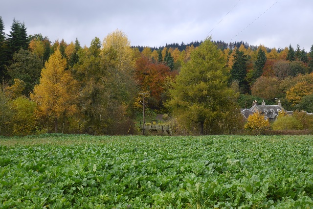
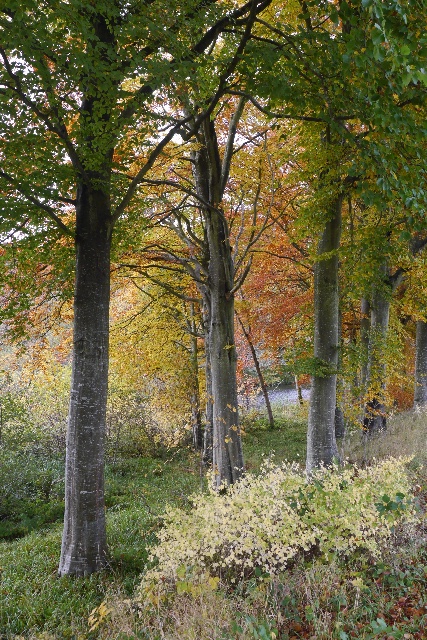
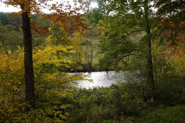
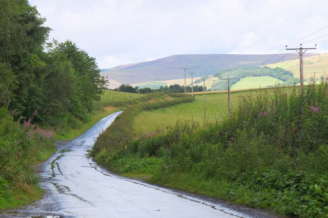
Colin's Plantation is a picturesque woodland located in Selkirkshire, a historic county in the Scottish Borders region of Scotland. Spanning a vast area, the plantation is renowned for its dense forest and towering trees that create a serene and tranquil atmosphere.

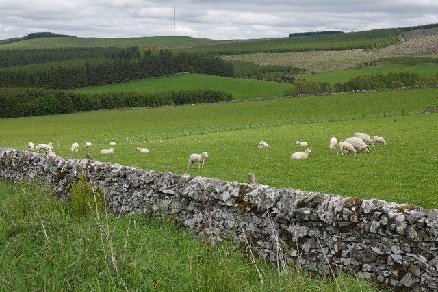
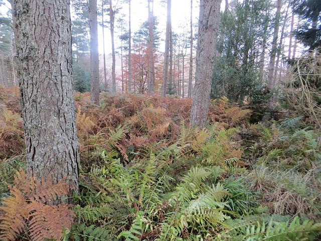
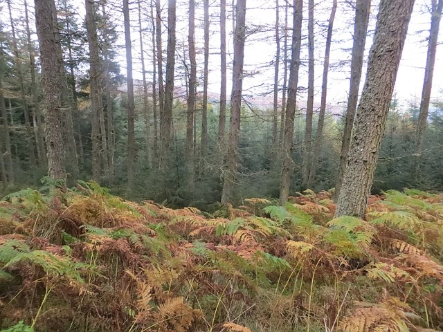
The plantation primarily consists of native Scottish tree species, such as oak, birch, and pine. These trees not only provide a stunning backdrop but also serve as a vital habitat for a diverse range of wildlife, including various bird species, small mammals, and insects. The dense canopy of the forest allows for a cool and shady environment, perfect for a leisurely stroll or a peaceful picnic amidst nature.

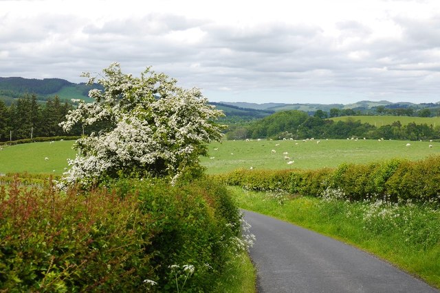
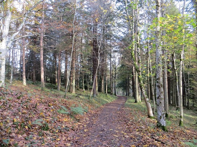
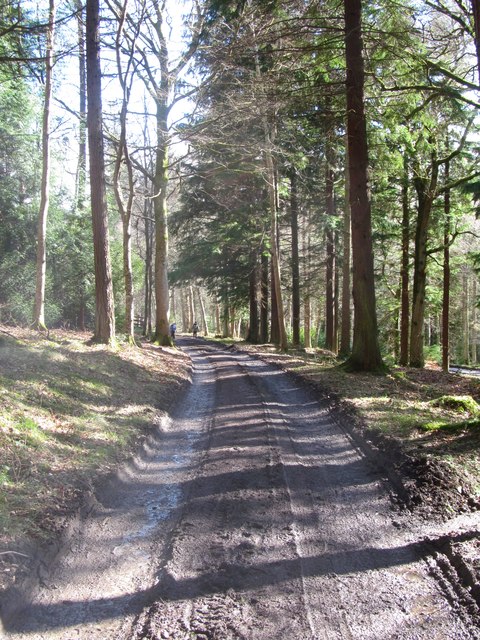
Colin's Plantation features well-maintained walking trails that wind through the woods, offering visitors a chance to immerse themselves in the beauty of the natural surroundings. The trails are suitable for all ages and abilities, with options ranging from short, leisurely walks to longer, more challenging routes for those seeking a more adventurous experience.

For nature enthusiasts and birdwatchers, the plantation is a paradise, providing ample opportunities to spot and observe a variety of native and migratory bird species. The tranquil atmosphere and abundant wildlife make it an ideal spot for photography and nature enthusiasts to capture stunning shots of the natural beauty on display.

In summary, Colin's Plantation in Selkirkshire offers a peaceful and idyllic escape into nature, with its lush forest, well-maintained trails, and diverse wildlife. Whether one seeks a leisurely stroll, a picnic with loved ones, or an opportunity to connect with nature, this plantation provides a delightful experience for all who visit.

If you have any feedback on the listing, please let us know in the comments section below.

Colin's Plantation Images

Images are sourced within 2km of 55.530454/-2.9081236 or Grid Reference NT4226. Thanks to Geograph Open Source API. All images are credited.

Minor road, Hartwoodmyres
Sheep, Hartwoodmyres
View over Carterhaugh Across the Ettrick towards heather covered hills above Bowhill woods.
View over Carterhaugh
Across the Ettrick towards heather covered hills above Bowhill woods.
The road from Woll Rig A hilly road, beloved of roadies, links Ashkirk and Ettrick Dale.
The road from Woll Rig
A hilly road, beloved of roadies, links Ashkirk and Ettrick Dale.
Track junction, Pernassie Hill Bowhill woodlands.
Track junction, Pernassie Hill
Bowhill woodlands.
Woodland, Pernassie Hill
Bowhill woodlands The northern side of Pernassie Hill.
Bowhill woodlands
The northern side of Pernassie Hill.
Path, Bowhill woods
Path, Bowhill woods
Woodland, Bowhill Mixed woodland at the foot of Pernassie Hill.
Woodland, Bowhill
Mixed woodland at the foot of Pernassie Hill.
Selkirk Flood Prevention Scheme work at Philiphaugh Traffic lights are in place while a low concrete wall is being constructed at a field boundary with the A708.
Selkirk Flood Prevention Scheme work at Philiphaugh
Traffic lights are in place while a low concrete wall is being constructed at a field boundary with the A708.
On the Duchess' Drive The lower end of the drive which forms a splendid 7+ mile walk from Bowhill House, being easily graded throughout.
On the Duchess' Drive
The lower end of the drive which forms a splendid 7+ mile walk from Bowhill House, being easily graded throughout.
Forestry clearance, Bowhill Estate A recently cleared area of conifers on the Bowhill Estate, the result being a much improved view towards the hills beyond the Ettrick Water.
Forestry clearance, Bowhill Estate
A recently cleared area of conifers on the Bowhill Estate, the result being a much improved view towards the hills beyond the Ettrick Water.
Through trees to the Upper Lake In the grounds of Bowhill House near Selkirk.
Through trees to the Upper Lake
In the grounds of Bowhill House near Selkirk.
Bowhill House north front The main block of the very large country house belonging to the Duke of Buccleuch. The central section seen here is 18thC whilst the wings to either side date from around 1814.
Bowhill House north front
The main block of the very large country house belonging to the Duke of Buccleuch. The central section seen here is 18thC whilst the wings to either side date from around 1814.
Shielshaugh Beside the Ettrick Water.
Shielshaugh
Beside the Ettrick Water.
Beeches, Carterhaugh Beside the Ettrick Water, on Halloween.
Beeches, Carterhaugh
Beside the Ettrick Water, on Halloween.
Ettrick Water, Carterhaugh
Estate road at Bowhill The road connects Bowhill with the North Lodge and passes Newark Castle.
Estate road at Bowhill
The road connects Bowhill with the North Lodge and passes Newark Castle.
Show me another place!

Colin's Plantation is located at Grid Ref: NT4226 (Lat: 55.530454, Lng: -2.9081236)

Unitary Authority: The Scottish Borders

Police Authority: The Lothians and Scottish Borders

What 3 Words

///slip.attending.chitchat. Near Selkirk, Scottish Borders

Related Wikis

Bowhill, Scottish Borders

Bowhill is a village off the A708, in the Scottish Borders area of Scotland, near Selkirk, by the Yarrow Water Other places nearby include Bowhill House...

Carterhaugh

Carterhaugh is a wood and farm near the confluence of the Yarrow Water and the Ettrick Water near Selkirk in the Scottish Borders. This real location...

Bowhill House

Bowhill House is a historic house near Bowhill at Selkirk in the Scottish Borders area of Scotland. It is a member of the Historic Houses Association,...

Aikwood Tower

Aikwood Tower (formerly known as Oakwood Tower) is a 16th-century tower house in the Scottish Borders area of Scotland, 4 miles (6 kilometres) southwest...

Nearby Amenities

Located within 500m of 55.530454,-2.9081236
Post Box
Collection Times: Mo-Sa 12:15
Operator: Royal Mail
Post Box Type: lamp
Ref: TD7 132
Royal Cypher: GVIR
Royal Cypher Wikidata: Q33102169
Lat/Long: 55.5302867/-2.9056511
Power: pole
Lat/Long: 55.5319083/-2.9059432
Power: pole
Lat/Long: 55.5319119/-2.9042466
Power: pole
Lat/Long: 55.5319131/-2.902592
Power: pole
Lat/Long: 55.5319131/-2.9009858
Bus Stop
Carterhaugh Bridge
Bus: yes
Naptan AtcoCode: 69001903
Naptan Bearing: SE
Naptan CommonName: Carterhaugh Bridge
Naptan Indicator: at
Naptan NaptanCode: 7271903
Naptan Street: B7009
Operator: Scottish Borders Council
Public Transport: platform
Ref: 69001903
Shelter: yes
Source: NaPTAN
Lat/Long: 55.5301607/-2.9045885
Bus Stop
Carterhaugh Bridge
Bus: yes
Naptan AtcoCode: 69001902
Naptan Bearing: NW
Naptan CommonName: Carterhaugh Bridge
Naptan Indicator: opp
Naptan NaptanCode: 7271902
Naptan Street: B7009
Operator: Scottish Borders Council
Public Transport: platform
Ref: 69001902
Shelter: yes
Source: NaPTAN
Lat/Long: 55.5302537/-2.9054974
The data included in this document is from www.openstreetmap.org. The data is made available under ODbL.

Have you been to Colin's Plantation?

Leave your review of Colin's Plantation below (or comments, questions and feedback).