Tillypronie Wood

Wood, Forest in Aberdeenshire

Scotland

Tillypronie Wood

Baderonach Hill Summit A "formal" cairn at the summit of Baderonach Hill 475m (Trump)
Baderonach Hill Summit Credit: Ralph Greig

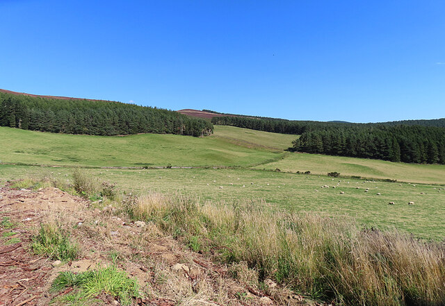
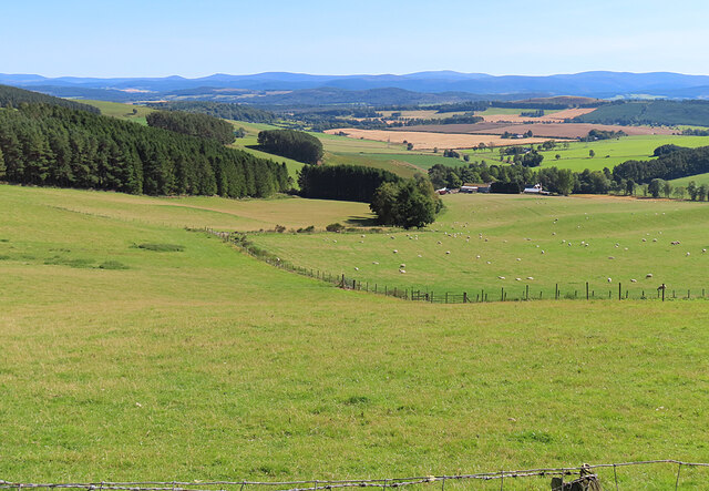
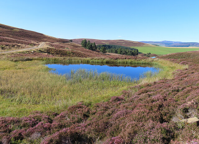
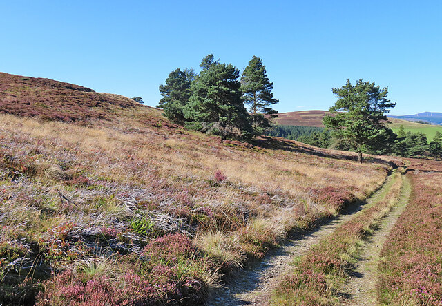
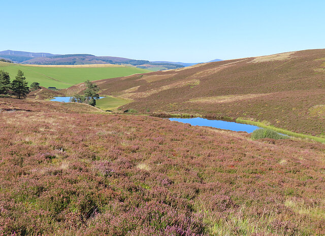
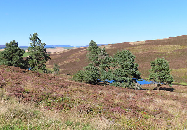
Tillypronie Wood is a charming forest located in Aberdeenshire, Scotland. Covering an area of approximately 350 acres, this woodland is a hidden gem for nature enthusiasts and outdoor lovers. The wood is situated on the eastern slopes of the Grampian Mountains, providing a picturesque setting for visitors.

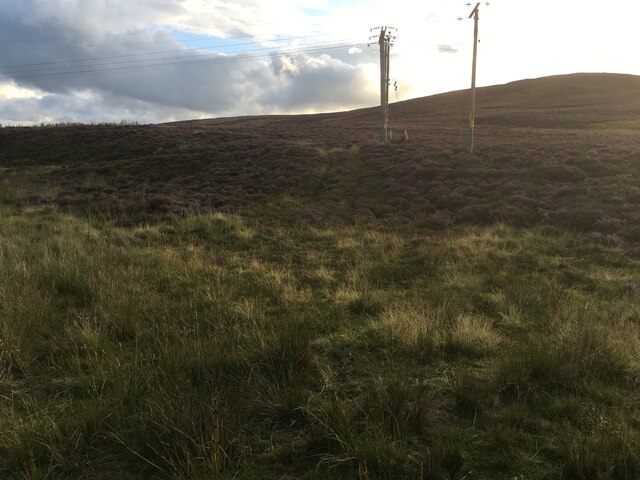
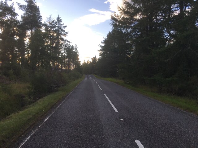
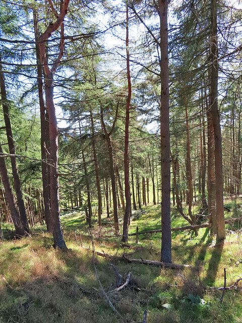
Tillypronie Wood is predominantly composed of majestic coniferous trees, including Scots pine, spruce, and fir. These towering giants create a dense canopy, offering shade and shelter to various wildlife species that call the forest home. The forest floor is covered in a lush carpet of ferns, mosses, and wildflowers, adding to its natural beauty.

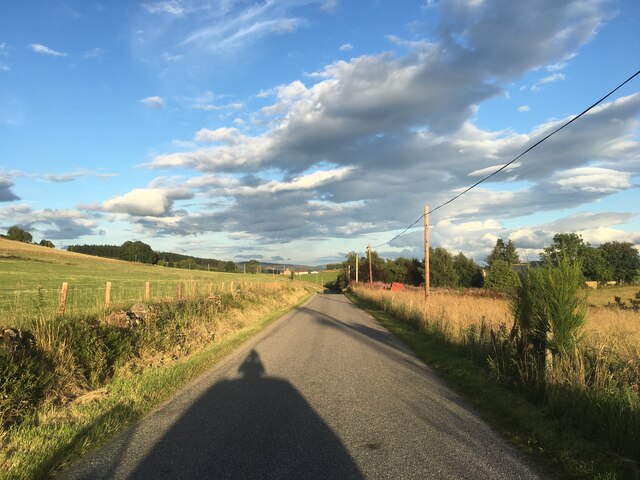
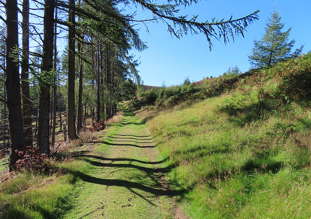
The wood boasts an extensive network of walking trails, allowing visitors to explore its hidden corners and appreciate the tranquility of the surroundings. These paths cater to various difficulty levels, ensuring that both casual strollers and experienced hikers can enjoy their time in the forest. Along the way, walkers may come across enchanting babbling streams and small waterfalls, adding to the magical atmosphere of Tillypronie Wood.

Birdwatchers will find delight in the diverse avian population that inhabits the wood. From woodpeckers and owls to red kites and buzzards, there is always something interesting to spot. Additionally, the forest is home to a variety of mammals, including red deer, squirrels, and pine martens.

Tillypronie Wood truly offers a peaceful escape from the hustle and bustle of daily life, providing visitors with a chance to connect with nature and appreciate the wonders of Aberdeenshire's landscapes.

If you have any feedback on the listing, please let us know in the comments section below.

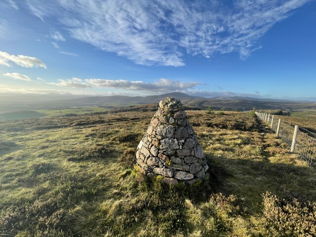
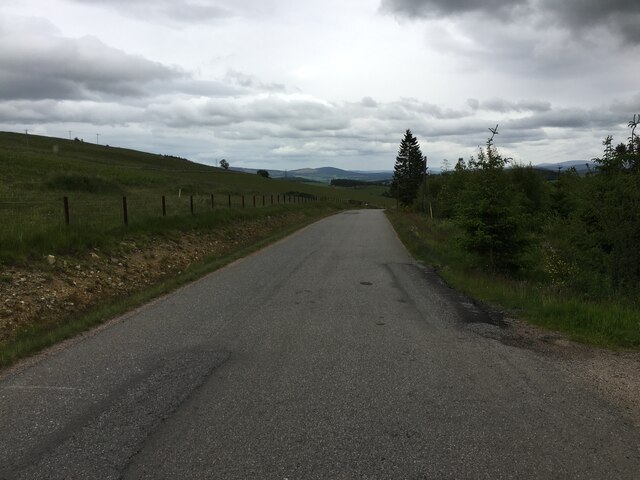
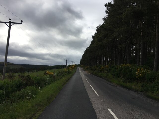
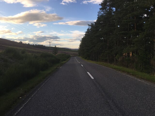
Tillypronie Wood Images

Images are sourced within 2km of 57.15835/-2.9492097 or Grid Reference NJ4207. Thanks to Geograph Open Source API. All images are credited.

Baderonach Hill Summit A "formal" cairn at the summit of Baderonach Hill 475m (Trump)
Baderonach Hill Summit
A "formal" cairn at the summit of Baderonach Hill 475m (Trump)
Minor road towards Migvie
A97 near Migvie
A97 near Migvie
A97 heading north
A97 heading north
Rough track on Craig Glas
A97 near Witchock Loch
Minor road near Migvie
Fields near Reinacharn Hill farming on the slopes of Molly Watt's Hill.
Fields near Reinacharn
Hill farming on the slopes of Molly Watt's Hill.
Fields at Reinacharn Looking downhill from the track north-east of Keeper's Cottage towards the flatter ground closer to the River Dee.
Fields at Reinacharn
Looking downhill from the track north-east of Keeper's Cottage towards the flatter ground closer to the River Dee.
Forest Belt This apparently unnamed strip of woodland is between two tracks east of Reinacharn Lodge.
Forest Belt
This apparently unnamed strip of woodland is between two tracks east of Reinacharn Lodge.
Forest Track This is the upper of two tracks that enclose a block of forest above Reinacharn Lodge.
Forest Track
This is the upper of two tracks that enclose a block of forest above Reinacharn Lodge.
Remains of a Fishing Hut The demise of the hut has been chronicled by Geograph contributors. See <a href="https://www.geograph.org.uk/photo/680832">NJ4408 : Fishing hut at Lazy Well</a>, taken in 2008 and <a href="https://www.geograph.org.uk/photo/2024069">NJ4408 : Weatherproof wooden bothy</a>, taken in 2010.
Remains of a Fishing Hut
The demise of the hut has been chronicled by Geograph contributors. See NJ4408 : Fishing hut at Lazy Well, taken in 2008 and NJ4408 : Weatherproof wooden bothy, taken in 2010.
Lazy Well Lazy Well is the name given to this artificial pool, created by a dam to the north.
Lazy Well
Lazy Well is the name given to this artificial pool, created by a dam to the north.
Track to the Lochans This track descends from Lazy Well to three more artificial ponds created for shooting.
Track to the Lochans
This track descends from Lazy Well to three more artificial ponds created for shooting.
Lazy Well Lochs This is the uppermost of three small artificial lochans created for shooting. There's a glimpse of the second one further down.
Lazy Well Lochs
This is the uppermost of three small artificial lochans created for shooting. There's a glimpse of the second one further down.
Scots Pines (Pinus sylvestris) A small row of native pines between tracks on the hill above the Lazy Well Lochans, one of which can be seen through the trees.
Scots Pines (Pinus sylvestris)
A small row of native pines between tracks on the hill above the Lazy Well Lochans, one of which can be seen through the trees.
Lonesome Pine This solitary Scots Pine stands beside the track from Lazy Well round Gallows Hill to the public road near Woodside. Below it is the lowest and largest of the three Lazy Well Lochans.
Lonesome Pine
This solitary Scots Pine stands beside the track from Lazy Well round Gallows Hill to the public road near Woodside. Below it is the lowest and largest of the three Lazy Well Lochans.
Looking towards Gallows Hill The track on the left skirts Gallows Hill and joins the public road near Woodside.
Looking towards Gallows Hill
The track on the left skirts Gallows Hill and joins the public road near Woodside.
Show me another place!

Tillypronie Wood is located at Grid Ref: NJ4207 (Lat: 57.15835, Lng: -2.9492097)

Unitary Authority: Aberdeenshire

Police Authority: North East

What 3 Words

///voucher.hurt.upsetting. Near Ballater, Aberdeenshire

Related Wikis

Migvie Castle

Migvie Castle was a 13th-century castle to the west of Migvie, Aberdeenshire, Scotland. Its remains were listed as a scheduled monument in 2007. ��2�...

Blue cairn circle

Blue cairn circle is a 21 metres (69 ft) diameter stone circle in Aberdeenshire, Scotland. In the center is a large stone cairn with several pits in it...

Logie Coldstone

Logie Coldstone (Scottish Gaelic: Lògaidh) is a village in Aberdeenshire, Scotland. The village lies north of the River Dee, near Tarland in the Cromar...

Blelack

Blelack (, Scottish Gaelic: Blàth Bholg) is a place in Aberdeenshire, Scotland, the location of Blelack House, a Scottish mansion house with origins in...

Towie, Aberdeenshire

Towie is a small hamlet and civil parish in Aberdeenshire, Scotland, close to Alford and Lumsden, on the River Don.One of the most notable features of...

Towie Castle

Towie Castle was a 17th-century tower house, about 3.5 miles (5.6 km) southwest of Kildrummy in Aberdeenshire, Scotland, on the right bank of the Don....

Tarland

Tarland (Gaelic: Turlann) is a village in Aberdeenshire, Scotland and is located 5 miles (8 km) northwest of Aboyne, and 30 miles (50 km) west of Aberdeen...

Morven, Aberdeenshire

Morven (Scottish Gaelic: A' Mhòr Bheinn) is a Corbett in Aberdeenshire, Scotland. It is 871 m (2858 ft) high. The poet, Lord Byron, who spent some of his...

Nearby Amenities

Located within 500m of 57.15835,-2.9492097
Power: pole
Lat/Long: 57.160444/-2.9418659
Power: pole
Lat/Long: 57.1602377/-2.9426856
Power: pole
Lat/Long: 57.1596246/-2.9434359
Power: pole
Lat/Long: 57.1590658/-2.944176
Power: pole
Lat/Long: 57.1585461/-2.944844
Power: pole
Lat/Long: 57.1580332/-2.9455198
Power: pole
Lat/Long: 57.1573852/-2.9461828
Power: pole
Lat/Long: 57.1565951/-2.9482821
Power: pole
Lat/Long: 57.155614/-2.9474136
Power: pole
Lat/Long: 57.1550858/-2.9469459
Power: pole
Lat/Long: 57.1547486/-2.946653
Hillside
Place: isolated_dwelling
Lat/Long: 57.1576039/-2.9451755
The data included in this document is from www.openstreetmap.org. The data is made available under ODbL.

Have you been to Tillypronie Wood?

Leave your review of Tillypronie Wood below (or comments, questions and feedback).