Woodside

Wood, Forest in Fife

Scotland

Woodside

Boghall Burn Just a line in the dirt after a long dry summer. This burn starts about 1k to the NE of here and flows out to the sea at Lower Largo some 5k away.
Boghall Burn Credit: Jim Bain

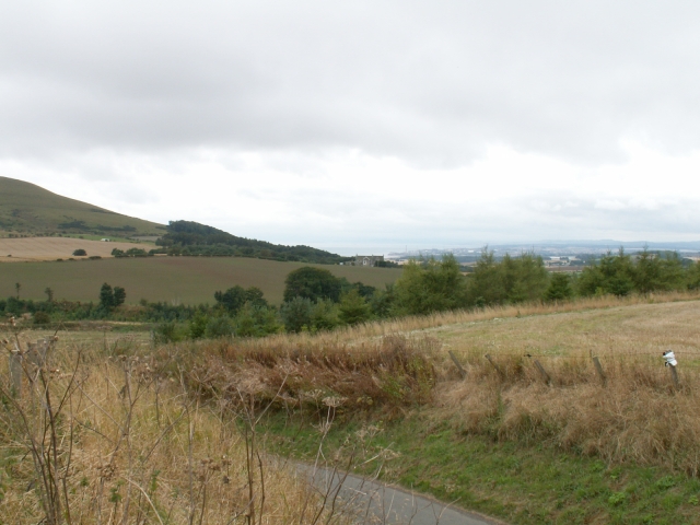
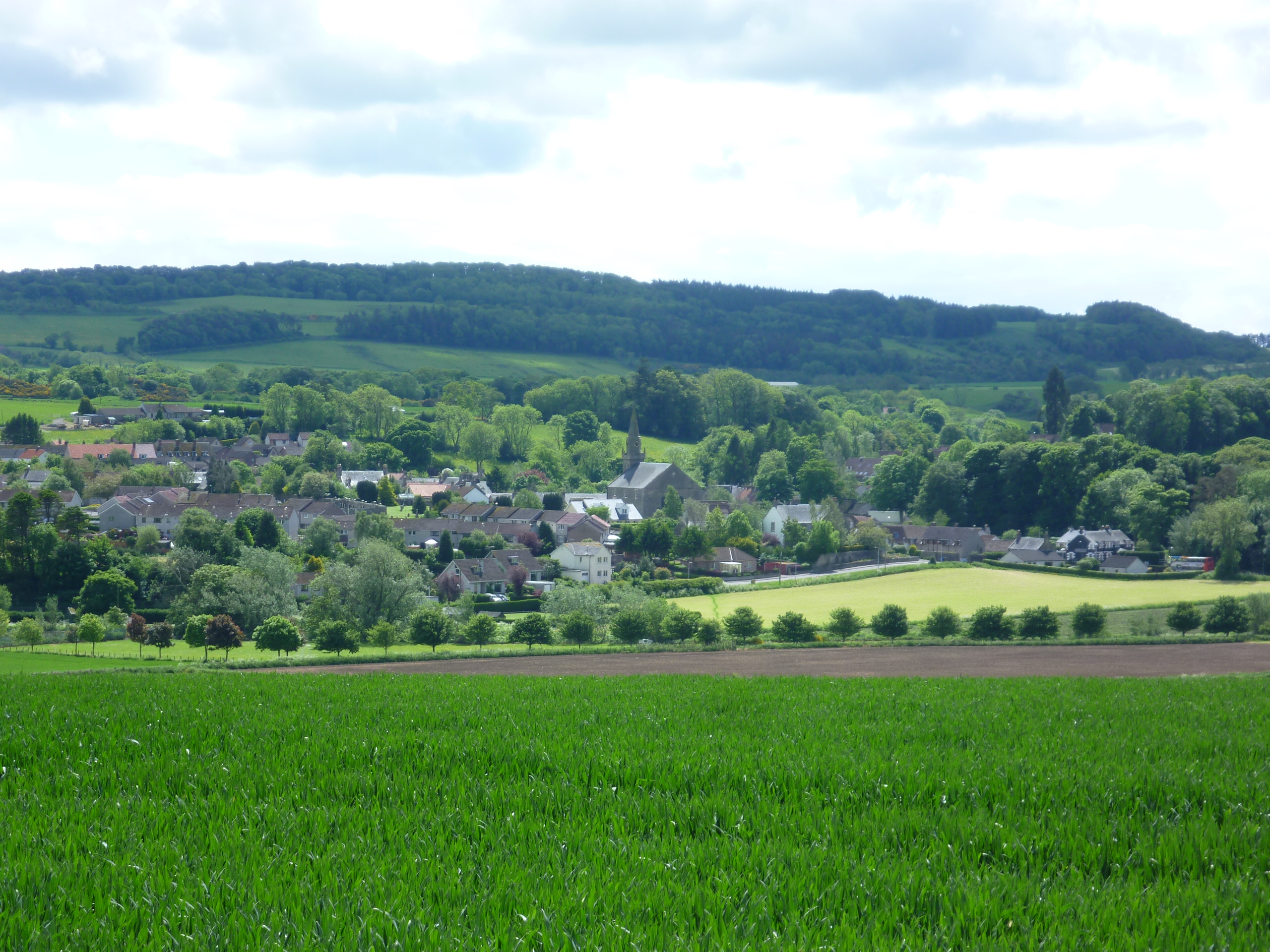
Woodside is a small village located in Fife, Scotland, known for its picturesque surroundings and lush forests. The village is nestled in the heart of the countryside, surrounded by rolling hills and woodlands, giving it a tranquil and peaceful atmosphere.

Woodside is home to a close-knit community of residents who take pride in their village and its natural beauty. The village is dotted with charming cottages and traditional stone buildings, giving it a quaint and idyllic feel.

The forests surrounding Woodside are a haven for wildlife, with an abundance of birds, deer, and other woodland creatures calling the area home. The woodlands are perfect for leisurely walks, hikes, and nature spotting, making Woodside a popular destination for outdoor enthusiasts.

In addition to its natural beauty, Woodside has a strong sense of community, with local events and activities organized throughout the year. The village also has a few local amenities, including a small shop and a pub, providing residents with the essentials they need.

Overall, Woodside is a charming and peaceful village, perfect for those looking to escape the hustle and bustle of city life and immerse themselves in nature.

If you have any feedback on the listing, please let us know in the comments section below.

Woodside Images

Images are sourced within 2km of 56.261391/-2.9387314 or Grid Reference NO4108. Thanks to Geograph Open Source API. All images are credited.

Boghall Burn Just a line in the dirt after a long dry summer. This burn starts about 1k to the NE of here and flows out to the sea at Lower Largo some 5k away.
Boghall Burn
Just a line in the dirt after a long dry summer. This burn starts about 1k to the NE of here and flows out to the sea at Lower Largo some 5k away.
Old Railway line The old rail line, marked by the line of trees once crossed the minor road at this point.
Old Railway line
The old rail line, marked by the line of trees once crossed the minor road at this point.
Looking towards Balhousie Looking from the NE corner of the square across to Balhousie Farm in the SW with Leven and the Forth in the background.
Looking towards Balhousie
Looking from the NE corner of the square across to Balhousie Farm in the SW with Leven and the Forth in the background.
New Gilston Traffic calming measures in New Gilston.
New Gilston
Traffic calming measures in New Gilston.
Mains at West Gilston Minor road towards Falfield from Lower Largo by West Gilston or Gilston Mains.
Mains at West Gilston
Minor road towards Falfield from Lower Largo by West Gilston or Gilston Mains.
Fleecefaulds Farm Fleecefaulds Farm. Taken looking due West from near Bankhead.
Fleecefaulds Farm
Fleecefaulds Farm. Taken looking due West from near Bankhead.
Teuchats crossroads Teuchats crossroads where two minor roads cross. To the left lies New Gilston about 3kms away and to the right lies Kame also about 3kms away. Beyond lies Largo about 5kms away and behind lies Ceres at about 4kms back.
Teuchats crossroads
Teuchats crossroads where two minor roads cross. To the left lies New Gilston about 3kms away and to the right lies Kame also about 3kms away. Beyond lies Largo about 5kms away and behind lies Ceres at about 4kms back.
Farmland by Balmain Looking out NE across the square from Balmain towards Baldastard.
Farmland by Balmain
Looking out NE across the square from Balmain towards Baldastard.
House beside Norrie's Law
Teuchats Farm The Teuchat, as you might surmise from the farm sign, is another name for the Peesweep or Lapwing
Teuchats Farm
The Teuchat, as you might surmise from the farm sign, is another name for the Peesweep or Lapwing
Baldastard Mains
Baldastard Mains
Hill Teasses Farm
Hill Teasses Farm
New Gilston Farm Farm at the west end of the village street
New Gilston Farm
Farm at the west end of the village street
Fleecefaulds Farm Seen from the hill near Carskerdo Farm. The mast in the background is on Drumcarrow Craig <a href="https://www.geograph.org.uk/gridref/NO4513">NO4513</a>
Fleecefaulds Farm
Seen from the hill near Carskerdo Farm. The mast in the background is on Drumcarrow Craig NO4513
Tower house Residential conversion of a keep
Tower house
Residential conversion of a keep
Gathercauld Wood Looking south from the track leading south from Callange Farm
Gathercauld Wood
Looking south from the track leading south from Callange Farm
By Gathercauld From by Gathercauld looking across the wooded ravine of the Craighall Burn to the Hall Teasses area on the high ground.
By Gathercauld
From by Gathercauld looking across the wooded ravine of the Craighall Burn to the Hall Teasses area on the high ground.
By West Gilston Field and trees just to the east of West Gilston Mains. Largo Law in the far distance.
By West Gilston
Field and trees just to the east of West Gilston Mains. Largo Law in the far distance.
Show me another place!

Woodside is located at Grid Ref: NO4108 (Lat: 56.261391, Lng: -2.9387314)

Unitary Authority: Fife

Police Authority: Fife

What 3 Words

///member.converter.evoked. Near Lundin Links, Fife

Related Wikis

Craighall Castle

Craighall Castle is located in Ceres, Fife, Scotland. It was built in 1637 by Sir Thomas Hope but there was a tower of previous land owners before 1637...

Peat Inn

Peat Inn is a hamlet in Fife, Scotland, around 7 miles (11 kilometres) southeast of Cupar on the B940 and 6 miles (10 kilometres) southwest of St Andrews...

Ceres, Fife

Ceres is a village in Fife, Scotland, located in a small glen approximately 2 miles (3 km) over the Ceres Moor from Cupar and 7 mi (11 km) from St Andrews...

Pitscottie

Pitscottie is a village in the Parish of Ceres, Fife, situated on the Ceres Burn at a road junction to the south of Dura Den and 3 miles (5 km) southeast...

Nearby Amenities

Located within 500m of 56.261391,-2.9387314
Woodside
Place: hamlet
Lat/Long: 56.260424/-2.9336705
Power: pole
Lat/Long: 56.2610179/-2.9467746
Power: pole
Lat/Long: 56.2606342/-2.9459478
Power: pole
Lat/Long: 56.2602425/-2.9450988
Power: pole
Lat/Long: 56.2597451/-2.9440249
Power: pole
Lat/Long: 56.259798/-2.9426126
Power: pole
Lat/Long: 56.2598396/-2.9415447
Power: pole
Lat/Long: 56.2599049/-2.9400635
Power: pole
Lat/Long: 56.259969/-2.9385985
Power: pole
Lat/Long: 56.2600298/-2.9373766
Power: pole
Lat/Long: 56.2600816/-2.9361325
Power: pole
Lat/Long: 56.2601446/-2.9349167
Power: pole
Lat/Long: 56.2601716/-2.9342338
Power: pole
Lat/Long: 56.2602279/-2.9329228
Power: pole
Lat/Long: 56.2602864/-2.9316341
The data included in this document is from www.openstreetmap.org. The data is made available under ODbL.

Have you been to Woodside?

Leave your review of Woodside below (or comments, questions and feedback).