Caythorpe

Settlement in Lincolnshire South Kesteven

England

Caythorpe

View from ridge
View from ridge Credit: Alex McGregor

Caythorpe is a village located in the county of Lincolnshire, England. Situated approximately 10 miles southwest of the city of Lincoln, it falls within the North Kesteven district. The village has a population of around 1,600 residents.

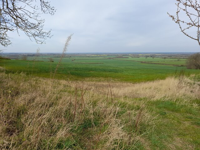
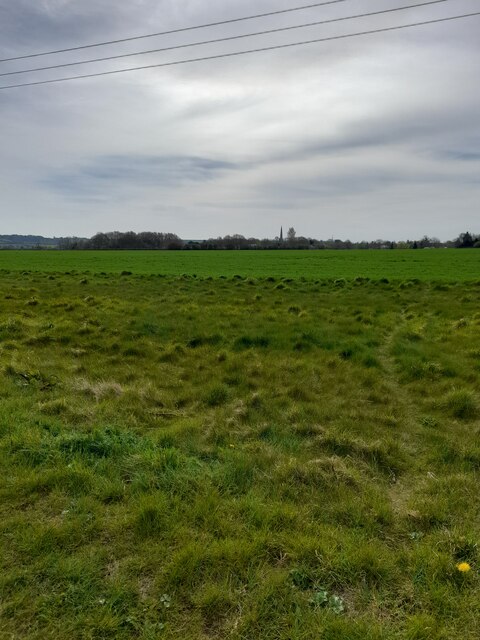
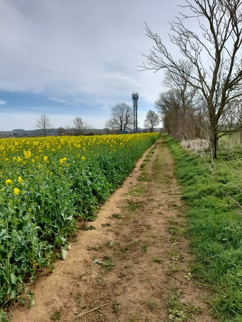
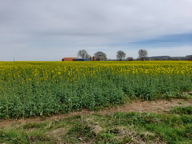
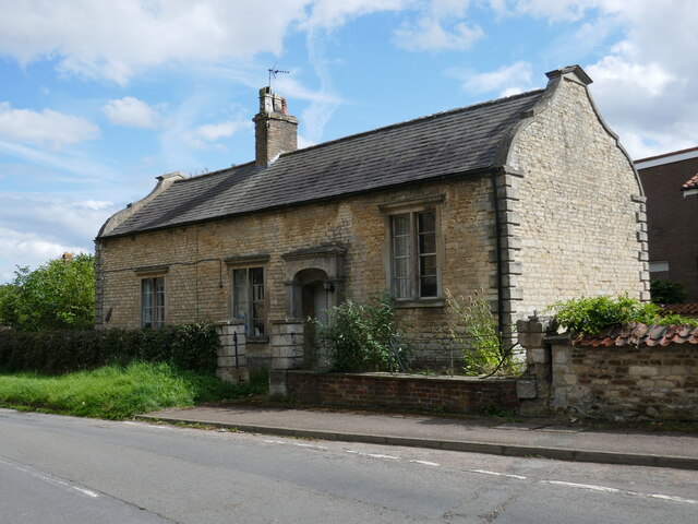
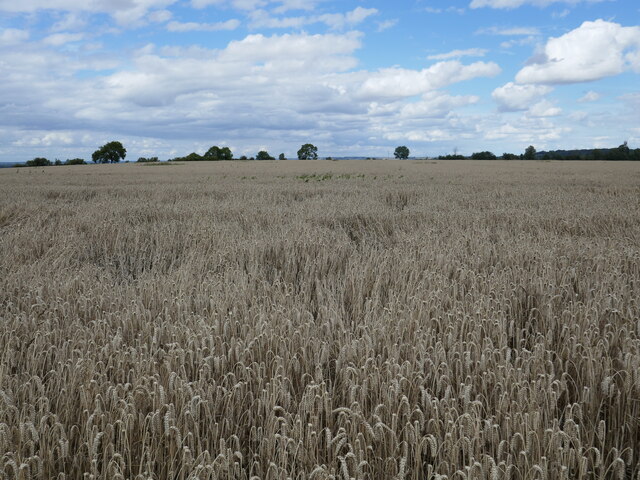
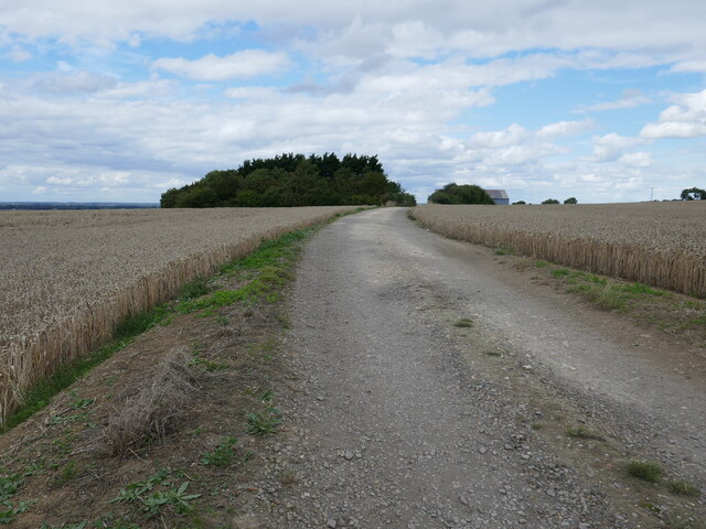
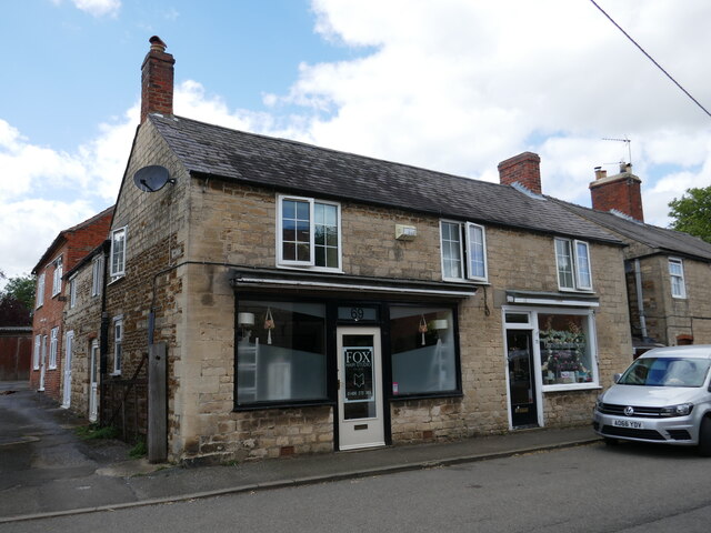
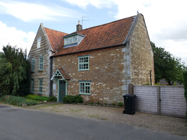
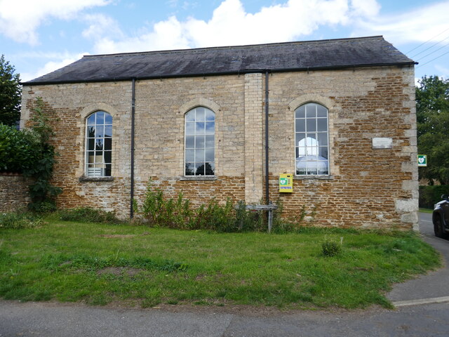
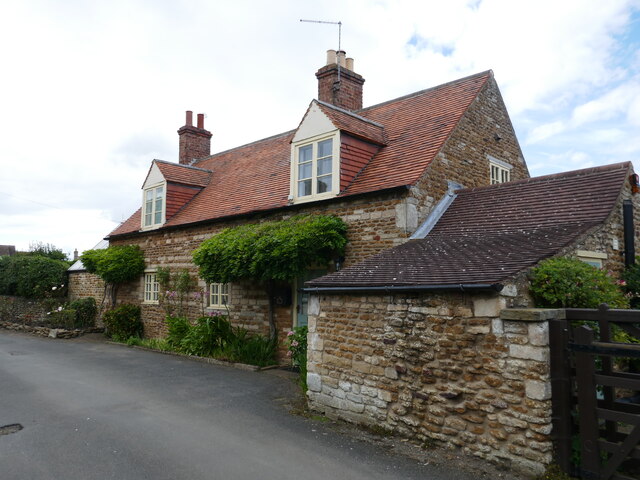
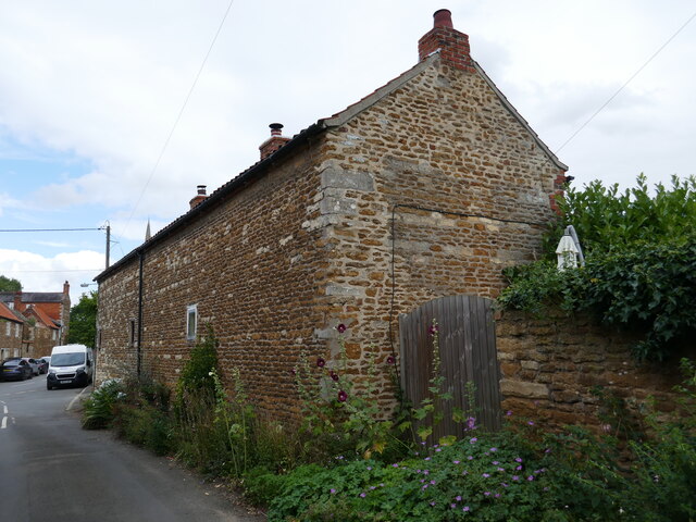
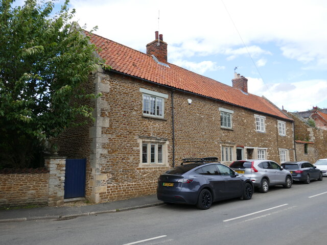
Caythorpe is known for its picturesque rural setting, surrounded by open countryside and farmland. The village itself features a mix of traditional stone cottages and modern houses, giving it a unique character. The local architecture reflects its long history, with some buildings dating back several centuries.

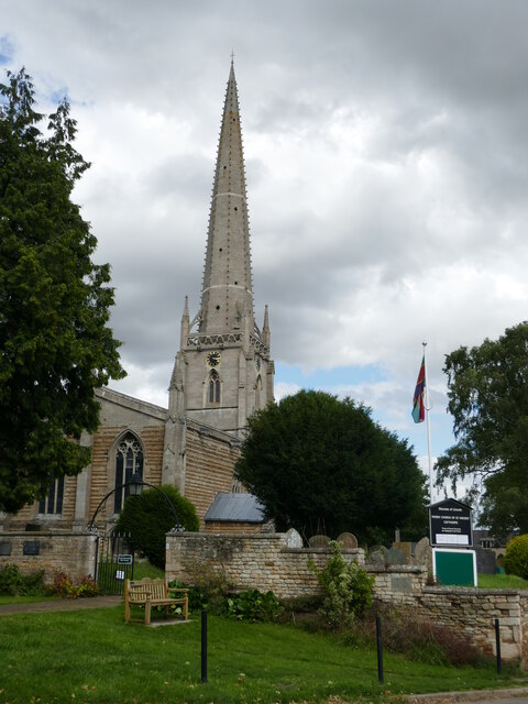
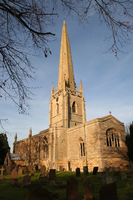
The heart of Caythorpe is dominated by St. Vincent's Church, a beautiful medieval structure that stands as a prominent landmark. The village also boasts a primary school, a village hall, and a local pub, providing essential amenities for residents and visitors alike.

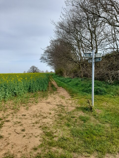
The surrounding area offers opportunities for outdoor activities, with numerous footpaths and bridleways to explore. There are also several parks and green spaces nearby, such as Caythorpe Playing Field, where locals can enjoy sports and recreational activities.

Caythorpe is well-connected to neighboring towns and cities through road links, with the A46 passing close by, providing easy access to Lincoln and Newark. The village is also served by regular bus services, ensuring convenient transportation options for residents.

Overall, Caythorpe offers a peaceful and idyllic setting, making it a desirable place to live for those seeking a tranquil village lifestyle within easy reach of nearby urban centers.

If you have any feedback on the listing, please let us know in the comments section below.

Caythorpe Images

Images are sourced within 2km of 53.021998/-0.602189 or Grid Reference SK9348. Thanks to Geograph Open Source API. All images are credited.

View from ridge
View from ridge
View across fields
View across fields
Communication mast
Communication mast
Victoria farm
Victoria farm
Public footpath
Public footpath
3 Church Lane, Caythorpe A former school dating from 1838 <span class="nowrap"><a title="https://historicengland.org.uk/listing/the-list/list-entry/1360306?section=official-list-entry" rel="nofollow ugc noopener" href="https://historicengland.org.uk/listing/the-list/list-entry/1360306?section=official-list-entry">Link</a><img style="margin-left:2px;" alt="External link" title="External link - shift click to open in new window" src="https://s1.geograph.org.uk/img/external.png" width="10" height="10"/></span>
3 Church Lane, Caythorpe
A former school dating from 1838 LinkExternal link
Wheat field, Caythorpe
Farm track to Gorse Barn
St Vincent's church, Caythorpe A rare exmple of a twin naved church <span class="nowrap"><a title="https://historicengland.org.uk/listing/the-list/list-entry/1317320?section=official-list-entry" rel="nofollow ugc noopener" href="https://historicengland.org.uk/listing/the-list/list-entry/1317320?section=official-list-entry">Link</a><img style="margin-left:2px;" alt="External link" title="External link - shift click to open in new window" src="https://s1.geograph.org.uk/img/external.png" width="10" height="10"/></span>
St Vincent's church, Caythorpe
A rare exmple of a twin naved church LinkExternal link
Commercial premises, High Street, Caythorpe
Templeway House, Caythorpe Seventeenth century house <span class="nowrap"><a title="https://historicengland.org.uk/listing/the-list/list-entry/1317395?section=official-list-entry" rel="nofollow ugc noopener" href="https://historicengland.org.uk/listing/the-list/list-entry/1317395?section=official-list-entry">Link</a><img style="margin-left:2px;" alt="External link" title="External link - shift click to open in new window" src="https://s1.geograph.org.uk/img/external.png" width="10" height="10"/></span>
Templeway House, Caythorpe
Seventeenth century house LinkExternal link
Former chapel, Caythorpe Now in commercial use.
Former chapel, Caythorpe
Now in commercial use.
26 Church Lane, Caythorpe Seventeenth century cottage <span class="nowrap"><a title="https://historicengland.org.uk/listing/the-list/list-entry/1165459?section=official-list-entry" rel="nofollow ugc noopener" href="https://historicengland.org.uk/listing/the-list/list-entry/1165459?section=official-list-entry">Link</a><img style="margin-left:2px;" alt="External link" title="External link - shift click to open in new window" src="https://s1.geograph.org.uk/img/external.png" width="10" height="10"/></span>
26 Church Lane, Caythorpe
Seventeenth century cottage LinkExternal link
21 and 23 Church Lane, Caythorpe Face away from the street.
21 and 23 Church Lane, Caythorpe
Face away from the street.
8 and 10 Church Lane, Caythorpe Seventeenth century house now subdivided <span class="nowrap"><a title="https://historicengland.org.uk/listing/the-list/list-entry/1062435?section=official-list-entry" rel="nofollow ugc noopener" href="https://historicengland.org.uk/listing/the-list/list-entry/1062435?section=official-list-entry">Link</a><img style="margin-left:2px;" alt="External link" title="External link - shift click to open in new window" src="https://s1.geograph.org.uk/img/external.png" width="10" height="10"/></span>
8 and 10 Church Lane, Caythorpe
Seventeenth century house now subdivided LinkExternal link
St.Vincent's church, Caythorpe, Lincs. One of only four churches in England dedicated to St.Vincent. A splendid Decorated, cruciform church with lofty, crocketed spire and unusual arcade down the centre of the nave.
St.Vincent's church, Caythorpe, Lincs.
One of only four churches in England dedicated to St.Vincent. A splendid Decorated, cruciform church with lofty, crocketed spire and unusual arcade down the centre of the nave.
Cross of Sacrifice at Caythorpe This is a war memorial erected outside the gate into St. Vincent church. On the stones supporting the cross are the names of the men from the village who died in World Wars 1 and 2.
Cross of Sacrifice at Caythorpe
This is a war memorial erected outside the gate into St. Vincent church. On the stones supporting the cross are the names of the men from the village who died in World Wars 1 and 2.
Falklands Campaign Memorial, Caythorpe This slate memorial is on a block of stone which is set amongst some granite chippings  close to the war memorial.
Falklands Campaign Memorial, Caythorpe
This slate memorial is on a block of stone which is set amongst some granite chippings close to the war memorial.
Show me another place!

Caythorpe is located at Grid Ref: SK9348 (Lat: 53.021998, Lng: -0.602189)

Division: Parts of Kesteven

Administrative County: Lincolnshire

District: South Kesteven

Police Authority: Lincolnshire

What 3 Words

///failed.sniff.calibrate. Near Caythorpe, Lincolnshire

Nearby Locations

Beighton's Gorse Caythorpe

Related Wikis

Caythorpe, Lincolnshire

Caythorpe is a large village and civil parish in the South Kesteven district of Lincolnshire, England. The population at 2011 census was 1,374. It is situated...

St Vincent's Church, Caythorpe

St Vincent's Church is a Grade I listed Church of England parish church in Caythorpe, Lincolnshire, England. It is at the southern edge of the Lincoln...

Frieston

Frieston is a village in the South Kesteven district of Lincolnshire, England. It is situated just west of the A607 road, and 7 miles (11 km) north from...

Caythorpe railway station

Caythorpe railway station was a station in Caythorpe, Lincolnshire. Built to serve the nearby village of the same name. It was on the Grantham and Lincoln...
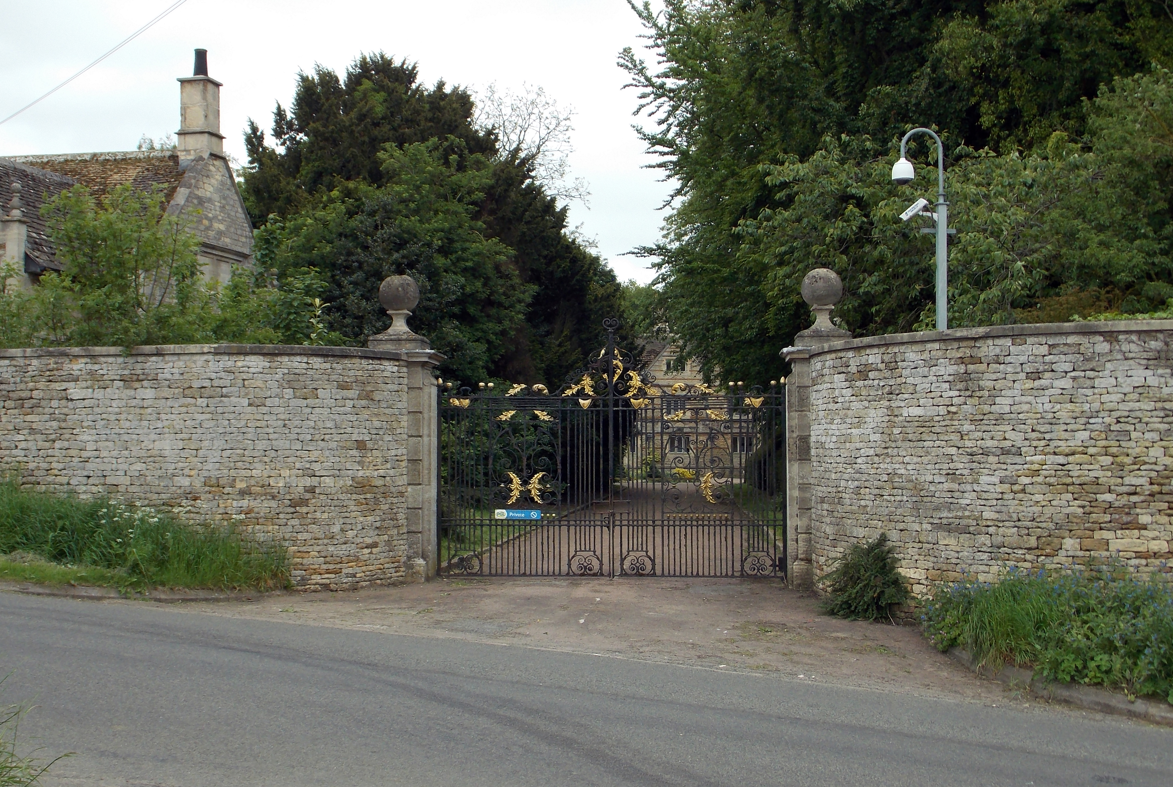
Caythorpe Court

Caythorpe Court is a Grade II* listed former hunting lodge situated about one mile to the east of Caythorpe, Lincolnshire, England. It was originally built...

Hough-on-the-Hill

Hough-on-the-Hill is a village and civil parish in the South Kesteven district of Lincolnshire, England. The population of the civil parish including Brandon...

Normanton-on-Cliffe

Normanton-on-Cliffe, sometimes known as Normanton, is a village and civil parish in the South Kesteven district of Lincolnshire, England. It lies on the...

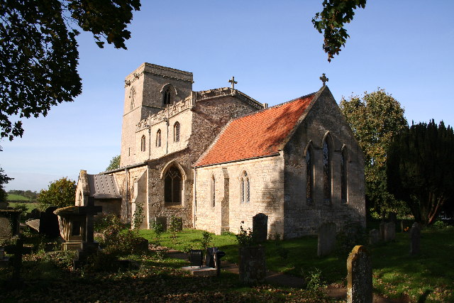
St Nicholas Church, Normanton

St Nicholas Church is a redundant Anglican church in Normanton-on-Cliffe, Lincolnshire, England. It is recorded in the National Heritage List for England...

Nearby Amenities

Located within 500m of 53.021998,-0.602189
Caythorpe
Place: village
Lat/Long: 53.0250422/-0.6033186
Frieston
Place: village
Lat/Long: 53.0187417/-0.6010851
Bus Stop
Eastcliffe Square
Naptan AtcoCode: 270000008567
Naptan Bearing: S
Naptan CommonName: Eastcliffe Square
Naptan Indicator: adj
Naptan Landmark: Eastcliffe Square
Naptan NaptanCode: lingtgpa
Naptan Street: High Street
Naptan Verified: no
Public Transport: platform
Source: naptan_import
Lat/Long: 53.0234948/-0.6026101
Bus Stop
Red Lion PH
Naptan AtcoCode: 270000008568
Naptan Bearing: NE
Naptan CommonName: Red Lion PH
Naptan Indicator: opp
Naptan Landmark: Red Lion PH
Naptan NaptanCode: lingtgpd
Naptan Street: High Street
Naptan Verified: no
Source: naptan_import
Lat/Long: 53.0252562/-0.6025531
Bus Stop
Frieston Road
Naptan AtcoCode: 270000008618
Naptan Bearing: NE
Naptan CommonName: Frieston Road
Naptan Indicator: adj
Naptan Landmark: Frieston Road
Naptan NaptanCode: lingtjpg
Naptan Street: Hough Road
Naptan Verified: no
Source: naptan_import
Lat/Long: 53.0179493/-0.6025442
Bus Stop
Frieston Road
Naptan AtcoCode: 270000008619
Naptan Bearing: SW
Naptan CommonName: Frieston Road
Naptan Indicator: opp
Naptan Landmark: Frieston Road
Naptan NaptanCode: lingtjpj
Naptan Street: Hough Road
Naptan Verified: no
Source: naptan_import
Lat/Long: 53.0179028/-0.602363
St Vincents Church
Naptan AtcoCode: 270002701081
Naptan Bearing: E
Naptan BusStopType: CUS
Naptan CommonName: St Vincents Church
Naptan Indicator: adj
Naptan Landmark: St Vincents Church
Naptan Street: Church Lane
Naptan Verified: no
Source: naptan_import
Lat/Long: 53.0259352/-0.6014278
St Vincents Church
Naptan AtcoCode: 270002701083
Naptan Bearing: W
Naptan BusStopType: CUS
Naptan CommonName: St Vincents Church
Naptan Indicator: opp
Naptan Landmark: St Vincents Church
Naptan Street: Church Lane
Naptan Verified: no
Source: naptan_import
Lat/Long: 53.0258275/-0.6014462
Bus Stop
South Parade
Naptan AtcoCode: 2700LCPS1314
Naptan Bearing: NW
Naptan CommonName: South Parade
Naptan Indicator: adj
Naptan Landmark: South Parade
Naptan NaptanCode: linajpaw
Naptan Street: High Street
Naptan Verified: no
Public Transport: platform
Source: naptan_import
Lat/Long: 53.02224/-0.6022779
Bus Stop
Red Lion PH
Naptan AtcoCode: 2700LCRLP405
Naptan Bearing: SW
Naptan CommonName: Red Lion PH
Naptan Indicator: adj
Naptan Landmark: Red Lion PH
Naptan NaptanCode: linadpam
Naptan Street: High Street
Naptan Verified: no
Public Transport: platform
Source: naptan_import
Lat/Long: 53.0252941/-0.6023823
Entrance: yes
Lat/Long: 53.0245695/-0.5984103
Ele: 63.0917969
Lat/Long: 53.0231534/-0.6004026
Ele: 65.4951172
Lat/Long: 53.02478/-0.6006875
Ele: 65.4951172
Lat/Long: 53.0249193/-0.600701
Bench
Check Date: 2021-07-09
Lat/Long: 53.0242079/-0.6053549
Ele: 72.2241211
Lat/Long: 53.0232004/-0.6046582
Ele: 73
Lat/Long: 53.0242242/-0.6051838
Ele: 69
Lat/Long: 53.021437/-0.6037777
Ele: 69.3403320
Lat/Long: 53.0213055/-0.6042242
Pub
Waggon and Horses
Addr City: Caythorpe
Addr Housenumber: 57
Addr Postcode: NG32 3DR
Addr Street: High Street
Ele: 65
Fhrs Authority: South Kesteven
Fhrs Id: 238528
Fhrs Local Authority Id: 4095
Real Ale: Black Sheep, Everards Tiger
Wikidata: Q26315765
Lat/Long: 53.0246468/-0.6029947
Fast Food
Cuisine: fish_and_chips
Ele: 65.7353516
Lat/Long: 53.024637/-0.6027049
Barrier: cycle_barrier
Ele: 63.8127441
Lat/Long: 53.0229439/-0.6025245
Pub
Red Lion
Addr City: Caythorpe
Addr Housenumber: 62
Addr Postcode: NG32 3DN
Addr Street: High Street
Ele: 65.5
Fhrs Authority: South Kesteven
Fhrs Id: 237691
Fhrs Local Authority Id: 4098
Food: yes
Note: Food on Saturday 12-2 and 6-9:30
Real Ale: Everards Tiger, Adnams Bitter
Wikidata: Q26315767
Lat/Long: 53.0253532/-0.6023153
Post Office
Ele: 65.7353516
Lat/Long: 53.0249822/-0.6024581
Post Box
Post Box Type: wall
Royal Cypher: GR
Lat/Long: 53.0249871/-0.602603
Ele: 68.1386719
Information: board
Tourism: information
Lat/Long: 53.0251307/-0.6065244
Post Box
Ele: 68.1386719
Post Box Type: lamp
Royal Cypher: EIIR
Lat/Long: 53.0251823/-0.6065458
Ele: 69.0999756
Lat/Long: 53.0197509/-0.6062658
Barrier: stile
Steps: 1
Stile: stepover
Lat/Long: 53.0188128/-0.6003639
Barrier: stile
Steps: 1
Stile: stepover
Lat/Long: 53.0195751/-0.6008538
Barrier: cycle_barrier
Lat/Long: 53.0213624/-0.6037255
Post Box
Post Box Type: lamp
Royal Cypher: EIIR
Lat/Long: 53.0180254/-0.6013715
Love Lane Farm
Place: farm
Source: Bing
Lat/Long: 53.0220413/-0.5970044
Barrier: entrance
Fixme: resurvey
Lat/Long: 53.0256523/-0.6005451
Spar
Addr City: Caythorpe
Addr Country: GB
Addr Housenumber: 17,19
Addr Postcode: NG32 3DR
Addr Street: High Street
Brand: Spar
Brand Wikidata: Q610492
Brand Wikipedia: en:Spar (retailer)
Fhrs Authority: South Kesteven
Fhrs Id: 237954
Fhrs Local Authority Id: 4089
Shop: convenience
Source: local knowledge;bing
Website: https://www.spar.co.uk/store-locator/afb31674-spar-caythorpe/
Lat/Long: 53.0221738/-0.6023833
Barrier: stile
Fixme: resurvey
Lat/Long: 53.0259168/-0.5995145
Entrance: yes
Fixme: resurvey
Lat/Long: 53.0259028/-0.5998792
Frieston Green
Place: locality
Source: Bing
Lat/Long: 53.01758/-0.6015409
Resurgam Farm
Place: farm
Source: Bing
Lat/Long: 53.0241451/-0.6086789
Generator Method: photovoltaic
Generator Output Electricity: yes
Generator Source: solar
Generator Type: solar_photovoltaic_panel
Location: roof
Power: generator
Lat/Long: 53.0178563/-0.6005259
Generator Method: photovoltaic
Generator Output Electricity: yes
Generator Source: solar
Generator Type: solar_photovoltaic_panel
Location: roof
Power: generator
Lat/Long: 53.0177515/-0.6020709
Generator Method: photovoltaic
Generator Output Electricity: yes
Generator Source: solar
Generator Type: solar_photovoltaic_panel
Location: roof
Power: generator
Lat/Long: 53.0179741/-0.6026073
Generator Method: photovoltaic
Generator Output Electricity: yes
Generator Source: solar
Generator Type: solar_photovoltaic_panel
Location: roof
Power: generator
Lat/Long: 53.0183501/-0.6039511
Generator Method: photovoltaic
Generator Output Electricity: yes
Generator Source: solar
Generator Type: solar_photovoltaic_panel
Location: roof
Power: generator
Lat/Long: 53.0190229/-0.6016203
Generator Method: photovoltaic
Generator Output Electricity: yes
Generator Source: solar
Generator Type: solar_photovoltaic_panel
Location: roof
Power: generator
Lat/Long: 53.0189906/-0.6017007
Generator Method: photovoltaic
Generator Output Electricity: yes
Generator Source: solar
Generator Type: solar_photovoltaic_panel
Location: roof
Power: generator
Lat/Long: 53.0191213/-0.6011214
Generator Method: photovoltaic
Generator Output Electricity: yes
Generator Source: solar
Generator Type: solar_photovoltaic_panel
Location: roof
Power: generator
Lat/Long: 53.0196586/-0.6011214
Generator Method: photovoltaic
Generator Output Electricity: yes
Generator Source: solar
Generator Type: solar_photovoltaic_panel
Location: roof
Power: generator
Lat/Long: 53.0196312/-0.6010892
Generator Method: photovoltaic
Generator Output Electricity: yes
Generator Source: solar
Generator Type: solar_photovoltaic_panel
Location: roof
Power: generator
Lat/Long: 53.0197312/-0.6017597
Generator Method: photovoltaic
Generator Output Electricity: yes
Generator Source: solar
Generator Type: solar_photovoltaic_panel
Location: roof
Power: generator
Lat/Long: 53.0201217/-0.6023954
Generator Method: photovoltaic
Generator Output Electricity: yes
Generator Source: solar
Generator Type: solar_photovoltaic_panel
Location: roof
Power: generator
Lat/Long: 53.0206961/-0.6005581
Generator Method: photovoltaic
Generator Output Electricity: yes
Generator Source: solar
Generator Type: solar_photovoltaic_panel
Location: roof
Power: generator
Lat/Long: 53.0209849/-0.6007191
Generator Method: photovoltaic
Generator Output Electricity: yes
Generator Source: solar
Generator Type: solar_photovoltaic_panel
Location: roof
Power: generator
Lat/Long: 53.0231452/-0.5998178
Generator Method: photovoltaic
Generator Output Electricity: yes
Generator Source: solar
Generator Type: solar_photovoltaic_panel
Location: roof
Power: generator
Lat/Long: 53.0252005/-0.6011241
Generator Method: photovoltaic
Generator Output Electricity: yes
Generator Source: solar
Generator Type: solar_photovoltaic_panel
Location: roof
Power: generator
Lat/Long: 53.0252166/-0.6009497
Generator Method: photovoltaic
Generator Output Electricity: yes
Generator Source: solar
Generator Type: solar_photovoltaic_panel
Location: roof
Power: generator
Lat/Long: 53.0257683/-0.6040664
Generator Method: photovoltaic
Generator Output Electricity: yes
Generator Source: solar
Generator Type: solar_photovoltaic_panel
Location: roof
Power: generator
Lat/Long: 53.0260797/-0.6042757
Generator Method: photovoltaic
Generator Output Electricity: yes
Generator Source: solar
Generator Type: solar_photovoltaic_panel
Location: roof
Power: generator
Lat/Long: 53.0254005/-0.6069069
Generator Method: photovoltaic
Generator Output Electricity: yes
Generator Source: solar
Generator Type: solar_photovoltaic_panel
Location: roof
Power: generator
Lat/Long: 53.024239/-0.6075131
Generator Method: photovoltaic
Generator Output Electricity: yes
Generator Source: solar
Generator Type: solar_photovoltaic_panel
Location: roof
Power: generator
Lat/Long: 53.0241131/-0.6079986
Generator Method: photovoltaic
Generator Output Electricity: yes
Generator Source: solar
Generator Type: solar_photovoltaic_panel
Location: roof
Power: generator
Lat/Long: 53.0232245/-0.6084505
Generator Method: photovoltaic
Generator Output Electricity: yes
Generator Source: solar
Generator Type: solar_photovoltaic_panel
Location: roof
Power: generator
Lat/Long: 53.0232471/-0.608362
Generator Method: photovoltaic
Generator Output Electricity: yes
Generator Source: solar
Generator Type: solar_photovoltaic_panel
Location: roof
Power: generator
Lat/Long: 53.0238997/-0.6054371
Generator Method: photovoltaic
Generator Output Electricity: yes
Generator Source: solar
Generator Type: solar_photovoltaic_panel
Location: roof
Power: generator
Lat/Long: 53.0244058/-0.6042247
Generator Method: photovoltaic
Generator Output Electricity: yes
Generator Source: solar
Generator Type: solar_photovoltaic_panel
Location: roof
Power: generator
Lat/Long: 53.0241654/-0.6033154
Generator Method: photovoltaic
Generator Output Electricity: yes
Generator Source: solar
Generator Type: solar_photovoltaic_panel
Location: roof
Power: generator
Lat/Long: 53.0233217/-0.6011053
Generator Method: photovoltaic
Generator Output Electricity: yes
Generator Source: solar
Generator Type: solar_photovoltaic_panel
Location: roof
Power: generator
Lat/Long: 53.0232071/-0.6018241
Generator Method: photovoltaic
Generator Output Electricity: yes
Generator Source: solar
Generator Type: solar_photovoltaic_panel
Location: roof
Power: generator
Lat/Long: 53.0237572/-0.6010677
Generator Method: photovoltaic
Generator Output Electricity: yes
Generator Source: solar
Generator Type: solar_photovoltaic_panel
Location: roof
Power: generator
Lat/Long: 53.0237726/-0.6010074
Generator Method: photovoltaic
Generator Output Electricity: yes
Generator Source: solar
Generator Type: solar_photovoltaic_panel
Location: roof
Power: generator
Lat/Long: 53.0221434/-0.6015827
Generator Method: photovoltaic
Generator Output Electricity: yes
Generator Source: solar
Generator Type: solar_photovoltaic_panel
Location: roof
Power: generator
Lat/Long: 53.021782/-0.6036856
Generator Method: photovoltaic
Generator Output Electricity: yes
Generator Source: solar
Generator Type: solar_photovoltaic_panel
Location: roof
Power: generator
Lat/Long: 53.0204519/-0.6038083
Generator Method: photovoltaic
Generator Output Electricity: yes
Generator Source: solar
Generator Type: solar_photovoltaic_panel
Location: roof
Power: generator
Lat/Long: 53.0201833/-0.604507
Generator Method: photovoltaic
Generator Output Electricity: yes
Generator Source: solar
Generator Type: solar_photovoltaic_panel
Location: roof
Power: generator
Lat/Long: 53.0198429/-0.6042696
Kindergarten
Caythorpe Pre-School
Addr City: Caythorpe
Addr Housename: Caythorpe County Primary School
Addr Postcode: NG32 3DR
Addr Street: High Street
Fhrs Authority: South Kesteven
Fhrs Id: 237765
Fhrs Local Authority Id: 73753
Lat/Long: 53.0225377/-0.6025851
Fhrs Authority: South Kesteven
Fhrs Id: 238245
Fhrs Local Authority Id: 4092
Lat/Long: 53.0224119/-0.6022069
Social Facility
Caythorpe Residential Home
Addr City: Caythorpe
Addr Housenumber: 77a
Addr Postcode: NG32 3DP
Addr Street: High Street
Fhrs Authority: South Kesteven
Fhrs Id: 238552
Fhrs Local Authority Id: 4100
Social Facility: assisted_living
Social Facility For: senior
Lat/Long: 53.0257966/-0.6024456
Caythorpe & Frieston Social Club
Addr City: Caythorpe
Addr Housename: Sports Pavilion
Addr Postcode: NG32 3DF
Addr Street: Old Lincoln Road
Club: social
Fhrs Authority: South Kesteven
Fhrs Id: 238334
Fhrs Local Authority Id: 4103
Lat/Long: 53.0249625/-0.6004661
Turning Circle
Lat/Long: 53.0234379/-0.6017402
Entrance: yes
Lat/Long: 53.0222796/-0.6021765
Defibrillator
Access: yes
Defibrillator Location: outside Caythorpe & Frieston Village Hall
Emergency: defibrillator
Indoor: no
Lat/Long: 53.0222819/-0.6022121
Telephone
Booth: KX100
Covered: booth
Lat/Long: 53.0219236/-0.6022157
Shelter
Shelter Type: public_transport
Lat/Long: 53.0218467/-0.6021763
Post Box
Post Box Type: lamp
Royal Cypher: EIIR
Lat/Long: 53.0217296/-0.602105
Disused Amenity: post_box
Post Box Type: wall
Royal Cypher: GVIR
Lat/Long: 53.0180211/-0.6013456
The data included in this document is from www.openstreetmap.org. The data is made available under ODbL.

Have you been to Caythorpe?

Leave your review of Caythorpe below (or comments, questions and feedback).