Caver's Moss

Wood, Forest in Selkirkshire

Scotland

Caver's Moss

Hungryhill Moss Last time I visited, a lot of images including one I needed to complete NT42 failed, I did not get anything fit to submit due to the gloom.  Much better on this bright afternoon.
Hungryhill Moss Credit: Richard Webb

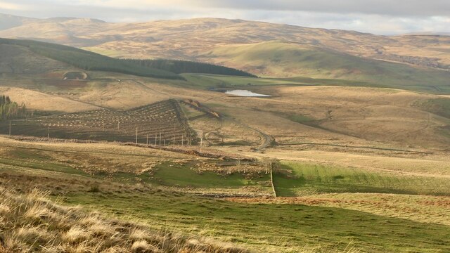
Caver's Moss is a picturesque woodland located in Selkirkshire, Scotland. Covering an area of approximately 150 acres, it is a popular destination for nature enthusiasts and outdoor lovers alike. The moss is nestled within the stunning landscape of the Scottish Borders, offering visitors a serene and tranquil retreat.

The woodland is known for its dense and ancient trees, predominantly consisting of Scots pine and oak. These towering giants create a dense canopy, shielding the forest floor from excessive sunlight, resulting in a unique and diverse ecosystem. The lush undergrowth is teeming with a variety of plant species, including ferns, mosses, and wildflowers, providing a vibrant tapestry of colors throughout the seasons.

Caver's Moss is home to a rich array of wildlife, making it a haven for animal lovers and birdwatchers. Visitors may catch a glimpse of red squirrels, roe deer, and even the elusive pine marten. The woodland is also a haven for birdlife, with various species such as woodpeckers, owls, and crossbills making their homes among the trees.

For those seeking outdoor activities, Caver's Moss offers several walking trails, allowing visitors to explore the natural beauty at their own pace. The well-maintained paths wind their way through the forest, providing opportunities to immerse oneself in the peaceful surroundings.

Overall, Caver's Moss in Selkirkshire is a captivating woodland that showcases the beauty and diversity of Scotland's natural landscapes. Whether one is looking for a peaceful walk, wildlife spotting, or simply a retreat into nature, this enchanting forest delivers an unforgettable experience.

If you have any feedback on the listing, please let us know in the comments section below.

Caver's Moss Images

Images are sourced within 2km of 55.481921/-2.9495395 or Grid Reference NT4021. Thanks to Geograph Open Source API. All images are credited.

Hungryhill Moss Last time I visited, a lot of images including one I needed to complete NT42 failed, I did not get anything fit to submit due to the gloom.  Much better on this bright afternoon.
Hungryhill Moss
Last time I visited, a lot of images including one I needed to complete NT42 failed, I did not get anything fit to submit due to the gloom. Much better on this bright afternoon.
Around the Langhope Burn Dismal moorland, even more dismal forestry and behind me a wind farm.
Around the Langhope Burn
Dismal moorland, even more dismal forestry and behind me a wind farm.
Wind turbines, Langhope Rig
Mast, Langhope Rig On the, current, edge of the wind farm.
Mast, Langhope Rig
On the, current, edge of the wind farm.
Forest edge, Shaw's Middle Hill A firebreak leads into the forest.
Forest edge, Shaw's Middle Hill
A firebreak leads into the forest.
Shaws Under Loch The northeast end of the loch viewed from the southeast bank in winter conditions.
Shaws Under Loch
The northeast end of the loch viewed from the southeast bank in winter conditions.
Caver's Hill summit The plantation had taken a battering in the recent storms (26/11/2021) but the summit area was relatively unscathed.
Caver's Hill summit
The plantation had taken a battering in the recent storms (26/11/2021) but the summit area was relatively unscathed.
Field, Helmburn
Field, Helmburn
Windthrow, Shaw's Hill Big block of conifers blown down in the northerly gale of 26th November 2021.
Windthrow, Shaw's Hill
Big block of conifers blown down in the northerly gale of 26th November 2021.
They have powerful electric fences around here The power line warning was obviously repositioned here. This is a new electric fence, solar powered but fortunately provisioned with gates. Electric fences are getting more and more common now and can be very awkward to deal with.
They have powerful electric fences around here
The power line warning was obviously repositioned here. This is a new electric fence, solar powered but fortunately provisioned with gates. Electric fences are getting more and more common now and can be very awkward to deal with.
Ditch and new electric fence, Helmburn
Caver's Hill Near the summit which is in the wood. The woodland had suffered windthrow on 26th November 2021 but there was a safe, undamaged route to the top.
Caver's Hill
Near the summit which is in the wood. The woodland had suffered windthrow on 26th November 2021 but there was a safe, undamaged route to the top.
Recent clearfell, Caver's Hill At the foot of Caver's Hill. I suspect they may have got them in in time. There was a lot of fresh windthrow in the area, as with many places after "Arwen", a big gale on 26th November 2021.
Recent clearfell, Caver's Hill
At the foot of Caver's Hill. I suspect they may have got them in in time. There was a lot of fresh windthrow in the area, as with many places after "Arwen", a big gale on 26th November 2021.
Sheepy singletrack Sheep path along the route of an old road heading for Ettrickbridge. It is a waymarked route and horse riding is actively encouraged.
Sheepy singletrack
Sheep path along the route of an old road heading for Ettrickbridge. It is a waymarked route and horse riding is actively encouraged.
Under Howford Hill Cannot find a name for the house. There are some very good old tracks here including waymarked routes for horse riding - ie no locked gates!
Under Howford Hill
Cannot find a name for the house. There are some very good old tracks here including waymarked routes for horse riding - ie no locked gates!
Pond above Helmburn
Pond above Helmburn
Gate on the track to Ettrickbridge A route contouring the south side of Helmburn Hill.
Gate on the track to Ettrickbridge
A route contouring the south side of Helmburn Hill.
Pond near Helmburn Hill This rectangular pond occupies a dip in the moorland south of Helmburn Hill.
Pond near Helmburn Hill
This rectangular pond occupies a dip in the moorland south of Helmburn Hill.
Show me another place!

Caver's Moss is located at Grid Ref: NT4021 (Lat: 55.481921, Lng: -2.9495395)

Unitary Authority: The Scottish Borders

Police Authority: The Lothians and Scottish Borders

What 3 Words

///dollar.inched.skidding. Near Selkirk, Scottish Borders

Related Wikis

Ettrickbridge

Ettrickbridge (Scottish Gaelic: Drochaid Eadaraig) is a village situated in the Scottish Borders region of Scotland, 7 miles (11 km) from the nearby town...

Selkirkshire

Selkirkshire or the County of Selkirk (Scottish Gaelic: Siorrachd Shalcraig) is a historic county and registration county of Scotland. It borders Peeblesshire...

Kirkhope Tower

Kirkhope Tower is a Scottish Pele, located in the Ettrick Valley, in the historic county of Selkirkshire, now a division of the Scottish Borders. The tower...

Oakwood Roman Fort and Camp

Oakwood Roman Fort and Camp is a British archaeological site, a Roman fort and nearby Roman camp, about 3.5 miles (5.6 km) south-west of Selkirk in the...

Have you been to Caver's Moss?

Leave your review of Caver's Moss below (or comments, questions and feedback).