Brockhill Wood
Wood, Forest in Selkirkshire
Scotland
Brockhill Wood
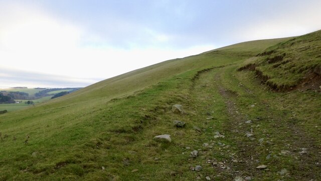
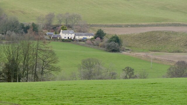
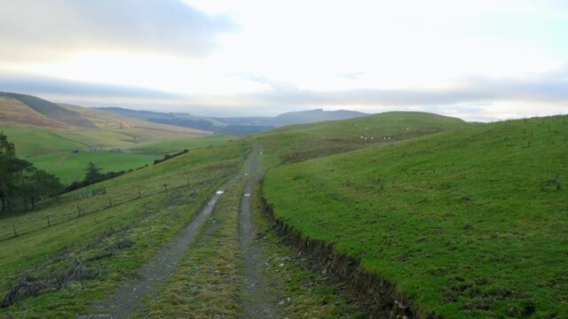
Brockhill Wood is a picturesque forest located in Selkirkshire, Scotland. Covering an area of approximately 200 hectares, it is a haven for nature enthusiasts and outdoor adventurers alike. The wood is situated just a few miles outside the town of Selkirk, making it easily accessible for visitors.
The forest is characterized by its diverse range of tree species, including oak, beech, birch, and pine. These towering trees create a dense canopy, providing shade and shelter for a multitude of wildlife. Visitors can expect to encounter a variety of bird species, such as woodpeckers and owls, as well as small mammals like squirrels and rabbits.
Brockhill Wood boasts a network of well-maintained trails, allowing visitors to explore its beauty at their own pace. These trails vary in difficulty, catering to both casual walkers and more experienced hikers. The forest also offers opportunities for cycling and horseback riding, with designated paths available.
The wood is a popular spot for picnicking and family outings, with several designated areas equipped with picnic tables and benches. There are also a number of information boards scattered throughout the forest, providing educational insights into the local flora and fauna.
Brockhill Wood is not only appreciated for its natural beauty but also for its historical significance. The wood has remnants of ancient settlements, including Iron Age forts and Roman camps, which add an extra layer of intrigue and fascination for history enthusiasts.
Overall, Brockhill Wood is a captivating natural gem in Selkirkshire, offering a peaceful retreat for those seeking solace in nature or an adventure in the great outdoors.
If you have any feedback on the listing, please let us know in the comments section below.
Brockhill Wood Images
Images are sourced within 2km of 55.512571/-2.9635634 or Grid Reference NT3924. Thanks to Geograph Open Source API. All images are credited.


Brockhill Wood is located at Grid Ref: NT3924 (Lat: 55.512571, Lng: -2.9635634)
Unitary Authority: The Scottish Borders
Police Authority: The Lothians and Scottish Borders
What 3 Words
///cross.montage.comically. Near Selkirk, Scottish Borders
Nearby Locations
Related Wikis

Ettrickbridge
Ettrickbridge (Scottish Gaelic: Drochaid Eadaraig) is a village situated in the Scottish Borders region of Scotland, 7 miles (11 km) from the nearby town...

Kirkhope Tower
Kirkhope Tower is a Scottish Pele, located in the Ettrick Valley, in the historic county of Selkirkshire, now a division of the Scottish Borders. The tower...

Selkirkshire
Selkirkshire or the County of Selkirk (Scottish Gaelic: Siorrachd Shalcraig) is a historic county and registration county of Scotland. It borders Peeblesshire...

Aikwood Tower
Aikwood Tower (formerly known as Oakwood Tower) is a 16th-century tower house in the Scottish Borders area of Scotland, 4 miles (6 kilometres) southwest...

Oakwood Roman Fort and Camp
Oakwood Roman Fort and Camp is a British archaeological site, a Roman fort and nearby Roman camp, about 3.5 miles (5.6 km) south-west of Selkirk in the...

Bowhill House
Bowhill House is a historic house near Bowhill at Selkirk in the Scottish Borders area of Scotland. It is a member of the Historic Houses Association,...

Yarrow, Scottish Borders
Yarrow is a place and parish in the Scottish Borders area of Scotland and in the former county of Selkirkshire.The name "Yarrow" may derive from the Celtic...

Bowhill, Scottish Borders
Bowhill is a village off the A708, in the Scottish Borders area of Scotland, near Selkirk, by the Yarrow Water Other places nearby include Bowhill House...
Nearby Amenities
Located within 500m of 55.512571,-2.9635634Have you been to Brockhill Wood?
Leave your review of Brockhill Wood below (or comments, questions and feedback).