Tinnis Stiel Wood

Wood, Forest in Selkirkshire

Scotland

Tinnis Stiel Wood

Track at Old Tinnis The track follows Lewenshope Burn.
Track at Old Tinnis Credit: Mary and Angus Hogg

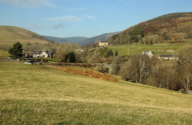
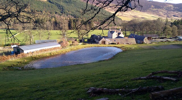
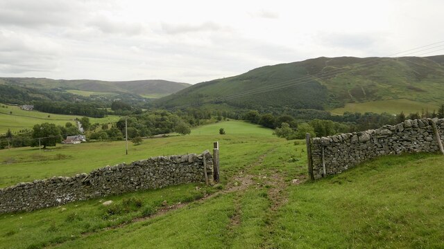
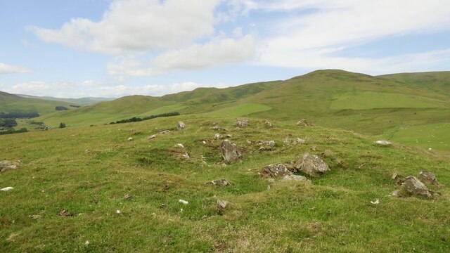
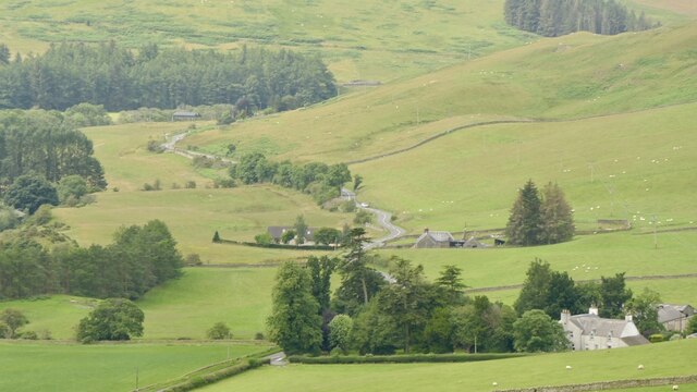
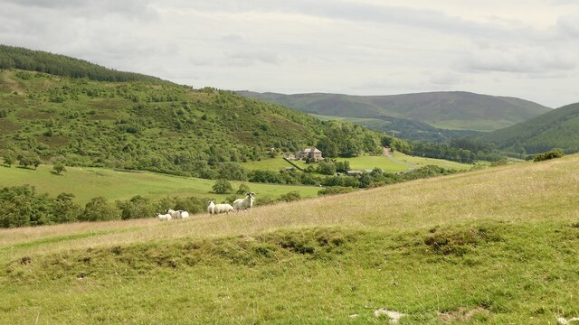
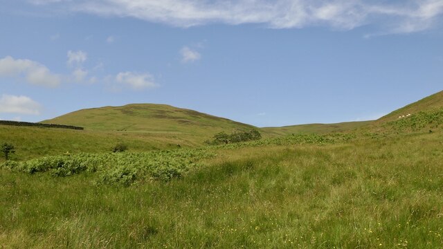
Tinnis Stiel Wood is located in Selkirkshire, a historic county in the Scottish Borders region of Scotland. This woodland area covers a vast expanse of approximately 200 acres and is renowned for its natural beauty and diverse ecosystems.

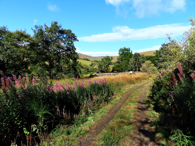
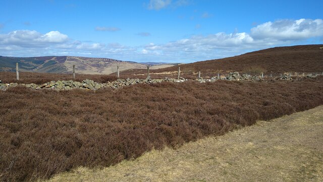
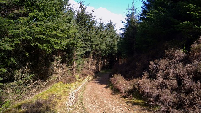
The wood is predominantly composed of native tree species such as oak, beech, and birch, creating a lush and vibrant environment. The trees stand tall and provide a dense canopy, offering shade and shelter to various flora and fauna that call this forest their home.

Tinnis Stiel Wood is home to a wide range of wildlife, including both common and rare species. Visitors may encounter red squirrels, roe deer, and a variety of bird species, such as woodpeckers and owls. The wood is also known for its abundance of wildflowers during the spring and summer months, adding bursts of color to the enchanting landscape.

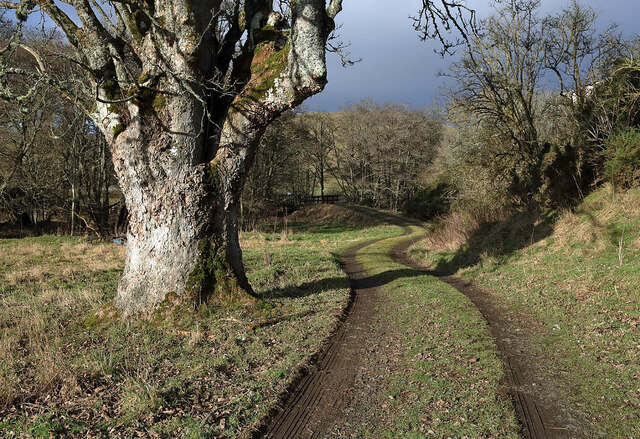
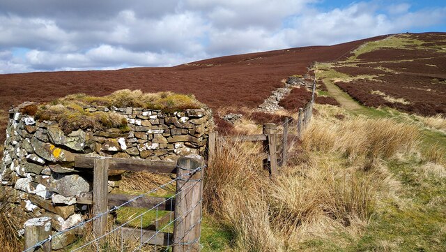
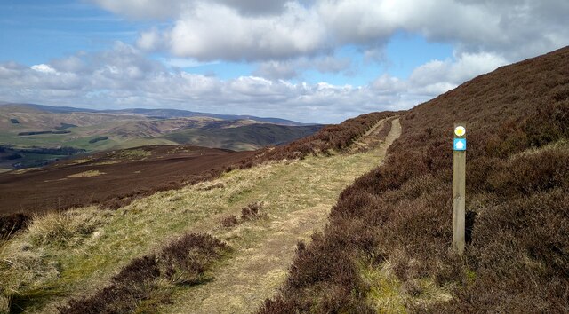
The wood offers numerous walking trails and paths that wind through the forest, allowing visitors to explore its hidden corners and enjoy the tranquility of nature. It is a popular destination for nature enthusiasts, hikers, and photographers, who are drawn to its picturesque scenery and peaceful atmosphere.

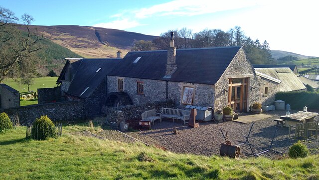
Tinnis Stiel Wood is managed by local authorities, who ensure its preservation and sustainable use. It serves as an important habitat for wildlife conservation and provides an opportunity for people to connect with nature and appreciate the beauty of the Scottish countryside.

If you have any feedback on the listing, please let us know in the comments section below.

Tinnis Stiel Wood Images

Images are sourced within 2km of 55.553825/-2.9657618 or Grid Reference NT3929. Thanks to Geograph Open Source API. All images are credited.

Track at Old Tinnis The track follows Lewenshope Burn.
Track at Old Tinnis
The track follows Lewenshope Burn.
A grazing field at Old Tinnis Some large stones have been positioned around the field.
A grazing field at Old Tinnis
Some large stones have been positioned around the field.
A gate sign at Old Tinnis The gate is on a track by the Lewenshope Burn.
A gate sign at Old Tinnis
The gate is on a track by the Lewenshope Burn.
An access track at Old Tinnis
A grazing field at Old Tinnis Old Hill is on the left and Lewenshope Rig is on the right.
A grazing field at Old Tinnis
Old Hill is on the left and Lewenshope Rig is on the right.
The Mill at Lewenshope The Mill is a beautifully converted former water mill and now available for holiday rent (I'm a happy customer - not the owner!).
The Mill at Lewenshope
The Mill is a beautifully converted former water mill and now available for holiday rent (I'm a happy customer - not the owner!).
Buildings at Lewenshope This includes the former mill, now converted as a holiday let.
Buildings at Lewenshope
This includes the former mill, now converted as a holiday let.
Well constructed butts by the Duchess's Drive This pleasant 7.5 mile walk follows the route of a Victorian carriage drive. Underfoot conditions are excellent, on good tracks and paths.
Well constructed butts by the Duchess's Drive
This pleasant 7.5 mile walk follows the route of a Victorian carriage drive. Underfoot conditions are excellent, on good tracks and paths.
On the Duchess's Drive, Bowhill This pleasant 7.5 mile walk follows the route of a Victorian carriage drive. Underfoot conditions are excellent, on good tracks and paths.  There is good waymarking too.
On the Duchess's Drive, Bowhill
This pleasant 7.5 mile walk follows the route of a Victorian carriage drive. Underfoot conditions are excellent, on good tracks and paths. There is good waymarking too.
On the Duchess's Drive, Bowhill This pleasant 7.5 mile walk follows the route of a Victorian carriage drive. Underfoot conditions are excellent, on good tracks and paths.
On the Duchess's Drive, Bowhill
This pleasant 7.5 mile walk follows the route of a Victorian carriage drive. Underfoot conditions are excellent, on good tracks and paths.
On the Duchess's Drive, in Black Andrew Wood This pleasant 7.5 mile walk follows the route of a Victorian carriage drive. Underfoot conditions are excellent, on good tracks and paths.
On the Duchess's Drive, in Black Andrew Wood
This pleasant 7.5 mile walk follows the route of a Victorian carriage drive. Underfoot conditions are excellent, on good tracks and paths.
A low level RAF Hercules in the Yarrow Valley There was a low flying slot between 19.00 and 21.00 and I was lucky enough to catch at 20.45 in lovely evening light Hercules ZH867 from Tinnis Top. This was my last low level Hercules as the RAF will retire this aircraft type at the end of June 2023. A farewell flypast tour of the UK with a three-ship of Hercules aircraft was held on 14/06/2023.
A low level RAF Hercules in the Yarrow Valley
There was a low flying slot between 19.00 and 21.00 and I was lucky enough to catch at 20.45 in lovely evening light Hercules ZH867 from Tinnis Top. This was my last low level Hercules as the RAF will retire this aircraft type at the end of June 2023. A farewell flypast tour of the UK with a three-ship of Hercules aircraft was held on 14/06/2023.
Gate, Tinnis A waymarked route from Traquair to the Yarrow Water.
Gate, Tinnis
A waymarked route from Traquair to the Yarrow Water.
Summit, Tinnis Top Rather stony and it has been quarried.
Summit, Tinnis Top
Rather stony and it has been quarried.
Tinnis Farm View up the Yarrow Water from. Tinnis Top.
Tinnis Farm
View up the Yarrow Water from. Tinnis Top.
Pasture, Tinnis Top
Pasture, Tinnis Top
Burn and Cat Craig Yarrow hill grazing, sheep and cattle.
Burn and Cat Craig
Yarrow hill grazing, sheep and cattle.
Show me another place!

Tinnis Stiel Wood is located at Grid Ref: NT3929 (Lat: 55.553825, Lng: -2.9657618)

Unitary Authority: The Scottish Borders

Police Authority: The Lothians and Scottish Borders

What 3 Words

///outhouse.prettiest.choirs. Near Selkirk, Scottish Borders

Related Wikis

Yarrowford

Yarrowford is a village on the A708, in the Scottish Borders area of Scotland, 4 miles north-west of Selkirk, in the Ettrick Forest. The Yarrow Water flows...

Broadmeadows, Scottish Borders

Broadmeadows is a village in the Scottish Borders area of Scotland, on the A708 near Selkirk. Places nearby include Boleside, Bowhill, Caddonfoot, Ettrickbridge...

Newark Castle, Selkirkshire

Newark Tower is a large, ruined tower house standing in the grounds of Bowhill House, in the valley of the Yarrow Water three miles west of Selkirk in...

Yarrow Water

The Yarrow Water is a river in the Borders in the south east of Scotland. It is a tributary of the Ettrick Water (itself a tributary of the Tweed) and...

Bowhill House

Bowhill House is a historic house near Bowhill at Selkirk in the Scottish Borders area of Scotland. It is a member of the Historic Houses Association,...

Yarrow, Scottish Borders

Yarrow is a place and parish in the Scottish Borders area of Scotland and in the former county of Selkirkshire.The name "Yarrow" may derive from the Celtic...

Aikwood Tower

Aikwood Tower (formerly known as Oakwood Tower) is a 16th-century tower house in the Scottish Borders area of Scotland, 4 miles (6 kilometres) southwest...

Kirkhope Tower

Kirkhope Tower is a Scottish Pele, located in the Ettrick Valley, in the historic county of Selkirkshire, now a division of the Scottish Borders. The tower...

Nearby Amenities

Located within 500m of 55.553825,-2.9657618
Old Tinnis
Place: locality
Lat/Long: 55.5550092/-2.9708898
Power: pole
Lat/Long: 55.5543209/-2.9736506
Power: pole
Lat/Long: 55.5548557/-2.9727029
Power: pole
Lat/Long: 55.5550376/-2.9718039
Power: pole
Lat/Long: 55.555503/-2.9709112
Power: pole
Lat/Long: 55.5561036/-2.9696272
Power: pole
Lat/Long: 55.5564386/-2.9689355
Power: pole
Lat/Long: 55.5569423/-2.9679074
Power: pole
Lat/Long: 55.5566946/-2.9667229
Power: pole
Lat/Long: 55.5564505/-2.9655277
Power: pole
Lat/Long: 55.5561574/-2.9641591
Power: pole
Lat/Long: 55.5559337/-2.9630718
Power: pole
Lat/Long: 55.5559564/-2.9618407
Power: pole
Lat/Long: 55.5559768/-2.9606202
Power: pole
Lat/Long: 55.5559971/-2.9593488
Power: pole
Lat/Long: 55.5563273/-2.9702703
Power: pole
Lat/Long: 55.5566252/-2.9711143
The data included in this document is from www.openstreetmap.org. The data is made available under ODbL.

Have you been to Tinnis Stiel Wood?

Leave your review of Tinnis Stiel Wood below (or comments, questions and feedback).