George Wood

Wood, Forest in Midlothian

Scotland

George Wood

Summit, The Struther Rough ground, grazed by horses. They stayed lower down the hill as it was rather windy.
Summit, The Struther Credit: Richard Webb

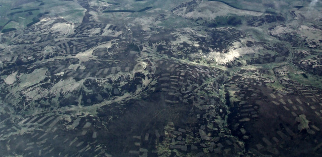
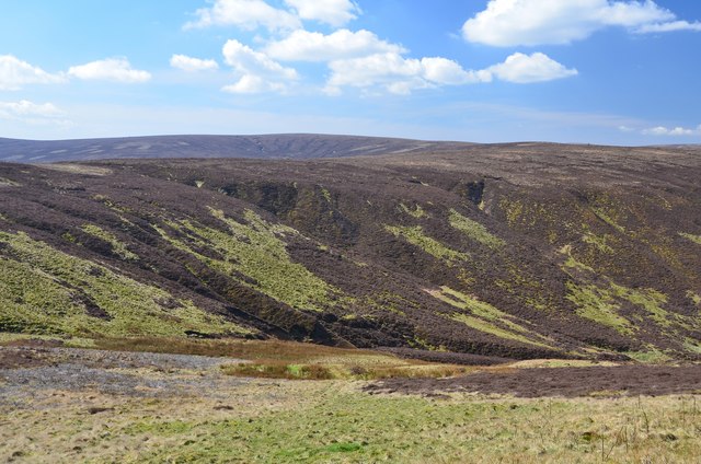
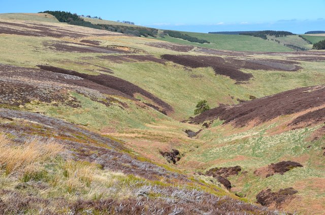
George Wood is a natural woodland located in Midlothian, Scotland. Spanning over 100 hectares, it is part of the wider Pentland Hills Regional Park. The woodland is named after the nearby village of Loanhead, which is commonly referred to as George Wood, Forest or simply Wood.

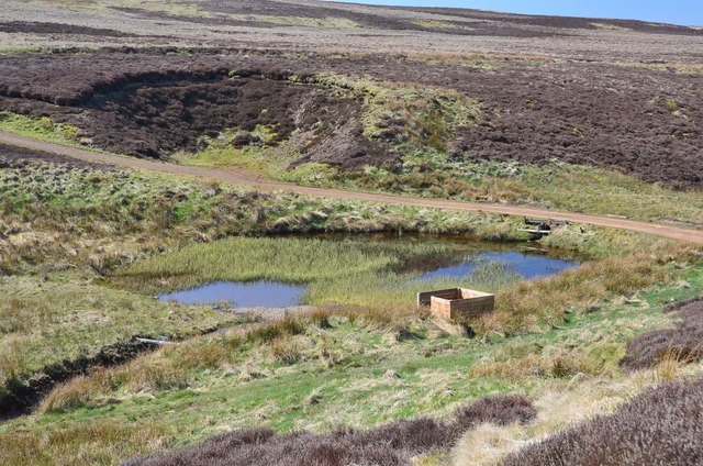
The forest is characterized by a diverse range of tree species, including native Scots pine, oak, and birch, as well as exotic conifers such as Douglas fir and Norway spruce. The varying tree types create a rich and vibrant habitat for a wide array of wildlife, with notable species including red squirrels, roe deer, and a variety of bird species.

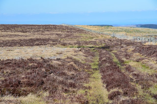
George Wood offers numerous walking trails and paths, allowing visitors to explore its natural beauty and enjoy the tranquility of the surroundings. The trails are well-maintained and suitable for all ages and abilities. The woodland also provides opportunities for outdoor activities like birdwatching, photography, and nature appreciation.

Furthermore, George Wood serves as an important ecological site, contributing to the conservation and restoration of native woodlands in the area. Efforts are made to protect and enhance the natural features of the woodland, promoting sustainable management practices.

Overall, George Wood, Midlothian, is a picturesque and ecologically valuable woodland, offering visitors a chance to connect with nature and experience the beauty of Scotland's natural environment.

If you have any feedback on the listing, please let us know in the comments section below.

George Wood Images

Images are sourced within 2km of 55.723243/-2.987007 or Grid Reference NT3848. Thanks to Geograph Open Source API. All images are credited.

Summit, The Struther Rough ground, grazed by horses. They stayed lower down the hill as it was rather windy.
Summit, The Struther
Rough ground, grazed by horses. They stayed lower down the hill as it was rather windy.
Town Law from the air Hazelbank Quarry can be seen to the left, with part of Toddleburn wind farm on the extreme left. Viewed from a flight from Prague, heading for Edinburgh.
Town Law from the air
Hazelbank Quarry can be seen to the left, with part of Toddleburn wind farm on the extreme left. Viewed from a flight from Prague, heading for Edinburgh.
Glenwhinnie Hill from the air The patchwork pattern indicates that the moorland is managed for game bird shooting.
Glenwhinnie Hill from the air
The patchwork pattern indicates that the moorland is managed for game bird shooting.
Track from Ladyside Grouse moors with hill tracks for quick access by vehicle or quad bike.
Track from Ladyside
Grouse moors with hill tracks for quick access by vehicle or quad bike.
Cleuch by Ladyside Burn A good example of a cleuch - a steep-sided valley on a hillside. This one has no name on the 1:25,000 map but is a tributary of Ladyside Burn.
Cleuch by Ladyside Burn
A good example of a cleuch - a steep-sided valley on a hillside. This one has no name on the 1:25,000 map but is a tributary of Ladyside Burn.
Track junctions, Ladyside Burn The right-hand track comes up the glen from Ladyside and splits into two at the Ladyside Burn, with the third track in the foreground climbing SE towards Rawburn Head. In the background is Peatrig Hill. The shooting box shown on the 1:25,000 map is not evident.
Track junctions, Ladyside Burn
The right-hand track comes up the glen from Ladyside and splits into two at the Ladyside Burn, with the third track in the foreground climbing SE towards Rawburn Head. In the background is Peatrig Hill. The shooting box shown on the 1:25,000 map is not evident.
Valley of the Raw Burn Looking up the valley from the sheepfold near the junction with the Ladyside Burn.
Valley of the Raw Burn
Looking up the valley from the sheepfold near the junction with the Ladyside Burn.
Fence on Rawburn Head Looking northwards over grouse moor to the turbines of Carcant wind farm.
Fence on Rawburn Head
Looking northwards over grouse moor to the turbines of Carcant wind farm.
Bend in the track, Rawburn Head The track bends to the east here a short distance S of the 542m spot height.
Bend in the track, Rawburn Head
The track bends to the east here a short distance S of the 542m spot height.
Head of the Raw Burn The head of the valley with Ladyside Height and Eastside Heights in the background.
Head of the Raw Burn
The head of the valley with Ladyside Height and Eastside Heights in the background.
Hill track at George Wood An estate track past the plantation on open moorland at over 500m.
Hill track at George Wood
An estate track past the plantation on open moorland at over 500m.
George Wood, Mount Main A sketchy track passes the scattered trees in this old plantation high on Mount Main, whose summit is R of centre in this view.
George Wood, Mount Main
A sketchy track passes the scattered trees in this old plantation high on Mount Main, whose summit is R of centre in this view.
Trig point, Mount Main summit The highest point (516m) of this moorland hill looking NE towards Lauderdale with the Toddleburn wind farm in view.
Trig point, Mount Main summit
The highest point (516m) of this moorland hill looking NE towards Lauderdale with the Toddleburn wind farm in view.
Looking SW from Mount Main summit George Wood is in the middle distance, separated by an expanse of strength-sapping tussock grass and heather.
Looking SW from Mount Main summit
George Wood is in the middle distance, separated by an expanse of strength-sapping tussock grass and heather.
Fence on Mount Main An old boundary wall and a parallel fence with Mt Main's summit trig point on the skyline.
Fence on Mount Main
An old boundary wall and a parallel fence with Mt Main's summit trig point on the skyline.
Track to Nether Birchy Law A track crossing the boggy col N of Mount Main.
Track to Nether Birchy Law
A track crossing the boggy col N of Mount Main.
Decoy pond, Nether Birchy Law A pond formed by a dam on the Corsehope Burn, also shown in <a href="https://www.geograph.org.uk/photo/208720">NT3849 : Nether Birchy Law</a>.
Decoy pond, Nether Birchy Law
A pond formed by a dam on the Corsehope Burn, also shown in NT3849 : Nether Birchy Law.
Corsehope Burn A tributary of the Heriot Water, draining northwards from Mount Main.
Corsehope Burn
A tributary of the Heriot Water, draining northwards from Mount Main.
Show me another place!

George Wood is located at Grid Ref: NT3848 (Lat: 55.723243, Lng: -2.987007)

Unitary Authority: The Scottish Borders

Police Authority: The Lothians and Scottish Borders

What 3 Words

///officers.ruled.tolerates. Near Innerleithen, Scottish Borders

Nearby Locations

Mount Main George Wood

Related Wikis

Peatrig Hill

Peatrig Hill is a minor hill in Scotland, located about 15 km south-southeast of Edinburgh. One of the Moorfoot Hills, it is located in the parish of Heriot...

Dewar, Scottish Borders

Dewar is a village by the Dewar Burn and Peatrig Hill, in the Scottish Borders area of Scotland. Places nearby include Allanshaugh, Borthwick Hall, Fountainhall...

Garvald, Scottish Borders

Garvald (Scots: Garvit) is a hamlet on the B7007, near Dewar, by the Dewar Burn, in the Moorfoot Hills, in the Scottish Borders area of Scotland, in the...

Carcant

Carcant is a small settlement and a wind farm, near Heriot in the Scottish Borders area of Scotland. A famous inhabitant of Carcant was Eric Liddell....

Have you been to George Wood?

Leave your review of George Wood below (or comments, questions and feedback).