Kirkhope Tower Plantation

Wood, Forest in Selkirkshire

Scotland

Kirkhope Tower Plantation

Ettrick Bridge View from Helmburn Hill.
Ettrick Bridge Credit: Richard Webb

Kirkhope Tower Plantation is a picturesque woodland located in Selkirkshire, Scotland. Covering an area of approximately 50 acres, it is situated near the village of Ettrickbridge, nestled in the rolling hills of the Scottish Borders.

The plantation is predominantly composed of native broadleaf trees such as oak, birch, and beech, which create a diverse and vibrant ecosystem. These trees provide a haven for numerous species of flora and fauna, making it a popular spot for nature enthusiasts and birdwatchers.

The woodland features well-maintained walking trails that wind through the plantation, offering visitors a chance to explore its natural beauty. The paths are easily accessible and suitable for all ages and abilities, making it an ideal destination for families and individuals seeking a peaceful retreat.

Kirkhope Tower Plantation also holds historical significance, as it is home to the ruins of Kirkhope Tower, a medieval stronghold that dates back to the 15th century. The tower, although partly in ruins, still stands tall and adds a touch of intrigue and antiquity to the woodland.

Visitors to the plantation can enjoy a range of activities, including hiking, picnicking, and wildlife spotting. The tranquil atmosphere, coupled with the stunning views of the surrounding countryside, makes Kirkhope Tower Plantation a perfect destination for those seeking solace in nature.

Overall, Kirkhope Tower Plantation offers a beautiful and serene woodland experience, where visitors can immerse themselves in the wonders of nature while exploring a piece of Scottish history.

If you have any feedback on the listing, please let us know in the comments section below.

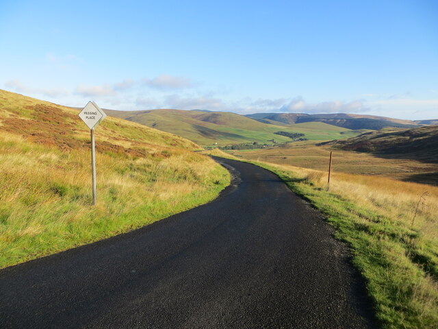
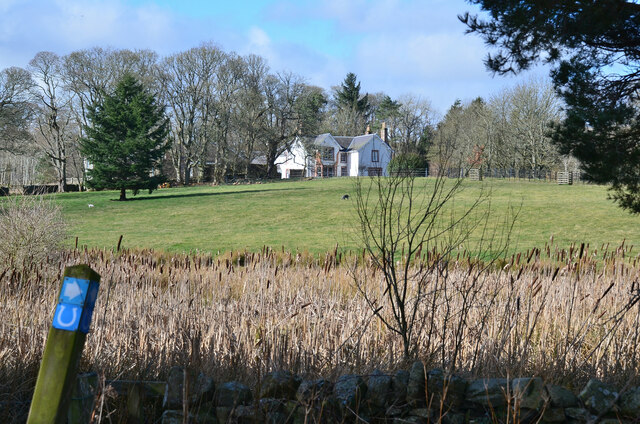
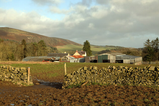
Kirkhope Tower Plantation Images

Images are sourced within 2km of 55.514559/-2.9902329 or Grid Reference NT3724. Thanks to Geograph Open Source API. All images are credited.

Ettrick Bridge View from Helmburn Hill.
Ettrick Bridge
View from Helmburn Hill.
Minor road at Witchie Knowe Looking northward.
Minor road at Witchie Knowe
Looking northward.
Wallside track descending from Tower Hill at Witchie Knowe Looking westward.
Wallside track descending from Tower Hill at Witchie Knowe
Looking westward.
Road and bridge crossing Hawkshaw Burn Looking south-eastward towards Hawkshaw.
Road and bridge crossing Hawkshaw Burn
Looking south-eastward towards Hawkshaw.
Minor road at The Birks, Kirkhope Looking north-westward.
Minor road at The Birks, Kirkhope
Looking north-westward.
Road (B7009) at Kirkhope Farm Looking north-eastward.
Road (B7009) at Kirkhope Farm
Looking north-eastward.
Road (B7009) in Ettrickbridge Looking westward.
Road (B7009) in Ettrickbridge
Looking westward.
Road (B7009) leaving the confines of Ettrickbridge Looking north-eastward.
Road (B7009) leaving the confines of Ettrickbridge
Looking north-eastward.
A grass track at Witchie Knowe This is a view towards Tower Hill.
A grass track at Witchie Knowe
This is a view towards Tower Hill.
Ordnance Survey Cut Mark with Bolt This mark and bolt can be found on the wall of Kirkhope parish Church, Ettrickbridge.
The recorded details give a height of 169.8364 metres above sea level.
For more details see : <span class="nowrap"><a title="https://www.bench-marks.org.uk/bm161144" rel="nofollow ugc noopener" href="https://www.bench-marks.org.uk/bm161144">Link</a><img style="margin-left:2px;" alt="External link" title="External link - shift click to open in new window" src="https://s1.geograph.org.uk/img/external.png" width="10" height="10"/></span>
Ordnance Survey Cut Mark with Bolt
This mark and bolt can be found on the wall of Kirkhope parish Church, Ettrickbridge. The recorded details give a height of 169.8364 metres above sea level. For more details see : LinkExternal link
The Ettrick Water at Ettrickbridge Looking upstream from the bridge.
The Ettrick Water at Ettrickbridge
Looking upstream from the bridge.
Bulrushes at Howford Bulrushes in a marshy corner below the house. The waymark indicates the Buccleuch Country Ride, a 59 mile (95 km) route between the Ettrick and Yarrow valleys.
Bulrushes at Howford
Bulrushes in a marshy corner below the house. The waymark indicates the Buccleuch Country Ride, a 59 mile (95 km) route between the Ettrick and Yarrow valleys.
Track to Ettrickbridge The track descending the western side of Helmburn Hill. Kirkhope Tower is in view top left.
Track to Ettrickbridge
The track descending the western side of Helmburn Hill. Kirkhope Tower is in view top left.
Ettrick Bridge and Ettrickbridge The village seen from the path below Helmburn Cottage.
Ettrick Bridge and Ettrickbridge
The village seen from the path below Helmburn Cottage.
Ettrickbridge The main street is the B7009 to Selkirk.
Ettrickbridge
The main street is the B7009 to Selkirk.
Helmburn Farm
Helmburn Farm
Private Bridge to Ettrickshaws 'Please respect this listed bridge built in 1891'
Over Ettrick Water.
Private Bridge to Ettrickshaws
'Please respect this listed bridge built in 1891' Over Ettrick Water.
The road to Old Kirkhope Not the day to walk up to Kirkhope Tower!
The lorry with the tarmac spreader has just arrived, further down the road they are cutting out the dubious bits, down by the house they are digging out the bits.
With two layers of tarmac to be laid eventually it seems a bit excessive for a house and tower!
The road to Old Kirkhope
Not the day to walk up to Kirkhope Tower! The lorry with the tarmac spreader has just arrived, further down the road they are cutting out the dubious bits, down by the house they are digging out the bits. With two layers of tarmac to be laid eventually it seems a bit excessive for a house and tower!
Show me another place!

Kirkhope Tower Plantation is located at Grid Ref: NT3724 (Lat: 55.514559, Lng: -2.9902329)

Unitary Authority: The Scottish Borders

Police Authority: The Lothians and Scottish Borders

What 3 Words

///stove.winters.pave. Near Selkirk, Scottish Borders

Nearby Locations

Kirkhope Tower Plantation

Related Wikis

Kirkhope Tower

Kirkhope Tower is a Scottish Pele, located in the Ettrick Valley, in the historic county of Selkirkshire, now a division of the Scottish Borders. The tower...

Ettrickbridge

Ettrickbridge (Scottish Gaelic: Drochaid Eadaraig) is a village situated in the Scottish Borders region of Scotland, 7 miles (11 km) from the nearby town...

Selkirkshire

Selkirkshire or the County of Selkirk (Scottish Gaelic: Siorrachd Shalcraig) is a historic county and registration county of Scotland. It borders Peeblesshire...

Yarrow, Scottish Borders

Yarrow is a place and parish in the Scottish Borders area of Scotland and in the former county of Selkirkshire.The name "Yarrow" may derive from the Celtic...

Aikwood Tower

Aikwood Tower (formerly known as Oakwood Tower) is a 16th-century tower house in the Scottish Borders area of Scotland, 4 miles (6 kilometres) southwest...

Oakwood Roman Fort and Camp

Oakwood Roman Fort and Camp is a British archaeological site, a Roman fort and nearby Roman camp, about 3.5 miles (5.6 km) south-west of Selkirk in the...

Bowhill House

Bowhill House is a historic house near Bowhill at Selkirk in the Scottish Borders area of Scotland. It is a member of the Historic Houses Association,...

Yarrowford

Yarrowford is a village on the A708, in the Scottish Borders area of Scotland, 4 miles north-west of Selkirk, in the Ettrick Forest. The Yarrow Water flows...

Nearby Amenities

Located within 500m of 55.514559,-2.9902329
Power: pole
Lat/Long: 55.5139043/-2.992122
Power: pole
Lat/Long: 55.5134079/-2.9920484
Power: pole
Lat/Long: 55.5127841/-2.9917751
Power: pole
Lat/Long: 55.5121306/-2.991445
Power: pole
Lat/Long: 55.5114961/-2.9911107
Power: pole
Lat/Long: 55.5108723/-2.9908353
Power: pole
Lat/Long: 55.5101568/-2.9904674
The data included in this document is from www.openstreetmap.org. The data is made available under ODbL.

Have you been to Kirkhope Tower Plantation?

Leave your review of Kirkhope Tower Plantation below (or comments, questions and feedback).