Ardler Wood

Wood, Forest in Angus

Scotland

Ardler Wood

Old trees Particularly stunning tree in Camperdown Country Park.
Old trees Credit: Aleks Scholz

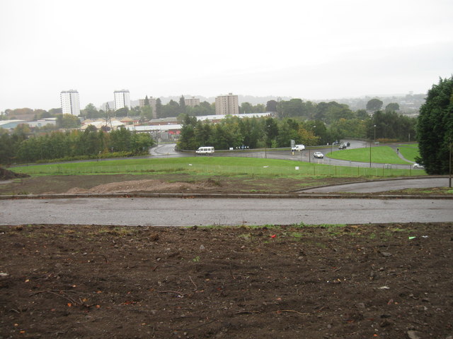
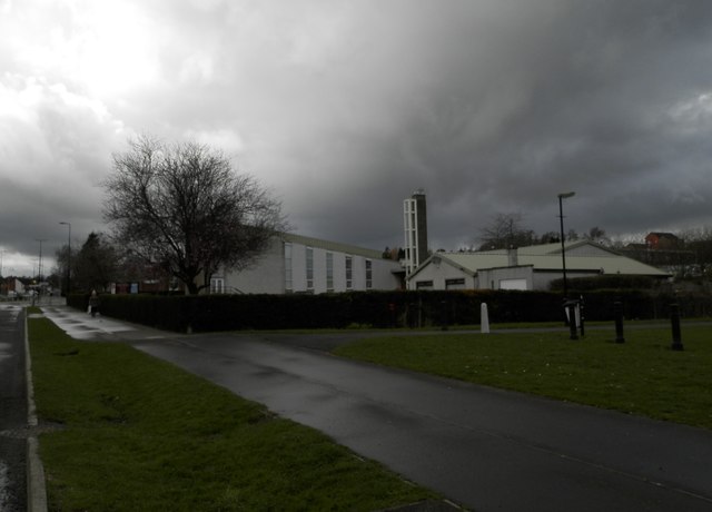
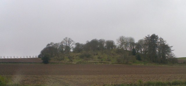
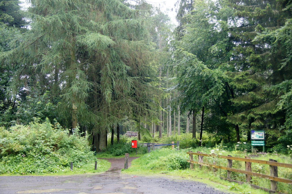
Ardler Wood, located in Angus, Scotland, is a picturesque and biodiverse forest covering an area of approximately 80 hectares. This woodland area is part of the Scottish Natural Heritage and is managed by the Forestry Commission Scotland.

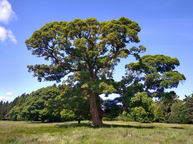
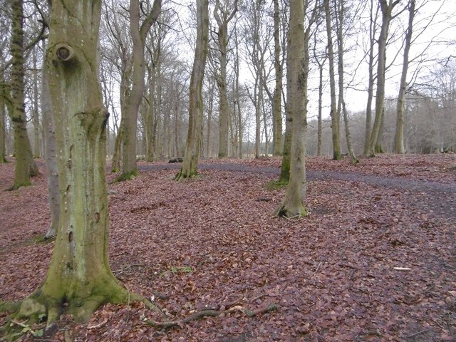
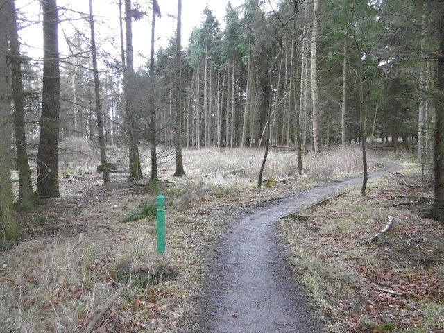
Ardler Wood is characterized by its diverse range of tree species, including oak, birch, beech, and Scots pine. These trees provide a habitat for a variety of wildlife, such as red squirrels, roe deer, and a diverse range of bird species. The forest floor is adorned with a rich carpet of wildflowers, adding to its natural beauty.

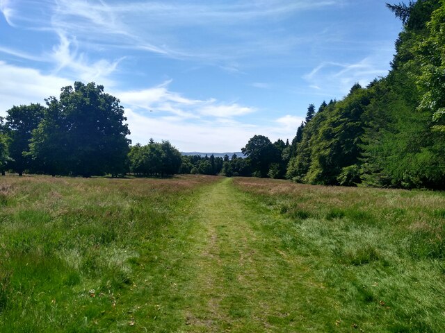
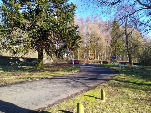
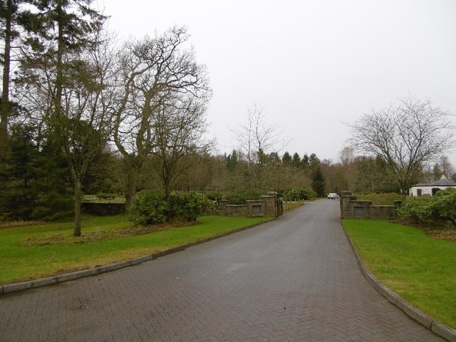
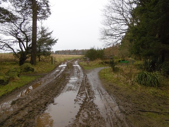
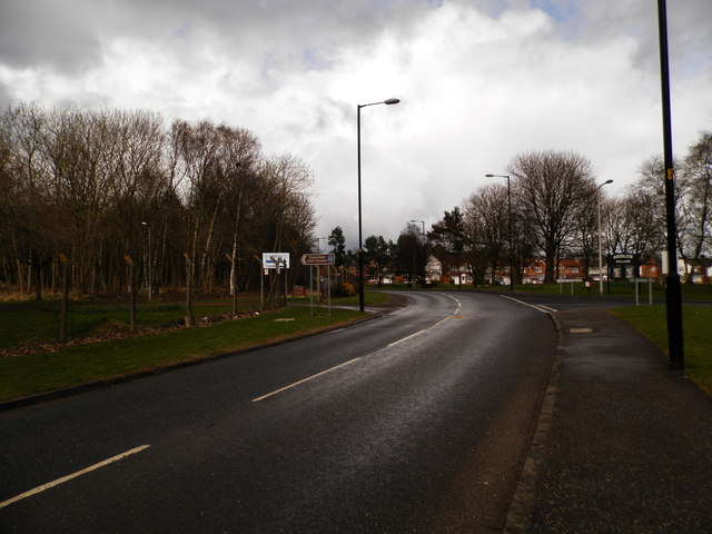
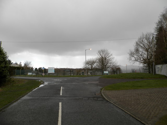
The wood offers a range of recreational activities for visitors, including walking trails, cycling paths, and picnic areas. The trails are well-maintained and provide stunning views of the surrounding countryside. The wood is a popular destination for nature enthusiasts, photographers, and families looking for a peaceful and relaxing day out.

The management of Ardler Wood focuses on sustainable forest practices, including timber production, conservation, and wildlife preservation. The Forestry Commission Scotland ensures the responsible management of the wood, promoting the growth of native species and maintaining a healthy ecosystem.

Ardler Wood is easily accessible, situated just off the A90 road. It is open to the public throughout the year, with no entrance fee. Visitors are encouraged to follow the designated trails, respect the wildlife, and take their litter home to preserve the natural beauty of this tranquil woodland.

If you have any feedback on the listing, please let us know in the comments section below.

Ardler Wood Images

Images are sourced within 2km of 56.489622/-3.0233868 or Grid Reference NO3733. Thanks to Geograph Open Source API. All images are credited.

Old trees Particularly stunning tree in Camperdown Country Park.
Old trees
Particularly stunning tree in Camperdown Country Park.
Walking in Camperdown Camperdown Country Park used to be a golf course. Now the former greens are wild meadows with narrow paths mown into them for convenient walking. Over and over again one encounters these green lanes between tall trees. Lots of dog walkers around, but also lots of space to get lost.
Walking in Camperdown
Camperdown Country Park used to be a golf course. Now the former greens are wild meadows with narrow paths mown into them for convenient walking. Over and over again one encounters these green lanes between tall trees. Lots of dog walkers around, but also lots of space to get lost.
Camperdown, north entry This is the entry or exit on the north side of Camperdown Country Park.
Camperdown, north entry
This is the entry or exit on the north side of Camperdown Country Park.
Weavers Mill
Weavers Mill
Looking towards town
Woodland, Downfield Golf Club Woods between the road and course.
Woodland, Downfield Golf Club
Woods between the road and course.
Hanging timber warning After a couple of storms (now given silly names) there is a fair bit of timber up there awaiting its turn to fly around.
Hanging timber warning
After a couple of storms (now given silly names) there is a fair bit of timber up there awaiting its turn to fly around.
Birkhill Cemetery
Birkhill Cemetery
Path, Templeton Woods Towards the carpark.
Path, Templeton Woods
Towards the carpark.
Edge of Templeton Woods A field entrance and path in the direction of Birkhill.
Edge of Templeton Woods
A field entrance and path in the direction of Birkhill.
Industrial premises in Dunsinane Avenue Dovetail Enterprises is an employer of disabled persons who manufacture furniture.
Industrial premises in Dunsinane Avenue
Dovetail Enterprises is an employer of disabled persons who manufacture furniture.
Industrial premises, Faraday Street, Dundee
Faraday Street, Dryburgh Industrial Estate
Chalmers-Ardler Church of Scotland, Dundee
Dalmahoy Drive near entrance to Downfield Golf Course Near Ardler Woods.
Dalmahoy Drive near entrance to Downfield Golf Course
Near Ardler Woods.
Scottish Water Depot, Clatto Looks like more of the wet stuff is about to arrive!
Scottish Water Depot, Clatto
Looks like more of the wet stuff is about to arrive!
An interesting looking hill seen from the Birkie Inn
Lochee West Church, Dundee
Show me another place!

Ardler Wood is located at Grid Ref: NO3733 (Lat: 56.489622, Lng: -3.0233868)

Unitary Authority: City of Dundee

Police Authority: Tayside

What 3 Words

///lives.spine.ships. Near Muirhead, Angus

Related Wikis

Ardler

Ardler is an area in the north-west of Dundee, Scotland, built on land previously owned by Downfield Golf Club. The housing scheme was completed in the...

St Marys, Dundee

St Mary's is in a residential area of Dundee located in the extreme northwest of the city, to the north of Ardler and west of Kirkton. It is also bounded...

Dundee Ice Arena

Dundee Ice Arena is a multi-purpose ice rink arena located in the Camperdown area of Dundee. The arena has a capacity of 2,400 seats making it the fourth...

Templeton, Angus

Templeton, Angus is a rural area to the north west of Dundee, Scotland, UK, close to Camperdown House. == See also == List of places in Angus

Murder of Elizabeth McCabe

The murder of Elizabeth McCabe was the infamous murder of a 20-year-old woman in Dundee, Scotland in February 1980. The case is one of Scotland's most...

Dryburgh, Dundee

Dryburgh is the name of a district of Dundee, Scotland, home to The View. The band featured locations throughout the area in their video for their 2006...

Lawside Academy

Lawside Academy was a Roman Catholic secondary school in Dundee, Scotland. It was the northernmost state Catholic school in Europe. Lawside closed in June...

Camperdown, Dundee

Camperdown is an area of Dundee, Scotland, best known for Camperdown Park, which is the largest park in the city. The name is Dutch in origin, being the...

Nearby Amenities

Located within 500m of 56.489622,-3.0233868
Traffic Calming: table
Lat/Long: 56.4909982/-3.0210014
Traffic Calming: table
Lat/Long: 56.4909199/-3.0198606
Traffic Calming: table
Lat/Long: 56.4909287/-3.0189145
Traffic Calming: table
Lat/Long: 56.4897573/-3.0216916
Traffic Calming: table
Lat/Long: 56.4896385/-3.0207167
Traffic Calming: table
Lat/Long: 56.4894845/-3.0200808
Traffic Calming: cushion
Lat/Long: 56.4893145/-3.0193991
Traffic Calming: cushion
Lat/Long: 56.489844/-3.0195561
Traffic Calming: cushion
Lat/Long: 56.4904024/-3.0186904
Traffic Calming: cushion
Lat/Long: 56.4907306/-3.016162
Traffic Calming: table
Lat/Long: 56.4901671/-3.0205096
Bicycle Parking
Bicycle Parking: wall_loops
Capacity: 8
Lat/Long: 56.4885624/-3.0156098
Noexit: yes
Lat/Long: 56.490338/-3.0216972
Noexit: yes
Lat/Long: 56.4871608/-3.0232898
Traffic Calming: cushion
Lat/Long: 56.4882465/-3.0248289
Traffic Calming: cushion
Lat/Long: 56.4885976/-3.0244021
Traffic Calming: cushion
Lat/Long: 56.4888223/-3.0196462
Bus Stop
Larchfield Gardens
Bus: yes
Naptan AtcoCode: 6400S08
Naptan CommonName: Larchfield Gardens
Naptan Indicator: opp
Naptan NaptanCode: 36323975
Public Transport: platform
Lat/Long: 56.4928519/-3.0211888
Generator Method: photovoltaic
Generator Output Electricity: yes
Generator Source: solar
Generator Type: solar_photovoltaic_panel
Power: generator
Lat/Long: 56.4907179/-3.0196932
Generator Method: photovoltaic
Generator Output Electricity: yes
Generator Source: solar
Generator Type: solar_photovoltaic_panel
Power: generator
Lat/Long: 56.4900843/-3.0197952
Bus Stop
Larchfield Gardens
Naptan AtcoCode: 6400PT1188
Naptan CommonName: Larchfield Gardens
Naptan Indicator: at
Naptan NaptanCode: 36323972
Naptan Verified: no
Public Transport: platform
Lat/Long: 56.4934535/-3.0214079
Bus Stop
Wentworth Road
Naptan AtcoCode: 640011027
Naptan CommonName: Wentworth Road
Naptan Indicator: at
Naptan NaptanCode: 36325862
Naptan Verified: no
Public Transport: platform
Lat/Long: 56.4886758/-3.0209465
Bus Stop
Wentworth Road
Naptan AtcoCode: 640011025
Naptan CommonName: Wentworth Road
Naptan Indicator: opp
Naptan NaptanCode: 36325859
Naptan Verified: no
Public Transport: platform
Lat/Long: 56.4887654/-3.0209103
Bus Stop
Wentworth Street
Naptan AtcoCode: 64006831
Naptan CommonName: Wentworth Street
Naptan Indicator: opp
Naptan NaptanCode: 36325789
Naptan Verified: no
Public Transport: platform
Lat/Long: 56.4883263/-3.0187015
Bus Stop
Wentworth Street
Naptan AtcoCode: 64006833
Naptan CommonName: Wentworth Street
Naptan Indicator: at
Naptan NaptanCode: 36325792
Naptan Verified: no
Public Transport: platform
Lat/Long: 56.4882708/-3.0187753
Bus Stop
Harrison Road
Naptan AtcoCode: 6400S17
Naptan CommonName: Harrison Road
Naptan Indicator: opp
Naptan NaptanCode: 36325346
Naptan Verified: no
Public Transport: platform
Lat/Long: 56.4862893/-3.0196014
Bus Stop
Harrison Road
Naptan AtcoCode: 6400PT1444
Naptan CommonName: Harrison Road
Naptan Indicator: at
Naptan NaptanCode: 36325329
Naptan Verified: no
Public Transport: platform
Lat/Long: 56.4861664/-3.0203578
Bus Stop
Downfield Golf Course
Naptan AtcoCode: 6400S16
Naptan CommonName: Downfield Golf Course
Naptan Indicator: opp
Naptan NaptanCode: 36325342
Naptan Verified: no
Public Transport: platform
Lat/Long: 56.4875837/-3.0239157
Bus Stop
Downfield Golf Course
Naptan AtcoCode: 6400PT1446
Naptan CommonName: Downfield Golf Course
Naptan Indicator: at
Naptan NaptanCode: 36325348
Naptan Verified: no
Public Transport: platform
Lat/Long: 56.4881871/-3.0238514
Bus Stop
Birkdale Place
Naptan AtcoCode: 6400PT1769
Naptan CommonName: Birkdale Place
Naptan Indicator: near
Naptan NaptanCode: 36323973
Naptan Verified: no
Public Transport: platform
Lat/Long: 56.4899719/-3.0219979
Bus Stop
Birkdale Place
Naptan AtcoCode: 6400PT1190
Naptan CommonName: Birkdale Place
Naptan Indicator: opp
Naptan NaptanCode: 36323976
Naptan Verified: no
Public Transport: platform
Lat/Long: 56.4902173/-3.0220382
Bus Stop
Troon Road
Naptan AtcoCode: 6400S14
Naptan CommonName: Troon Road
Naptan Indicator: at
Naptan NaptanCode: 36323629
Naptan Verified: no
Public Transport: platform
Lat/Long: 56.4915619/-3.0192098
Bus Stop
Troon Road
Naptan AtcoCode: 6400S09
Naptan CommonName: Troon Road
Naptan Indicator: opp
Naptan NaptanCode: 36323626
Naptan Verified: no
Public Transport: platform
Lat/Long: 56.4916455/-3.0192353
Traffic Calming: cushion
Lat/Long: 56.4937777/-3.0206576
Noexit: yes
Lat/Long: 56.4924958/-3.0212248
Noexit: yes
Lat/Long: 56.4934498/-3.0211437
Traffic Calming: table
Lat/Long: 56.4904991/-3.0201271
Traffic Calming: cushion
Lat/Long: 56.4906997/-3.0171888
Give Way
Direction: forward
Lat/Long: 56.4888196/-3.0217745
Traffic Calming: table
Lat/Long: 56.4874733/-3.0214928
The data included in this document is from www.openstreetmap.org. The data is made available under ODbL.

Have you been to Ardler Wood?

Leave your review of Ardler Wood below (or comments, questions and feedback).