Dean Bank Plantation

Wood, Forest in Dumfriesshire

Scotland

Dean Bank Plantation

The Tarras Water Looking upstream from the B6318 bridge over, with about 800 m to go before it joins the River Esk.
The Tarras Water Credit: M J Richardson

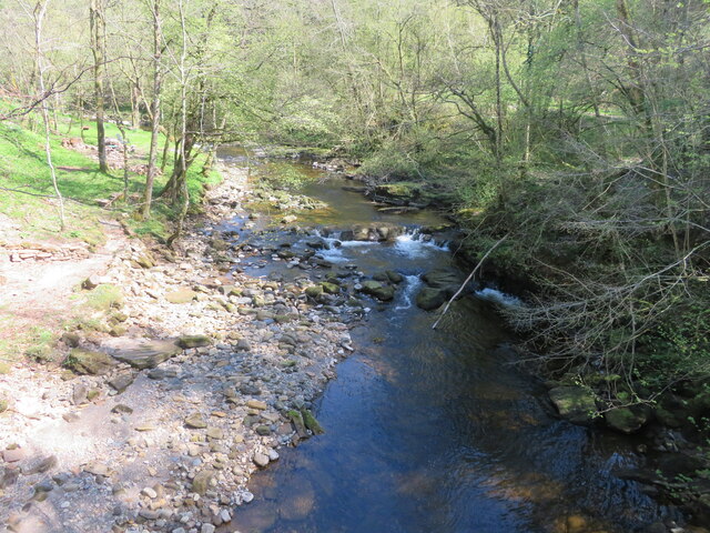
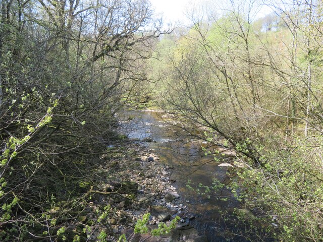
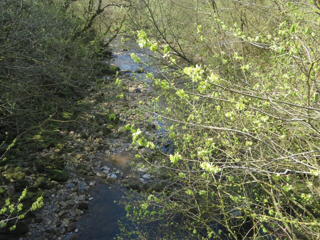
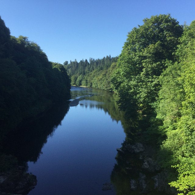
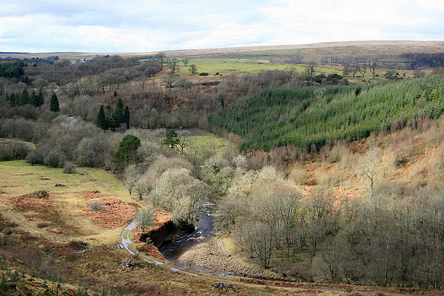
Dean Bank Plantation is a picturesque woodland located in Dumfriesshire, Scotland. Covering an area of approximately 100 acres, it is a notable site for nature enthusiasts, hikers, and those seeking a tranquil escape from the hustle and bustle of city life.

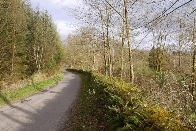
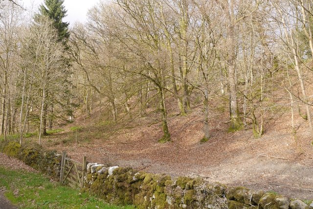
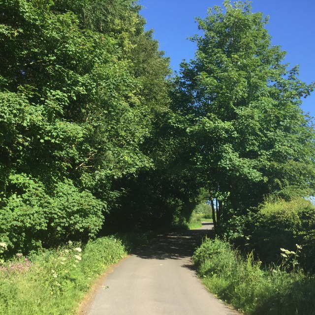
The plantation is predominantly composed of a diverse range of native tree species, including oak, birch, beech, and pine. The lush greenery and dense foliage create a soothing atmosphere and provide a haven for various wildlife species. Visitors can spot a plethora of bird species, such as woodpeckers, owls, and thrushes, as well as small mammals like squirrels, rabbits, and deer.

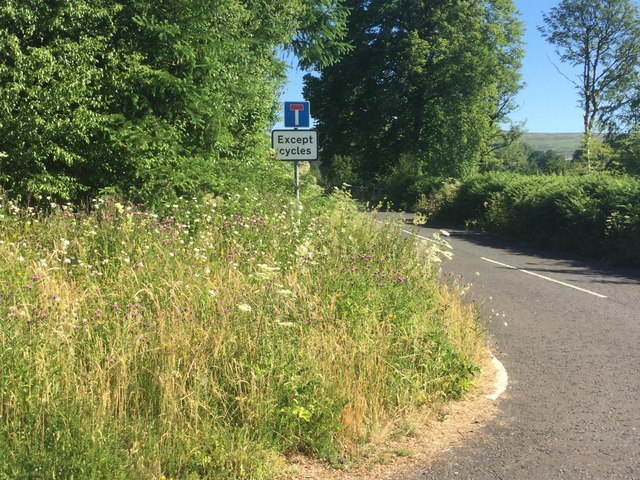
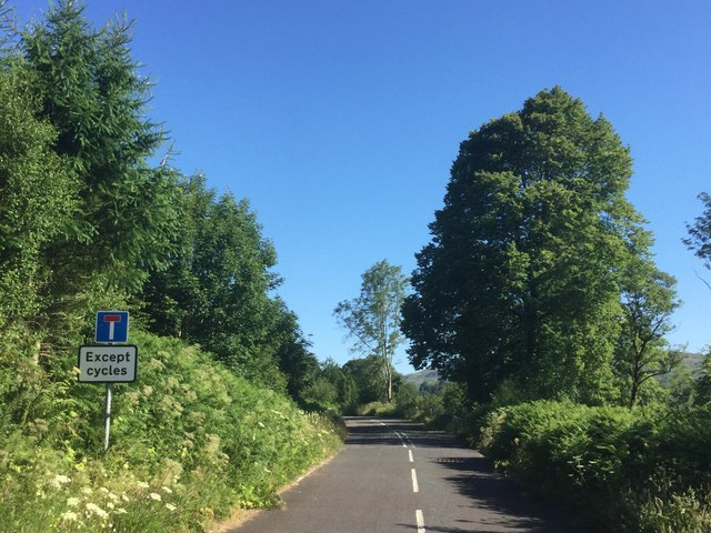
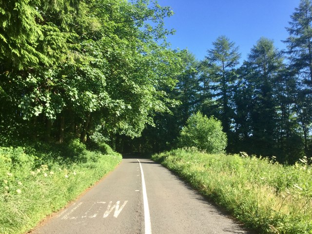
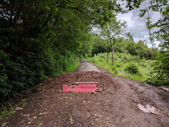
Well-maintained walking trails meander through the plantation, offering visitors the opportunity to explore the area at their own pace. These paths are accessible to all, making it suitable for families and individuals of all ages and abilities. The trails also provide interpretive signs, offering insights into the local flora and fauna, adding an educational aspect to the visit.

Dean Bank Plantation is open year-round, and each season brings its own unique charm. In spring, the woodland is carpeted with vibrant wildflowers, while autumn offers a spectacle of colors as the leaves change to brilliant shades of red, orange, and gold. During winter, the plantation becomes a serene, snow-covered wonderland.

The plantation is conveniently located near the town of Dumfries, making it easily accessible for both locals and tourists. Whether you are seeking a peaceful retreat, a chance to connect with nature, or simply a leisurely stroll through a beautiful woodland, Dean Bank Plantation offers an enchanting experience for all.

If you have any feedback on the listing, please let us know in the comments section below.

Dean Bank Plantation Images

Images are sourced within 2km of 55.128844/-2.9883152 or Grid Reference NY3782. Thanks to Geograph Open Source API. All images are credited.

The Tarras Water Looking upstream from the B6318 bridge over, with about 800 m to go before it joins the River Esk.
The Tarras Water
Looking upstream from the B6318 bridge over, with about 800 m to go before it joins the River Esk.
The Tarras Water Looking downstream from the B6318 bridge over, with about 800 m to go before it joins the River Esk.
The Tarras Water
Looking downstream from the B6318 bridge over, with about 800 m to go before it joins the River Esk.
The Tarras Water Looking downstream from the B6318 bridge over, with about 800 m to go before it joins the River Esk. The light green on the nearby twigs are fruits of an overhanging Elm.
The Tarras Water
Looking downstream from the B6318 bridge over, with about 800 m to go before it joins the River Esk. The light green on the nearby twigs are fruits of an overhanging Elm.
A7 towards Langholm
A7 towards Langholm
B6318 The B6318 has been closed for a long time, but this bit was accessible from Langholm.  We have family connections here so were having a quick look around during a long journey home.
B6318
The B6318 has been closed for a long time, but this bit was accessible from Langholm. We have family connections here so were having a quick look around during a long journey home.
Beechwood near Langholm Woodland between road and the Waverley Line trackbed.
Beechwood near Langholm
Woodland between road and the Waverley Line trackbed.
Round bales near Langholm Wrapped silage beside the Esk.
Round bales near Langholm
Wrapped silage beside the Esk.
River Esk, Langholm Upstream from Skipper’s Bridge.
River Esk, Langholm
Upstream from Skipper’s Bridge.
River Esk Downstream of Skipper’s Bridge.
River Esk
Downstream of Skipper’s Bridge.
The old A7 Now replaced by a wide and straight route above, this is the former alignment near the Esk, downstream of Langholm. Some of the old road is accessible as a through loop, this bit narrows to a path at the north end.
The old A7
Now replaced by a wide and straight route above, this is the former alignment near the Esk, downstream of Langholm. Some of the old road is accessible as a through loop, this bit narrows to a path at the north end.
Cemetery Road, Langholm Winds its way up to the cemetery from the A7 near Skipper’s Bridge.
Cemetery Road, Langholm
Winds its way up to the cemetery from the A7 near Skipper’s Bridge.
Old A7 Now a loop road below the modern alignment south of Langholm.
Old A7
Now a loop road below the modern alignment south of Langholm.
Road closed because of subsidence
The edge of a birch wood at Tarrasfoot Hill Viewed from a clear fell area on the northwest slopes of the hill above the Tarras Water.
The edge of a birch wood at Tarrasfoot Hill
Viewed from a clear fell area on the northwest slopes of the hill above the Tarras Water.
A mossy birch wood at Tarrasfoot Hill This wood is on the northwest side of the hill.
A mossy birch wood at Tarrasfoot Hill
This wood is on the northwest side of the hill.
Birch Polypore (Piptoporus betulinus) Two older fruiting bodies are resting on fresher specimens of this birch tree fungus in a wood on Tarrasfoot Hill. The brown mark on the tree indicates where a decaying branch has fallen off.
Birch Polypore (Piptoporus betulinus)
Two older fruiting bodies are resting on fresher specimens of this birch tree fungus in a wood on Tarrasfoot Hill. The brown mark on the tree indicates where a decaying branch has fallen off.
The Tarras Water Viewed in early March from the northwest side of Tarrasfoot Hill with the site of the Roman fort on Broomholm Knowe at the field in the background beyond the trees. For a closer view of Broomholm Fort, see <a href="https://www.geograph.org.uk/photo/2125537">NY3781 : Broomholm Roman Fort</a>.
The Tarras Water
Viewed in early March from the northwest side of Tarrasfoot Hill with the site of the Roman fort on Broomholm Knowe at the field in the background beyond the trees. For a closer view of Broomholm Fort, see NY3781 : Broomholm Roman Fort.
Show me another place!

Dean Bank Plantation is located at Grid Ref: NY3782 (Lat: 55.128844, Lng: -2.9883152)

Unitary Authority: Dumfries and Galloway

Police Authority: Dumfries and Galloway

What 3 Words

///probably.stealthier.acting. Near Langholm, Dumfries & Galloway

Related Wikis

Langholm railway station

Langholm railway station served the burgh of Langholm, Dumfries and Galloway, Scotland from 1864 to 1967 on the Border Union Railway. == History == The...

Battle of Arkinholm

The Battle of Arkinholm was fought on 1 May 1455, at Arkinholm near Langholm in Scotland, during the reign of King James II of Scotland. Although a small...

Langholm Town Hall

Langholm Town Hall is a municipal building in the High Street in Langholm, Dumfries and Galloway, Scotland. The structure, which is used as a community...

Wauchope Castle

Wauchope Castle was a castle located at Wauchope, in Dumfries and Galloway, Scotland. The castle was a stronghold of the Lindsay family. It was the caput...

Thomas Hope Hospital

Thomas Hope Hospital is a health facility in Strand Street, Langholm, Dumfries and Galloway, Scotland. It is managed by NHS Dumfries and Galloway. ��2...

Langholm

Langholm , also known colloquially as the "Muckle Toon", is a burgh in Dumfries and Galloway, southern Scotland. Langholm lies between four hills in the...

Langholm Academy

Langholm Academy is a non-denominational, co-educational six-year comprehensive secondary school in Langholm, Scotland. Currently, the school has 240 pupils...

Glencartholm

Glencartholm is a location in Dumfries and Galloway, southern Scotland, along the River Esk.The Glencartholm Volcanic Beds contain a Palaeozoic (specifically...

Nearby Amenities

Located within 500m of 55.128844,-2.9883152
Dog Island
Rapids: 3
Waterway: rapids
Lat/Long: 55.1295418/-2.9820724
Power: pole
Lat/Long: 55.1312567/-2.9946836
Power: pole
Lat/Long: 55.1304547/-2.9944583
Power: pole
Lat/Long: 55.1297064/-2.9942813
Power: pole
Lat/Long: 55.1289259/-2.9941069
Power: pole
Lat/Long: 55.1281683/-2.9939085
Power: pole
Lat/Long: 55.1274015/-2.9936831
Power: pole
Lat/Long: 55.1266225/-2.9935008
Power: pole
Lat/Long: 55.1258948/-2.9941914
Broomholm
Place: locality
Lat/Long: 55.1262537/-2.9853847
Ford: yes
Lat/Long: 55.1298502/-2.9934031
Power: pole
Lat/Long: 55.1264076/-2.9826063
Power: pole
Lat/Long: 55.126521/-2.9834354
Power: pole
Lat/Long: 55.1326481/-2.9904908
Power: pole
Lat/Long: 55.1319974/-2.9900762
Power: pole
Lat/Long: 55.1315043/-2.9897286
Power: pole
Lat/Long: 55.1309861/-2.989332
The data included in this document is from www.openstreetmap.org. The data is made available under ODbL.

Have you been to Dean Bank Plantation?

Leave your review of Dean Bank Plantation below (or comments, questions and feedback).